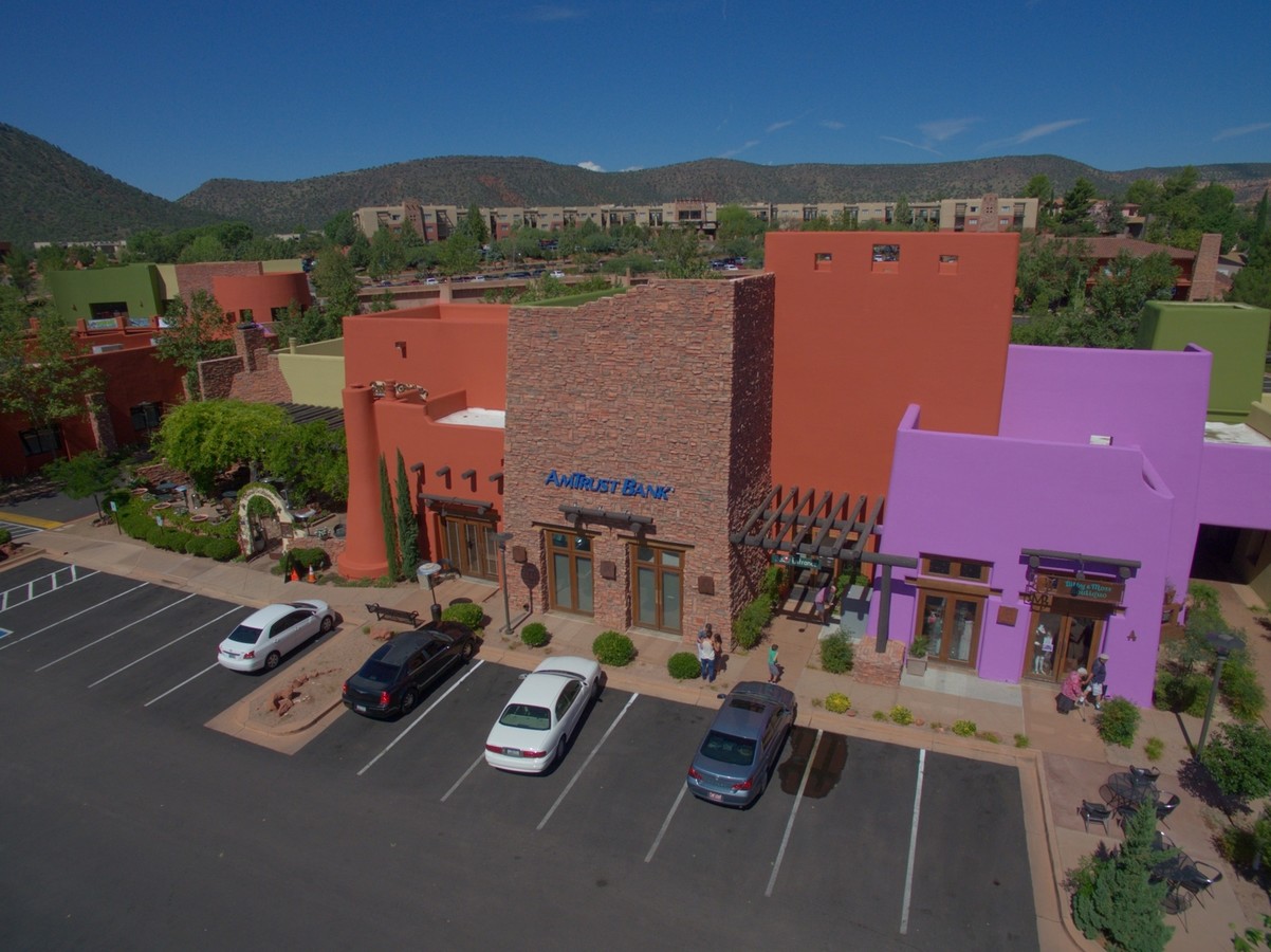
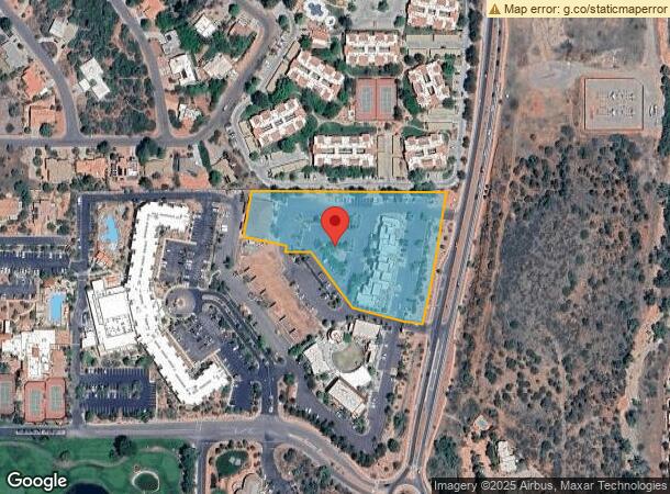
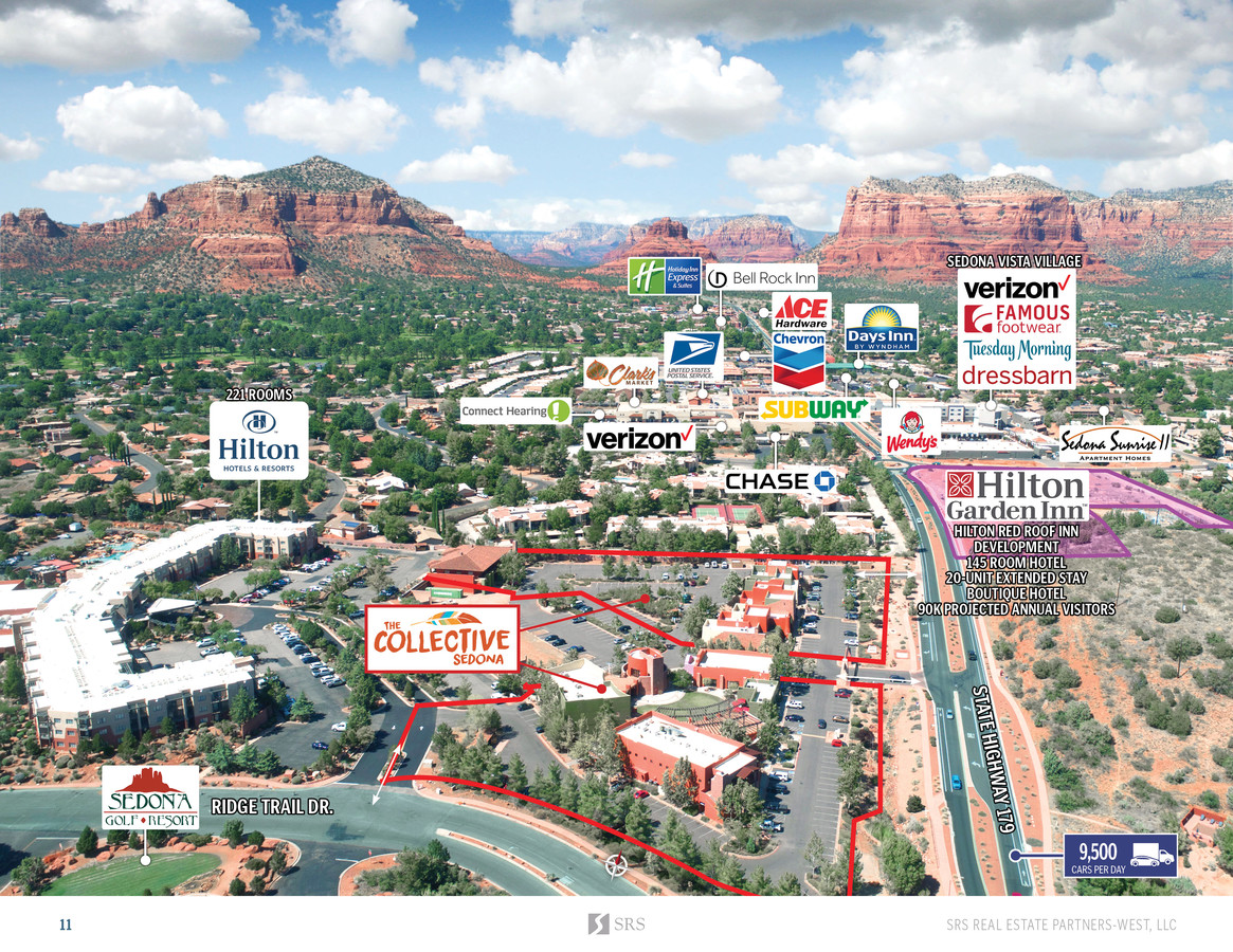
Property Record
7000 State Route 179, Sedona, AZ 86351

NEARBY LISTINGS FOR SALE OR LEASE
-
-
View all Sedona listings for sale on LoopNet.com
Property Detail
7000 State Route 179
405-28-270P
AN IRREG SHAPED PCL LOCATED IN THE NE4 OF 24-16-5E NE COR APPROX 180WLY & 2633NLY FROM E4 COR OF SAID SEC 24 CONT 3.39AC
Stripcommercialcenter
Yavapai
X
Arizona
04005C7670G
3.39 AC
2023
Prescott & Sedona
2024
Other Market Areas
001705
Prescott, AZ
23,505 SF
DEMOGRAPHICS near 7000 State Route 179
1 Mile
3 Mile
5 Mile
2024 Total Population
5,054
7,796
9,739
2029 Population
5,721
8,852
10,972
Pop Growth 2024-2029
+ 13.20%
+ 13.55%
+ 12.66%
Average Age
59
60
60
2024 Total Households
2,718
4,111
5,058
HH Growth 2024-2029
+ 13.65%
+ 14.01%
+ 13.07%
Median Household Inc
$65,428
$68,634
$71,215
Avg Household Size
1.80
1.80
1.90
2024 Avg HH Vehicles
2.00
2.00
2.00
Median Home Value
$551,262
$591,289
$632,958
Median Year Built
1991
1993
1993
Nearby Places
- Restaurants
- Banks
- Shops
- Fitness
- Groceries
PUBLIC TRANSPORTATION
AIRPORT
Flagstaff Pulliam
DRIVE
WALK
Distance
Flagstaff Pulliam
50 min
46.5 mi
Freight Ports
Port of San Diego
DRIVE
WALK
Distance
Port of San Diego
497 min
452.8 mi
SALE & LEASE HISTORY
LISTING DATE
SALE/LEASE

Sep 25, 2016
For Lease
Oct 22, 2019
For Sale
Nov 28, 2016
For Lease
Mar 04, 2019
For Lease
Jan 31, 2018
For Lease
Jan 31, 2018
For Sale
Nearby Properties
Address
Land Use
TOTAL SIZE
Lot Size
Zoning
Address
Land Use
TOTAL SIZE
Lot Size
Zoning
305,420 SF
0.88 AC
CMX4
Address
Land Use
TOTAL SIZE
Lot Size
Zoning
180,457 SF
3.45 AC
Address
Land Use
TOTAL SIZE
Lot Size
Zoning
77,290 SF
2.48 AC
Address
Land Use
TOTAL SIZE
Lot Size
Zoning
91,167 SF
7.85 AC
Address
Land Use
TOTAL SIZE
Lot Size
Zoning
69,712 SF
20.80 AC
Address
Land Use
TOTAL SIZE
Lot Size
Zoning
59,391 SF
4.84 AC
Address
Land Use
TOTAL SIZE
Lot Size
Zoning
53,549 SF
6.52 AC
Address
Land Use
TOTAL SIZE
Lot Size
Zoning
27,201 SF
2.77 AC
Address
Land Use
TOTAL SIZE
Lot Size
Zoning
47,315 SF
2.03 AC
Address
Land Use
TOTAL SIZE
Lot Size
Zoning
42,467 SF
7.55 AC
Address
Land Use
TOTAL SIZE
Lot Size
Zoning
18,900 SF
2.83 AC
Address
Land Use
TOTAL SIZE
Lot Size
Zoning
24,479 SF
1.48 AC
Address
Land Use
TOTAL SIZE
Lot Size
Zoning
13,076 SF
9.15 AC
Address
Land Use
TOTAL SIZE
Lot Size
Zoning
15,596 SF
1.63 AC
Address
Land Use
TOTAL SIZE
Lot Size
Zoning
10,312 SF
2.05 AC
Address
Land Use
TOTAL SIZE
Lot Size
Zoning
18,490 SF
1.13 AC
Address
Land Use
TOTAL SIZE
Lot Size
Zoning
17,343 SF
0.93 AC
Address
Land Use
TOTAL SIZE
Lot Size
Zoning
27,328 SF
0.63 AC
Address
Land Use
TOTAL SIZE
Lot Size
Zoning
17,164 SF
0.78 AC
Address
Land Use
TOTAL SIZE
Lot Size
Zoning
18,080 SF
1.13 AC
Address
Land Use
TOTAL SIZE
Lot Size
Zoning
7,481 SF
1 AC
Address
Land Use
TOTAL SIZE
Lot Size
Zoning
3,697 SF
1.71 AC
Address
Land Use
TOTAL SIZE
Lot Size
Zoning
Address
Land Use
TOTAL SIZE
Lot Size
Zoning
10,973 SF
0.51 AC
Address
Land Use
TOTAL SIZE
Lot Size
Zoning
7,764 SF
0.31 AC
Address
Land Use
TOTAL SIZE
Lot Size
Zoning
8,989 SF
0.71 AC
Address
Land Use
TOTAL SIZE
Lot Size
Zoning
29,099 SF
1.37 AC
Address
Land Use
TOTAL SIZE
Lot Size
Zoning
8,967 SF
0.21 AC
Address
Land Use
TOTAL SIZE
Lot Size
Zoning
7,524 SF
1.72 AC
The World's #1 Commercial Real Estate Marketplace
Connect with us
© 2025 CoStar Group
The information above has been obtained from sources believed reliable. While we do not doubt its accuracy we have not verified it and make no guarantee, warranty or representation about it. It is your responsibility to independently confirm its accuracy and completeness. Any projections, opinions, assumptions, or estimates used are for example only and do not represent the current or future performance of the property. The value of this transaction to you depends on tax and other factors which should be evaluated by your tax, financial, and legal advisors. You and your advisors should conduct a careful, independent investigation of the property to determine to your satisfaction the suitability of the property for your needs.