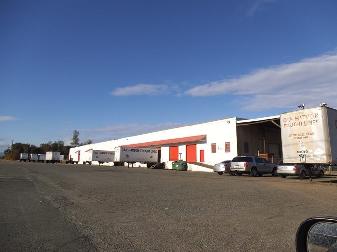
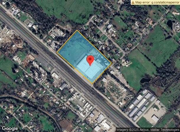
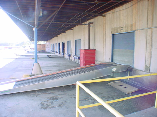
Property Record
7001 Eastside Rd, Anderson, CA 96007
NEARBY LISTINGS FOR SALE OR LEASE
Property Detail
7001 Eastside Rd
050-070-004-000
P B Reading Grant
Wholesaleoutletdiscountstore
Shasta
X
California
06089C1930G
13.10 AC
2023
Other Market Areas
2024
Redding, CA
012301
DEMOGRAPHICS near 7001 Eastside Rd
1 Mile
3 Mile
5 Mile
2024 Total Population
1,556
13,522
52,698
2029 Population
1,552
13,495
52,568
Pop Growth 2024-2029
(0.26%)
(0.20%)
(0.25%)
Average Age
41
43
41
2024 Total Households
651
5,267
20,181
HH Growth 2024-2029
(0.31%)
(0.25%)
(0.26%)
Median Household Inc
$34,041
$62,323
$62,323
Avg Household Size
2.40
2.50
2.50
2024 Avg HH Vehicles
2.00
2.00
2.00
Median Home Value
$150,000
$319,431
$328,056
Median Year Built
1974
1978
1979
Nearby Places
- Restaurants
- Banks
- Shops
- Fitness
- Groceries
PUBLIC TRANSPORTATION
COMMUTER RAIL
Redding Amtrak (Coast Starlight - Amtrak)
DRIVE
WALK
Distance
Redding Amtrak (Coast Starlight - Amtrak)
15 min
7.5 mi
AIRPORT
Redding Regional
DRIVE
WALK
Distance
Redding Regional
13 min
7.2 mi
Freight Ports
Port of Richmond
DRIVE
WALK
Distance
Port of Richmond
225 min
198.0 mi
SALE & LEASE HISTORY
LISTING DATE
SALE/LEASE

Sep 25, 2016
For Lease
Jul 18, 2019
For Sale
Jan 13, 2020
For Lease
Nearby Properties
Address
Land Use
TOTAL SIZE
Lot Size
Zoning
Address
Land Use
TOTAL SIZE
Lot Size
Zoning
373 SF
113.03 AC
Address
Land Use
TOTAL SIZE
Lot Size
Zoning
Address
Land Use
TOTAL SIZE
Lot Size
Zoning
97,213 SF
7.94 AC
Address
Land Use
TOTAL SIZE
Lot Size
Zoning
37,651 SF
26.49 AC
M-L
Address
Land Use
TOTAL SIZE
Lot Size
Zoning
20.19 AC
C-M
Address
Land Use
TOTAL SIZE
Lot Size
Zoning
7.34 AC
F-1
Address
Land Use
TOTAL SIZE
Lot Size
Zoning
3.50 AC
M-L
Address
Land Use
TOTAL SIZE
Lot Size
Zoning
1,472 SF
7.59 AC
M-L
Address
Land Use
TOTAL SIZE
Lot Size
Zoning
8.31 AC
Address
Land Use
TOTAL SIZE
Lot Size
Zoning
56,474 SF
19.20 AC
Address
Land Use
TOTAL SIZE
Lot Size
Zoning
7.56 AC
Address
Land Use
TOTAL SIZE
Lot Size
Zoning
9.89 AC
F-1
Address
Land Use
TOTAL SIZE
Lot Size
Zoning
2.58 AC
Address
Land Use
TOTAL SIZE
Lot Size
Zoning
42,268 SF
3.07 AC
Address
Land Use
TOTAL SIZE
Lot Size
Zoning
1,440 SF
17.13 AC
R-R-T-BA-9
Address
Land Use
TOTAL SIZE
Lot Size
Zoning
3.23 AC
Address
Land Use
TOTAL SIZE
Lot Size
Zoning
18,648 SF
2.61 AC
Address
Land Use
TOTAL SIZE
Lot Size
Zoning
33,558 SF
2.10 AC
Address
Land Use
TOTAL SIZE
Lot Size
Zoning
7.49 AC
Address
Land Use
TOTAL SIZE
Lot Size
Zoning
9,301 SF
1.76 AC
Address
Land Use
TOTAL SIZE
Lot Size
Zoning
20.39 AC
C-R
Address
Land Use
TOTAL SIZE
Lot Size
Zoning
17.22 AC
M
Address
Land Use
TOTAL SIZE
Lot Size
Zoning
12,464 SF
3.01 AC
Address
Land Use
TOTAL SIZE
Lot Size
Zoning
4,410 SF
5.67 AC
PD-MRB
Address
Land Use
TOTAL SIZE
Lot Size
Zoning
20,000 SF
10.12 AC
Address
Land Use
TOTAL SIZE
Lot Size
Zoning
0.94 AC
Address
Land Use
TOTAL SIZE
Lot Size
Zoning
Address
Land Use
TOTAL SIZE
Lot Size
Zoning
2,764 SF
29.42 AC
A-1
Address
Land Use
TOTAL SIZE
Lot Size
Zoning
2,680 SF
0.72 AC
The World's #1 Commercial Real Estate Marketplace
Connect with us
© 2025 CoStar Group
The information above has been obtained from sources believed reliable. While we do not doubt its accuracy we have not verified it and make no guarantee, warranty or representation about it. It is your responsibility to independently confirm its accuracy and completeness. Any projections, opinions, assumptions, or estimates used are for example only and do not represent the current or future performance of the property. The value of this transaction to you depends on tax and other factors which should be evaluated by your tax, financial, and legal advisors. You and your advisors should conduct a careful, independent investigation of the property to determine to your satisfaction the suitability of the property for your needs.