Property Record
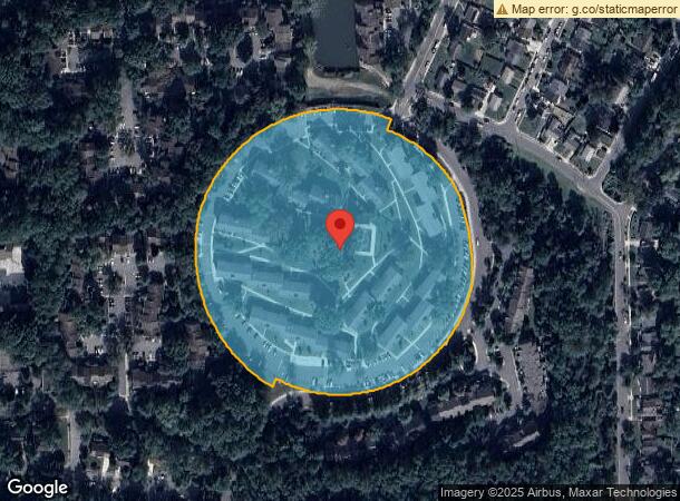
701 Monroe St, Rockville, MD 20850

NEARBY LISTINGS FOR SALE OR LEASE
Property Detail
701 Monroe St
Washington-Arlington-Alexandria, DC-VA-MD-WV
Rockville Town
04-02038424
PAR A WADDINGTON VILLAGE
Apartment
Montgomery
X
Maryland
51059C0075E
a
2024
10.78 AC
2024
Central Rockville
701001
Washington, DC
221,850 SF
DEMOGRAPHICS near 701 Monroe St
1 Mile
3 Mile
5 Mile
2024 Total Population
15,009
110,794
308,861
2029 Population
14,970
109,481
305,683
Pop Growth 2024-2029
(0.26%)
(1.19%)
(1.03%)
Average Age
43
42
41
2024 Total Households
6,282
42,980
115,648
HH Growth 2024-2029
(0.02%)
(1.24%)
(1.07%)
Median Household Inc
$106,892
$123,143
$118,339
Avg Household Size
2.30
2.50
2.60
2024 Avg HH Vehicles
2.00
2.00
2.00
Median Home Value
$673,935
$694,924
$637,067
Median Year Built
1981
1978
1978
Nearby Places
- Restaurants
- Banks
- Shops
- Fitness
- Groceries
PUBLIC TRANSPORTATION
TRANSIT/SUBWAY
Rockville (Red Line - Washington Metropolitan Area Transit Authority Metrorail (Metrorail))
DRIVE
WALK
Distance
Rockville (Red Line - Washington Metropolitan Area Transit Authority Metrorail (Metrorail))
3 min
16 min
0.8 mi
COMMUTER RAIL
Rockville (Brunswick Line - Maryland Area Regional Commuter Trains (The MARC))
DRIVE
WALK
Distance
Rockville (Brunswick Line - Maryland Area Regional Commuter Trains (The MARC))
3 min
20 min
1.1 mi
Garrett Park (Brunswick Line - Maryland Area Regional Commuter Trains (The MARC))
DRIVE
WALK
Distance
Garrett Park (Brunswick Line - Maryland Area Regional Commuter Trains (The MARC))
13 min
5.5 mi
AIRPORT
Ronald Reagan Washington Ntl
DRIVE
WALK
Distance
Ronald Reagan Washington Ntl
39 min
20.9 mi
Washington Dulles International
DRIVE
WALK
Distance
Washington Dulles International
44 min
27.2 mi
Baltimore/Washington International Thurgood Marshall
DRIVE
WALK
Distance
Baltimore/Washington International Thurgood Marshall
51 min
36.9 mi
Freight Ports
Port of Baltimore
DRIVE
WALK
Distance
Port of Baltimore
55 min
39.8 mi
Nearby Properties
Address
Land Use
TOTAL SIZE
Lot Size
Zoning
Address
Land Use
TOTAL SIZE
Lot Size
Zoning
987,382 SF
5 AC
MXTD
Address
Land Use
TOTAL SIZE
Lot Size
Zoning
1,332,482 SF
3.79 AC
CR2.0
Address
Land Use
TOTAL SIZE
Lot Size
Zoning
713,627 SF
38.49 AC
LSC1.
Address
Land Use
TOTAL SIZE
Lot Size
Zoning
1,136,684 SF
84.61 AC
R200
Address
Land Use
TOTAL SIZE
Lot Size
Zoning
533,012 SF
18.08 AC
LSC1.
Address
Land Use
TOTAL SIZE
Lot Size
Zoning
432,000 SF
1.77 AC
CR4.0
Address
Land Use
TOTAL SIZE
Lot Size
Zoning
515,000 SF
5.23 AC
CR1.5
Address
Land Use
TOTAL SIZE
Lot Size
Zoning
379,100 SF
11.80 AC
CR4.0
Address
Land Use
TOTAL SIZE
Lot Size
Zoning
380,452 SF
2.38 AC
CR3.0
Address
Land Use
TOTAL SIZE
Lot Size
Zoning
393,977 SF
17.88 AC
MXCD
Address
Land Use
TOTAL SIZE
Lot Size
Zoning
461,295 SF
45.71 AC
LSC2.
Address
Land Use
TOTAL SIZE
Lot Size
Zoning
815,414 SF
3.27 AC
CR4.0
Address
Land Use
TOTAL SIZE
Lot Size
Zoning
414,000 SF
7.28 AC
MXCD
Address
Land Use
TOTAL SIZE
Lot Size
Zoning
978,527 SF
11.54 AC
03
Address
Land Use
TOTAL SIZE
Lot Size
Zoning
674,400 SF
3.21 AC
CR3.0
Address
Land Use
TOTAL SIZE
Lot Size
Zoning
223,520 SF
2.77 AC
CR2.0
Address
Land Use
TOTAL SIZE
Lot Size
Zoning
633,793 SF
31.03 AC
RE
Address
Land Use
TOTAL SIZE
Lot Size
Zoning
353,867 SF
11 AC
RS
Address
Land Use
TOTAL SIZE
Lot Size
Zoning
291,194 SF
0.72 AC
CR4.0
Address
Land Use
TOTAL SIZE
Lot Size
Zoning
465,983 SF
1.38 AC
CR3.0
Address
Land Use
TOTAL SIZE
Lot Size
Zoning
149,170 SF
13.13 AC
CRT0.
Address
Land Use
TOTAL SIZE
Lot Size
Zoning
330,650 SF
2.89 AC
MXTD
Address
Land Use
TOTAL SIZE
Lot Size
Zoning
172,740 SF
6.93 AC
PD-RC
Address
Land Use
TOTAL SIZE
Lot Size
Zoning
322,078 SF
30.28 AC
R90
Address
Land Use
TOTAL SIZE
Lot Size
Zoning
215,558 SF
13.74 AC
RS
Address
Land Use
TOTAL SIZE
Lot Size
Zoning
311,500 SF
29.05 AC
R60
Address
Land Use
TOTAL SIZE
Lot Size
Zoning
243,000 SF
2.10 AC
PD-KS
Address
Land Use
TOTAL SIZE
Lot Size
Zoning
405,742 SF
14.48 AC
R30
Address
Land Use
TOTAL SIZE
Lot Size
Zoning
316,883 SF
8.62 AC
OCPD
Address
Land Use
TOTAL SIZE
Lot Size
Zoning
152,330 SF
CR
The World's #1 Commercial Real Estate Marketplace
Connect with us
© 2025 CoStar Group
The information above has been obtained from sources believed reliable. While we do not doubt its accuracy we have not verified it and make no guarantee, warranty or representation about it. It is your responsibility to independently confirm its accuracy and completeness. Any projections, opinions, assumptions, or estimates used are for example only and do not represent the current or future performance of the property. The value of this transaction to you depends on tax and other factors which should be evaluated by your tax, financial, and legal advisors. You and your advisors should conduct a careful, independent investigation of the property to determine to your satisfaction the suitability of the property for your needs.