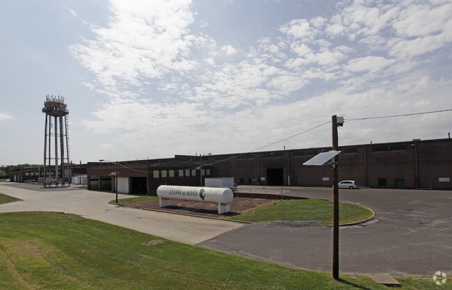
Property Record
701 N 36Th St, Pennsauken, NJ 08110


NEARBY LISTINGS FOR SALE OR LEASE
Property Detail
701 N 36Th St
08-00974-0000-00005
Camden
Industrialgeneral
New Jersey
X
5
34007C0029F
17.33 AC
2024
Camden County
2025
Philadelphia
601102
Philadelphia-Camden-Wilmington, PA-NJ-DE-MD
DEMOGRAPHICS near 701 N 36Th St
1 Mile
3 Mile
5 Mile
2024 Total Population
28,343
168,594
698,076
2029 Population
28,374
167,928
687,077
Pop Growth 2024-2029
+ 0.11%
(0.40%)
(1.58%)
Average Age
36
37
37
2024 Total Households
8,863
63,312
284,586
HH Growth 2024-2029
+ 0.11%
(0.58%)
(1.79%)
Median Household Inc
$50,815
$58,993
$62,783
Avg Household Size
3.10
2.60
2.30
2024 Avg HH Vehicles
1.00
1.00
1.00
Median Home Value
$142,851
$201,831
$248,169
Median Year Built
1953
1948
1949
Nearby Places
Map Layers
Map Styles
 Street
 Aerial
- Restaurants
- Banks
- Shops
- Fitness
- Groceries
PUBLIC TRANSPORTATION
TRANSIT/SUBWAY
36th Street (River LINE - River LINE (River LINE))
DRIVE
WALK
Distance
36th Street (River LINE - River LINE (River LINE))
2 min
6 min
0.3 mi
COMMUTER RAIL
DRIVE
WALK
Distance
6 min
2.5 mi
Cherry Hill (Atlantic City Line - NJ Transit Commuter Rail (NJ Transit))
DRIVE
WALK
Distance
Cherry Hill (Atlantic City Line - NJ Transit Commuter Rail (NJ Transit))
11 min
5.0 mi
AIRPORT
Philadelphia International
DRIVE
WALK
Distance
Philadelphia International
29 min
15.5 mi
Trenton Mercer
DRIVE
WALK
Distance
Trenton Mercer
51 min
31.6 mi
SALE & LEASE HISTORY
LISTING DATE
SALE/LEASE

Sep 24, 2016
For Sale
Sep 24, 2016
For Sale
Nearby Properties
Address
Land Use
TOTAL SIZE
Lot Size
Zoning
Address
Land Use
TOTAL SIZE
Lot Size
Zoning
880,950 SF
27.71 AC
SPENT
Address
Land Use
TOTAL SIZE
Lot Size
Zoning
1.17 AC
Address
Land Use
TOTAL SIZE
Lot Size
Zoning
7.17 AC
Address
Land Use
TOTAL SIZE
Lot Size
Zoning
12.53 AC
Address
Land Use
TOTAL SIZE
Lot Size
Zoning
322,000 SF
7.44 AC
CMX3
Address
Land Use
TOTAL SIZE
Lot Size
Zoning
1.62 AC
Address
Land Use
TOTAL SIZE
Lot Size
Zoning
740,701 SF
47.70 AC
I2
Address
Land Use
TOTAL SIZE
Lot Size
Zoning
Address
Land Use
TOTAL SIZE
Lot Size
Zoning
458,556 SF
1.57 AC
CMX3
Address
Land Use
TOTAL SIZE
Lot Size
Zoning
2.32 AC
Address
Land Use
TOTAL SIZE
Lot Size
Zoning
7.11 AC
Address
Land Use
TOTAL SIZE
Lot Size
Zoning
8.50 AC
Address
Land Use
TOTAL SIZE
Lot Size
Zoning
1.88 AC
Address
Land Use
TOTAL SIZE
Lot Size
Zoning
1.68 AC
Address
Land Use
TOTAL SIZE
Lot Size
Zoning
458,556 SF
1.39 AC
CMX3
Address
Land Use
TOTAL SIZE
Lot Size
Zoning
6.43 AC
Address
Land Use
TOTAL SIZE
Lot Size
Zoning
Address
Land Use
TOTAL SIZE
Lot Size
Zoning
37.60 AC
Address
Land Use
TOTAL SIZE
Lot Size
Zoning
31.99 AC
Address
Land Use
TOTAL SIZE
Lot Size
Zoning
265,000 SF
1.83 AC
CMX3
Address
Land Use
TOTAL SIZE
Lot Size
Zoning
1,504 SF
61.44 AC
Address
Land Use
TOTAL SIZE
Lot Size
Zoning
184,842 SF
0.76 AC
CMX3
Address
Land Use
TOTAL SIZE
Lot Size
Zoning
17.62 AC
Address
Land Use
TOTAL SIZE
Lot Size
Zoning
21.13 AC
Address
Land Use
TOTAL SIZE
Lot Size
Zoning
227,844 SF
19.82 AC
I2
Address
Land Use
TOTAL SIZE
Lot Size
Zoning
123,750 SF
0.54 AC
CMX2.5
Address
Land Use
TOTAL SIZE
Lot Size
Zoning
2.32 AC
Address
Land Use
TOTAL SIZE
Lot Size
Zoning
253,800 SF
0.61 AC
RM1
Address
Land Use
TOTAL SIZE
Lot Size
Zoning
1.53 AC
Address
Land Use
TOTAL SIZE
Lot Size
Zoning
1.15 AC
The World's #1 Commercial Real Estate Marketplace
Connect with us
© 2025 CoStar Group
The information above has been obtained from sources believed reliable. While we do not doubt its accuracy we have not verified it and make no guarantee, warranty or representation about it. It is your responsibility to independently confirm its accuracy and completeness. Any projections, opinions, assumptions, or estimates used are for example only and do not represent the current or future performance of the property. The value of this transaction to you depends on tax and other factors which should be evaluated by your tax, financial, and legal advisors. You and your advisors should conduct a careful, independent investigation of the property to determine to your satisfaction the suitability of the property for your needs.