Property Record
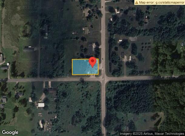
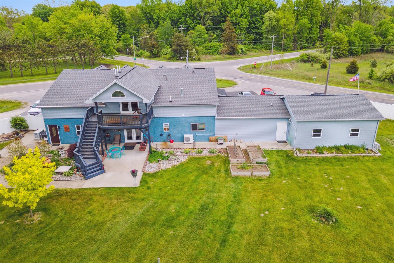
7010 Frances Rd, Flushing, MI 48433

NEARBY LISTINGS FOR SALE OR LEASE
Property Detail
7010 Frances Rd
Flint, MI
A PARCEL OF LAND BEG AT SE COR OF SEC TH S 89 DEG 30 SEC 53 SEC W 246.50 FT TH N 0 DEG 17 MIN 39 SEC W 199. FT TH N 89 DEG 30 MIN 53 SEC E 246.50 FT TH S 0 DEG 17 MIN 39 SEC E 199 FT TO POB SEC 36 T9N R5E (22) 1.13A SPLIT ON 10/27/2021 FROM 13-36-400
13-36-400-043
Genesee
Commercialnec
Michigan
2024
1.12 AC
2024
Flint
012603
Detroit
1,782 SF
DEMOGRAPHICS near 7010 Frances Rd
1 Mile
3 Mile
5 Mile
2024 Total Population
936
6,983
27,924
2029 Population
916
6,798
27,167
Pop Growth 2024-2029
(2.14%)
(2.65%)
(2.71%)
Average Age
38
42
43
2024 Total Households
345
2,573
11,130
HH Growth 2024-2029
(2.32%)
(2.72%)
(2.77%)
Median Household Inc
$51,364
$66,010
$63,336
Avg Household Size
2.60
2.60
2.50
2024 Avg HH Vehicles
2.00
2.00
2.00
Median Home Value
$146,703
$176,442
$169,638
Median Year Built
1975
1972
1971
Nearby Places
- Restaurants
- Banks
- Shops
- Fitness
- Groceries
PUBLIC TRANSPORTATION
AIRPORT
Bishop International
DRIVE
WALK
Distance
Bishop International
33 min
16.1 mi
Freight Ports
Port of Toledo
DRIVE
WALK
Distance
Port of Toledo
148 min
123.9 mi
SALE & LEASE HISTORY
LISTING DATE
SALE/LEASE

Jun 30, 2023
For Sale
Nearby Properties
Address
Land Use
TOTAL SIZE
Lot Size
Zoning
Address
Land Use
TOTAL SIZE
Lot Size
Zoning
4,204 SF
53 AC
RU-4
Address
Land Use
TOTAL SIZE
Lot Size
Zoning
1,440 SF
51.33 AC
RU-4
Address
Land Use
TOTAL SIZE
Lot Size
Zoning
Address
Land Use
TOTAL SIZE
Lot Size
Zoning
Address
Land Use
TOTAL SIZE
Lot Size
Zoning
Address
Land Use
TOTAL SIZE
Lot Size
Zoning
Address
Land Use
TOTAL SIZE
Lot Size
Zoning
Address
Land Use
TOTAL SIZE
Lot Size
Zoning
9,100 SF
2.52 AC
C-2
Address
Land Use
TOTAL SIZE
Lot Size
Zoning
76.70 AC
RSA
Address
Land Use
TOTAL SIZE
Lot Size
Zoning
1,316 SF
17.80 AC
RU-4
Address
Land Use
TOTAL SIZE
Lot Size
Zoning
Address
Land Use
TOTAL SIZE
Lot Size
Zoning
Address
Land Use
TOTAL SIZE
Lot Size
Zoning
113.16 AC
Address
Land Use
TOTAL SIZE
Lot Size
Zoning
1,610 SF
78.70 AC
AR
Address
Land Use
TOTAL SIZE
Lot Size
Zoning
2.08 AC
Address
Land Use
TOTAL SIZE
Lot Size
Zoning
Address
Land Use
TOTAL SIZE
Lot Size
Zoning
Address
Land Use
TOTAL SIZE
Lot Size
Zoning
2,736 SF
20 AC
RF-RESID F
Address
Land Use
TOTAL SIZE
Lot Size
Zoning
68.50 AC
Address
Land Use
TOTAL SIZE
Lot Size
Zoning
Address
Land Use
TOTAL SIZE
Lot Size
Zoning
123 AC
AG-AGRICUL
Address
Land Use
TOTAL SIZE
Lot Size
Zoning
19.70 AC
Address
Land Use
TOTAL SIZE
Lot Size
Zoning
Address
Land Use
TOTAL SIZE
Lot Size
Zoning
18.29 AC
Address
Land Use
TOTAL SIZE
Lot Size
Zoning
5.34 AC
Address
Land Use
TOTAL SIZE
Lot Size
Zoning
1,779 SF
60 AC
RU-1
Address
Land Use
TOTAL SIZE
Lot Size
Zoning
1,840 SF
40.24 AC
RU-1
Address
Land Use
TOTAL SIZE
Lot Size
Zoning
4.53 AC
Address
Land Use
TOTAL SIZE
Lot Size
Zoning
34.38 AC
The World's #1 Commercial Real Estate Marketplace
Connect with us
© 2025 CoStar Group
The information above has been obtained from sources believed reliable. While we do not doubt its accuracy we have not verified it and make no guarantee, warranty or representation about it. It is your responsibility to independently confirm its accuracy and completeness. Any projections, opinions, assumptions, or estimates used are for example only and do not represent the current or future performance of the property. The value of this transaction to you depends on tax and other factors which should be evaluated by your tax, financial, and legal advisors. You and your advisors should conduct a careful, independent investigation of the property to determine to your satisfaction the suitability of the property for your needs.