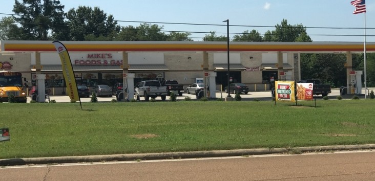
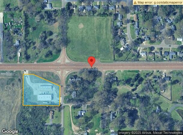
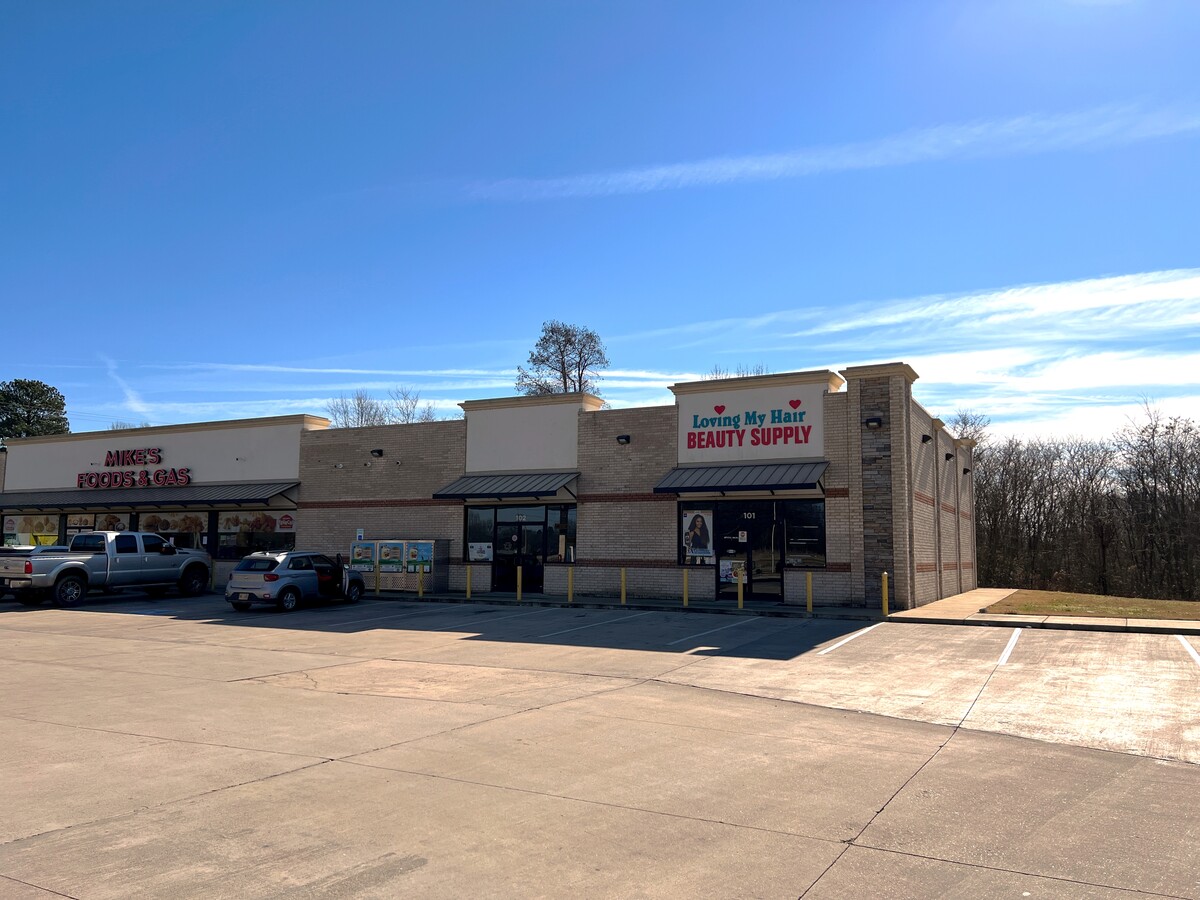
Property Record
7011 Goodman Rd, Walls, MS 38680
NEARBY LISTINGS FOR SALE OR LEASE
Property Detail
7011 Goodman Rd
Memphis, TN-MS-AR
Chancery Clarks Office
1097350000000100
35-1-9 PT NE1/4
Commercialnec
DeSoto
X
Mississippi
28033C0055H
1
2024
2.57 AC
2024
Southaven-Horn Lake
070102
Memphis
9,913 SF
DEMOGRAPHICS near 7011 Goodman Rd
1 Mile
3 Mile
5 Mile
2024 Total Population
2,534
13,491
46,864
2029 Population
2,754
14,604
49,560
Pop Growth 2024-2029
+ 8.68%
+ 8.25%
+ 5.75%
Average Age
38
37
38
2024 Total Households
903
4,820
17,073
HH Growth 2024-2029
+ 8.75%
+ 8.34%
+ 5.72%
Median Household Inc
$73,332
$65,378
$49,907
Avg Household Size
2.70
2.70
2.70
2024 Avg HH Vehicles
2.00
2.00
2.00
Median Home Value
$158,419
$164,362
$133,521
Median Year Built
1993
1992
1985
Nearby Places
- Restaurants
- Banks
- Shops
- Fitness
- Groceries
PUBLIC TRANSPORTATION
AIRPORT
Memphis International
DRIVE
WALK
Distance
Memphis International
21 min
14.7 mi
Freight Ports
Port of Shreveport
DRIVE
WALK
Distance
Port of Shreveport
418 min
380.8 mi
SALE & LEASE HISTORY
LISTING DATE
SALE/LEASE

Jan 27, 2022
For Lease
Aug 26, 2019
For Lease
Nearby Properties
Address
Land Use
TOTAL SIZE
Lot Size
Zoning
Address
Land Use
TOTAL SIZE
Lot Size
Zoning
10,092 SF
21.02 AC
PUD
Address
Land Use
TOTAL SIZE
Lot Size
Zoning
192,408 SF
29 AC
C-4
Address
Land Use
TOTAL SIZE
Lot Size
Zoning
9,636 SF
16 AC
PUD
Address
Land Use
TOTAL SIZE
Lot Size
Zoning
9,531 SF
15 AC
RM-6
Address
Land Use
TOTAL SIZE
Lot Size
Zoning
80,022 SF
6.78 AC
PUD
Address
Land Use
TOTAL SIZE
Lot Size
Zoning
9,330 SF
1.32 AC
CMU-3
Address
Land Use
TOTAL SIZE
Lot Size
Zoning
9,180 SF
1.11 AC
CMU-3
Address
Land Use
TOTAL SIZE
Lot Size
Zoning
80,144 SF
22.98 AC
M-1
Address
Land Use
TOTAL SIZE
Lot Size
Zoning
19,826 SF
2.19 AC
PUD
Address
Land Use
TOTAL SIZE
Lot Size
Zoning
11,050 SF
1.33 AC
CMU-3
Address
Land Use
TOTAL SIZE
Lot Size
Zoning
14,922 SF
2.03 AC
C-4
Address
Land Use
TOTAL SIZE
Lot Size
Zoning
22,828 SF
3.28 AC
C-4
Address
Land Use
TOTAL SIZE
Lot Size
Zoning
12,439 SF
1.46 AC
C-1
Address
Land Use
TOTAL SIZE
Lot Size
Zoning
17,966 SF
1.91 AC
C-4
Address
Land Use
TOTAL SIZE
Lot Size
Zoning
6,840 SF
4 AC
PUD
Address
Land Use
TOTAL SIZE
Lot Size
Zoning
16,310 SF
1.43 AC
PUD
Address
Land Use
TOTAL SIZE
Lot Size
Zoning
3,260 SF
1.15 AC
PUD
Address
Land Use
TOTAL SIZE
Lot Size
Zoning
3,458 SF
3.37 AC
C-1
Address
Land Use
TOTAL SIZE
Lot Size
Zoning
4,449 SF
1.02 AC
PUD
Address
Land Use
TOTAL SIZE
Lot Size
Zoning
2,280 SF
99 AC
A
Address
Land Use
TOTAL SIZE
Lot Size
Zoning
3,407 SF
1.48 AC
C-4
Address
Land Use
TOTAL SIZE
Lot Size
Zoning
19,650 SF
2.40 AC
M-1
Address
Land Use
TOTAL SIZE
Lot Size
Zoning
8,400 SF
20 AC
A-R
Address
Land Use
TOTAL SIZE
Lot Size
Zoning
7,352 SF
1.97 AC
C-4
Address
Land Use
TOTAL SIZE
Lot Size
Zoning
9,242 SF
1.12 AC
C-1
Address
Land Use
TOTAL SIZE
Lot Size
Zoning
4,000 SF
0.82 AC
CMU-3
Address
Land Use
TOTAL SIZE
Lot Size
Zoning
3,382 SF
1 AC
C-4
Address
Land Use
TOTAL SIZE
Lot Size
Zoning
17,364 SF
1.69 AC
C-4
Address
Land Use
TOTAL SIZE
Lot Size
Zoning
11,290 SF
81.06 AC
PUD
The World's #1 Commercial Real Estate Marketplace
Connect with us
© 2025 CoStar Group
The information above has been obtained from sources believed reliable. While we do not doubt its accuracy we have not verified it and make no guarantee, warranty or representation about it. It is your responsibility to independently confirm its accuracy and completeness. Any projections, opinions, assumptions, or estimates used are for example only and do not represent the current or future performance of the property. The value of this transaction to you depends on tax and other factors which should be evaluated by your tax, financial, and legal advisors. You and your advisors should conduct a careful, independent investigation of the property to determine to your satisfaction the suitability of the property for your needs.