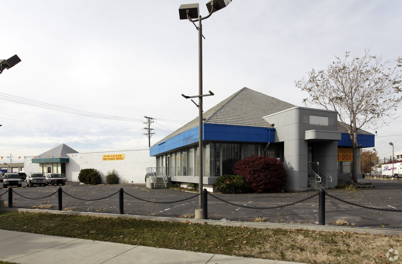
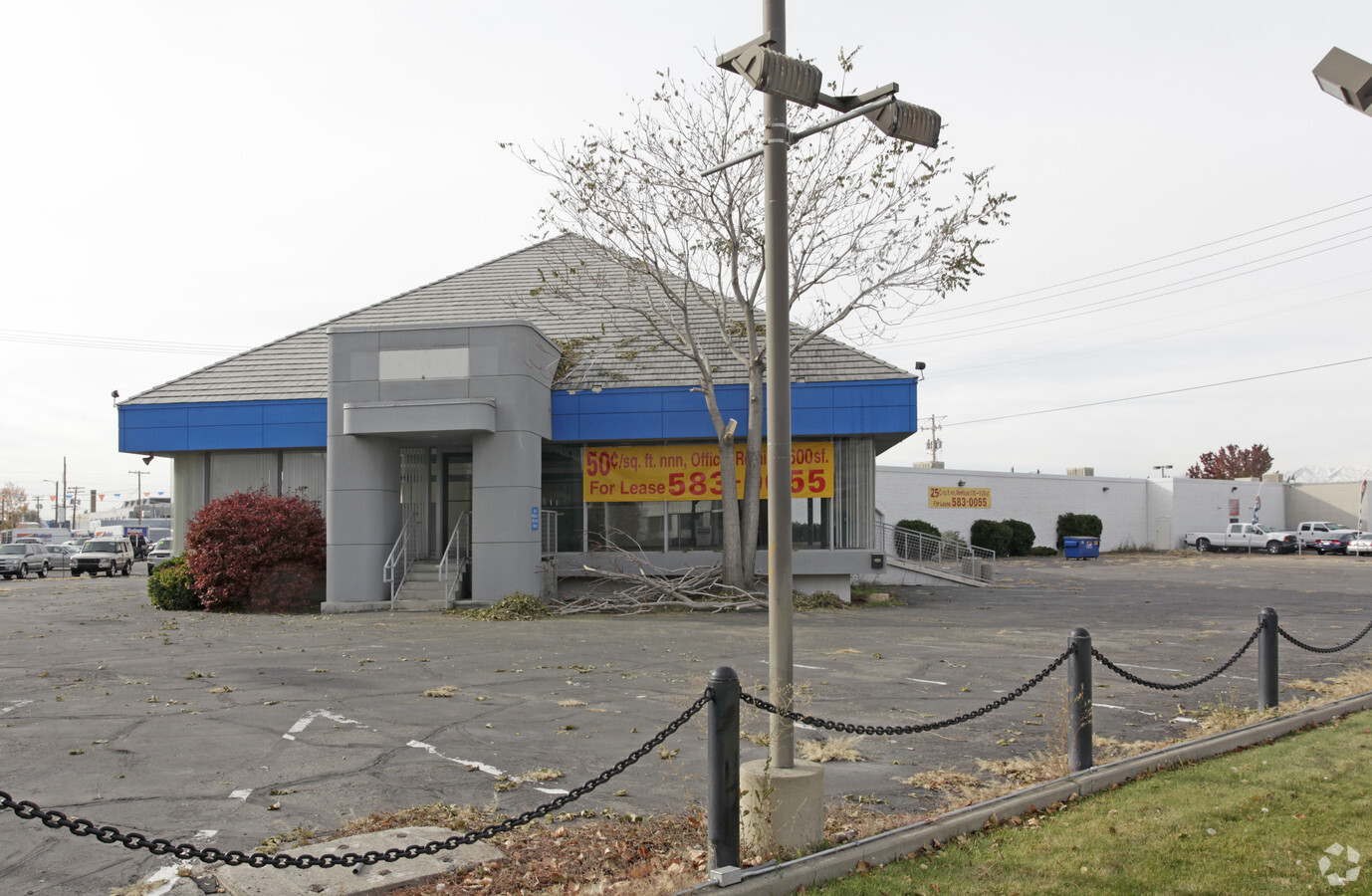
Property Record
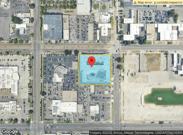
702 S Main St, Salt Lake City, UT 84101
NEARBY LISTINGS FOR SALE OR LEASE
Property Detail
702 S Main St
15-12-233-030-0000
Salt Lake City Survey Plat A
Apartment
BEG NE COR BLK 15, PLAT A, SLC SUR; S 301.84 FT; W 321 FT; N205.28 FT; E 0.7 FT; N 96.56 FT; E 320.3 FT TO BEG. 8281-5844 8538-4396 09059-3218 10574-4891 10578-0267 10694-2278
X
Salt Lake
49035C0144H
Utah
2023
2.22 AC
2023
CBD/Periphery
114000
Salt Lake City
335,747 SF
Salt Lake City, UT
DEMOGRAPHICS near 702 S Main St
1 Mile
3 Mile
5 Mile
2024 Total Population
22,110
154,358
275,708
2029 Population
23,114
157,391
279,822
Pop Growth 2024-2029
+ 4.54%
+ 1.96%
+ 1.49%
Average Age
38
37
37
2024 Total Households
11,915
70,915
115,271
HH Growth 2024-2029
+ 5.14%
+ 2.43%
+ 1.86%
Median Household Inc
$46,597
$60,355
$63,696
Avg Household Size
1.70
2.00
2.20
2024 Avg HH Vehicles
1.00
1.00
2.00
Median Home Value
$451,262
$470,612
$459,580
Median Year Built
1993
1967
1970
Nearby Places
- Restaurants
- Banks
- Shops
- Fitness
- Groceries
PUBLIC TRANSPORTATION
TRANSIT/SUBWAY
600 South Station (Red Line - Utah Transit Authority (UTA))
DRIVE
WALK
Distance
600 South Station (Red Line - Utah Transit Authority (UTA))
1 min
2 min
0.1 mi
Courthouse (TRAX Murray/Midvale/University Line - Utah Transit Authority (UTA), TRAX Salt Lake/Sandy Line - Utah Transit Authority (UTA))
DRIVE
WALK
Distance
Courthouse (TRAX Murray/Midvale/University Line - Utah Transit Authority (UTA), TRAX Salt Lake/Sandy Line - Utah Transit Authority (UTA))
2 min
7 min
0.4 mi
900 South (TRAX Murray/Midvale/University Line - Utah Transit Authority (UTA), TRAX Salt Lake/Sandy Line - Utah Transit Authority (UTA))
DRIVE
WALK
Distance
900 South (TRAX Murray/Midvale/University Line - Utah Transit Authority (UTA), TRAX Salt Lake/Sandy Line - Utah Transit Authority (UTA))
2 min
9 min
0.5 mi
Gallivan Plaza (TRAX Salt Lake/Sandy Line - Utah Transit Authority (UTA), TRAX University Line - Utah Transit Authority (UTA))
DRIVE
WALK
Distance
Gallivan Plaza (TRAX Salt Lake/Sandy Line - Utah Transit Authority (UTA), TRAX University Line - Utah Transit Authority (UTA))
3 min
13 min
0.7 mi
Main Library (TRAX Murray/Midvale/University Line - Utah Transit Authority (UTA), TRAX University Line - Utah Transit Authority (UTA))
DRIVE
WALK
Distance
Main Library (TRAX Murray/Midvale/University Line - Utah Transit Authority (UTA), TRAX University Line - Utah Transit Authority (UTA))
2 min
15 min
0.8 mi
COMMUTER RAIL
North Temple Station (FrontRunner - Utah Transit Authority (UTA))
DRIVE
WALK
Distance
North Temple Station (FrontRunner - Utah Transit Authority (UTA))
6 min
2.1 mi
Warm Springs Relief Point (FrontRunner - Utah Transit Authority (UTA))
DRIVE
WALK
Distance
Warm Springs Relief Point (FrontRunner - Utah Transit Authority (UTA))
9 min
3.5 mi
AIRPORT
Salt Lake City International
DRIVE
WALK
Distance
Salt Lake City International
12 min
6.9 mi
Freight Ports
Port of Stockton
DRIVE
WALK
Distance
Port of Stockton
712 min
697.3 mi
Nearby Properties
Address
Land Use
TOTAL SIZE
Lot Size
Zoning
Address
Land Use
TOTAL SIZE
Lot Size
Zoning
1,259,285 SF
59.07 AC
I
Address
Land Use
TOTAL SIZE
Lot Size
Zoning
1,450,542 SF
9.72 AC
D-4
Address
Land Use
TOTAL SIZE
Lot Size
Zoning
1,573,360 SF
44.15 AC
I
Address
Land Use
TOTAL SIZE
Lot Size
Zoning
629,582 SF
80.77 AC
I
Address
Land Use
TOTAL SIZE
Lot Size
Zoning
94,230 SF
13.71 AC
I
Address
Land Use
TOTAL SIZE
Lot Size
Zoning
329,989 SF
33.64 AC
I
Address
Land Use
TOTAL SIZE
Lot Size
Zoning
268,830 SF
20.05 AC
1205
Address
Land Use
TOTAL SIZE
Lot Size
Zoning
56,741 SF
1.70 AC
D-1
Address
Land Use
TOTAL SIZE
Lot Size
Zoning
350,000 SF
10 AC
2000
Address
Land Use
TOTAL SIZE
Lot Size
Zoning
836,183 SF
5.89 AC
TSA-UC
Address
Land Use
TOTAL SIZE
Lot Size
Zoning
205,570 SF
5.63 AC
UI
Address
Land Use
TOTAL SIZE
Lot Size
Zoning
566,160 SF
4.14 AC
3000
Address
Land Use
TOTAL SIZE
Lot Size
Zoning
1,561,092 SF
3.50 AC
D-1
Address
Land Use
TOTAL SIZE
Lot Size
Zoning
296,978 SF
27.30 AC
I
Address
Land Use
TOTAL SIZE
Lot Size
Zoning
87,933 SF
4.90 AC
D-1
Address
Land Use
TOTAL SIZE
Lot Size
Zoning
1,779,694 SF
6.88 AC
D-1
Address
Land Use
TOTAL SIZE
Lot Size
Zoning
661,345 SF
0.01 AC
D1
Address
Land Use
TOTAL SIZE
Lot Size
Zoning
35,720 SF
0.55 AC
D-1
Address
Land Use
TOTAL SIZE
Lot Size
Zoning
737,755 SF
1.63 AC
D-1
Address
Land Use
TOTAL SIZE
Lot Size
Zoning
543,780 SF
0.33 AC
D1
Address
Land Use
TOTAL SIZE
Lot Size
Zoning
163,932 SF
14.65 AC
PL
Address
Land Use
TOTAL SIZE
Lot Size
Zoning
82,851 SF
9.76 AC
PL2
Address
Land Use
TOTAL SIZE
Lot Size
Zoning
2,566,335 SF
10.01 AC
D-1
Address
Land Use
TOTAL SIZE
Lot Size
Zoning
16,933 SF
34.68 AC
1205
Address
Land Use
TOTAL SIZE
Lot Size
Zoning
497,018 SF
13.11 AC
1205
Address
Land Use
TOTAL SIZE
Lot Size
Zoning
449,528 SF
1.64 AC
2000
Address
Land Use
TOTAL SIZE
Lot Size
Zoning
366,584 SF
1.95 AC
TSAUC
Address
Land Use
TOTAL SIZE
Lot Size
Zoning
166,938 SF
51.07 AC
I
Address
Land Use
TOTAL SIZE
Lot Size
Zoning
146,422 SF
2.62 AC
UI
Address
Land Use
TOTAL SIZE
Lot Size
Zoning
380,988 SF
1.64 AC
D-1
The World's #1 Commercial Real Estate Marketplace
Connect with us
© 2025 CoStar Group
The information above has been obtained from sources believed reliable. While we do not doubt its accuracy we have not verified it and make no guarantee, warranty or representation about it. It is your responsibility to independently confirm its accuracy and completeness. Any projections, opinions, assumptions, or estimates used are for example only and do not represent the current or future performance of the property. The value of this transaction to you depends on tax and other factors which should be evaluated by your tax, financial, and legal advisors. You and your advisors should conduct a careful, independent investigation of the property to determine to your satisfaction the suitability of the property for your needs.