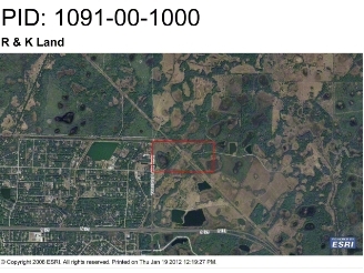
Property Record
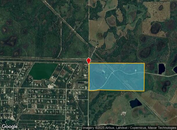
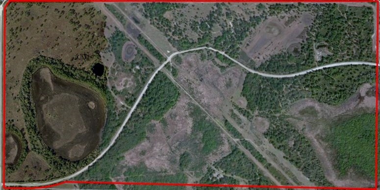
7020 N Toledo Blade Blvd, North Port, FL 34286
NEARBY LISTINGS FOR SALE OR LEASE
Property Detail
7020 N Toledo Blade Blvd
North Port-Sarasota-Bradenton, FL
Not Part Of A Subdivision
1091-00-1000
N 1/2 OF SEC 6-39-22, & PART OF S 1/2 OF SEC 6 DESC AS COM AT NW COR OF SEC 6, TH S-0-30-07-W 2548.44 FT TO SW COR OF N 1/2 OF SEC FOR POB TH S-88-26-46-E 877.49 FT TH SWLY ALG CURVE TO RIGHT
Pasture
Sarasota
AE
Florida
12115C0382F
319 AC
2023
Sarasota Outlying
2024
Tampa/St Petersburg
002726
DEMOGRAPHICS near 7020 N Toledo Blade Blvd
1 Mile
3 Mile
5 Mile
2024 Total Population
5,713
38,925
81,865
2029 Population
6,607
44,886
95,152
Pop Growth 2024-2029
+ 15.65%
+ 15.31%
+ 16.23%
Average Age
44
42
45
2024 Total Households
2,212
14,520
32,400
HH Growth 2024-2029
+ 15.55%
+ 15.28%
+ 16.37%
Median Household Inc
$66,576
$75,862
$66,138
Avg Household Size
2.50
2.60
2.50
2024 Avg HH Vehicles
2.00
2.00
2.00
Median Home Value
$252,095
$256,471
$243,841
Median Year Built
2005
2004
2001
Nearby Places
- Restaurants
- Banks
- Shops
- Fitness
- Groceries
PUBLIC TRANSPORTATION
AIRPORT
Punta Gorda
DRIVE
WALK
Distance
Punta Gorda
27 min
20.0 mi
Freight Ports
Port Manatee
DRIVE
WALK
Distance
Port Manatee
68 min
56.6 mi
SALE & LEASE HISTORY
LISTING DATE
SALE/LEASE

Sep 05, 2017
For Sale
Nearby Properties
Address
Land Use
TOTAL SIZE
Lot Size
Zoning
Address
Land Use
TOTAL SIZE
Lot Size
Zoning
287,899 SF
26.96 AC
AC4
Address
Land Use
TOTAL SIZE
Lot Size
Zoning
285,000 SF
148.79 AC
PCDN
Address
Land Use
TOTAL SIZE
Lot Size
Zoning
145,713 SF
30.50 AC
GU
Address
Land Use
TOTAL SIZE
Lot Size
Zoning
54,876 SF
23.57 AC
AC4
Address
Land Use
TOTAL SIZE
Lot Size
Zoning
96,325 SF
5.73 AC
AC4
Address
Land Use
TOTAL SIZE
Lot Size
Zoning
54,710 SF
8.48 AC
AC4
Address
Land Use
TOTAL SIZE
Lot Size
Zoning
36,000 SF
2.87 AC
AC4
Address
Land Use
TOTAL SIZE
Lot Size
Zoning
40,789 SF
20.91 AC
AC4
Address
Land Use
TOTAL SIZE
Lot Size
Zoning
92,904 SF
7.98 AC
AC4
Address
Land Use
TOTAL SIZE
Lot Size
Zoning
35,600 SF
13.19 AC
AC4
Address
Land Use
TOTAL SIZE
Lot Size
Zoning
29.90 AC
AC4
Address
Land Use
TOTAL SIZE
Lot Size
Zoning
30,000 SF
5.66 AC
AC4
Address
Land Use
TOTAL SIZE
Lot Size
Zoning
34,062 SF
2.72 AC
AC4
Address
Land Use
TOTAL SIZE
Lot Size
Zoning
40,640 SF
3.05 AC
AC4
Address
Land Use
TOTAL SIZE
Lot Size
Zoning
35,280 SF
2.33 AC
AC4
Address
Land Use
TOTAL SIZE
Lot Size
Zoning
38,350 SF
3.86 AC
AC4
Address
Land Use
TOTAL SIZE
Lot Size
Zoning
3,115 SF
3.35 AC
AC4
Address
Land Use
TOTAL SIZE
Lot Size
Zoning
33,600 SF
2.32 AC
PCDN
Address
Land Use
TOTAL SIZE
Lot Size
Zoning
16,212 SF
1.77 AC
AC4
Address
Land Use
TOTAL SIZE
Lot Size
Zoning
10,640 SF
1.51 AC
AC4
Address
Land Use
TOTAL SIZE
Lot Size
Zoning
34,363 SF
2.91 AC
AC4
Address
Land Use
TOTAL SIZE
Lot Size
Zoning
5,856 SF
3.47 AC
AC4
Address
Land Use
TOTAL SIZE
Lot Size
Zoning
33,563 SF
3.11 AC
AC4
Address
Land Use
TOTAL SIZE
Lot Size
Zoning
10,168 SF
1.30 AC
AC4
Address
Land Use
TOTAL SIZE
Lot Size
Zoning
8,842 SF
1.34 AC
AC4
Address
Land Use
TOTAL SIZE
Lot Size
Zoning
2,828 SF
1 AC
AC4
Address
Land Use
TOTAL SIZE
Lot Size
Zoning
10,052 SF
1.06 AC
AC4
Address
Land Use
TOTAL SIZE
Lot Size
Zoning
26,752 SF
1.46 AC
AC4
Address
Land Use
TOTAL SIZE
Lot Size
Zoning
18,920 SF
1.52 AC
AC4
The World's #1 Commercial Real Estate Marketplace
Connect with us
© 2025 CoStar Group
The information above has been obtained from sources believed reliable. While we do not doubt its accuracy we have not verified it and make no guarantee, warranty or representation about it. It is your responsibility to independently confirm its accuracy and completeness. Any projections, opinions, assumptions, or estimates used are for example only and do not represent the current or future performance of the property. The value of this transaction to you depends on tax and other factors which should be evaluated by your tax, financial, and legal advisors. You and your advisors should conduct a careful, independent investigation of the property to determine to your satisfaction the suitability of the property for your needs.