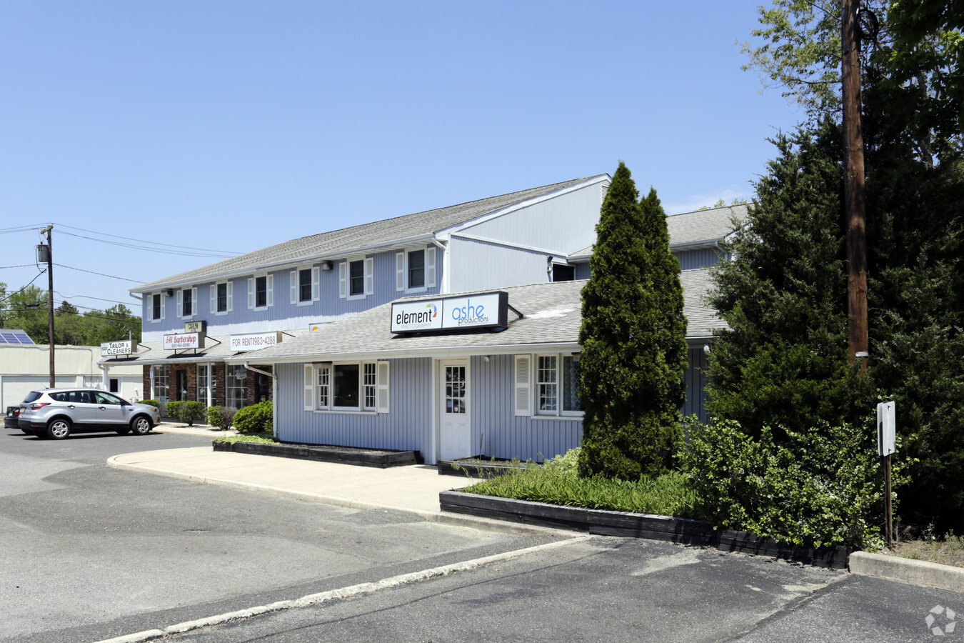
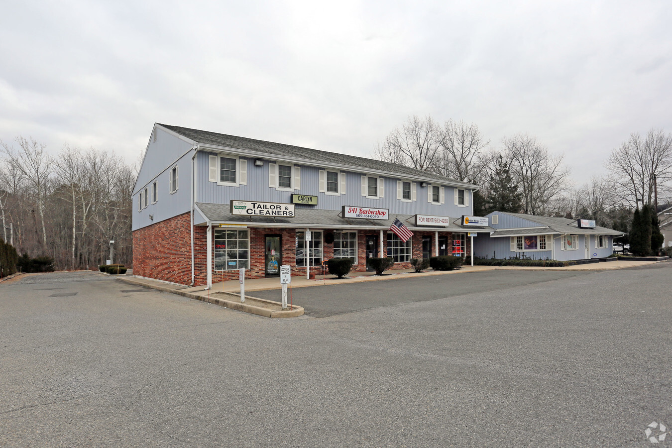
Property Record
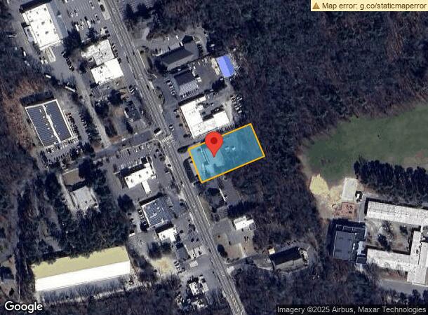
703 Stokes Rd, Medford, NJ 08055
NEARBY LISTINGS FOR SALE OR LEASE
Property Detail
703 Stokes Rd
20-04802-0000-00006-03
FIRE DAM-PART VALUE
Storebuilding
Burlington
X
New Jersey
34005C0381F
6.3
2023
0.97 AC
2024
South Burlington County
703801
Philadelphia
10,348 SF
Philadelphia-Camden-Wilmington, PA-NJ-DE-MD
DEMOGRAPHICS near 703 Stokes Rd
1 Mile
3 Mile
5 Mile
2024 Total Population
4,710
25,170
56,868
2029 Population
4,760
25,500
57,807
Pop Growth 2024-2029
+ 1.06%
+ 1.31%
+ 1.65%
Average Age
42
42
42
2024 Total Households
1,675
8,973
21,580
HH Growth 2024-2029
+ 1.01%
+ 1.37%
+ 1.72%
Median Household Inc
$138,173
$141,470
$126,714
Avg Household Size
2.80
2.80
2.60
2024 Avg HH Vehicles
2.00
2.00
2.00
Median Home Value
$372,231
$390,560
$378,185
Median Year Built
1963
1976
1983
Nearby Places
- Restaurants
- Banks
- Shops
- Fitness
- Groceries
PUBLIC TRANSPORTATION
AIRPORT
Philadelphia International
DRIVE
WALK
Distance
Philadelphia International
46 min
31.5 mi
Trenton Mercer
DRIVE
WALK
Distance
Trenton Mercer
54 min
36.7 mi
Freight Ports
Port of Philadelphia
DRIVE
WALK
Distance
Port of Philadelphia
31 min
21.6 mi
SALE & LEASE HISTORY
LISTING DATE
SALE/LEASE

Sep 25, 2016
For Lease
Sep 24, 2016
For Sale
Jun 14, 2019
For Lease
Nearby Properties
Address
Land Use
TOTAL SIZE
Lot Size
Zoning
Address
Land Use
TOTAL SIZE
Lot Size
Zoning
103.84 AC
PPE
Address
Land Use
TOTAL SIZE
Lot Size
Zoning
48.43 AC
Address
Land Use
TOTAL SIZE
Lot Size
Zoning
3 AC
GMN
Address
Land Use
TOTAL SIZE
Lot Size
Zoning
Address
Land Use
TOTAL SIZE
Lot Size
Zoning
49.38 AC
PPE
Address
Land Use
TOTAL SIZE
Lot Size
Zoning
22.74 AC
HC-1
Address
Land Use
TOTAL SIZE
Lot Size
Zoning
57.38 AC
PPE
Address
Land Use
TOTAL SIZE
Lot Size
Zoning
86.30 AC
PPE
Address
Land Use
TOTAL SIZE
Lot Size
Zoning
9.88 AC
PPE
Address
Land Use
TOTAL SIZE
Lot Size
Zoning
23.70 AC
HM
Address
Land Use
TOTAL SIZE
Lot Size
Zoning
1,754 SF
10.68 AC
HC-2
Address
Land Use
TOTAL SIZE
Lot Size
Zoning
17.54 AC
PPE
Address
Land Use
TOTAL SIZE
Lot Size
Zoning
19.40 AC
PPE
Address
Land Use
TOTAL SIZE
Lot Size
Zoning
23,402 SF
2.42 AC
RHO
Address
Land Use
TOTAL SIZE
Lot Size
Zoning
37.51 AC
CC
Address
Land Use
TOTAL SIZE
Lot Size
Zoning
727.20 AC
PPE
Address
Land Use
TOTAL SIZE
Lot Size
Zoning
11.14 AC
CC
Address
Land Use
TOTAL SIZE
Lot Size
Zoning
13.50 AC
HC-1
Address
Land Use
TOTAL SIZE
Lot Size
Zoning
1,716 SF
42.56 AC
GMN
Address
Land Use
TOTAL SIZE
Lot Size
Zoning
12,364 SF
11.16 AC
HC-1
Address
Land Use
TOTAL SIZE
Lot Size
Zoning
18.55 AC
LI
Address
Land Use
TOTAL SIZE
Lot Size
Zoning
3,684 SF
8.80 AC
HC-1
Address
Land Use
TOTAL SIZE
Lot Size
Zoning
157.02 AC
VRD
Address
Land Use
TOTAL SIZE
Lot Size
Zoning
1.64 AC
SGRA
Address
Land Use
TOTAL SIZE
Lot Size
Zoning
81.20 AC
RGD
Address
Land Use
TOTAL SIZE
Lot Size
Zoning
4.90 AC
PPE
Address
Land Use
TOTAL SIZE
Lot Size
Zoning
17,194 SF
150.35 AC
GD
Address
Land Use
TOTAL SIZE
Lot Size
Zoning
10.65 AC
GMS
Address
Land Use
TOTAL SIZE
Lot Size
Zoning
18,362 SF
5.59 AC
RHC
Address
Land Use
TOTAL SIZE
Lot Size
Zoning
3.87 AC
PPE
The World's #1 Commercial Real Estate Marketplace
Connect with us
© 2025 CoStar Group
The information above has been obtained from sources believed reliable. While we do not doubt its accuracy we have not verified it and make no guarantee, warranty or representation about it. It is your responsibility to independently confirm its accuracy and completeness. Any projections, opinions, assumptions, or estimates used are for example only and do not represent the current or future performance of the property. The value of this transaction to you depends on tax and other factors which should be evaluated by your tax, financial, and legal advisors. You and your advisors should conduct a careful, independent investigation of the property to determine to your satisfaction the suitability of the property for your needs.