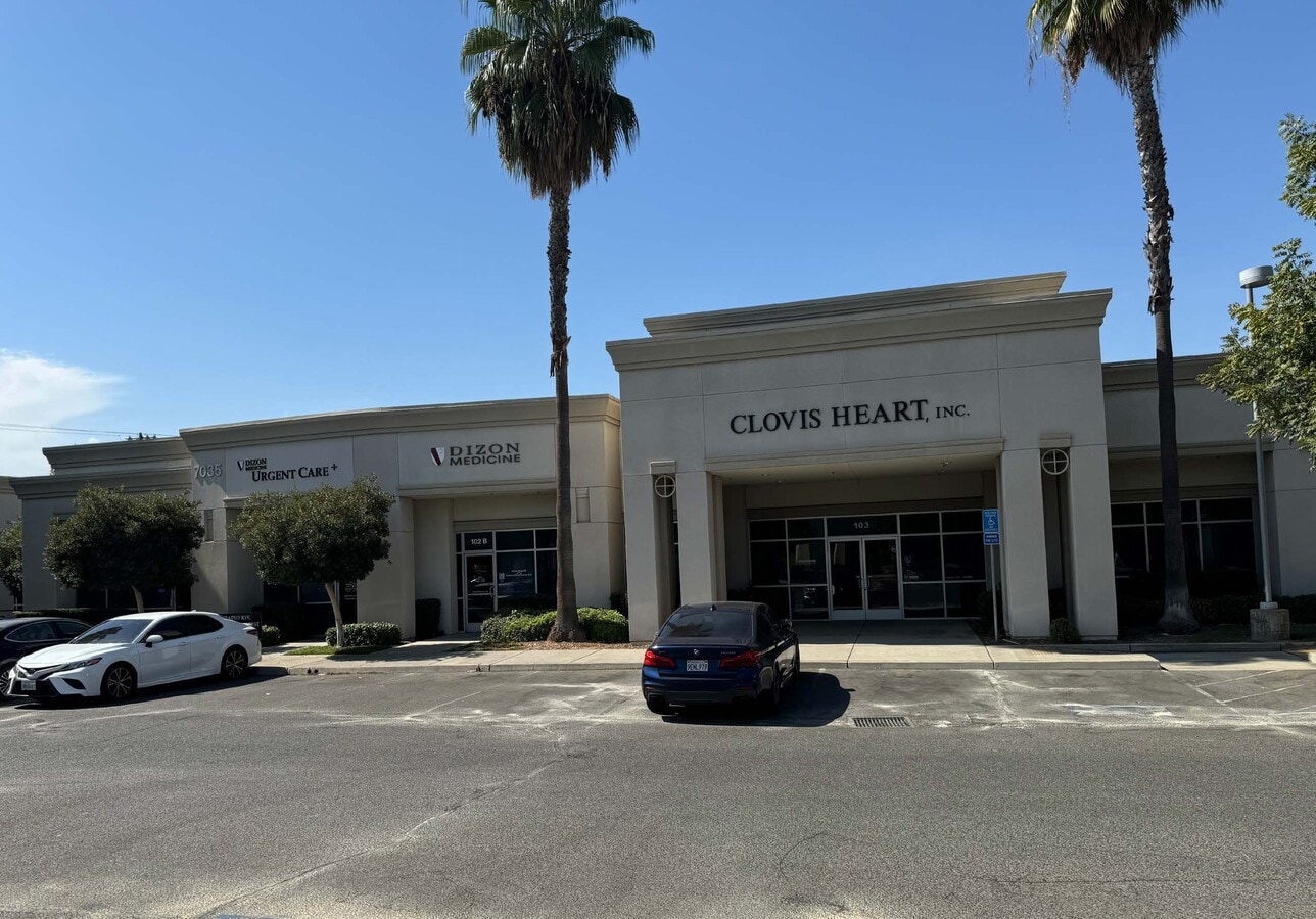
Property Record
7035 N Maple Ave, Fresno, CA 93720


Current Lease Availabilities
NEARBY LISTINGS FOR SALE OR LEASE
Property Detail
7035 N Maple Ave
404-300-25
PARCEL D P/M 2005-34 BK 66 PGS 44-45
Medicalbuilding
Fresno
X
California
06019C1580H
0.70 AC
2023
Woodward
2023
Fresno
005509
Fresno, CA
7,936 SF
DEMOGRAPHICS near 7035 N Maple Ave
1 Mile
3 Mile
5 Mile
2024 Total Population
15,509
146,245
304,926
2029 Population
15,803
149,273
311,728
Pop Growth 2024-2029
+ 1.90%
+ 2.07%
+ 2.23%
Average Age
41
38
38
2024 Total Households
6,024
55,705
111,517
HH Growth 2024-2029
+ 1.98%
+ 2.08%
+ 2.24%
Median Household Inc
$82,378
$71,113
$72,778
Avg Household Size
2.50
2.50
2.70
2024 Avg HH Vehicles
2.00
2.00
2.00
Median Home Value
$342,483
$363,887
$368,996
Median Year Built
1985
1983
1979
Nearby Places
- Restaurants
- Banks
- Shops
- Fitness
- Groceries
PUBLIC TRANSPORTATION
COMMUTER RAIL
Fresno (San Joaquins - Amtrak)
DRIVE
WALK
Distance
Fresno (San Joaquins - Amtrak)
14 min
9.8 mi
AIRPORT
Fresno Yosemite International
DRIVE
WALK
Distance
Fresno Yosemite International
13 min
6.8 mi
Freight Ports
Port of Stockton
DRIVE
WALK
Distance
Port of Stockton
154 min
127.0 mi
Nearby Properties
Address
Land Use
TOTAL SIZE
Lot Size
Zoning
Address
Land Use
TOTAL SIZE
Lot Size
Zoning
574,093 SF
25.54 AC
C3
Address
Land Use
TOTAL SIZE
Lot Size
Zoning
143,370 SF
6.92 AC
CP
Address
Land Use
TOTAL SIZE
Lot Size
Zoning
451,977 SF
24.17 AC
SPLIT
Address
Land Use
TOTAL SIZE
Lot Size
Zoning
693,292 SF
29.86 AC
CP
Address
Land Use
TOTAL SIZE
Lot Size
Zoning
267,481 SF
33.19 AC
CP
Address
Land Use
TOTAL SIZE
Lot Size
Zoning
180,770 SF
19.03 AC
PCC
Address
Land Use
TOTAL SIZE
Lot Size
Zoning
239,000 SF
20.34 AC
R2
Address
Land Use
TOTAL SIZE
Lot Size
Zoning
32.70 AC
RA
Address
Land Use
TOTAL SIZE
Lot Size
Zoning
81,545 SF
3.18 AC
CP
Address
Land Use
TOTAL SIZE
Lot Size
Zoning
192,062 SF
11.50 AC
RS5
Address
Land Use
TOTAL SIZE
Lot Size
Zoning
184,694 SF
9.99 AC
SPLIT
Address
Land Use
TOTAL SIZE
Lot Size
Zoning
119,869 SF
11.08 AC
C1
Address
Land Use
TOTAL SIZE
Lot Size
Zoning
328,887 SF
16.34 AC
R3
Address
Land Use
TOTAL SIZE
Lot Size
Zoning
241,133 SF
13.61 AC
R3
Address
Land Use
TOTAL SIZE
Lot Size
Zoning
188,177 SF
5.58 AC
CP
Address
Land Use
TOTAL SIZE
Lot Size
Zoning
212,354 SF
13.12 AC
R2
Address
Land Use
TOTAL SIZE
Lot Size
Zoning
174,577 SF
8.40 AC
RM1
Address
Land Use
TOTAL SIZE
Lot Size
Zoning
181,538 SF
0.01 AC
CP
Address
Land Use
TOTAL SIZE
Lot Size
Zoning
200,826 SF
19.23 AC
R2
Address
Land Use
TOTAL SIZE
Lot Size
Zoning
152,550 SF
9.23 AC
R3
Address
Land Use
TOTAL SIZE
Lot Size
Zoning
208,444 SF
11.75 AC
R3
Address
Land Use
TOTAL SIZE
Lot Size
Zoning
175,117 SF
10 AC
C1
Address
Land Use
TOTAL SIZE
Lot Size
Zoning
185,584 SF
19.19 AC
C2
Address
Land Use
TOTAL SIZE
Lot Size
Zoning
57,486 SF
4.61 AC
R2A
Address
Land Use
TOTAL SIZE
Lot Size
Zoning
122,486 SF
6.24 AC
CP
Address
Land Use
TOTAL SIZE
Lot Size
Zoning
132,084 SF
9.68 AC
RM1
Address
Land Use
TOTAL SIZE
Lot Size
Zoning
8.80 AC
AE5
Address
Land Use
TOTAL SIZE
Lot Size
Zoning
137,094 SF
4.88 AC
CM
The World's #1 Commercial Real Estate Marketplace
Connect with us
© 2025 CoStar Group
The information above has been obtained from sources believed reliable. While we do not doubt its accuracy we have not verified it and make no guarantee, warranty or representation about it. It is your responsibility to independently confirm its accuracy and completeness. Any projections, opinions, assumptions, or estimates used are for example only and do not represent the current or future performance of the property. The value of this transaction to you depends on tax and other factors which should be evaluated by your tax, financial, and legal advisors. You and your advisors should conduct a careful, independent investigation of the property to determine to your satisfaction the suitability of the property for your needs.