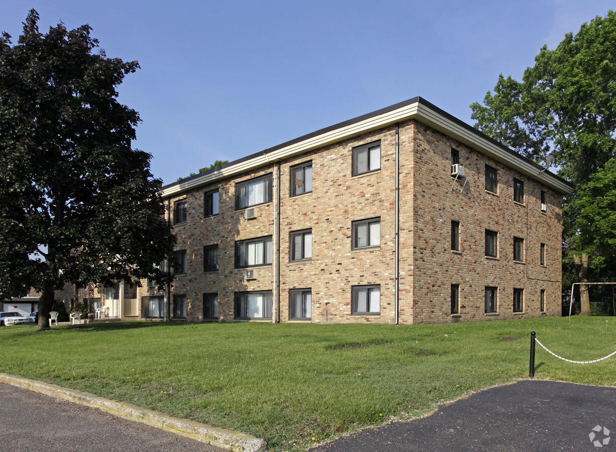
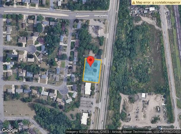
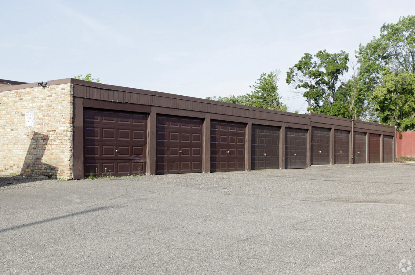
Property Record
7037 Concord Blvd, Inver Grove Heights, MN 55076

NEARBY LISTINGS FOR SALE OR LEASE
-
-
View all Inver Grove Heights listings for sale on LoopNet.com
Property Detail
7037 Concord Blvd
Minneapolis-St. Paul-Bloomington, MN-WI
South Grove No 12
20-71161-00-012
SOUTH GROVE NO 12 A PT OF OUTLOT A COM NE COR L5 B5 S ON E LINES L5-6 & 7 B5 215 FT SE AT RT ANGLE 150 FT TO E LINE OUTL A N 215 FT NW 150 FT TO BEG
Apartment
Dakota
X
Minnesota
27037C0107E
12
2024
0.74 AC
2023
South Grove
060503
Minneapolis/St Paul
17,130 SF
DEMOGRAPHICS near 7037 Concord Blvd
1 Mile
3 Mile
5 Mile
2024 Total Population
7,571
49,523
121,191
2029 Population
7,733
51,399
127,176
Pop Growth 2024-2029
+ 2.14%
+ 3.79%
+ 4.94%
Average Age
40
40
40
2024 Total Households
2,891
19,604
47,078
HH Growth 2024-2029
+ 2.14%
+ 3.62%
+ 4.83%
Median Household Inc
$75,582
$82,311
$86,362
Avg Household Size
2.50
2.50
2.50
2024 Avg HH Vehicles
2.00
2.00
2.00
Median Home Value
$260,116
$285,829
$299,562
Median Year Built
1973
1981
1983
Nearby Places
- Restaurants
- Banks
- Shops
- Fitness
- Groceries
PUBLIC TRANSPORTATION
COMMUTER RAIL
St. Paul-Minneapolis (Empire Builder - Amtrak)
DRIVE
WALK
Distance
St. Paul-Minneapolis (Empire Builder - Amtrak)
15 min
9.8 mi
AIRPORT
Minneapolis-St Paul International/Wold-Chamberlain
DRIVE
WALK
Distance
Minneapolis-St Paul International/Wold-Chamberlain
21 min
13.1 mi
Freight Ports
Port Milwaukee
DRIVE
WALK
Distance
Port Milwaukee
364 min
331.0 mi
Nearby Properties
Address
Land Use
TOTAL SIZE
Lot Size
Zoning
Address
Land Use
TOTAL SIZE
Lot Size
Zoning
238,188 SF
4.86 AC
Address
Land Use
TOTAL SIZE
Lot Size
Zoning
196,078 SF
31.29 AC
Address
Land Use
TOTAL SIZE
Lot Size
Zoning
794,084 SF
6.97 AC
Address
Land Use
TOTAL SIZE
Lot Size
Zoning
284,876 SF
29.54 AC
Address
Land Use
TOTAL SIZE
Lot Size
Zoning
169,237 SF
23.38 AC
Address
Land Use
TOTAL SIZE
Lot Size
Zoning
343,282 SF
10.79 AC
Address
Land Use
TOTAL SIZE
Lot Size
Zoning
227,382 SF
13.14 AC
Address
Land Use
TOTAL SIZE
Lot Size
Zoning
147,944 SF
5.17 AC
Address
Land Use
TOTAL SIZE
Lot Size
Zoning
117,356 SF
2.96 AC
Address
Land Use
TOTAL SIZE
Lot Size
Zoning
96,036 SF
2.67 AC
Address
Land Use
TOTAL SIZE
Lot Size
Zoning
219,438 SF
90.20 AC
Address
Land Use
TOTAL SIZE
Lot Size
Zoning
106,040 SF
5.70 AC
Address
Land Use
TOTAL SIZE
Lot Size
Zoning
143,712 SF
9.57 AC
Address
Land Use
TOTAL SIZE
Lot Size
Zoning
290,362 SF
12.83 AC
Address
Land Use
TOTAL SIZE
Lot Size
Zoning
64,860 SF
2.65 AC
Address
Land Use
TOTAL SIZE
Lot Size
Zoning
87,080 SF
2.16 AC
Address
Land Use
TOTAL SIZE
Lot Size
Zoning
95,693 SF
3.64 AC
Address
Land Use
TOTAL SIZE
Lot Size
Zoning
185,715 SF
11.50 AC
Address
Land Use
TOTAL SIZE
Lot Size
Zoning
186,856 SF
Address
Land Use
TOTAL SIZE
Lot Size
Zoning
108,000 SF
6.44 AC
Address
Land Use
TOTAL SIZE
Lot Size
Zoning
130,171 SF
10.22 AC
Address
Land Use
TOTAL SIZE
Lot Size
Zoning
161,676 SF
13.90 AC
Address
Land Use
TOTAL SIZE
Lot Size
Zoning
141,090 SF
16.79 AC
Address
Land Use
TOTAL SIZE
Lot Size
Zoning
72,350 SF
1.86 AC
Address
Land Use
TOTAL SIZE
Lot Size
Zoning
83,000 SF
6.45 AC
Address
Land Use
TOTAL SIZE
Lot Size
Zoning
35,396 SF
2.02 AC
Address
Land Use
TOTAL SIZE
Lot Size
Zoning
96,000 SF
6.41 AC
Address
Land Use
TOTAL SIZE
Lot Size
Zoning
61,138 SF
7.67 AC
Address
Land Use
TOTAL SIZE
Lot Size
Zoning
71,296 SF
4.99 AC
Address
Land Use
TOTAL SIZE
Lot Size
Zoning
85,104 SF
11.75 AC
The World's #1 Commercial Real Estate Marketplace
Connect with us
© 2025 CoStar Group
The information above has been obtained from sources believed reliable. While we do not doubt its accuracy we have not verified it and make no guarantee, warranty or representation about it. It is your responsibility to independently confirm its accuracy and completeness. Any projections, opinions, assumptions, or estimates used are for example only and do not represent the current or future performance of the property. The value of this transaction to you depends on tax and other factors which should be evaluated by your tax, financial, and legal advisors. You and your advisors should conduct a careful, independent investigation of the property to determine to your satisfaction the suitability of the property for your needs.