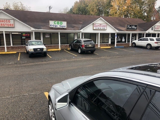
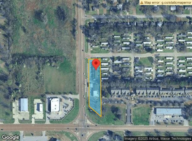
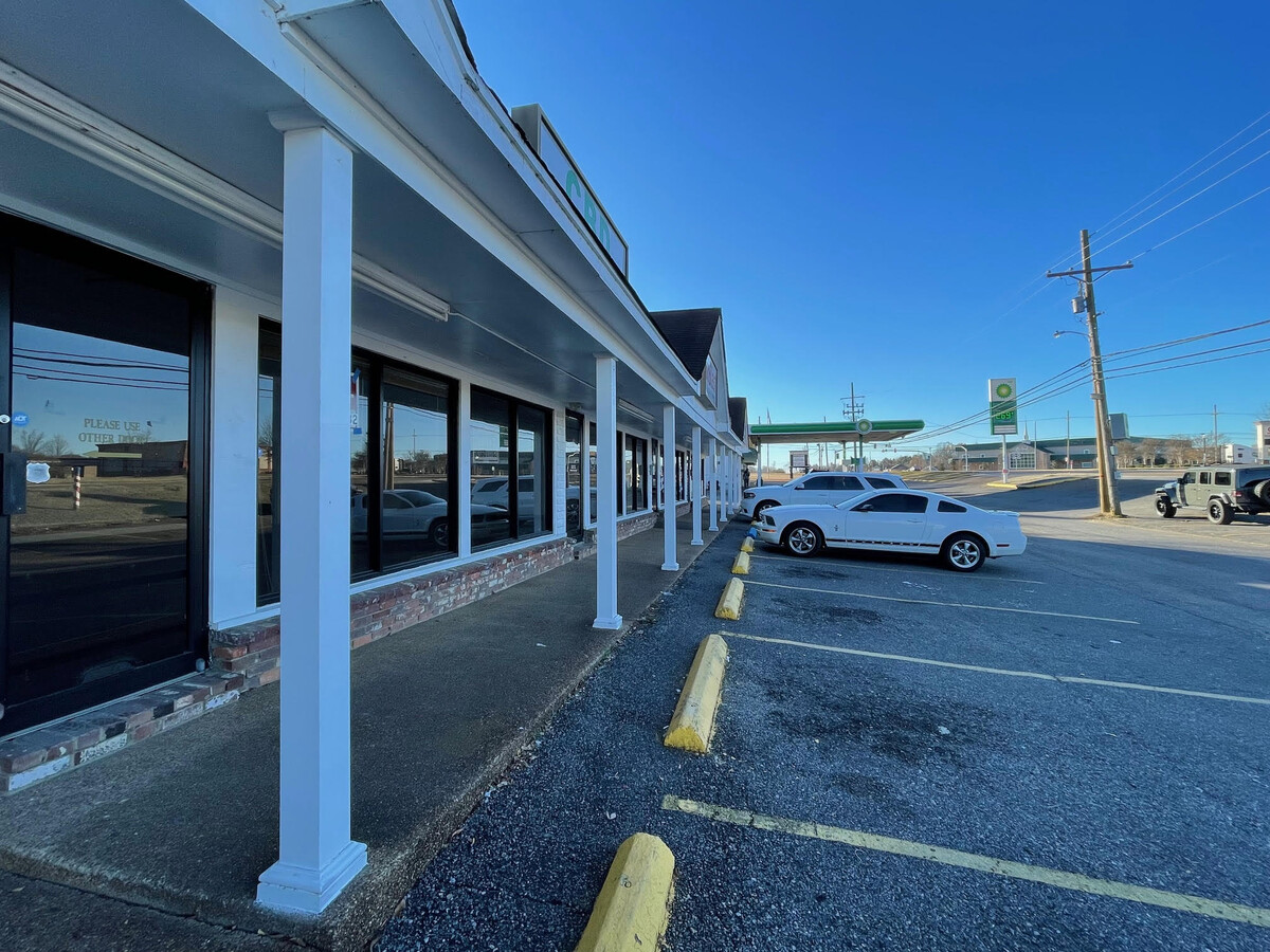
Property Record
7074 Highway 301, Horn Lake, MS 38637
NEARBY LISTINGS FOR SALE OR LEASE
Property Detail
7074 Highway 301
Memphis, TN-MS-AR
Rose Commercial Plaza
1089300000000900
ROSE COMM PLAZA PT SW1/4 SW1/4 LESS ROW
Realpropertynec
DeSoto
X
Mississippi
28033C0055H
9
2024
1.33 AC
2024
Southaven-Horn Lake
070210
Memphis
4,600 SF
DEMOGRAPHICS near 7074 Highway 301
1 Mile
3 Mile
5 Mile
2024 Total Population
3,689
26,599
66,142
2029 Population
3,977
28,668
69,685
Pop Growth 2024-2029
+ 7.81%
+ 7.78%
+ 5.36%
Average Age
37
36
38
2024 Total Households
1,318
9,525
24,478
HH Growth 2024-2029
+ 7.81%
+ 7.84%
+ 5.36%
Median Household Inc
$83,125
$54,595
$47,149
Avg Household Size
2.70
2.70
2.60
2024 Avg HH Vehicles
2.00
2.00
2.00
Median Home Value
$152,981
$155,383
$123,684
Median Year Built
1991
1992
1980
Nearby Places
- Restaurants
- Banks
- Shops
- Fitness
- Groceries
PUBLIC TRANSPORTATION
AIRPORT
Memphis International
DRIVE
WALK
Distance
Memphis International
20 min
12.1 mi
Freight Ports
Port of Shreveport
DRIVE
WALK
Distance
Port of Shreveport
416 min
379.8 mi
SALE & LEASE HISTORY
LISTING DATE
SALE/LEASE

Nov 28, 2023
For Lease
Apr 02, 2024
For Lease
Nearby Properties
Address
Land Use
TOTAL SIZE
Lot Size
Zoning
Address
Land Use
TOTAL SIZE
Lot Size
Zoning
868,060 SF
51.02 AC
PBP
Address
Land Use
TOTAL SIZE
Lot Size
Zoning
39.98 AC
PUD
Address
Land Use
TOTAL SIZE
Lot Size
Zoning
11,937 SF
18.14 AC
PUD
Address
Land Use
TOTAL SIZE
Lot Size
Zoning
10,092 SF
21.02 AC
PUD
Address
Land Use
TOTAL SIZE
Lot Size
Zoning
192,408 SF
29 AC
C-4
Address
Land Use
TOTAL SIZE
Lot Size
Zoning
9,684 SF
13.06 AC
R-6
Address
Land Use
TOTAL SIZE
Lot Size
Zoning
9,636 SF
16 AC
PUD
Address
Land Use
TOTAL SIZE
Lot Size
Zoning
24.18 AC
PUD
Address
Land Use
TOTAL SIZE
Lot Size
Zoning
9,531 SF
15 AC
RM-6
Address
Land Use
TOTAL SIZE
Lot Size
Zoning
15,620 SF
8.68 AC
RM-6
Address
Land Use
TOTAL SIZE
Lot Size
Zoning
19,553 SF
8.65 AC
RM-6
Address
Land Use
TOTAL SIZE
Lot Size
Zoning
80,022 SF
6.78 AC
PUD
Address
Land Use
TOTAL SIZE
Lot Size
Zoning
66,817 SF
5.91 AC
C-4
Address
Land Use
TOTAL SIZE
Lot Size
Zoning
35,551 SF
6.80 AC
C-4
Address
Land Use
TOTAL SIZE
Lot Size
Zoning
9,330 SF
1.32 AC
CMU-3
Address
Land Use
TOTAL SIZE
Lot Size
Zoning
9,180 SF
1.11 AC
CMU-3
Address
Land Use
TOTAL SIZE
Lot Size
Zoning
80,144 SF
22.98 AC
M-1
Address
Land Use
TOTAL SIZE
Lot Size
Zoning
4.50 AC
RM-6
Address
Land Use
TOTAL SIZE
Lot Size
Zoning
19,826 SF
2.19 AC
PUD
Address
Land Use
TOTAL SIZE
Lot Size
Zoning
11,050 SF
1.33 AC
CMU-3
Address
Land Use
TOTAL SIZE
Lot Size
Zoning
14,922 SF
2.03 AC
C-4
Address
Land Use
TOTAL SIZE
Lot Size
Zoning
15,707 SF
3.88 AC
C-4
Address
Land Use
TOTAL SIZE
Lot Size
Zoning
7,589 SF
23 AC
A-R
Address
Land Use
TOTAL SIZE
Lot Size
Zoning
2,791 SF
1.79 AC
CMU-3
Address
Land Use
TOTAL SIZE
Lot Size
Zoning
22,828 SF
3.28 AC
C-4
Address
Land Use
TOTAL SIZE
Lot Size
Zoning
5,922 SF
3.89 AC
RM-6
Address
Land Use
TOTAL SIZE
Lot Size
Zoning
12,439 SF
1.46 AC
C-1
Address
Land Use
TOTAL SIZE
Lot Size
Zoning
11,092 SF
1.43 AC
C-4
Address
Land Use
TOTAL SIZE
Lot Size
Zoning
10,228 SF
2.37 AC
C-4
Address
Land Use
TOTAL SIZE
Lot Size
Zoning
15,593 SF
0.83 AC
PUD
The World's #1 Commercial Real Estate Marketplace
Connect with us
© 2025 CoStar Group
The information above has been obtained from sources believed reliable. While we do not doubt its accuracy we have not verified it and make no guarantee, warranty or representation about it. It is your responsibility to independently confirm its accuracy and completeness. Any projections, opinions, assumptions, or estimates used are for example only and do not represent the current or future performance of the property. The value of this transaction to you depends on tax and other factors which should be evaluated by your tax, financial, and legal advisors. You and your advisors should conduct a careful, independent investigation of the property to determine to your satisfaction the suitability of the property for your needs.