Property Record
708 W Us Highway 54, Vandalia, MO 63382
NEARBY LISTINGS FOR SALE OR LEASE
Property Detail
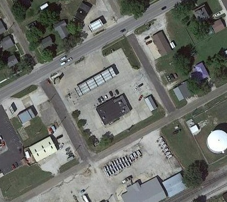
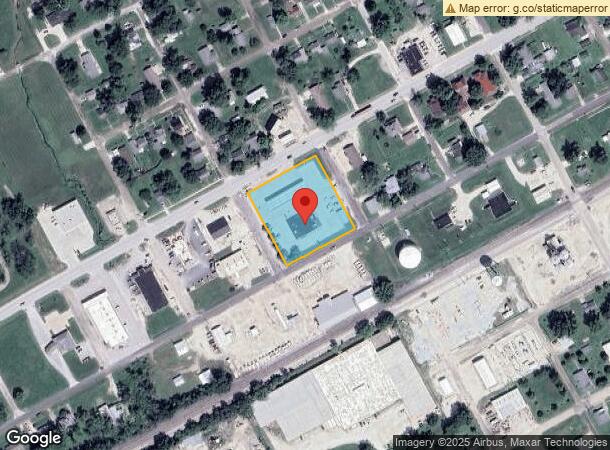
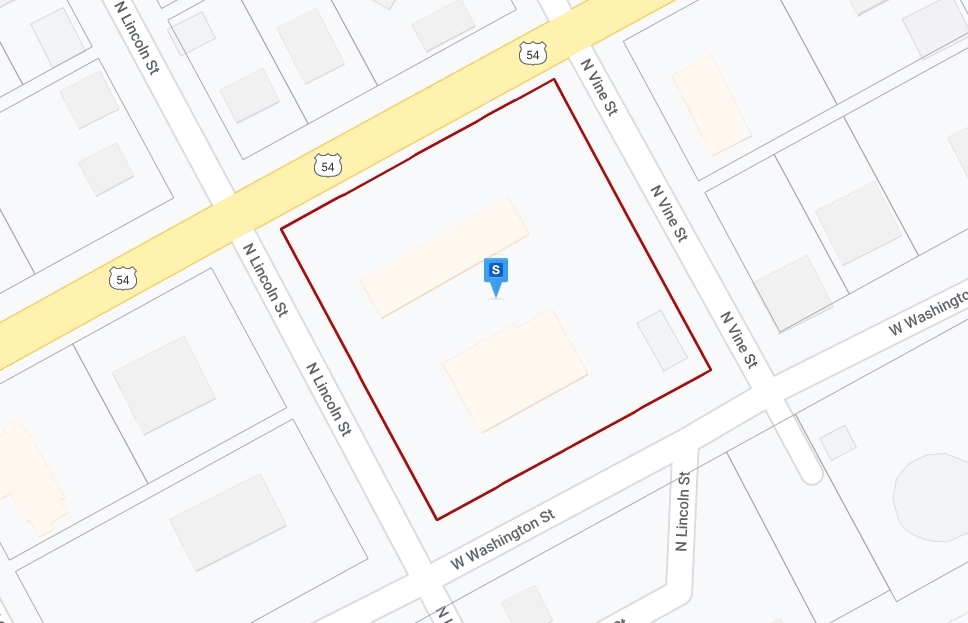
708 W Us Highway 54
14-3-05-3-046-001
Mcpikes First Addition
Conveniencestore
MCPIKES FIRST ADDITION (240 X 250) ALL BLOCK 8
X
Audrain
29163C0225C
Missouri
2024
1.38 AC
2024
Missouri North Area
950100
Other Market Areas
4,908 SF
Mexico, MO
DEMOGRAPHICS near 708 W Us Highway 54
1 Mile
3 Mile
5 Mile
2024 Total Population
3,483
3,700
4,207
2029 Population
3,410
3,625
4,127
Pop Growth 2024-2029
(2.10%)
(2.03%)
(1.90%)
Average Age
40
40
40
2024 Total Households
1,148
1,231
1,433
HH Growth 2024-2029
+ 0.09%
+ 0.16%
(0.14%)
Median Household Inc
$40,081
$41,742
$48,749
Avg Household Size
2.30
2.30
2.30
2024 Avg HH Vehicles
2.00
2.00
2.00
Median Home Value
$64,811
$66,128
$70,677
Median Year Built
1965
1965
1965
Nearby Places
- Restaurants
- Banks
- Shops
- Fitness
- Groceries
Nearby Properties
Address
Land Use
TOTAL SIZE
Lot Size
Zoning
Address
Land Use
TOTAL SIZE
Lot Size
Zoning
1.02 AC
Address
Land Use
TOTAL SIZE
Lot Size
Zoning
600 SF
19.27 AC
Address
Land Use
TOTAL SIZE
Lot Size
Zoning
43,483 SF
7.71 AC
Address
Land Use
TOTAL SIZE
Lot Size
Zoning
51,512 SF
13.60 AC
Address
Land Use
TOTAL SIZE
Lot Size
Zoning
113 AC
Address
Land Use
TOTAL SIZE
Lot Size
Zoning
192 SF
7.90 AC
Address
Land Use
TOTAL SIZE
Lot Size
Zoning
6,448 SF
0.68 AC
Address
Land Use
TOTAL SIZE
Lot Size
Zoning
0.66 AC
Address
Land Use
TOTAL SIZE
Lot Size
Zoning
38.65 AC
Address
Land Use
TOTAL SIZE
Lot Size
Zoning
413.50 AC
Address
Land Use
TOTAL SIZE
Lot Size
Zoning
12,976 SF
1.97 AC
Address
Land Use
TOTAL SIZE
Lot Size
Zoning
17,780 SF
1.38 AC
Address
Land Use
TOTAL SIZE
Lot Size
Zoning
0.55 AC
Address
Land Use
TOTAL SIZE
Lot Size
Zoning
50,000 SF
4.37 AC
Address
Land Use
TOTAL SIZE
Lot Size
Zoning
20,000 SF
1.54 AC
Address
Land Use
TOTAL SIZE
Lot Size
Zoning
1,793 SF
4.29 AC
Address
Land Use
TOTAL SIZE
Lot Size
Zoning
9.08 AC
Address
Land Use
TOTAL SIZE
Lot Size
Zoning
10,640 SF
1.22 AC
Address
Land Use
TOTAL SIZE
Lot Size
Zoning
7,344 SF
0.16 AC
Address
Land Use
TOTAL SIZE
Lot Size
Zoning
3,300 SF
0.77 AC
Address
Land Use
TOTAL SIZE
Lot Size
Zoning
900 SF
2.96 AC
Address
Land Use
TOTAL SIZE
Lot Size
Zoning
2,835 SF
2.69 AC
Address
Land Use
TOTAL SIZE
Lot Size
Zoning
2,880 SF
0.40 AC
Address
Land Use
TOTAL SIZE
Lot Size
Zoning
4,748 SF
0.33 AC
Address
Land Use
TOTAL SIZE
Lot Size
Zoning
0.33 AC
Address
Land Use
TOTAL SIZE
Lot Size
Zoning
1,400 SF
0.96 AC
Address
Land Use
TOTAL SIZE
Lot Size
Zoning
1,600 SF
6.14 AC
Address
Land Use
TOTAL SIZE
Lot Size
Zoning
0.69 AC
Address
Land Use
TOTAL SIZE
Lot Size
Zoning
4,950 SF
0.33 AC
The World's #1 Commercial Real Estate Marketplace
Connect with us
© 2025 CoStar Group
The information above has been obtained from sources believed reliable. While we do not doubt its accuracy we have not verified it and make no guarantee, warranty or representation about it. It is your responsibility to independently confirm its accuracy and completeness. Any projections, opinions, assumptions, or estimates used are for example only and do not represent the current or future performance of the property. The value of this transaction to you depends on tax and other factors which should be evaluated by your tax, financial, and legal advisors. You and your advisors should conduct a careful, independent investigation of the property to determine to your satisfaction the suitability of the property for your needs.