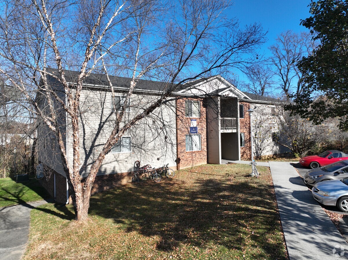
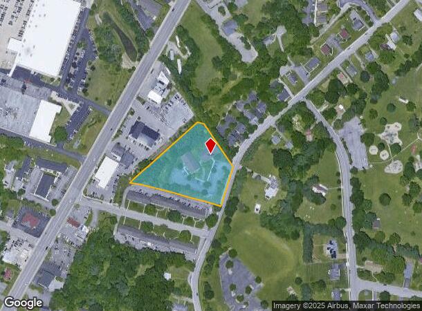
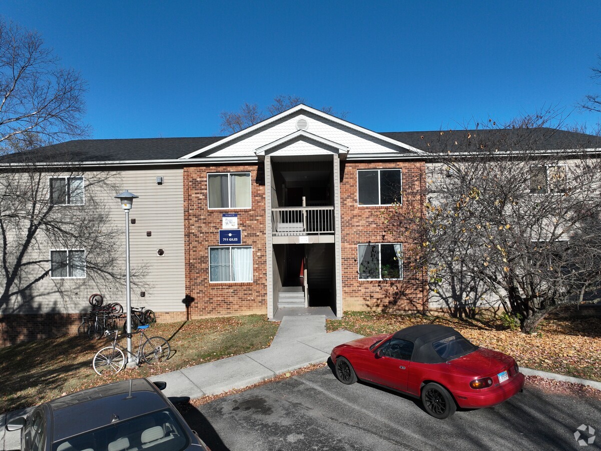
Property Record
709 Giles Rd, Blacksburg, VA 24060
NEARBY LISTINGS FOR SALE OR LEASE
-
-
View all Blacksburg listings for sale on LoopNet.com
Property Detail
709 Giles Rd
005491
Patrick D Cupp
Multifamilydwelling
NS OF OLD NEWPORT RD
X
Montgomery
51121C0131C
Virginia
2024
2.20 AC
2024
Kabrich Crescent
020500
Other Market Areas
26,088 SF
Blacksburg-Christiansburg-Radford, VA
DEMOGRAPHICS near 709 Giles Rd
1 Mile
3 Mile
5 Mile
2024 Total Population
15,929
36,866
45,216
2029 Population
15,740
36,514
44,815
Pop Growth 2024-2029
(1.19%)
(0.95%)
(0.89%)
Average Age
29
33
34
2024 Total Households
6,817
15,750
19,339
HH Growth 2024-2029
(1.28%)
(1.03%)
(0.95%)
Median Household Inc
$19,375
$41,540
$46,655
Avg Household Size
2.30
2.30
2.30
2024 Avg HH Vehicles
2.00
2.00
2.00
Median Home Value
$364,547
$396,794
$387,591
Median Year Built
1985
1986
1987
Nearby Places
- Restaurants
- Banks
- Shops
- Fitness
- Groceries
PUBLIC TRANSPORTATION
AIRPORT
Roanoke/Blacksburg Regional (Woodrum Field)
DRIVE
WALK
Distance
Roanoke/Blacksburg Regional (Woodrum Field)
59 min
42.4 mi
Freight Ports
Virginia Port Authority - Richmond
DRIVE
WALK
Distance
Virginia Port Authority - Richmond
261 min
226.3 mi
Nearby Properties
Address
Land Use
TOTAL SIZE
Lot Size
Zoning
Address
Land Use
TOTAL SIZE
Lot Size
Zoning
1,761.28 AC
UNIV
Address
Land Use
TOTAL SIZE
Lot Size
Zoning
Address
Land Use
TOTAL SIZE
Lot Size
Zoning
41.51 AC
PR
Address
Land Use
TOTAL SIZE
Lot Size
Zoning
120,948 SF
15.28 AC
RM-48
Address
Land Use
TOTAL SIZE
Lot Size
Zoning
134,784 SF
21.21 AC
PR
Address
Land Use
TOTAL SIZE
Lot Size
Zoning
224,316 SF
6.10 AC
RM48
Address
Land Use
TOTAL SIZE
Lot Size
Zoning
31,178 SF
7.32 AC
RM48
Address
Land Use
TOTAL SIZE
Lot Size
Zoning
3.23 AC
DC
Address
Land Use
TOTAL SIZE
Lot Size
Zoning
50,000 SF
25.93 AC
R&D
Address
Land Use
TOTAL SIZE
Lot Size
Zoning
230,692 SF
12.90 AC
PR
Address
Land Use
TOTAL SIZE
Lot Size
Zoning
47,153 SF
30.90 AC
R&D
Address
Land Use
TOTAL SIZE
Lot Size
Zoning
4,332 SF
24.35 AC
RM-48
Address
Land Use
TOTAL SIZE
Lot Size
Zoning
212,497 SF
10.75 AC
PR
Address
Land Use
TOTAL SIZE
Lot Size
Zoning
50,728 SF
14.25 AC
PR
Address
Land Use
TOTAL SIZE
Lot Size
Zoning
125,184 SF
9.12 AC
RM-48
Address
Land Use
TOTAL SIZE
Lot Size
Zoning
7.38 AC
R&D
Address
Land Use
TOTAL SIZE
Lot Size
Zoning
197,024 SF
9.86 AC
PR
Address
Land Use
TOTAL SIZE
Lot Size
Zoning
183,569 SF
8.38 AC
PR
Address
Land Use
TOTAL SIZE
Lot Size
Zoning
33,716 SF
15.72 AC
R&D
Address
Land Use
TOTAL SIZE
Lot Size
Zoning
140,302 SF
1.09 AC
DC
Address
Land Use
TOTAL SIZE
Lot Size
Zoning
7,820 SF
58.14 AC
R&D
Address
Land Use
TOTAL SIZE
Lot Size
Zoning
5.58 AC
MXD
Address
Land Use
TOTAL SIZE
Lot Size
Zoning
150,108 SF
8.19 AC
PR
Address
Land Use
TOTAL SIZE
Lot Size
Zoning
124,356 SF
4.79 AC
RM-48
Address
Land Use
TOTAL SIZE
Lot Size
Zoning
111,728 SF
8.11 AC
PR
Address
Land Use
TOTAL SIZE
Lot Size
Zoning
125,388 SF
5.68 AC
RM-48
Address
Land Use
TOTAL SIZE
Lot Size
Zoning
127,968 SF
5.62 AC
RM-48
Address
Land Use
TOTAL SIZE
Lot Size
Zoning
148,695 SF
7.97 AC
PR
Address
Land Use
TOTAL SIZE
Lot Size
Zoning
147,862 SF
7.73 AC
PR
Address
Land Use
TOTAL SIZE
Lot Size
Zoning
3.47 AC
MXD
The World's #1 Commercial Real Estate Marketplace
Connect with us
© 2025 CoStar Group
The information above has been obtained from sources believed reliable. While we do not doubt its accuracy we have not verified it and make no guarantee, warranty or representation about it. It is your responsibility to independently confirm its accuracy and completeness. Any projections, opinions, assumptions, or estimates used are for example only and do not represent the current or future performance of the property. The value of this transaction to you depends on tax and other factors which should be evaluated by your tax, financial, and legal advisors. You and your advisors should conduct a careful, independent investigation of the property to determine to your satisfaction the suitability of the property for your needs.