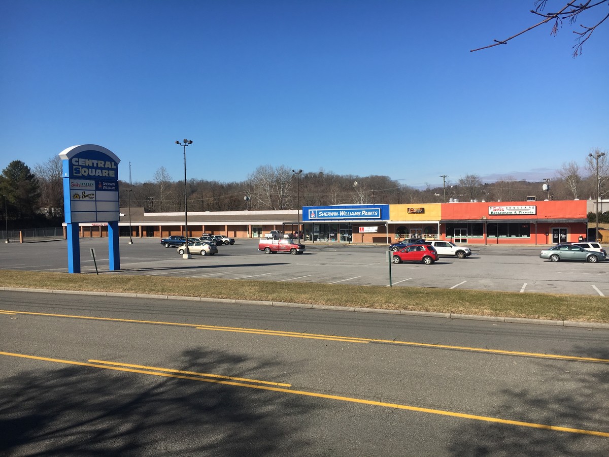
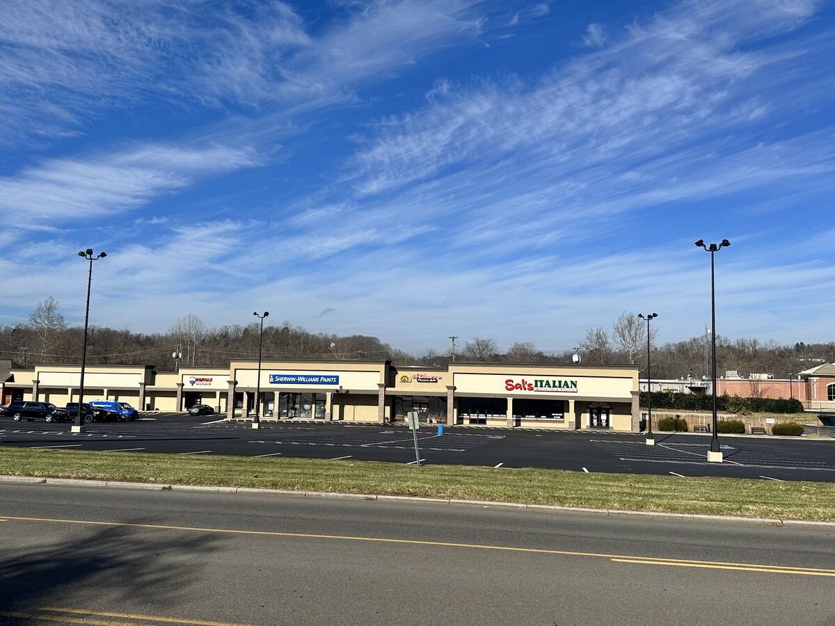
Property Record
709 W Main St, Radford, VA 24141
NEARBY LISTINGS FOR SALE OR LEASE
Property Detail
709 W Main St
13-1-7A-8A-9
N FIRST STREET 6.681 ACRES-MORE OR LESS
Commercialbuilding
Radford City
X
Virginia
51155C0089H
6.68 AC
2024
Blacksburg & Wytheville
2024
Other Market Areas
010202
Blacksburg-Christiansburg-Radford, VA
DEMOGRAPHICS near 709 W Main St
1 Mile
3 Mile
5 Mile
2024 Total Population
3,479
18,630
25,185
2029 Population
3,827
20,430
26,967
Pop Growth 2024-2029
+ 10.00%
+ 9.66%
+ 7.08%
Average Age
42
37
39
2024 Total Households
1,478
8,051
10,665
HH Growth 2024-2029
+ 9.20%
+ 9.41%
+ 7.04%
Median Household Inc
$56,456
$46,724
$50,043
Avg Household Size
2.20
2.20
2.20
2024 Avg HH Vehicles
2.00
2.00
2.00
Median Home Value
$177,637
$211,620
$212,874
Median Year Built
1955
1975
1977
Nearby Places
- Restaurants
- Banks
- Shops
- Fitness
- Groceries
SALE & LEASE HISTORY
LISTING DATE
SALE/LEASE

Sep 25, 2016
For Lease
Jan 20, 2018
For Lease
Nearby Properties
Address
Land Use
TOTAL SIZE
Lot Size
Zoning
Address
Land Use
TOTAL SIZE
Lot Size
Zoning
45.01 AC
I1
Address
Land Use
TOTAL SIZE
Lot Size
Zoning
2.75 AC
C1
Address
Land Use
TOTAL SIZE
Lot Size
Zoning
25.18 AC
R3
Address
Land Use
TOTAL SIZE
Lot Size
Zoning
13.84 AC
Address
Land Use
TOTAL SIZE
Lot Size
Zoning
17.95 AC
CM1
Address
Land Use
TOTAL SIZE
Lot Size
Zoning
7.57 AC
Address
Land Use
TOTAL SIZE
Lot Size
Zoning
14.32 AC
CM1
Address
Land Use
TOTAL SIZE
Lot Size
Zoning
8.63 AC
I0
Address
Land Use
TOTAL SIZE
Lot Size
Zoning
0.25 AC
Address
Land Use
TOTAL SIZE
Lot Size
Zoning
13.62 AC
Address
Land Use
TOTAL SIZE
Lot Size
Zoning
2.96 AC
Address
Land Use
TOTAL SIZE
Lot Size
Zoning
2.44 AC
Address
Land Use
TOTAL SIZE
Lot Size
Zoning
15.33 AC
CM1
Address
Land Use
TOTAL SIZE
Lot Size
Zoning
6.69 AC
Address
Land Use
TOTAL SIZE
Lot Size
Zoning
30.09 AC
Address
Land Use
TOTAL SIZE
Lot Size
Zoning
88.40 AC
I0
Address
Land Use
TOTAL SIZE
Lot Size
Zoning
1.66 AC
Address
Land Use
TOTAL SIZE
Lot Size
Zoning
15.52 AC
CM1
Address
Land Use
TOTAL SIZE
Lot Size
Zoning
5.27 AC
R3
Address
Land Use
TOTAL SIZE
Lot Size
Zoning
50.83 AC
Address
Land Use
TOTAL SIZE
Lot Size
Zoning
3.74 AC
Address
Land Use
TOTAL SIZE
Lot Size
Zoning
1.23 AC
A1
Address
Land Use
TOTAL SIZE
Lot Size
Zoning
56.09 AC
CM1
Address
Land Use
TOTAL SIZE
Lot Size
Zoning
7.12 AC
Address
Land Use
TOTAL SIZE
Lot Size
Zoning
Address
Land Use
TOTAL SIZE
Lot Size
Zoning
7.93 AC
Address
Land Use
TOTAL SIZE
Lot Size
Zoning
3.53 AC
Address
Land Use
TOTAL SIZE
Lot Size
Zoning
3.82 AC
CM1
Address
Land Use
TOTAL SIZE
Lot Size
Zoning
7.07 AC
Address
Land Use
TOTAL SIZE
Lot Size
Zoning
11.40 AC
The World's #1 Commercial Real Estate Marketplace
Connect with us
© 2025 CoStar Group
The information above has been obtained from sources believed reliable. While we do not doubt its accuracy we have not verified it and make no guarantee, warranty or representation about it. It is your responsibility to independently confirm its accuracy and completeness. Any projections, opinions, assumptions, or estimates used are for example only and do not represent the current or future performance of the property. The value of this transaction to you depends on tax and other factors which should be evaluated by your tax, financial, and legal advisors. You and your advisors should conduct a careful, independent investigation of the property to determine to your satisfaction the suitability of the property for your needs.