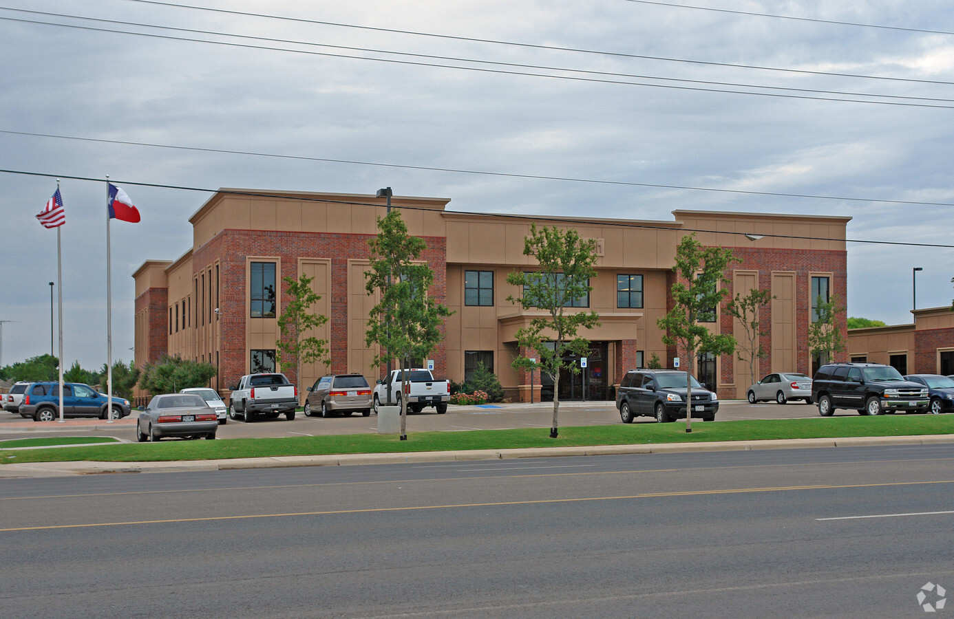
Property Record
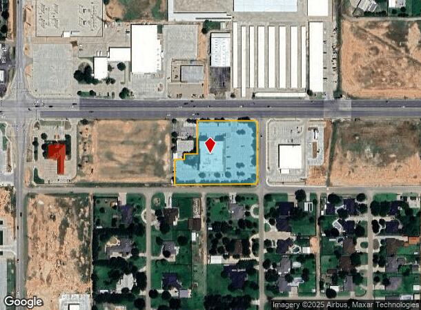
7101 82Nd St, Lubbock, TX 79424

NEARBY LISTINGS FOR SALE OR LEASE
Property Detail
7101 82Nd St
R304763
Westwood
Officebuilding
WESTWOOD TR B2
X
Lubbock
48303C0290G
Texas
2023
2.27 AC
2024
South Outer Lubbock
010413
Lubbock
30,992 SF
Lubbock, TX
DEMOGRAPHICS near 7101 82Nd St
1 Mile
3 Mile
5 Mile
2024 Total Population
7,530
50,136
130,589
2029 Population
7,931
53,460
139,405
Pop Growth 2024-2029
+ 5.33%
+ 6.63%
+ 6.75%
Average Age
33
37
37
2024 Total Households
2,606
20,029
53,229
HH Growth 2024-2029
+ 5.56%
+ 6.85%
+ 6.97%
Median Household Inc
$81,160
$82,824
$71,341
Avg Household Size
2.90
2.50
2.40
2024 Avg HH Vehicles
2.00
2.00
2.00
Median Home Value
$193,671
$241,546
$224,559
Median Year Built
2005
2001
1991
Nearby Places
- Restaurants
- Banks
- Shops
- Fitness
- Groceries
PUBLIC TRANSPORTATION
AIRPORT
Lubbock Preston Smith International
DRIVE
WALK
Distance
Lubbock Preston Smith International
33 min
19.8 mi
Freight Ports
Tulsa Port Of Catoosa
DRIVE
WALK
Distance
Tulsa Port Of Catoosa
516 min
477.2 mi
SALE & LEASE HISTORY
LISTING DATE
SALE/LEASE

Jun 11, 2024
For Sale
Nearby Properties
Address
Land Use
TOTAL SIZE
Lot Size
Zoning
Address
Land Use
TOTAL SIZE
Lot Size
Zoning
111,769 SF
25.02 AC
Address
Land Use
TOTAL SIZE
Lot Size
Zoning
236,871 SF
6.76 AC
Address
Land Use
TOTAL SIZE
Lot Size
Zoning
276,552 SF
12.05 AC
Address
Land Use
TOTAL SIZE
Lot Size
Zoning
290,322 SF
11.96 AC
Address
Land Use
TOTAL SIZE
Lot Size
Zoning
289,796 SF
14.67 AC
Address
Land Use
TOTAL SIZE
Lot Size
Zoning
196,103 SF
12.33 AC
Address
Land Use
TOTAL SIZE
Lot Size
Zoning
4,738 SF
15.92 AC
Address
Land Use
TOTAL SIZE
Lot Size
Zoning
186,763 SF
12 AC
Address
Land Use
TOTAL SIZE
Lot Size
Zoning
108,363 SF
11.35 AC
Address
Land Use
TOTAL SIZE
Lot Size
Zoning
210,939 SF
26.49 AC
Address
Land Use
TOTAL SIZE
Lot Size
Zoning
150,520 SF
10.57 AC
Address
Land Use
TOTAL SIZE
Lot Size
Zoning
151.50 AC
Address
Land Use
TOTAL SIZE
Lot Size
Zoning
138,202 SF
11.33 AC
Address
Land Use
TOTAL SIZE
Lot Size
Zoning
103,560 SF
7.04 AC
Address
Land Use
TOTAL SIZE
Lot Size
Zoning
24,540 SF
8.05 AC
Address
Land Use
TOTAL SIZE
Lot Size
Zoning
139,501 SF
10.56 AC
Address
Land Use
TOTAL SIZE
Lot Size
Zoning
79,733 SF
3.14 AC
Address
Land Use
TOTAL SIZE
Lot Size
Zoning
2,048 SF
8.12 AC
Address
Land Use
TOTAL SIZE
Lot Size
Zoning
128,355 SF
8.91 AC
Address
Land Use
TOTAL SIZE
Lot Size
Zoning
75,154 SF
6.95 AC
Address
Land Use
TOTAL SIZE
Lot Size
Zoning
57,897 SF
4.24 AC
Address
Land Use
TOTAL SIZE
Lot Size
Zoning
139,085 SF
17.53 AC
Address
Land Use
TOTAL SIZE
Lot Size
Zoning
175,958 SF
8.13 AC
Address
Land Use
TOTAL SIZE
Lot Size
Zoning
55,778 SF
8.71 AC
Address
Land Use
TOTAL SIZE
Lot Size
Zoning
9,200 SF
10.29 AC
Address
Land Use
TOTAL SIZE
Lot Size
Zoning
32,260 SF
15.19 AC
Address
Land Use
TOTAL SIZE
Lot Size
Zoning
140,424 SF
6.92 AC
Address
Land Use
TOTAL SIZE
Lot Size
Zoning
81,695 SF
2.70 AC
Address
Land Use
TOTAL SIZE
Lot Size
Zoning
93,964 SF
9.37 AC
Address
Land Use
TOTAL SIZE
Lot Size
Zoning
125,090 SF
12.03 AC
The World's #1 Commercial Real Estate Marketplace
Connect with us
© 2025 CoStar Group
The information above has been obtained from sources believed reliable. While we do not doubt its accuracy we have not verified it and make no guarantee, warranty or representation about it. It is your responsibility to independently confirm its accuracy and completeness. Any projections, opinions, assumptions, or estimates used are for example only and do not represent the current or future performance of the property. The value of this transaction to you depends on tax and other factors which should be evaluated by your tax, financial, and legal advisors. You and your advisors should conduct a careful, independent investigation of the property to determine to your satisfaction the suitability of the property for your needs.