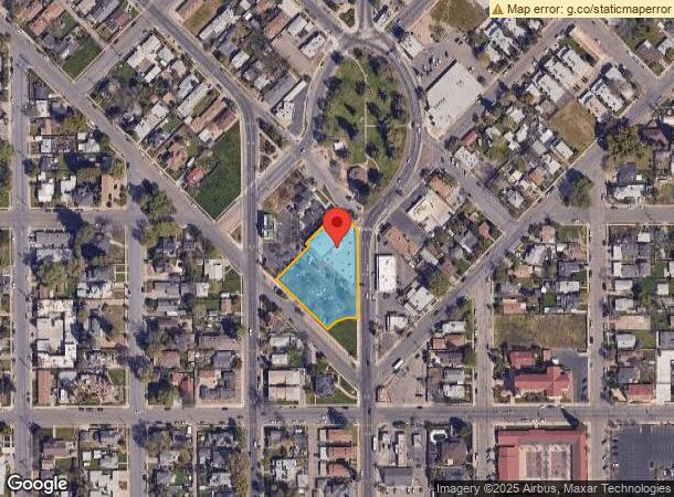
Property Record
711 N Court St, Visalia, CA 93291


NEARBY LISTINGS FOR SALE OR LEASE
Property Detail
711 N Court St
Visalia-Porterville, CA
Aughinbaughs Addition
094-015-014-000
PAR 2 PAR MAP 3447 V35 P49 PM
Medicalbuilding
Tulare
AE
California
06107C0933E
1.11 AC
2023
North Visalia
2024
Visalia/Porterville
001101
DEMOGRAPHICS near 711 N Court St
1 Mile
3 Mile
5 Mile
2024 Total Population
18,732
118,980
162,108
2029 Population
19,368
123,353
168,228
Pop Growth 2024-2029
+ 3.40%
+ 3.68%
+ 3.78%
Average Age
34
36
36
2024 Total Households
5,739
38,465
52,901
HH Growth 2024-2029
+ 3.43%
+ 3.65%
+ 3.76%
Median Household Inc
$43,100
$65,887
$69,682
Avg Household Size
3.10
3.00
3.00
2024 Avg HH Vehicles
2.00
2.00
2.00
Median Home Value
$197,393
$286,629
$296,438
Median Year Built
1972
1984
1987
Nearby Places
- Restaurants
- Banks
- Shops
- Fitness
- Groceries
SALE & LEASE HISTORY
LISTING DATE
SALE/LEASE

Sep 24, 2016
For Sale
Mar 24, 2017
For Lease
Nearby Properties
Address
Land Use
TOTAL SIZE
Lot Size
Zoning
Address
Land Use
TOTAL SIZE
Lot Size
Zoning
393,784 SF
17.79 AC
CR
Address
Land Use
TOTAL SIZE
Lot Size
Zoning
93,743 SF
3.16 AC
IL
Address
Land Use
TOTAL SIZE
Lot Size
Zoning
Address
Land Use
TOTAL SIZE
Lot Size
Zoning
146,890 SF
11.73 AC
CCM
Address
Land Use
TOTAL SIZE
Lot Size
Zoning
139,410 SF
11.35 AC
CC
Address
Land Use
TOTAL SIZE
Lot Size
Zoning
6.96 AC
Address
Land Use
TOTAL SIZE
Lot Size
Zoning
91,492 SF
4.80 AC
RM3
Address
Land Use
TOTAL SIZE
Lot Size
Zoning
134,055 SF
3.49 AC
CDT
Address
Land Use
TOTAL SIZE
Lot Size
Zoning
133,910 SF
14.35 AC
CSO
Address
Land Use
TOTAL SIZE
Lot Size
Zoning
185,883 SF
9.97 AC
CSO
Address
Land Use
TOTAL SIZE
Lot Size
Zoning
92,298 SF
7.32 AC
CR
Address
Land Use
TOTAL SIZE
Lot Size
Zoning
54,674 SF
1.26 AC
CDT
Address
Land Use
TOTAL SIZE
Lot Size
Zoning
56,384 SF
9.14 AC
Address
Land Use
TOTAL SIZE
Lot Size
Zoning
126,532 SF
8.63 AC
RM2
Address
Land Use
TOTAL SIZE
Lot Size
Zoning
87,160 SF
0.75 AC
PA
Address
Land Use
TOTAL SIZE
Lot Size
Zoning
5.85 AC
RM2
Address
Land Use
TOTAL SIZE
Lot Size
Zoning
69,120 SF
5.23 AC
CR
Address
Land Use
TOTAL SIZE
Lot Size
Zoning
83,011 SF
4.46 AC
QP
Address
Land Use
TOTAL SIZE
Lot Size
Zoning
88,589 SF
7.98 AC
CR
Address
Land Use
TOTAL SIZE
Lot Size
Zoning
7,311 SF
2.31 AC
Address
Land Use
TOTAL SIZE
Lot Size
Zoning
17,933 SF
3.98 AC
CR
Address
Land Use
TOTAL SIZE
Lot Size
Zoning
51,362 SF
1.61 AC
CH
Address
Land Use
TOTAL SIZE
Lot Size
Zoning
1.07 AC
CDT
Address
Land Use
TOTAL SIZE
Lot Size
Zoning
103,550 SF
8.63 AC
CR
Address
Land Use
TOTAL SIZE
Lot Size
Zoning
47,035 SF
3.29 AC
CCM
Address
Land Use
TOTAL SIZE
Lot Size
Zoning
6.42 AC
CN
Address
Land Use
TOTAL SIZE
Lot Size
Zoning
131,624 SF
7.44 AC
RM3
Address
Land Use
TOTAL SIZE
Lot Size
Zoning
70,254 SF
9.08 AC
R16
Address
Land Use
TOTAL SIZE
Lot Size
Zoning
27,603 SF
2.86 AC
CCM
The World's #1 Commercial Real Estate Marketplace
Connect with us
© 2025 CoStar Group
The information above has been obtained from sources believed reliable. While we do not doubt its accuracy we have not verified it and make no guarantee, warranty or representation about it. It is your responsibility to independently confirm its accuracy and completeness. Any projections, opinions, assumptions, or estimates used are for example only and do not represent the current or future performance of the property. The value of this transaction to you depends on tax and other factors which should be evaluated by your tax, financial, and legal advisors. You and your advisors should conduct a careful, independent investigation of the property to determine to your satisfaction the suitability of the property for your needs.