Property Record
711 Ward Rd, Chesapeake, VA 23323
NEARBY LISTINGS FOR SALE OR LEASE
Property Detail
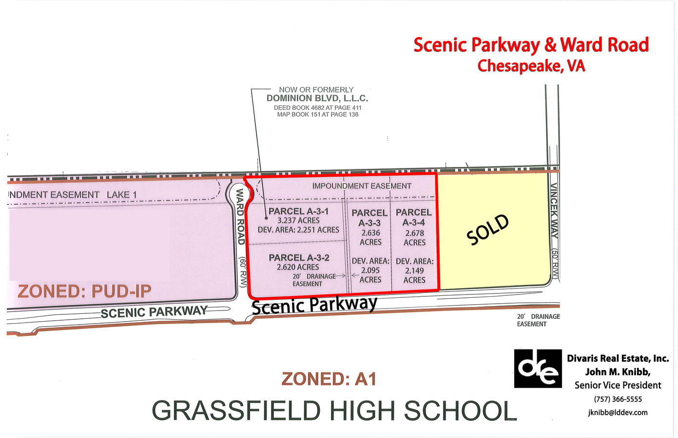
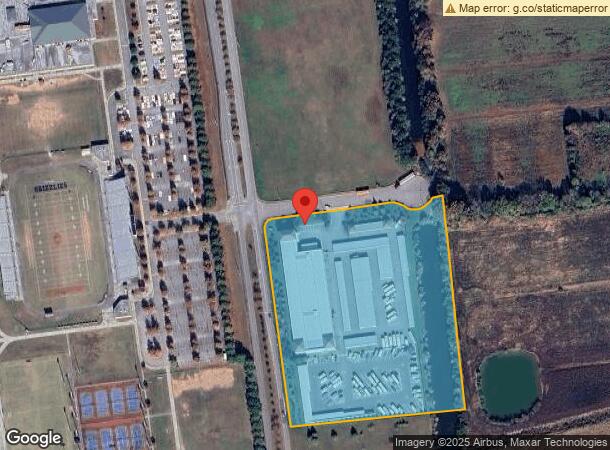
711 Ward Rd
0580000000900
Deep Creek - Commercial
Publicstorage
PAR A3B RESUB PARS A3A,A33 DOMMINION COMM PK 8.518 AC
X
Chesapeake
5100340048D
Virginia
2023
8.52 AC
2024
Southern Chesapeake
021200
Hampton Roads
4,300 SF
Virginia Beach-Norfolk-Newport News, VA-NC
DEMOGRAPHICS near 711 Ward Rd
1 Mile
3 Mile
5 Mile
2024 Total Population
4,033
36,984
91,199
2029 Population
4,198
38,386
94,491
Pop Growth 2024-2029
+ 4.09%
+ 3.79%
+ 3.61%
Average Age
37
37
38
2024 Total Households
1,298
12,142
32,414
HH Growth 2024-2029
+ 4.24%
+ 3.89%
+ 3.70%
Median Household Inc
$125,371
$121,178
$99,996
Avg Household Size
3.10
3.00
2.70
2024 Avg HH Vehicles
2.00
2.00
2.00
Median Home Value
$404,886
$397,408
$356,102
Median Year Built
1998
1996
1993
Nearby Places
- Restaurants
- Banks
- Shops
- Fitness
- Groceries
PUBLIC TRANSPORTATION
AIRPORT
Norfolk International
DRIVE
WALK
Distance
Norfolk International
28 min
17.9 mi
Freight Ports
Virginia Port Authority - Portsmouth
DRIVE
WALK
Distance
Virginia Port Authority - Portsmouth
26 min
15.5 mi
Nearby Properties
Address
Land Use
TOTAL SIZE
Lot Size
Zoning
Address
Land Use
TOTAL SIZE
Lot Size
Zoning
6,820 SF
89.90 AC
R15S: RESI
Address
Land Use
TOTAL SIZE
Lot Size
Zoning
26.78 AC
RMF1: MULT
Address
Land Use
TOTAL SIZE
Lot Size
Zoning
338,400 SF
96.79 AC
A1: AGRICU
Address
Land Use
TOTAL SIZE
Lot Size
Zoning
195,637 SF
96.04 AC
RE1: RESID
Address
Land Use
TOTAL SIZE
Lot Size
Zoning
63,050 SF
27.71 AC
O-I: OFFIC
Address
Land Use
TOTAL SIZE
Lot Size
Zoning
107,223 SF
48.07 AC
O-I: OFFIC
Address
Land Use
TOTAL SIZE
Lot Size
Zoning
148,905 SF
7.32 AC
PUD: PLANN
Address
Land Use
TOTAL SIZE
Lot Size
Zoning
213,740 SF
26.51 AC
B2: GENERA
Address
Land Use
TOTAL SIZE
Lot Size
Zoning
38,354 SF
2.23 AC
PUD: PLANN
Address
Land Use
TOTAL SIZE
Lot Size
Zoning
91,968 SF
6.33 AC
O-I: OFFIC
Address
Land Use
TOTAL SIZE
Lot Size
Zoning
103,693 SF
5.83 AC
O-I: OFFIC
Address
Land Use
TOTAL SIZE
Lot Size
Zoning
48,360 SF
14.74 AC
M3: WATERF
Address
Land Use
TOTAL SIZE
Lot Size
Zoning
59,712 SF
8.33 AC
O-I: OFFIC
Address
Land Use
TOTAL SIZE
Lot Size
Zoning
43,800 SF
2.50 AC
PUD: PLANN
Address
Land Use
TOTAL SIZE
Lot Size
Zoning
42,174 SF
5.28 AC
PUD: PLANN
Address
Land Use
TOTAL SIZE
Lot Size
Zoning
48,803 SF
23.45 AC
R10S: RESI
Address
Land Use
TOTAL SIZE
Lot Size
Zoning
41,092 SF
5.96 AC
B1: NEIGHB
Address
Land Use
TOTAL SIZE
Lot Size
Zoning
44,500 SF
15.54 AC
M3: WATERF
Address
Land Use
TOTAL SIZE
Lot Size
Zoning
71,438 SF
20.14 AC
B2: GENERA
Address
Land Use
TOTAL SIZE
Lot Size
Zoning
71.97 AC
MULTI: MUL
Address
Land Use
TOTAL SIZE
Lot Size
Zoning
58,190 SF
5.85 AC
B2: GENERA
Address
Land Use
TOTAL SIZE
Lot Size
Zoning
53,454 SF
8.43 AC
B4: SHOPPI
Address
Land Use
TOTAL SIZE
Lot Size
Zoning
73,075 SF
4.36 AC
M1: LIGHT
Address
Land Use
TOTAL SIZE
Lot Size
Zoning
19,832 SF
7.24 AC
O-I: OFFIC
Address
Land Use
TOTAL SIZE
Lot Size
Zoning
34,276 SF
14.67 AC
R10S: RESI
Address
Land Use
TOTAL SIZE
Lot Size
Zoning
57,330 SF
16.52 AC
MULTI: MUL
Address
Land Use
TOTAL SIZE
Lot Size
Zoning
21.53 AC
PUD: PLANN
Address
Land Use
TOTAL SIZE
Lot Size
Zoning
7,134 SF
30.41 AC
A1: AGRICU
Address
Land Use
TOTAL SIZE
Lot Size
Zoning
19,301 SF
9.23 AC
PUD: PLANN
The World's #1 Commercial Real Estate Marketplace
Connect with us
© 2025 CoStar Group
The information above has been obtained from sources believed reliable. While we do not doubt its accuracy we have not verified it and make no guarantee, warranty or representation about it. It is your responsibility to independently confirm its accuracy and completeness. Any projections, opinions, assumptions, or estimates used are for example only and do not represent the current or future performance of the property. The value of this transaction to you depends on tax and other factors which should be evaluated by your tax, financial, and legal advisors. You and your advisors should conduct a careful, independent investigation of the property to determine to your satisfaction the suitability of the property for your needs.