Property Record
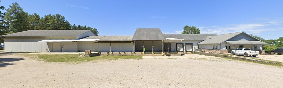
7117 136Th Ave, Holland, MI 49424
NEARBY LISTINGS FOR SALE OR LEASE
-
-
View all Holland listings for sale on LoopNet.com
Property Detail
7117 136Th Ave
70-12-19-200-007
E 1/2 OF NE 1/4 EXC COM 90523 FT N 89D 21M 19S W & 102139 FT S 0D 38M 41S W OF NE SEC COR, TH S 02D 21M 19S E 20871 FT, W 20871 FT, N 02D 21M 19S W 20871 FT, E 20871 FT TO BEG ALSO EXC COM N 01D 24M 04S W 82777 FT FROM E 1/4 COR, TH S 88D 35M 56S W 5
Officebuilding
Ottawa
X
Michigan
26139C0225E
63.02 AC
2023
Holland North
2024
West Michigan
022001
Grand Rapids-Wyoming, MI
1,600 SF
DEMOGRAPHICS near 7117 136Th Ave
1 Mile
3 Mile
5 Mile
2024 Total Population
176
5,325
19,749
2029 Population
182
5,753
20,898
Pop Growth 2024-2029
+ 3.41%
+ 8.04%
+ 5.82%
Average Age
37
38
38
2024 Total Households
56
1,755
6,886
HH Growth 2024-2029
+ 3.57%
+ 8.38%
+ 5.98%
Median Household Inc
$71,999
$74,887
$77,213
Avg Household Size
3.00
2.90
2.80
2024 Avg HH Vehicles
3.00
2.00
2.00
Median Home Value
$243,333
$272,446
$275,241
Median Year Built
1974
1993
1992
Nearby Places
- Restaurants
- Banks
- Shops
- Fitness
- Groceries
PUBLIC TRANSPORTATION
COMMUTER RAIL
Holland Amtrak Station (Pere Marquette - Amtrak)
DRIVE
WALK
Distance
Holland Amtrak Station (Pere Marquette - Amtrak)
16 min
9.0 mi
Freight Ports
Port Milwaukee
DRIVE
WALK
Distance
Port Milwaukee
291 min
244.6 mi
Nearby Properties
Address
Land Use
TOTAL SIZE
Lot Size
Zoning
Address
Land Use
TOTAL SIZE
Lot Size
Zoning
1,728 SF
91.76 AC
MHR
Address
Land Use
TOTAL SIZE
Lot Size
Zoning
122,739 SF
9.61 AC
I-2
Address
Land Use
TOTAL SIZE
Lot Size
Zoning
70,370 SF
11.72 AC
LDR
Address
Land Use
TOTAL SIZE
Lot Size
Zoning
3,760 SF
73.28 AC
AG
Address
Land Use
TOTAL SIZE
Lot Size
Zoning
34.78 AC
Address
Land Use
TOTAL SIZE
Lot Size
Zoning
23,507 SF
21.80 AC
CO
Address
Land Use
TOTAL SIZE
Lot Size
Zoning
6,851 SF
127.86 AC
AG
Address
Land Use
TOTAL SIZE
Lot Size
Zoning
34,690 SF
10.23 AC
H
Address
Land Use
TOTAL SIZE
Lot Size
Zoning
36,140 SF
17.16 AC
CO
Address
Land Use
TOTAL SIZE
Lot Size
Zoning
3.10 AC
Address
Land Use
TOTAL SIZE
Lot Size
Zoning
160.04 AC
Address
Land Use
TOTAL SIZE
Lot Size
Zoning
40,000 SF
12.83 AC
CO
Address
Land Use
TOTAL SIZE
Lot Size
Zoning
234.18 AC
RR
Address
Land Use
TOTAL SIZE
Lot Size
Zoning
154 AC
Address
Land Use
TOTAL SIZE
Lot Size
Zoning
41,220 SF
Address
Land Use
TOTAL SIZE
Lot Size
Zoning
10,992 SF
7.47 AC
CO
Address
Land Use
TOTAL SIZE
Lot Size
Zoning
2,518 SF
39.17 AC
RR
Address
Land Use
TOTAL SIZE
Lot Size
Zoning
2.84 AC
Address
Land Use
TOTAL SIZE
Lot Size
Zoning
26,000 SF
10.18 AC
Address
Land Use
TOTAL SIZE
Lot Size
Zoning
2,822 SF
157.28 AC
AG
Address
Land Use
TOTAL SIZE
Lot Size
Zoning
193 AC
A-1
Address
Land Use
TOTAL SIZE
Lot Size
Zoning
41,901 SF
Address
Land Use
TOTAL SIZE
Lot Size
Zoning
10,108 SF
88.06 AC
Address
Land Use
TOTAL SIZE
Lot Size
Zoning
174.14 AC
RR
Address
Land Use
TOTAL SIZE
Lot Size
Zoning
1,120 SF
29.44 AC
Address
Land Use
TOTAL SIZE
Lot Size
Zoning
44,250 SF
4.80 AC
LI
Address
Land Use
TOTAL SIZE
Lot Size
Zoning
105.90 AC
Address
Land Use
TOTAL SIZE
Lot Size
Zoning
103.90 AC
Address
Land Use
TOTAL SIZE
Lot Size
Zoning
157.21 AC
RR
Address
Land Use
TOTAL SIZE
Lot Size
Zoning
117 AC
OVERLAY
The World's #1 Commercial Real Estate Marketplace
Connect with us
© 2025 CoStar Group
The information above has been obtained from sources believed reliable. While we do not doubt its accuracy we have not verified it and make no guarantee, warranty or representation about it. It is your responsibility to independently confirm its accuracy and completeness. Any projections, opinions, assumptions, or estimates used are for example only and do not represent the current or future performance of the property. The value of this transaction to you depends on tax and other factors which should be evaluated by your tax, financial, and legal advisors. You and your advisors should conduct a careful, independent investigation of the property to determine to your satisfaction the suitability of the property for your needs.