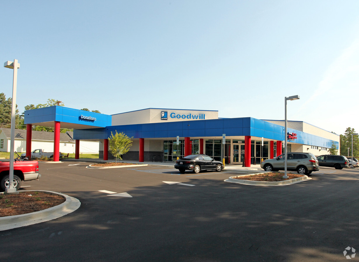
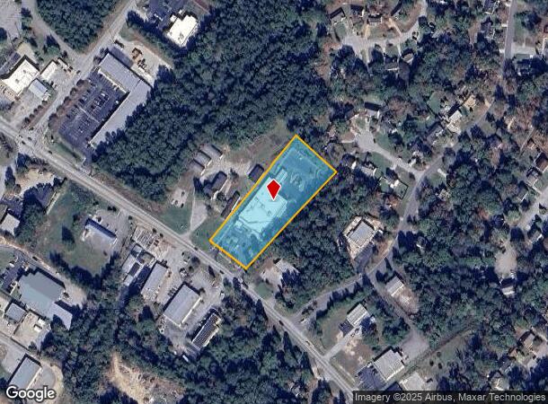
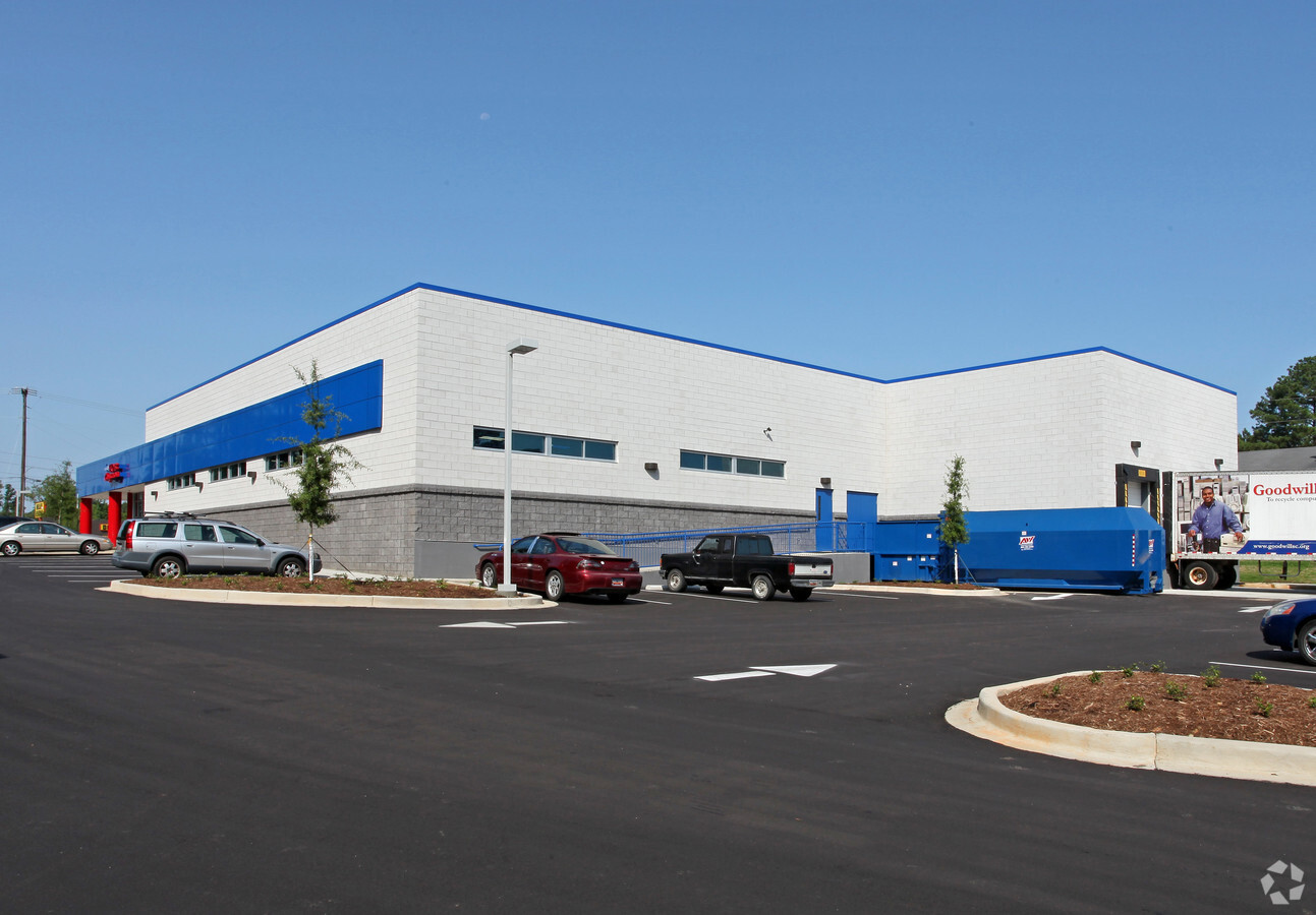
Property Record
7138 Broad River Rd, Irmo, SC 29063
NEARBY LISTINGS FOR SALE OR LEASE
Property Detail
7138 Broad River Rd
05000-02-25
Irmo Whiterock Ballentine
Commercialnec
NO LEGAL DESCRIPTON EXISTS #SU #PR
X
Richland
45079C0207L
South Carolina
2024
1.99 AC
2023
Dutch Fork/Irmo
010315
Columbia
18,817 SF
Columbia, SC
DEMOGRAPHICS near 7138 Broad River Rd
1 Mile
3 Mile
5 Mile
2024 Total Population
5,805
39,082
88,389
2029 Population
5,809
40,328
92,119
Pop Growth 2024-2029
+ 0.07%
+ 3.19%
+ 4.22%
Average Age
37
40
40
2024 Total Households
2,628
16,383
35,533
HH Growth 2024-2029
+ 0.11%
+ 3.27%
+ 4.54%
Median Household Inc
$49,740
$66,469
$63,459
Avg Household Size
2.20
2.30
2.30
2024 Avg HH Vehicles
2.00
2.00
2.00
Median Home Value
$176,101
$171,820
$186,200
Median Year Built
1991
1985
1984
Nearby Places
- Restaurants
- Banks
- Shops
- Fitness
- Groceries
PUBLIC TRANSPORTATION
AIRPORT
Columbia Metro
DRIVE
WALK
Distance
Columbia Metro
29 min
15.9 mi
Freight Ports
North Charleston Terminal
DRIVE
WALK
Distance
North Charleston Terminal
129 min
112.1 mi
Nearby Properties
Address
Land Use
TOTAL SIZE
Lot Size
Zoning
Address
Land Use
TOTAL SIZE
Lot Size
Zoning
24.90 AC
PD
Address
Land Use
TOTAL SIZE
Lot Size
Zoning
370,876 SF
14.43 AC
PD
Address
Land Use
TOTAL SIZE
Lot Size
Zoning
302,835 SF
11.48 AC
PD
Address
Land Use
TOTAL SIZE
Lot Size
Zoning
241,756 SF
14.25 AC
PD
Address
Land Use
TOTAL SIZE
Lot Size
Zoning
215,796 SF
12.71 AC
PD
Address
Land Use
TOTAL SIZE
Lot Size
Zoning
73,380 SF
16.07 AC
PDD
Address
Land Use
TOTAL SIZE
Lot Size
Zoning
88,284 SF
0.78 AC
PD
Address
Land Use
TOTAL SIZE
Lot Size
Zoning
70,390 SF
12.76 AC
CAC
Address
Land Use
TOTAL SIZE
Lot Size
Zoning
183,237 SF
13.65 AC
GC
Address
Land Use
TOTAL SIZE
Lot Size
Zoning
159,139 SF
16.95 AC
GC
Address
Land Use
TOTAL SIZE
Lot Size
Zoning
87,200 SF
7 AC
PDD
Address
Land Use
TOTAL SIZE
Lot Size
Zoning
146,254 SF
12.12 AC
PD
Address
Land Use
TOTAL SIZE
Lot Size
Zoning
126,596 SF
10.84 AC
PD
Address
Land Use
TOTAL SIZE
Lot Size
Zoning
153,210 SF
31.78 AC
LM
Address
Land Use
TOTAL SIZE
Lot Size
Zoning
86,542 SF
3.25 AC
PD
Address
Land Use
TOTAL SIZE
Lot Size
Zoning
81,197 SF
10.34 AC
C-3
Address
Land Use
TOTAL SIZE
Lot Size
Zoning
136,641 SF
9 AC
PDD
Address
Land Use
TOTAL SIZE
Lot Size
Zoning
32.33 AC
PD
Address
Land Use
TOTAL SIZE
Lot Size
Zoning
61,333 SF
3.23 AC
PD
Address
Land Use
TOTAL SIZE
Lot Size
Zoning
75,358 SF
13.84 AC
M-1
Address
Land Use
TOTAL SIZE
Lot Size
Zoning
66,351 SF
2.20 AC
PD
Address
Land Use
TOTAL SIZE
Lot Size
Zoning
100,797 SF
3.90 AC
PDD
Address
Land Use
TOTAL SIZE
Lot Size
Zoning
7.81 AC
PD
Address
Land Use
TOTAL SIZE
Lot Size
Zoning
243,045 SF
12.97 AC
PD
Address
Land Use
TOTAL SIZE
Lot Size
Zoning
15,098 SF
1.78 AC
CAC
Address
Land Use
TOTAL SIZE
Lot Size
Zoning
76,204 SF
2.26 AC
CN
Address
Land Use
TOTAL SIZE
Lot Size
Zoning
49,840 SF
2.25 AC
CG
Address
Land Use
TOTAL SIZE
Lot Size
Zoning
13.81 AC
M-1
Address
Land Use
TOTAL SIZE
Lot Size
Zoning
66,612 SF
5.56 AC
CG
Address
Land Use
TOTAL SIZE
Lot Size
Zoning
23,907 SF
14 AC
PD
The World's #1 Commercial Real Estate Marketplace
Connect with us
© 2025 CoStar Group
The information above has been obtained from sources believed reliable. While we do not doubt its accuracy we have not verified it and make no guarantee, warranty or representation about it. It is your responsibility to independently confirm its accuracy and completeness. Any projections, opinions, assumptions, or estimates used are for example only and do not represent the current or future performance of the property. The value of this transaction to you depends on tax and other factors which should be evaluated by your tax, financial, and legal advisors. You and your advisors should conduct a careful, independent investigation of the property to determine to your satisfaction the suitability of the property for your needs.