Property Record
7147 S Constance Ave, Chicago, IL 60649
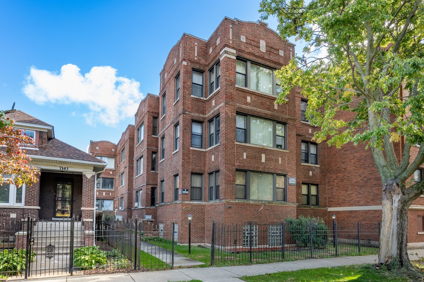


This Property Is For Sale
NEARBY LISTINGS FOR SALE OR LEASE
Property Detail
7147 S Constance Ave
Chicago-Naperville-Elgin, IL-IN-WI
Christopher Columbus Add To Jackson
20-25-107-013-0000
(CHRISTOPHER)(COLUMBUS) ADD TO (JACKSON) PARK SUB OF BLKS 4 & 5 IN GEO W CLARKS SUB OF EH NW SEC 25-38-14
Apartment
Cook
X
Illinois
17031C0539K
10
2022
0.15 AC
2024
South Shore
430500
Chicago
10,848 SF
DEMOGRAPHICS near 7147 S Constance Ave
1 Mile
3 Mile
5 Mile
2024 Total Population
45,690
241,859
464,707
2029 Population
44,500
235,168
449,815
Pop Growth 2024-2029
(2.60%)
(2.77%)
(3.20%)
Average Age
40
40
40
2024 Total Households
21,355
108,368
195,960
HH Growth 2024-2029
(2.89%)
(3.06%)
(3.45%)
Median Household Inc
$36,072
$39,349
$38,488
Avg Household Size
2.10
2.10
2.30
2024 Avg HH Vehicles
1.00
1.00
1.00
Median Home Value
$215,454
$208,261
$181,804
Median Year Built
1948
1948
1948
Nearby Places
- Restaurants
- Banks
- Shops
- Fitness
- Groceries
PUBLIC TRANSPORTATION
COMMUTER RAIL
Bryn Mawr Station (Metra Electric Line - Northeast Illinois Regional Commuter Railroad (Metra))
Drive
Walk
Distance
Bryn Mawr Station (Metra Electric Line - Northeast Illinois Regional Commuter Railroad (Metra))
1 min
5 min
0.3 mi
Stony Island Station (Metra Electric Line - Northeast Illinois Regional Commuter Railroad (Metra))
Drive
Walk
Distance
Stony Island Station (Metra Electric Line - Northeast Illinois Regional Commuter Railroad (Metra))
1 min
8 min
0.4 mi
AIRPORT
Chicago Midway International
Drive
Walk
Distance
Chicago Midway International
21 min
10.9 mi
Chicago O'Hare International
Drive
Walk
Distance
Chicago O'Hare International
44 min
27.7 mi
Freight Ports
Port Milwaukee
Drive
Walk
Distance
Port Milwaukee
122 min
95.9 mi
Nearby Properties
Address
Land Use
TOTAL SIZE
Lot Size
Zoning
Address
Land Use
TOTAL SIZE
Lot Size
Zoning
0.49 AC
SLI
Address
Land Use
TOTAL SIZE
Lot Size
Zoning
10.73 AC
PD 1243
Address
Land Use
TOTAL SIZE
Lot Size
Zoning
172962
10.23 AC
R3
Address
Land Use
TOTAL SIZE
Lot Size
Zoning
1302463
3.14 AC
PD 1211
Address
Land Use
TOTAL SIZE
Lot Size
Zoning
3.14 AC
PD 1211
Address
Land Use
TOTAL SIZE
Lot Size
Zoning
115000
1.97 AC
C1-2
Address
Land Use
TOTAL SIZE
Lot Size
Zoning
Address
Land Use
TOTAL SIZE
Lot Size
Zoning
6000
0.09 AC
RM1
Address
Land Use
TOTAL SIZE
Lot Size
Zoning
163258
4.44 AC
SPC1*
Address
Land Use
TOTAL SIZE
Lot Size
Zoning
2.65 AC
PD 38
Address
Land Use
TOTAL SIZE
Lot Size
Zoning
304685
1.10 AC
PD 1218
Address
Land Use
TOTAL SIZE
Lot Size
Zoning
115000
1.12 AC
C1-2
Address
Land Use
TOTAL SIZE
Lot Size
Zoning
7200
0.22 AC
B3-3
Address
Land Use
TOTAL SIZE
Lot Size
Zoning
156800
2.65 AC
PD 38
Address
Land Use
TOTAL SIZE
Lot Size
Zoning
Address
Land Use
TOTAL SIZE
Lot Size
Zoning
23799
0.91 AC
PD 571
Address
Land Use
TOTAL SIZE
Lot Size
Zoning
451349
1.62 AC
PD 1062
Address
Land Use
TOTAL SIZE
Lot Size
Zoning
7.47 AC
RT-4
Address
Land Use
TOTAL SIZE
Lot Size
Zoning
78000
0.62 AC
RM-5
Address
Land Use
TOTAL SIZE
Lot Size
Zoning
769600
PD 282
Address
Land Use
TOTAL SIZE
Lot Size
Zoning
117557
2.69 AC
B3-3
Address
Land Use
TOTAL SIZE
Lot Size
Zoning
8259
0.10 AC
NBEACH
Address
Land Use
TOTAL SIZE
Lot Size
Zoning
40641
5.26 AC
Address
Land Use
TOTAL SIZE
Lot Size
Zoning
214720
0.92 AC
RM-6.5
Address
Land Use
TOTAL SIZE
Lot Size
Zoning
134655
2.40 AC
B3-3
Address
Land Use
TOTAL SIZE
Lot Size
Zoning
743663
7.14 AC
RT-4
Address
Land Use
TOTAL SIZE
Lot Size
Zoning
0.84 AC
RM-5
Address
Land Use
TOTAL SIZE
Lot Size
Zoning
14340
0.74 AC
R4L
Address
Land Use
TOTAL SIZE
Lot Size
Zoning
130785
2.27 AC
PD 1174
Address
Land Use
TOTAL SIZE
Lot Size
Zoning
156249
0.57 AC
B3-5
Start a new search to find other properties for sale or lease
Connect with us
© 2024 CoStar Group
The information above has been obtained from sources believed reliable. While we do not doubt its accuracy we have not verified it and make no guarantee, warranty or representation about it. It is your responsibility to independently confirm its accuracy and completeness. Any projections, opinions, assumptions, or estimates used are for example only and do not represent the current or future performance of the property. The value of this transaction to you depends on tax and other factors which should be evaluated by your tax, financial, and legal advisors. You and your advisors should conduct a careful, independent investigation of the property to determine to your satisfaction the suitability of the property for your needs.