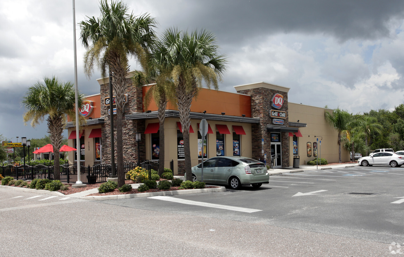
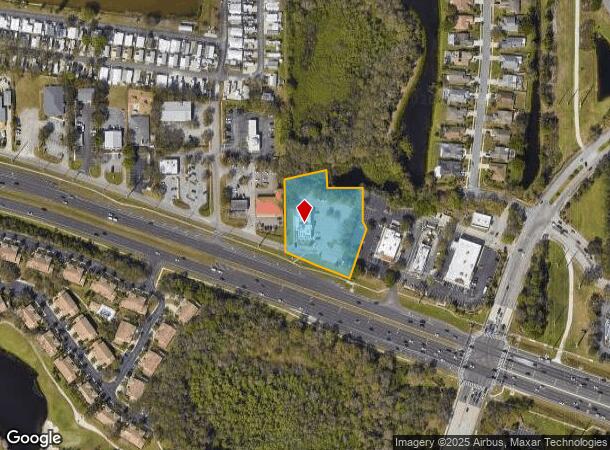
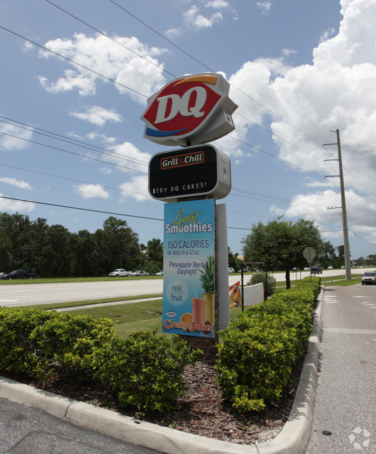
Property Record
7155 State Road 70 E, Bradenton, FL 34203
NEARBY LISTINGS FOR SALE OR LEASE
Property Detail
7155 State Road 70 E
North Port-Sarasota-Bradenton, FL
Creekwood West Commons
17304-0632-9
UNITS 5 & 6 PHASE II CREEKWOOD WEST COMMONS A LAND CONDO PI#17304.0632/9
Restaurantdrivein
Manatee
X
Florida
12081C0328F
5
2023
1.24 AC
2023
Manatee
002012
Tampa/St Petersburg
5,499 SF
DEMOGRAPHICS near 7155 State Road 70 E
1 Mile
3 Mile
5 Mile
2024 Total Population
6,026
42,765
134,599
2029 Population
7,091
50,088
157,394
Pop Growth 2024-2029
+ 17.67%
+ 17.12%
+ 16.94%
Average Age
53
51
47
2024 Total Households
2,777
18,895
57,368
HH Growth 2024-2029
+ 16.92%
+ 16.19%
+ 16.07%
Median Household Inc
$82,005
$91,669
$86,163
Avg Household Size
2.10
2.20
2.30
2024 Avg HH Vehicles
2.00
2.00
2.00
Median Home Value
$326,629
$358,572
$367,172
Median Year Built
1996
2001
2002
Nearby Places
- Restaurants
- Banks
- Shops
- Fitness
- Groceries
PUBLIC TRANSPORTATION
AIRPORT
Sarasota/Bradenton International
DRIVE
WALK
Distance
Sarasota/Bradenton International
18 min
10.3 mi
Freight Ports
Port Manatee
DRIVE
WALK
Distance
Port Manatee
27 min
17.9 mi
Nearby Properties
Address
Land Use
TOTAL SIZE
Lot Size
Zoning
Address
Land Use
TOTAL SIZE
Lot Size
Zoning
512,380 SF
11.24 AC
PD-MU
Address
Land Use
TOTAL SIZE
Lot Size
Zoning
451,049 SF
55.56 AC
PDMU
Address
Land Use
TOTAL SIZE
Lot Size
Zoning
510,024 SF
105.27 AC
PD-PI
Address
Land Use
TOTAL SIZE
Lot Size
Zoning
349,151 SF
16.70 AC
PD-MU
Address
Land Use
TOTAL SIZE
Lot Size
Zoning
483,594 SF
23.32 AC
PD-MU
Address
Land Use
TOTAL SIZE
Lot Size
Zoning
405,307 SF
23.79 AC
PD-MU
Address
Land Use
TOTAL SIZE
Lot Size
Zoning
211,519 SF
82.32 AC
PD-MU
Address
Land Use
TOTAL SIZE
Lot Size
Zoning
303,515 SF
36.98 AC
PD-MU
Address
Land Use
TOTAL SIZE
Lot Size
Zoning
310,215 SF
134.06 AC
A GENERAL
Address
Land Use
TOTAL SIZE
Lot Size
Zoning
241,504 SF
27.72 AC
A GENERAL
Address
Land Use
TOTAL SIZE
Lot Size
Zoning
125,972 SF
24.18 AC
PD-PI
Address
Land Use
TOTAL SIZE
Lot Size
Zoning
175,410 SF
39.05 AC
PD-MU
Address
Land Use
TOTAL SIZE
Lot Size
Zoning
343,415 SF
31.02 AC
PD-C
Address
Land Use
TOTAL SIZE
Lot Size
Zoning
345,812 SF
37 AC
PD-R
Address
Land Use
TOTAL SIZE
Lot Size
Zoning
89,137 SF
11.61 AC
Address
Land Use
TOTAL SIZE
Lot Size
Zoning
227,842 SF
12.97 AC
PD-C
Address
Land Use
TOTAL SIZE
Lot Size
Zoning
29,566 SF
1.17 AC
PD-PI
Address
Land Use
TOTAL SIZE
Lot Size
Zoning
10,389 SF
57.58 AC
PD-RV
Address
Land Use
TOTAL SIZE
Lot Size
Zoning
109,010 SF
7 AC
PD-MU
Address
Land Use
TOTAL SIZE
Lot Size
Zoning
121,771 SF
28.17 AC
A-1 SUBURB
Address
Land Use
TOTAL SIZE
Lot Size
Zoning
10,094 SF
51.90 AC
PD-RV
Address
Land Use
TOTAL SIZE
Lot Size
Zoning
167,844 SF
21.96 AC
PD-MU
Address
Land Use
TOTAL SIZE
Lot Size
Zoning
94,206 SF
10.62 AC
PD-C
Address
Land Use
TOTAL SIZE
Lot Size
Zoning
92,466 SF
18.80 AC
A-1 SUBURB
Address
Land Use
TOTAL SIZE
Lot Size
Zoning
104,470 SF
13.22 AC
PD-I
Address
Land Use
TOTAL SIZE
Lot Size
Zoning
105,072 SF
9.69 AC
PD-R
Address
Land Use
TOTAL SIZE
Lot Size
Zoning
88,713 SF
8.70 AC
PD-C
Address
Land Use
TOTAL SIZE
Lot Size
Zoning
76,672 SF
15.39 AC
PD-C
Address
Land Use
TOTAL SIZE
Lot Size
Zoning
17,974 SF
15.75 AC
PD-RV
Address
Land Use
TOTAL SIZE
Lot Size
Zoning
160,767 SF
15.63 AC
PD-C
The World's #1 Commercial Real Estate Marketplace
Connect with us
© 2025 CoStar Group
The information above has been obtained from sources believed reliable. While we do not doubt its accuracy we have not verified it and make no guarantee, warranty or representation about it. It is your responsibility to independently confirm its accuracy and completeness. Any projections, opinions, assumptions, or estimates used are for example only and do not represent the current or future performance of the property. The value of this transaction to you depends on tax and other factors which should be evaluated by your tax, financial, and legal advisors. You and your advisors should conduct a careful, independent investigation of the property to determine to your satisfaction the suitability of the property for your needs.