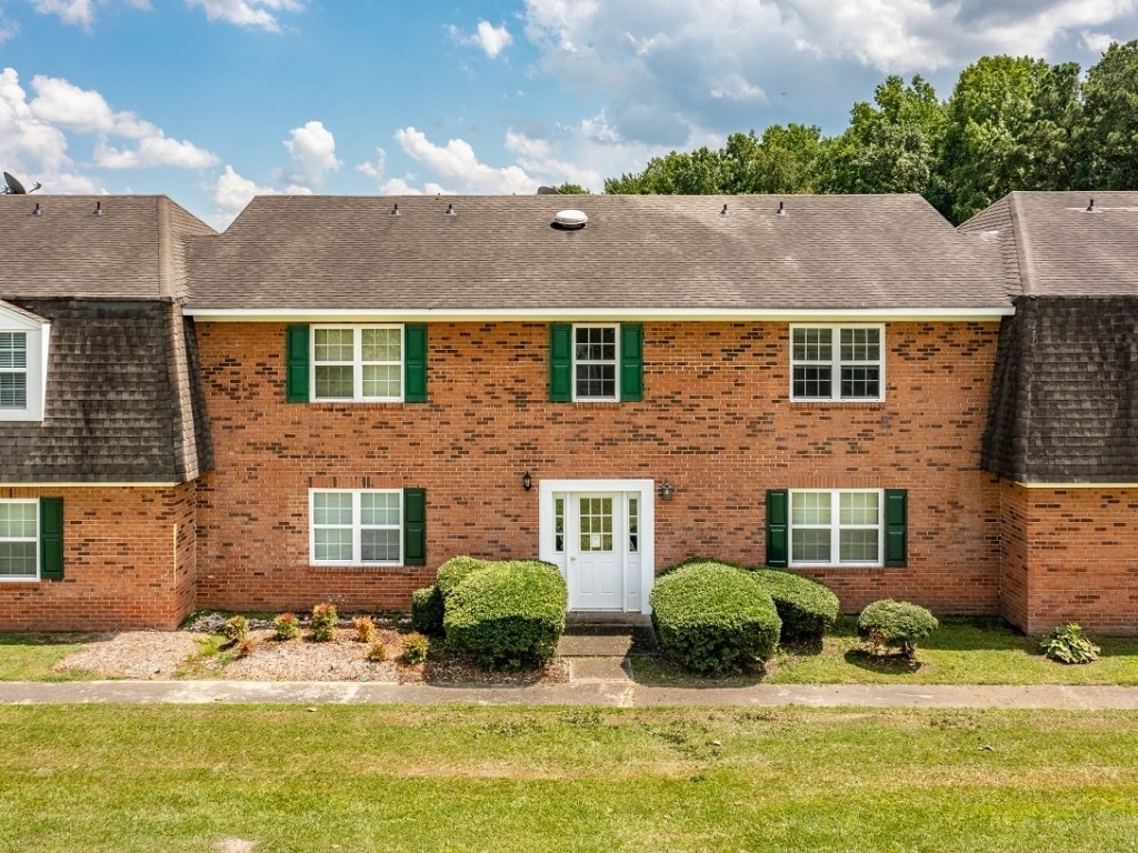
Property Record
718 Doctors Dr, Kinston, NC 28501

NEARBY LISTINGS FOR SALE OR LEASE
-
-
View all Kinston listings for sale on LoopNet.com
Property Detail
718 Doctors Dr
452613140390
HERRITAGE COURT APTS DOCTORS DR
Multifamilydwelling
Lenoir
AE
North Carolina
3720452600K
112 AC
2024
North Carolina Southeast Area
2024
Other Market Areas
010800
Kinston, NC
11,270 SF
DEMOGRAPHICS near 718 Doctors Dr
1 Mile
3 Mile
5 Mile
2024 Total Population
3,827
20,263
27,828
2029 Population
3,739
20,268
27,686
Pop Growth 2024-2029
(2.30%)
+ 0.02%
(0.51%)
Average Age
46
43
43
2024 Total Households
1,614
8,780
11,915
HH Growth 2024-2029
(2.35%)
+ 0.07%
(0.50%)
Median Household Inc
$46,571
$32,809
$36,873
Avg Household Size
2.20
2.20
2.20
2024 Avg HH Vehicles
2.00
1.00
2.00
Median Home Value
$144,965
$98,110
$97,713
Median Year Built
1972
1967
1971
Nearby Places
- Restaurants
- Banks
- Shops
- Fitness
- Groceries
PUBLIC TRANSPORTATION
AIRPORT
Pitt-Greenville
DRIVE
WALK
Distance
Pitt-Greenville
44 min
34.0 mi
Freight Ports
Port of Morehead City
DRIVE
WALK
Distance
Port of Morehead City
113 min
77.9 mi
Nearby Properties
Address
Land Use
TOTAL SIZE
Lot Size
Zoning
Address
Land Use
TOTAL SIZE
Lot Size
Zoning
357,454 SF
54.92 AC
OI
Address
Land Use
TOTAL SIZE
Lot Size
Zoning
217,381 SF
77.79 AC
O&I
Address
Land Use
TOTAL SIZE
Lot Size
Zoning
207,102 SF
64.24 AC
RA6
Address
Land Use
TOTAL SIZE
Lot Size
Zoning
166,712 SF
23.48 AC
RA8
Address
Land Use
TOTAL SIZE
Lot Size
Zoning
85,993 SF
33.29 AC
I1
Address
Land Use
TOTAL SIZE
Lot Size
Zoning
525,504 SF
228 AC
I1
Address
Land Use
TOTAL SIZE
Lot Size
Zoning
139,392 SF
2.19 AC
RA6
Address
Land Use
TOTAL SIZE
Lot Size
Zoning
61,370 SF
20.71 AC
SC
Address
Land Use
TOTAL SIZE
Lot Size
Zoning
122,274 SF
1.86 AC
B2
Address
Land Use
TOTAL SIZE
Lot Size
Zoning
65,100 SF
1.91 AC
B2
Address
Land Use
TOTAL SIZE
Lot Size
Zoning
69,696 SF
0.32 AC
B2
Address
Land Use
TOTAL SIZE
Lot Size
Zoning
73,536 SF
5.38 AC
B1
Address
Land Use
TOTAL SIZE
Lot Size
Zoning
25,163 SF
159.12 AC
OI
Address
Land Use
TOTAL SIZE
Lot Size
Zoning
106,276 SF
8.84 AC
RA5
Address
Land Use
TOTAL SIZE
Lot Size
Zoning
407.13 AC
RA6
Address
Land Use
TOTAL SIZE
Lot Size
Zoning
77,500 SF
1.30 AC
B2
Address
Land Use
TOTAL SIZE
Lot Size
Zoning
115.74 AC
RA12
Address
Land Use
TOTAL SIZE
Lot Size
Zoning
83,088 SF
1.19 AC
B2
Address
Land Use
TOTAL SIZE
Lot Size
Zoning
25,885 SF
88.62 AC
RA6
Address
Land Use
TOTAL SIZE
Lot Size
Zoning
39,450 SF
1.02 AC
B2
Address
Land Use
TOTAL SIZE
Lot Size
Zoning
61,056 SF
7.05 AC
O&I
Address
Land Use
TOTAL SIZE
Lot Size
Zoning
11.45 AC
RA6
Address
Land Use
TOTAL SIZE
Lot Size
Zoning
14,736 SF
2.85 AC
B1
Address
Land Use
TOTAL SIZE
Lot Size
Zoning
12.35 AC
RA5
Address
Land Use
TOTAL SIZE
Lot Size
Zoning
60,762 SF
57.80 AC
I1
Address
Land Use
TOTAL SIZE
Lot Size
Zoning
7,910 SF
52.32 AC
RO
Address
Land Use
TOTAL SIZE
Lot Size
Zoning
448,513 SF
104.04 AC
SC
Address
Land Use
TOTAL SIZE
Lot Size
Zoning
39,503 SF
3.94 AC
RA6
Address
Land Use
TOTAL SIZE
Lot Size
Zoning
20,672 SF
4.66 AC
OI
Address
Land Use
TOTAL SIZE
Lot Size
Zoning
8,640 SF
8.03 AC
RA5
The World's #1 Commercial Real Estate Marketplace
Connect with us
© 2025 CoStar Group
The information above has been obtained from sources believed reliable. While we do not doubt its accuracy we have not verified it and make no guarantee, warranty or representation about it. It is your responsibility to independently confirm its accuracy and completeness. Any projections, opinions, assumptions, or estimates used are for example only and do not represent the current or future performance of the property. The value of this transaction to you depends on tax and other factors which should be evaluated by your tax, financial, and legal advisors. You and your advisors should conduct a careful, independent investigation of the property to determine to your satisfaction the suitability of the property for your needs.