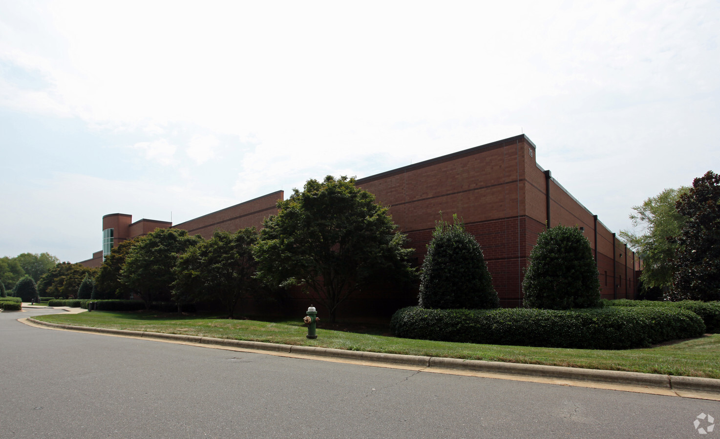
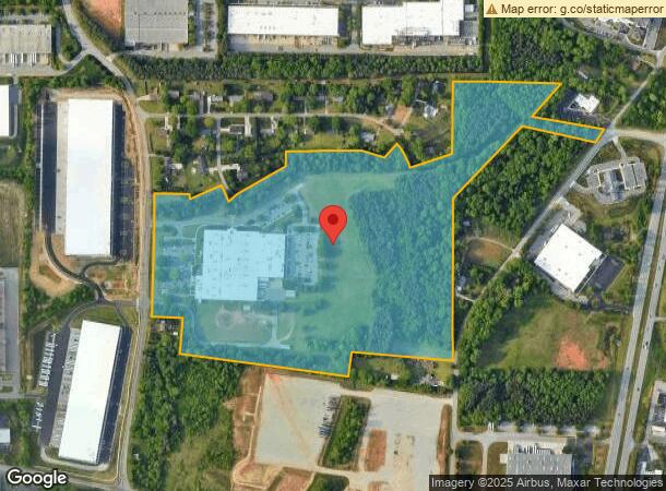
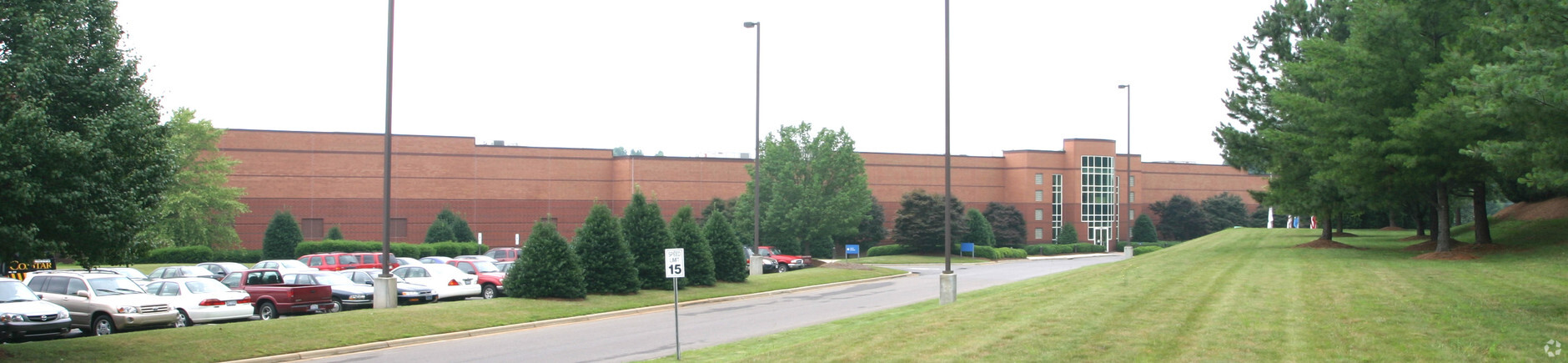
Property Record
719 Pegg Rd, Greensboro, NC 27409
NEARBY LISTINGS FOR SALE OR LEASE
Property Detail
719 Pegg Rd
Greensboro-High Point, NC
Davenport
0098335
49.58AC DAVENPORT SR 1840
Industrialgeneral
Guilford
X
North Carolina
3710781400J
13
2023
49.58 AC
2023
Airport/W Guilford County
016204
Greensboro/Winston-Salem
207,745 SF
DEMOGRAPHICS near 719 Pegg Rd
1 Mile
3 Mile
5 Mile
2024 Total Population
918
24,165
90,813
2029 Population
928
24,268
90,740
Pop Growth 2024-2029
+ 1.09%
+ 0.43%
(0.08%)
Average Age
37
40
40
2024 Total Households
403
9,940
40,153
HH Growth 2024-2029
+ 0.99%
+ 0.33%
(0.12%)
Median Household Inc
$90,416
$86,890
$70,237
Avg Household Size
2.30
2.40
2.20
2024 Avg HH Vehicles
2.00
2.00
2.00
Median Home Value
$256,164
$258,764
$234,466
Median Year Built
2005
2001
1994
Nearby Places
- Restaurants
- Banks
- Shops
- Fitness
- Groceries
PUBLIC TRANSPORTATION
COMMUTER RAIL
High Point Station (Piedmont - North Carolina by Train (NC Train))
DRIVE
WALK
Distance
High Point Station (Piedmont - North Carolina by Train (NC Train))
18 min
9.4 mi
AIRPORT
Piedmont Triad International
DRIVE
WALK
Distance
Piedmont Triad International
17 min
5.0 mi
Freight Ports
Virginia Port Authority - Richmond
DRIVE
WALK
Distance
Virginia Port Authority - Richmond
243 min
209.2 mi
Nearby Properties
Address
Land Use
TOTAL SIZE
Lot Size
Zoning
Address
Land Use
TOTAL SIZE
Lot Size
Zoning
21,687 SF
268.52 AC
HI
Address
Land Use
TOTAL SIZE
Lot Size
Zoning
181,444 SF
127.32 AC
PD-P
Address
Land Use
TOTAL SIZE
Lot Size
Zoning
410,298 SF
33.10 AC
CU-RM-12
Address
Land Use
TOTAL SIZE
Lot Size
Zoning
462,568 SF
62.40 AC
BP
Address
Land Use
TOTAL SIZE
Lot Size
Zoning
691,408 SF
58.69 AC
LI
Address
Land Use
TOTAL SIZE
Lot Size
Zoning
552,314 SF
38.47 AC
CU-RS-12
Address
Land Use
TOTAL SIZE
Lot Size
Zoning
374,522 SF
56.55 AC
HI
Address
Land Use
TOTAL SIZE
Lot Size
Zoning
186,200 SF
10.58 AC
LI
Address
Land Use
TOTAL SIZE
Lot Size
Zoning
509,216 SF
40.85 AC
LI
Address
Land Use
TOTAL SIZE
Lot Size
Zoning
400,000 SF
46.72 AC
CU-LI
Address
Land Use
TOTAL SIZE
Lot Size
Zoning
354,454 SF
20.65 AC
CD-RM-12
Address
Land Use
TOTAL SIZE
Lot Size
Zoning
229,103 SF
18.76 AC
CZ-I
Address
Land Use
TOTAL SIZE
Lot Size
Zoning
309,749 SF
16.74 AC
CZ-PDM
Address
Land Use
TOTAL SIZE
Lot Size
Zoning
428,867 SF
76.65 AC
CU-LI
Address
Land Use
TOTAL SIZE
Lot Size
Zoning
362,708 SF
56.81 AC
LI
Address
Land Use
TOTAL SIZE
Lot Size
Zoning
274,999 SF
21.57 AC
CU-LI
Address
Land Use
TOTAL SIZE
Lot Size
Zoning
53,362 SF
0.51 AC
LAR3
Address
Land Use
TOTAL SIZE
Lot Size
Zoning
325.42 AC
AR
Address
Land Use
TOTAL SIZE
Lot Size
Zoning
180,568 SF
0.01 AC
AR
Address
Land Use
TOTAL SIZE
Lot Size
Zoning
341,000 SF
29.55 AC
CD-LI
Address
Land Use
TOTAL SIZE
Lot Size
Zoning
214,941 SF
13.29 AC
CU-PDR
Address
Land Use
TOTAL SIZE
Lot Size
Zoning
299,786 SF
24.49 AC
PDP
Address
Land Use
TOTAL SIZE
Lot Size
Zoning
543,123 SF
24.66 AC
BP
Address
Land Use
TOTAL SIZE
Lot Size
Zoning
227,652 SF
21.64 AC
CU-LI
Address
Land Use
TOTAL SIZE
Lot Size
Zoning
217,000 SF
16.58 AC
AG
Address
Land Use
TOTAL SIZE
Lot Size
Zoning
269,956 SF
19.44 AC
CU-GO-M
Address
Land Use
TOTAL SIZE
Lot Size
Zoning
209,184 SF
13.52 AC
CU-GO-H
Address
Land Use
TOTAL SIZE
Lot Size
Zoning
161,975 SF
20.66 AC
BP
Address
Land Use
TOTAL SIZE
Lot Size
Zoning
75,588 SF
6.49 AC
CU-LI
Address
Land Use
TOTAL SIZE
Lot Size
Zoning
760,545 SF
69.50 AC
CU-LI
The World's #1 Commercial Real Estate Marketplace
Connect with us
© 2025 CoStar Group
The information above has been obtained from sources believed reliable. While we do not doubt its accuracy we have not verified it and make no guarantee, warranty or representation about it. It is your responsibility to independently confirm its accuracy and completeness. Any projections, opinions, assumptions, or estimates used are for example only and do not represent the current or future performance of the property. The value of this transaction to you depends on tax and other factors which should be evaluated by your tax, financial, and legal advisors. You and your advisors should conduct a careful, independent investigation of the property to determine to your satisfaction the suitability of the property for your needs.