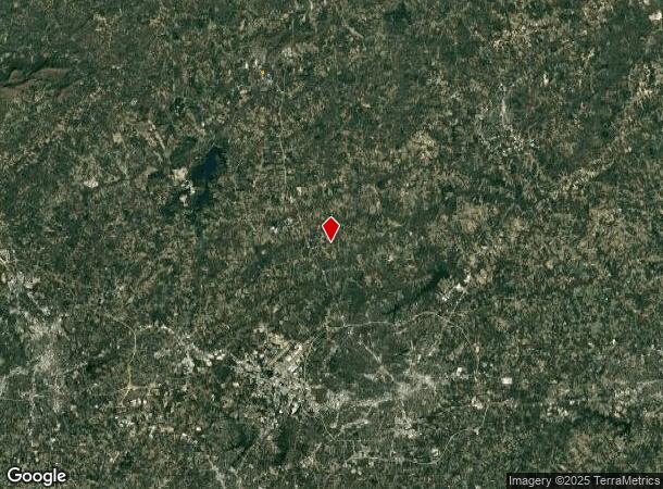
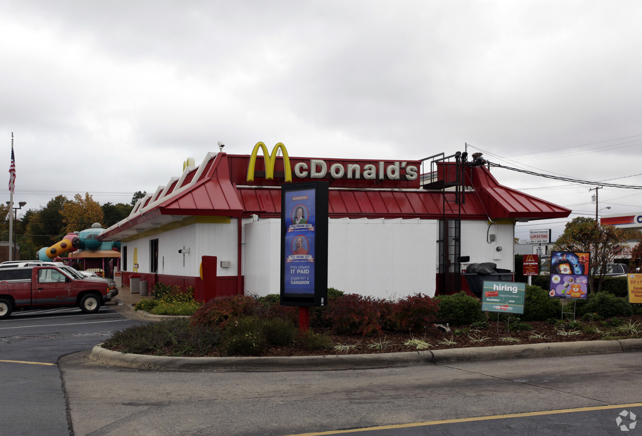
Property Record
720 N Highway St, Summerfield, NC 27358

NEARBY LISTINGS FOR SALE OR LEASE
Property Detail
720 N Highway St
118314
1.16 AC HWY 220
Restaurantdrivein
Rockingham
X
North Carolina
3710791600J
1.16 AC
2024
Rockingham County
2024
Greensboro/Winston-Salem
015800
Greensboro-High Point, NC
4,508 SF
DEMOGRAPHICS near 720 N Highway St
1 Mile
3 Mile
5 Mile
2024 Total Population
2,191
7,095
12,123
2029 Population
2,248
7,250
12,387
Pop Growth 2024-2029
+ 2.60%
+ 2.18%
+ 2.18%
Average Age
44
45
45
2024 Total Households
1,047
3,261
5,333
HH Growth 2024-2029
+ 2.58%
+ 2.15%
+ 2.16%
Median Household Inc
$34,916
$35,639
$41,979
Avg Household Size
2.10
2.10
2.20
2024 Avg HH Vehicles
2.00
2.00
2.00
Median Home Value
$133,173
$124,184
$130,991
Median Year Built
1960
1973
1978
Nearby Places
- Restaurants
- Banks
- Shops
- Fitness
- Groceries
PUBLIC TRANSPORTATION
AIRPORT
Piedmont Triad International
DRIVE
WALK
Distance
Piedmont Triad International
26 min
14.1 mi
Freight Ports
Virginia Port Authority - Richmond
DRIVE
WALK
Distance
Virginia Port Authority - Richmond
242 min
183.9 mi
Nearby Properties
Address
Land Use
TOTAL SIZE
Lot Size
Zoning
Address
Land Use
TOTAL SIZE
Lot Size
Zoning
54,260 SF
18.91 AC
RS-30
Address
Land Use
TOTAL SIZE
Lot Size
Zoning
52,167 SF
27.97 AC
RS-30
Address
Land Use
TOTAL SIZE
Lot Size
Zoning
38,926 SF
25.65 AC
CU-GB
Address
Land Use
TOTAL SIZE
Lot Size
Zoning
4,511 SF
463.69 AC
AG
Address
Land Use
TOTAL SIZE
Lot Size
Zoning
2,191 SF
43.13 AC
CU-GB
Address
Land Use
TOTAL SIZE
Lot Size
Zoning
56,095 SF
26.64 AC
PI
Address
Land Use
TOTAL SIZE
Lot Size
Zoning
42,298 SF
4.94 AC
HB
Address
Land Use
TOTAL SIZE
Lot Size
Zoning
3,644 SF
348.36 AC
AG
Address
Land Use
TOTAL SIZE
Lot Size
Zoning
14,676 SF
2.31 AC
HB
Address
Land Use
TOTAL SIZE
Lot Size
Zoning
17,640 SF
16.59 AC
AG-SP
Address
Land Use
TOTAL SIZE
Lot Size
Zoning
20,939 SF
4.61 AC
CU-PI
Address
Land Use
TOTAL SIZE
Lot Size
Zoning
5,913 SF
5.61 AC
RS-30
Address
Land Use
TOTAL SIZE
Lot Size
Zoning
13,547 SF
11.95 AC
CU-HB
Address
Land Use
TOTAL SIZE
Lot Size
Zoning
10,502 SF
1.44 AC
CU-LB
Address
Land Use
TOTAL SIZE
Lot Size
Zoning
34,903 SF
11.17 AC
PI
Address
Land Use
TOTAL SIZE
Lot Size
Zoning
45,131 SF
8.37 AC
AG
Address
Land Use
TOTAL SIZE
Lot Size
Zoning
116.65 AC
AG
Address
Land Use
TOTAL SIZE
Lot Size
Zoning
9,831 SF
5 AC
LO
Address
Land Use
TOTAL SIZE
Lot Size
Zoning
850 SF
140.07 AC
CU-RS-40
Address
Land Use
TOTAL SIZE
Lot Size
Zoning
21.17 AC
CU-GB
Address
Land Use
TOTAL SIZE
Lot Size
Zoning
3,881 SF
94.81 AC
AG
Address
Land Use
TOTAL SIZE
Lot Size
Zoning
3,025 SF
92.54 AC
AG
Address
Land Use
TOTAL SIZE
Lot Size
Zoning
828 SF
37.20 AC
AG
Address
Land Use
TOTAL SIZE
Lot Size
Zoning
7,279 SF
2.80 AC
RS-30
Address
Land Use
TOTAL SIZE
Lot Size
Zoning
6,730 SF
72.08 AC
AG
Address
Land Use
TOTAL SIZE
Lot Size
Zoning
7,752 SF
6.29 AC
RES AG/RES
Address
Land Use
TOTAL SIZE
Lot Size
Zoning
2,485 SF
86.54 AC
AG
Address
Land Use
TOTAL SIZE
Lot Size
Zoning
12,000 SF
4.43 AC
LI
Address
Land Use
TOTAL SIZE
Lot Size
Zoning
164.27 AC
AG
Address
Land Use
TOTAL SIZE
Lot Size
Zoning
16,621 SF
2.20 AC
PI
The World's #1 Commercial Real Estate Marketplace
Connect with us
© 2025 CoStar Group
The information above has been obtained from sources believed reliable. While we do not doubt its accuracy we have not verified it and make no guarantee, warranty or representation about it. It is your responsibility to independently confirm its accuracy and completeness. Any projections, opinions, assumptions, or estimates used are for example only and do not represent the current or future performance of the property. The value of this transaction to you depends on tax and other factors which should be evaluated by your tax, financial, and legal advisors. You and your advisors should conduct a careful, independent investigation of the property to determine to your satisfaction the suitability of the property for your needs.