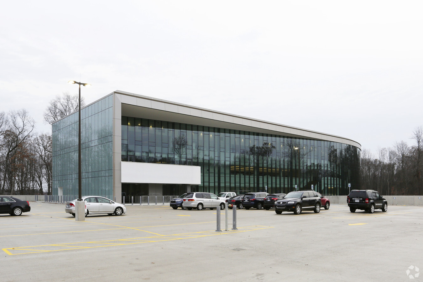
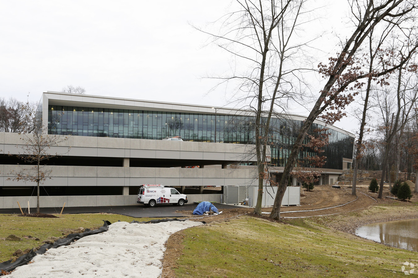
Property Record
7200 Elm Valley Dr, Kalamazoo, MI 49009
NEARBY LISTINGS FOR SALE OR LEASE
Property Detail
7200 Elm Valley Dr
09-02-305-008
SEC 2-3-12 BEG ON N & S 1/4 LI 974.4 FT NLY OF S 1/4 POSTTH N 89DEG38MIN55SEC W PAR S 1/8 LI 536.8 FT TH N 0DEG24MIN43SEC E ALG E LI LOTUS TOWN HOMES 350 FT TO S 1/8 LI TH S 89DEG38MIN55SEC E THEREON 536.8 FT TO SD 1/4 LI TH S 0DEG24MIN43SEC E 350 FT
Commercialnec
Kalamazoo
X
Michigan
26077C0300E
22.69 AC
2023
Western Kalamazoo County
2024
West Michigan
003005
Kalamazoo-Portage, MI
140,000 SF
DEMOGRAPHICS near 7200 Elm Valley Dr
1 Mile
3 Mile
5 Mile
2024 Total Population
1,410
23,965
86,123
2029 Population
1,410
23,798
86,005
Pop Growth 2024-2029
0.00%
(0.70%)
(0.14%)
Average Age
41
39
37
2024 Total Households
565
9,357
34,697
HH Growth 2024-2029
(0.18%)
(0.84%)
(0.12%)
Median Household Inc
$99,560
$92,856
$67,081
Avg Household Size
2.50
2.50
2.30
2024 Avg HH Vehicles
2.00
2.00
2.00
Median Home Value
$437,272
$290,052
$262,446
Median Year Built
1994
1994
1985
Nearby Places
- Restaurants
- Banks
- Shops
- Fitness
- Groceries
PUBLIC TRANSPORTATION
COMMUTER RAIL
Kalamazoo (Blue Water - Amtrak, Wolverine - Amtrak)
DRIVE
WALK
Distance
Kalamazoo (Blue Water - Amtrak, Wolverine - Amtrak)
20 min
8.8 mi
AIRPORT
Kalamazoo/Battle Creek International
DRIVE
WALK
Distance
Kalamazoo/Battle Creek International
20 min
9.1 mi
Freight Ports
Port of Toledo
DRIVE
WALK
Distance
Port of Toledo
184 min
150.6 mi
Nearby Properties
Address
Land Use
TOTAL SIZE
Lot Size
Zoning
Address
Land Use
TOTAL SIZE
Lot Size
Zoning
424,967 SF
55.60 AC
I-1
Address
Land Use
TOTAL SIZE
Lot Size
Zoning
204,579 SF
27.80 AC
R-4 MUL
Address
Land Use
TOTAL SIZE
Lot Size
Zoning
126.09 AC
R-5 MHP
Address
Land Use
TOTAL SIZE
Lot Size
Zoning
128,586 SF
14.27 AC
R-4 MUL
Address
Land Use
TOTAL SIZE
Lot Size
Zoning
55.46 AC
R-5 MHP
Address
Land Use
TOTAL SIZE
Lot Size
Zoning
16.75 AC
CBD
Address
Land Use
TOTAL SIZE
Lot Size
Zoning
4.33 AC
C-1
Address
Land Use
TOTAL SIZE
Lot Size
Zoning
17.31 AC
PD
Address
Land Use
TOTAL SIZE
Lot Size
Zoning
23,463 SF
15 AC
Address
Land Use
TOTAL SIZE
Lot Size
Zoning
12,480 SF
14.82 AC
Address
Land Use
TOTAL SIZE
Lot Size
Zoning
1,703 SF
20.29 AC
R-5
Address
Land Use
TOTAL SIZE
Lot Size
Zoning
92,694 SF
16.10 AC
EBT
Address
Land Use
TOTAL SIZE
Lot Size
Zoning
50.10 AC
C-3, C-4
Address
Land Use
TOTAL SIZE
Lot Size
Zoning
116,558 SF
5.03 AC
C COMM
Address
Land Use
TOTAL SIZE
Lot Size
Zoning
7.18 AC
CBD
Address
Land Use
TOTAL SIZE
Lot Size
Zoning
53,148 SF
6.19 AC
R-4 MUL
Address
Land Use
TOTAL SIZE
Lot Size
Zoning
51,000 SF
7.70 AC
R-4 MUL
Address
Land Use
TOTAL SIZE
Lot Size
Zoning
226,877 SF
20.48 AC
I-1
Address
Land Use
TOTAL SIZE
Lot Size
Zoning
142,144 SF
18.82 AC
R-4 MUL
Address
Land Use
TOTAL SIZE
Lot Size
Zoning
44,038 SF
6.50 AC
CBD
Address
Land Use
TOTAL SIZE
Lot Size
Zoning
1,489 SF
7.79 AC
R-1T
Address
Land Use
TOTAL SIZE
Lot Size
Zoning
14.38 AC
I-1
Address
Land Use
TOTAL SIZE
Lot Size
Zoning
80,550 SF
11.02 AC
R-5
Address
Land Use
TOTAL SIZE
Lot Size
Zoning
8.83 AC
I-1
Address
Land Use
TOTAL SIZE
Lot Size
Zoning
33,513 SF
Address
Land Use
TOTAL SIZE
Lot Size
Zoning
4.84 AC
OS-1
Address
Land Use
TOTAL SIZE
Lot Size
Zoning
44,944 SF
3.78 AC
R-4 MUL
Address
Land Use
TOTAL SIZE
Lot Size
Zoning
27,393 SF
12.37 AC
R-3 RES
Address
Land Use
TOTAL SIZE
Lot Size
Zoning
161,833 SF
33.48 AC
I-R IND
The World's #1 Commercial Real Estate Marketplace
Connect with us
© 2025 CoStar Group
The information above has been obtained from sources believed reliable. While we do not doubt its accuracy we have not verified it and make no guarantee, warranty or representation about it. It is your responsibility to independently confirm its accuracy and completeness. Any projections, opinions, assumptions, or estimates used are for example only and do not represent the current or future performance of the property. The value of this transaction to you depends on tax and other factors which should be evaluated by your tax, financial, and legal advisors. You and your advisors should conduct a careful, independent investigation of the property to determine to your satisfaction the suitability of the property for your needs.