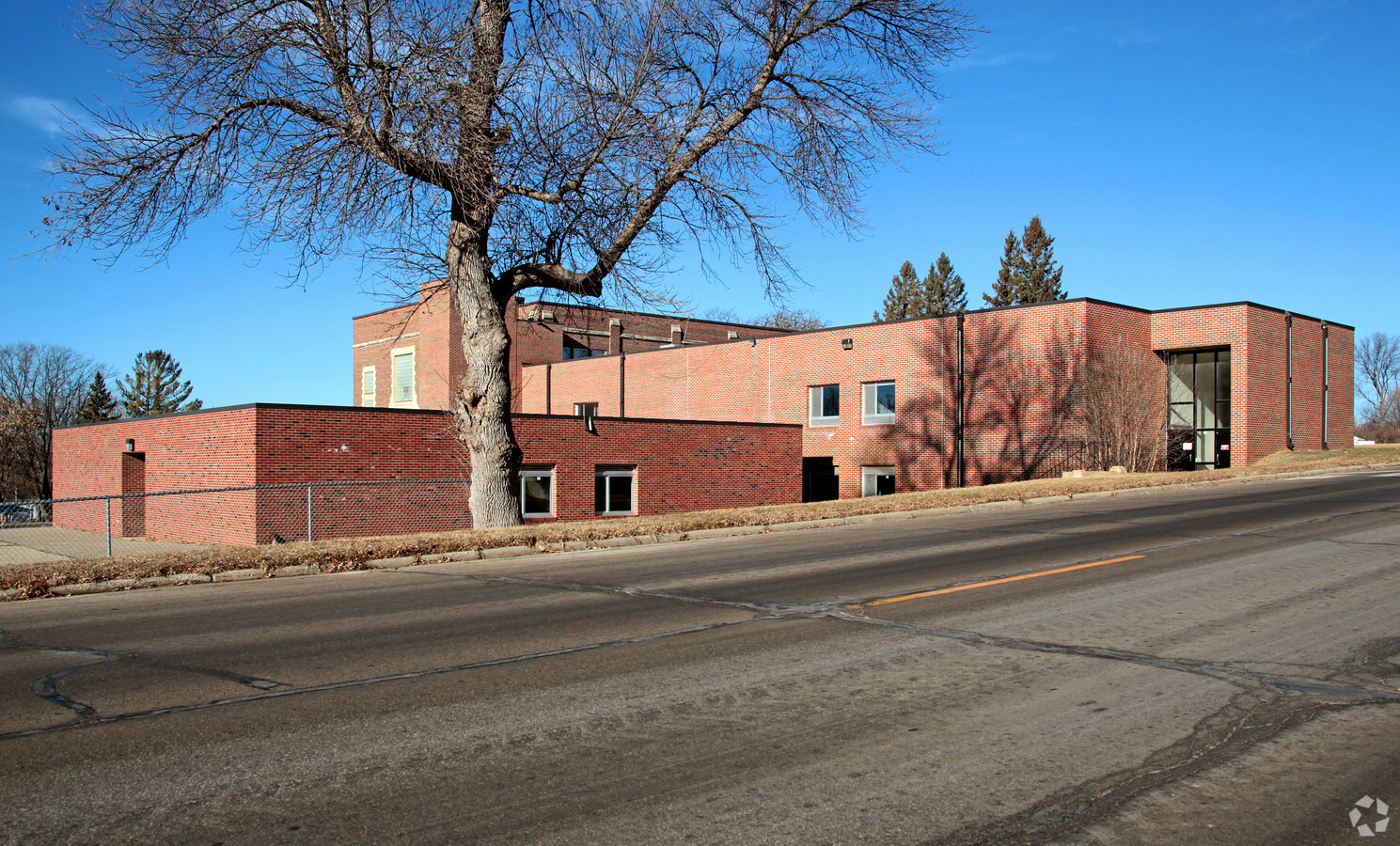
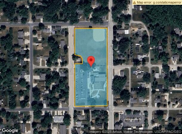
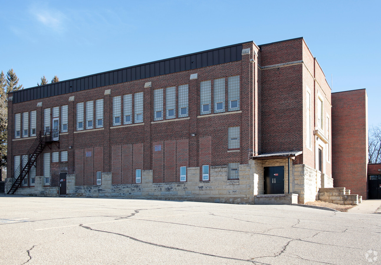
Property Record
721 Main St N, Mantorville, MN 55955
NEARBY LISTINGS FOR SALE OR LEASE
-
-
View all Mantorville listings for sale on LoopNet.com
Property Detail
721 Main St N
Other Market Areas
Original Plat
Rochester, MN
1,107,600 25100 SECT-16 TWP-107 RANGE-016 ORIGINAL PLAT PUBLIC SCHOOL SQUARE ALL THAT PART OF THE ORIGINAL PLAT OF THE CITY O
25.100.0840
Dodge
Governmentalpublicusegeneral
Minnesota
0
1-10
2024
4.90 AC
9501003032
Minnesota South Area
25,300 SF
DEMOGRAPHICS near 721 Main St N
1 Mile
3 Mile
5 Mile
2024 Total Population
1,350
8,580
10,957
2029 Population
1,365
8,752
11,156
Pop Growth 2024-2029
+ 1.11%
+ 2.00%
+ 1.82%
Average Age
40
38
38
2024 Total Households
486
3,132
4,084
HH Growth 2024-2029
+ 1.03%
+ 2.01%
+ 1.79%
Median Household Inc
$114,159
$101,161
$96,511
Avg Household Size
2.80
2.70
2.70
2024 Avg HH Vehicles
2.00
2.00
2.00
Median Home Value
$358,333
$275,705
$274,585
Median Year Built
1989
1993
1992
Nearby Places
- Restaurants
- Banks
- Shops
- Fitness
- Groceries
PUBLIC TRANSPORTATION
AIRPORT
Rochester International
DRIVE
WALK
Distance
Rochester International
36 min
25.8 mi
Freight Ports
Port Milwaukee
DRIVE
WALK
Distance
Port Milwaukee
330 min
295.3 mi
Nearby Properties
Address
Land Use
TOTAL SIZE
Lot Size
Zoning
Address
Land Use
TOTAL SIZE
Lot Size
Zoning
199,081 SF
50.63 AC
Address
Land Use
TOTAL SIZE
Lot Size
Zoning
19.39 AC
Address
Land Use
TOTAL SIZE
Lot Size
Zoning
148,405 SF
44.32 AC
Address
Land Use
TOTAL SIZE
Lot Size
Zoning
59,776 SF
6.12 AC
Address
Land Use
TOTAL SIZE
Lot Size
Zoning
50,936 SF
5 AC
Address
Land Use
TOTAL SIZE
Lot Size
Zoning
2.39 AC
Address
Land Use
TOTAL SIZE
Lot Size
Zoning
1,025 SF
27.93 AC
Address
Land Use
TOTAL SIZE
Lot Size
Zoning
26,598 SF
80 AC
Address
Land Use
TOTAL SIZE
Lot Size
Zoning
264.29 AC
Address
Land Use
TOTAL SIZE
Lot Size
Zoning
21,608 SF
2.30 AC
Address
Land Use
TOTAL SIZE
Lot Size
Zoning
6.33 AC
Address
Land Use
TOTAL SIZE
Lot Size
Zoning
12,340 SF
1.30 AC
Address
Land Use
TOTAL SIZE
Lot Size
Zoning
271.13 AC
Address
Land Use
TOTAL SIZE
Lot Size
Zoning
29,345 SF
5.67 AC
Address
Land Use
TOTAL SIZE
Lot Size
Zoning
10,923 SF
2.80 AC
Address
Land Use
TOTAL SIZE
Lot Size
Zoning
22,638 SF
0.70 AC
Address
Land Use
TOTAL SIZE
Lot Size
Zoning
Address
Land Use
TOTAL SIZE
Lot Size
Zoning
2,500 SF
8.08 AC
Address
Land Use
TOTAL SIZE
Lot Size
Zoning
226.82 AC
Address
Land Use
TOTAL SIZE
Lot Size
Zoning
151.74 AC
Address
Land Use
TOTAL SIZE
Lot Size
Zoning
Address
Land Use
TOTAL SIZE
Lot Size
Zoning
178.08 AC
Address
Land Use
TOTAL SIZE
Lot Size
Zoning
182.70 AC
Address
Land Use
TOTAL SIZE
Lot Size
Zoning
Address
Land Use
TOTAL SIZE
Lot Size
Zoning
Address
Land Use
TOTAL SIZE
Lot Size
Zoning
71.44 AC
Address
Land Use
TOTAL SIZE
Lot Size
Zoning
30,380 SF
1.03 AC
Address
Land Use
TOTAL SIZE
Lot Size
Zoning
35,176 SF
2.30 AC
Address
Land Use
TOTAL SIZE
Lot Size
Zoning
153.14 AC
Address
Land Use
TOTAL SIZE
Lot Size
Zoning
150 AC
The World's #1 Commercial Real Estate Marketplace
Connect with us
© 2025 CoStar Group
The information above has been obtained from sources believed reliable. While we do not doubt its accuracy we have not verified it and make no guarantee, warranty or representation about it. It is your responsibility to independently confirm its accuracy and completeness. Any projections, opinions, assumptions, or estimates used are for example only and do not represent the current or future performance of the property. The value of this transaction to you depends on tax and other factors which should be evaluated by your tax, financial, and legal advisors. You and your advisors should conduct a careful, independent investigation of the property to determine to your satisfaction the suitability of the property for your needs.