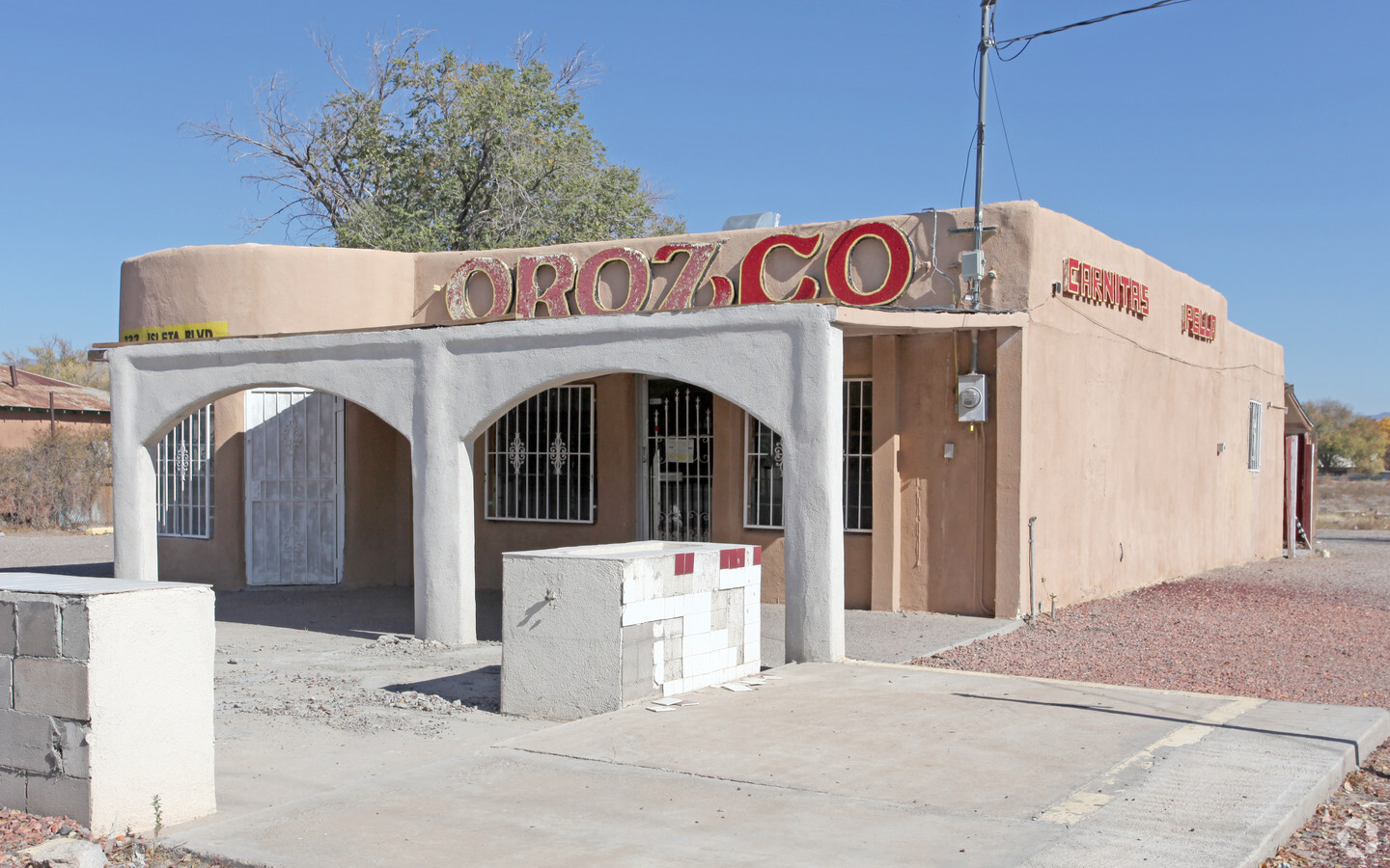
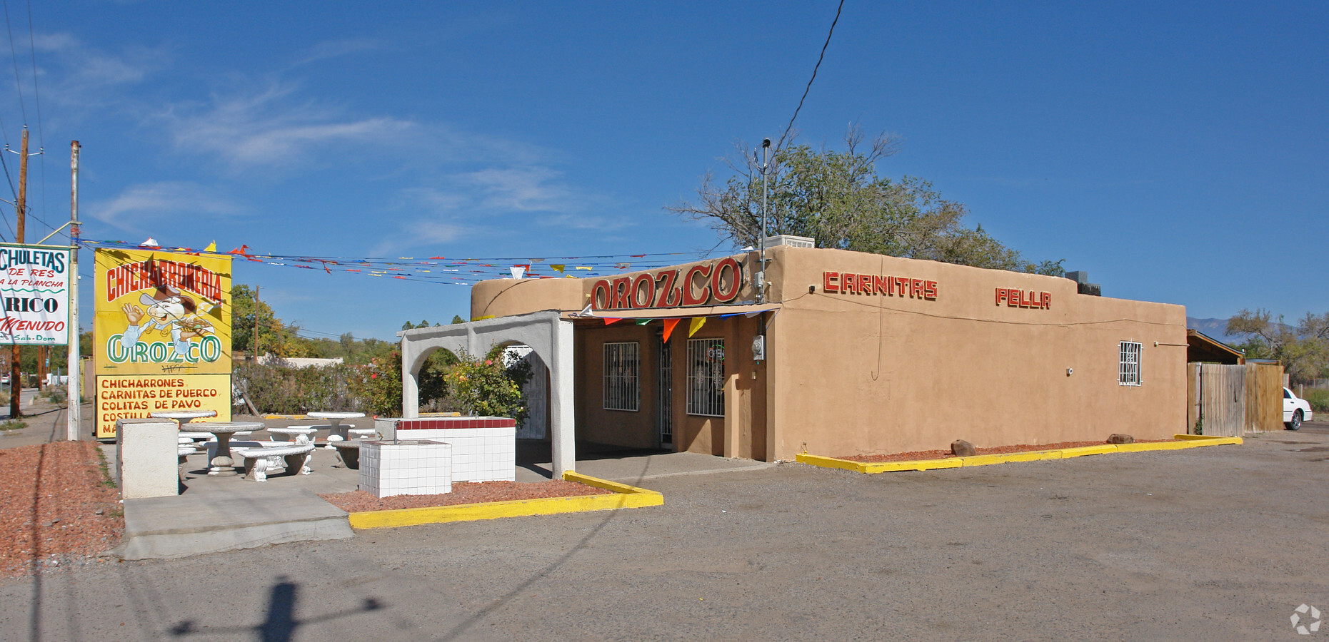
Property Record
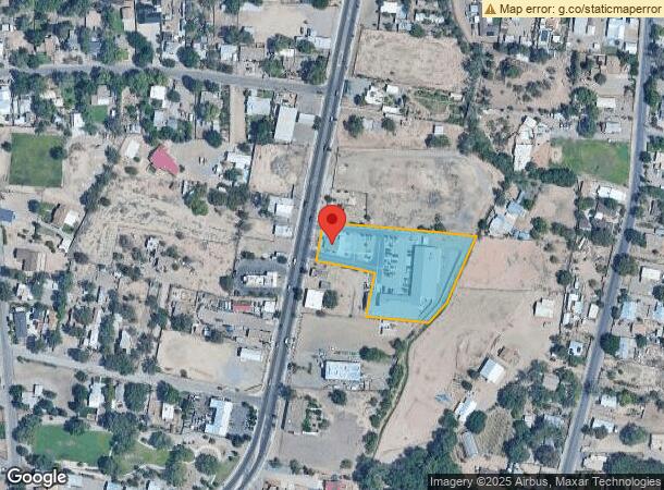
722 Isleta Blvd Sw, Albuquerque, NM 87105
NEARBY LISTINGS FOR SALE OR LEASE
Property Detail
722 Isleta Blvd Sw
1-013-055-223501-2-14-01
Lands Of Matty Romero
Restaurantbuilding
TR A1 PLAT OF TRACT A-1 & C-1 LANDS OF MATTY ROMERO CONT 1.9636 AC
X
Bernalillo
35001C0341G
New Mexico
0
1.96 AC
2024
South Valley
004300
Albuquerque
1,451 SF
Albuquerque, NM
DEMOGRAPHICS near 722 Isleta Blvd Sw
1 Mile
3 Mile
5 Mile
2024 Total Population
8,517
78,172
220,544
2029 Population
8,519
78,171
219,559
Pop Growth 2024-2029
+ 0.02%
0.00%
(0.45%)
Average Age
40
39
38
2024 Total Households
3,131
31,828
87,590
HH Growth 2024-2029
(0.06%)
+ 0.12%
(0.34%)
Median Household Inc
$33,886
$39,730
$49,208
Avg Household Size
2.60
2.30
2.40
2024 Avg HH Vehicles
2.00
2.00
2.00
Median Home Value
$175,859
$192,148
$208,596
Median Year Built
1962
1968
1978
Nearby Places
- Restaurants
- Banks
- Shops
- Fitness
- Groceries
PUBLIC TRANSPORTATION
COMMUTER RAIL
Downtown Albuquerque (Rail Runner Express - New Mexico Rail Runner Express)
DRIVE
WALK
Distance
Downtown Albuquerque (Rail Runner Express - New Mexico Rail Runner Express)
6 min
2.7 mi
Bernalillo County-International Sunport (Rail Runner Express - New Mexico Rail Runner Express)
DRIVE
WALK
Distance
Bernalillo County-International Sunport (Rail Runner Express - New Mexico Rail Runner Express)
10 min
4.7 mi
AIRPORT
Albuquerque International Sunport
DRIVE
WALK
Distance
Albuquerque International Sunport
25 min
10.3 mi
Freight Ports
Tulsa Port Of Catoosa
DRIVE
WALK
Distance
Tulsa Port Of Catoosa
694 min
666.0 mi
Nearby Properties
Address
Land Use
TOTAL SIZE
Lot Size
Zoning
Address
Land Use
TOTAL SIZE
Lot Size
Zoning
2,286.01 AC
Address
Land Use
TOTAL SIZE
Lot Size
Zoning
607,287 SF
8.26 AC
Address
Land Use
TOTAL SIZE
Lot Size
Zoning
849,036 SF
8.12 AC
Address
Land Use
TOTAL SIZE
Lot Size
Zoning
Address
Land Use
TOTAL SIZE
Lot Size
Zoning
4,279 SF
13.72 AC
Address
Land Use
TOTAL SIZE
Lot Size
Zoning
Address
Land Use
TOTAL SIZE
Lot Size
Zoning
37,700 SF
4.43 AC
Address
Land Use
TOTAL SIZE
Lot Size
Zoning
196,154 SF
14.81 AC
Address
Land Use
TOTAL SIZE
Lot Size
Zoning
355,645 SF
11.98 AC
Address
Land Use
TOTAL SIZE
Lot Size
Zoning
287,781 SF
38.18 AC
Address
Land Use
TOTAL SIZE
Lot Size
Zoning
370,665 SF
1.66 AC
Address
Land Use
TOTAL SIZE
Lot Size
Zoning
Address
Land Use
TOTAL SIZE
Lot Size
Zoning
267,101 SF
3.40 AC
Address
Land Use
TOTAL SIZE
Lot Size
Zoning
41.40 AC
Address
Land Use
TOTAL SIZE
Lot Size
Zoning
36,200 SF
12.21 AC
Address
Land Use
TOTAL SIZE
Lot Size
Zoning
Address
Land Use
TOTAL SIZE
Lot Size
Zoning
269,596 SF
9.33 AC
Address
Land Use
TOTAL SIZE
Lot Size
Zoning
313,812 SF
0.77 AC
Address
Land Use
TOTAL SIZE
Lot Size
Zoning
Address
Land Use
TOTAL SIZE
Lot Size
Zoning
6,631 SF
21.01 AC
Address
Land Use
TOTAL SIZE
Lot Size
Zoning
89,661 SF
6.12 AC
Address
Land Use
TOTAL SIZE
Lot Size
Zoning
Address
Land Use
TOTAL SIZE
Lot Size
Zoning
1.89 AC
Address
Land Use
TOTAL SIZE
Lot Size
Zoning
134,349 SF
38.81 AC
Address
Land Use
TOTAL SIZE
Lot Size
Zoning
149,648 SF
8.70 AC
Address
Land Use
TOTAL SIZE
Lot Size
Zoning
16.59 AC
Address
Land Use
TOTAL SIZE
Lot Size
Zoning
201,777 SF
1.08 AC
Address
Land Use
TOTAL SIZE
Lot Size
Zoning
115,611 SF
4.89 AC
Address
Land Use
TOTAL SIZE
Lot Size
Zoning
472,156 SF
1.78 AC
Address
Land Use
TOTAL SIZE
Lot Size
Zoning
115,099 SF
2.63 AC
The World's #1 Commercial Real Estate Marketplace
Connect with us
© 2025 CoStar Group
The information above has been obtained from sources believed reliable. While we do not doubt its accuracy we have not verified it and make no guarantee, warranty or representation about it. It is your responsibility to independently confirm its accuracy and completeness. Any projections, opinions, assumptions, or estimates used are for example only and do not represent the current or future performance of the property. The value of this transaction to you depends on tax and other factors which should be evaluated by your tax, financial, and legal advisors. You and your advisors should conduct a careful, independent investigation of the property to determine to your satisfaction the suitability of the property for your needs.