Property Record
320 Sw Upper Terrace Dr, Bend, OR 97702


Current Lease Availabilities
NEARBY LISTINGS FOR SALE OR LEASE
Property Detail
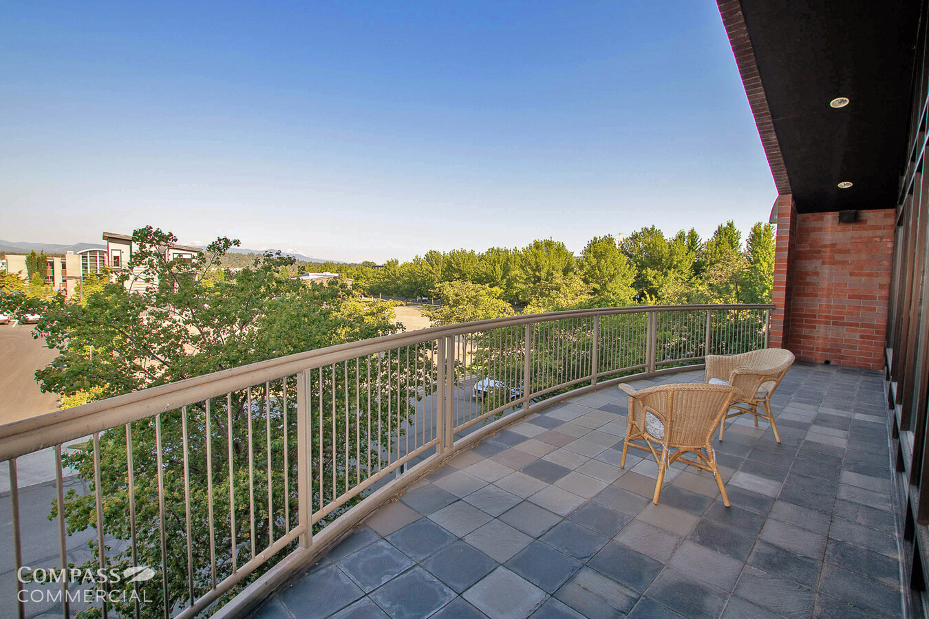
320 Sw Upper Terrace Dr
Bend-Redmond, OR
Upper Terrace Phase Ii
197445
UPPER TERRACE PHASE II LOT 16
Commercialnec
Deschutes
X
Oregon
41017C0670E
16
2024
0.96 AC
2024
Deschutes County
001502
Portland
20,432 SF
DEMOGRAPHICS near 320 Sw Upper Terrace Dr
1 Mile
3 Mile
5 Mile
2024 Total Population
9,631
84,660
112,716
2029 Population
10,871
94,614
125,765
Pop Growth 2024-2029
+ 12.88%
+ 11.76%
+ 11.58%
Average Age
39
41
41
2024 Total Households
4,314
35,482
46,062
HH Growth 2024-2029
+ 12.96%
+ 11.89%
+ 11.72%
Median Household Inc
$66,599
$80,926
$85,461
Avg Household Size
2.10
2.30
2.40
2024 Avg HH Vehicles
2.00
2.00
2.00
Median Home Value
$675,636
$622,444
$634,004
Median Year Built
1988
1999
1999
Nearby Places
- Restaurants
- Banks
- Shops
- Fitness
- Groceries
PUBLIC TRANSPORTATION
AIRPORT
Roberts Field
DRIVE
WALK
Distance
Roberts Field
28 min
17.9 mi
Freight Ports
Port of Portland
DRIVE
WALK
Distance
Port of Portland
236 min
179.4 mi
Nearby Properties
Address
Land Use
TOTAL SIZE
Lot Size
Zoning
Address
Land Use
TOTAL SIZE
Lot Size
Zoning
35.14 AC
RH
Address
Land Use
TOTAL SIZE
Lot Size
Zoning
35.14 AC
RH
Address
Land Use
TOTAL SIZE
Lot Size
Zoning
35.14 AC
RH
Address
Land Use
TOTAL SIZE
Lot Size
Zoning
35.14 AC
Address
Land Use
TOTAL SIZE
Lot Size
Zoning
35.14 AC
Address
Land Use
TOTAL SIZE
Lot Size
Zoning
144,000 SF
35.14 AC
RH
Address
Land Use
TOTAL SIZE
Lot Size
Zoning
11,947 SF
35.14 AC
RH
Address
Land Use
TOTAL SIZE
Lot Size
Zoning
35.14 AC
RH
Address
Land Use
TOTAL SIZE
Lot Size
Zoning
35.14 AC
RH
Address
Land Use
TOTAL SIZE
Lot Size
Zoning
61,869 SF
35.14 AC
RH
Address
Land Use
TOTAL SIZE
Lot Size
Zoning
10,490 SF
35.14 AC
RH
Address
Land Use
TOTAL SIZE
Lot Size
Zoning
116,476 SF
35.14 AC
RH
Address
Land Use
TOTAL SIZE
Lot Size
Zoning
35.14 AC
RH
Address
Land Use
TOTAL SIZE
Lot Size
Zoning
144,000 SF
35.14 AC
RH
Address
Land Use
TOTAL SIZE
Lot Size
Zoning
35.14 AC
RH
Address
Land Use
TOTAL SIZE
Lot Size
Zoning
144,000 SF
35.14 AC
RH
Address
Land Use
TOTAL SIZE
Lot Size
Zoning
12,000 SF
1.84 AC
IL
Address
Land Use
TOTAL SIZE
Lot Size
Zoning
1.84 AC
IL
Address
Land Use
TOTAL SIZE
Lot Size
Zoning
3.74 AC
MR
Address
Land Use
TOTAL SIZE
Lot Size
Zoning
25,574 SF
3.74 AC
MR
Address
Land Use
TOTAL SIZE
Lot Size
Zoning
27,863 SF
4.23 AC
MU
Address
Land Use
TOTAL SIZE
Lot Size
Zoning
318,598 SF
9.77 AC
RS
Address
Land Use
TOTAL SIZE
Lot Size
Zoning
201,150 SF
3.75 AC
RH
Address
Land Use
TOTAL SIZE
Lot Size
Zoning
199,892 SF
19.16 AC
CG
Address
Land Use
TOTAL SIZE
Lot Size
Zoning
1.04 AC
CB
Address
Land Use
TOTAL SIZE
Lot Size
Zoning
201,575 SF
1.04 AC
CB
Address
Land Use
TOTAL SIZE
Lot Size
Zoning
165,048 SF
4.68 AC
RM
Address
Land Use
TOTAL SIZE
Lot Size
Zoning
1,248 SF
5.04 AC
RM
Address
Land Use
TOTAL SIZE
Lot Size
Zoning
49,923 SF
18.42 AC
PF
Address
Land Use
TOTAL SIZE
Lot Size
Zoning
129,449 SF
2.91 AC
MR
The World's #1 Commercial Real Estate Marketplace
Connect with us
© 2025 CoStar Group
The information above has been obtained from sources believed reliable. While we do not doubt its accuracy we have not verified it and make no guarantee, warranty or representation about it. It is your responsibility to independently confirm its accuracy and completeness. Any projections, opinions, assumptions, or estimates used are for example only and do not represent the current or future performance of the property. The value of this transaction to you depends on tax and other factors which should be evaluated by your tax, financial, and legal advisors. You and your advisors should conduct a careful, independent investigation of the property to determine to your satisfaction the suitability of the property for your needs.