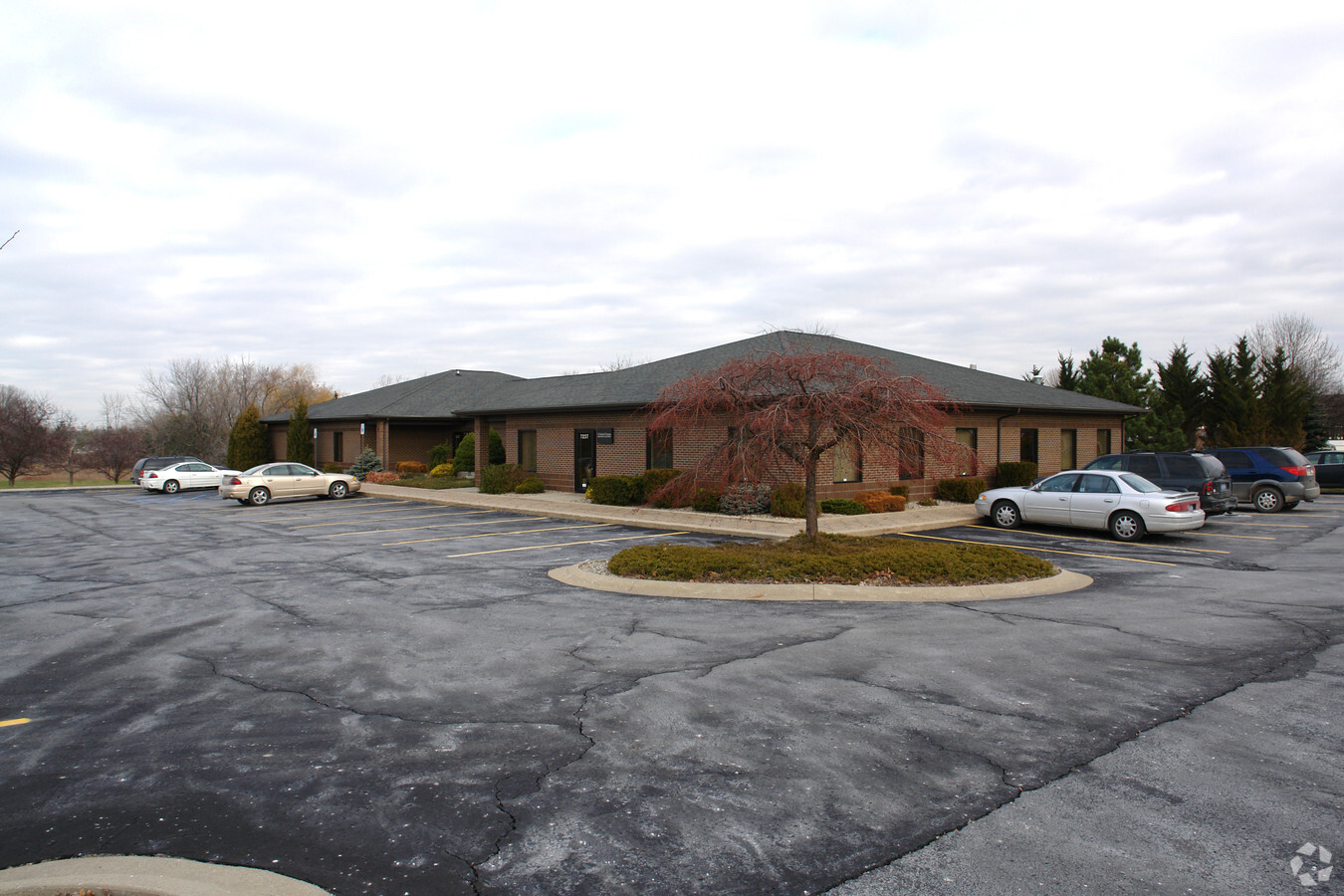
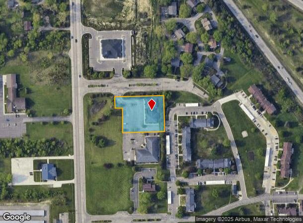
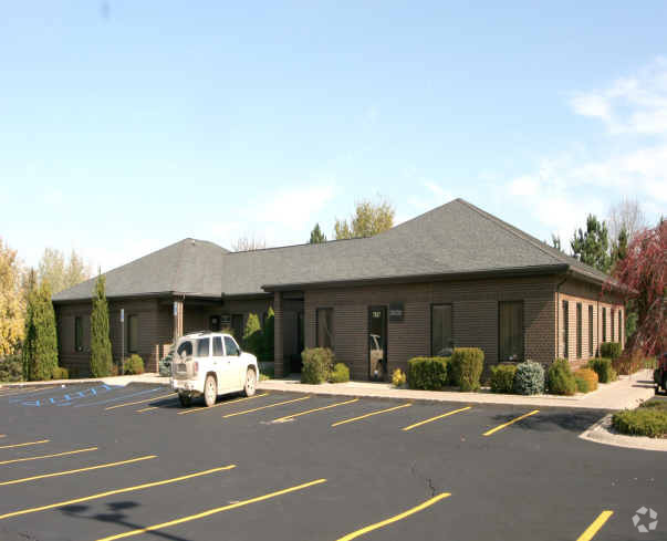
Property Record
7227 Fenton Rd, Grand Blanc, MI 48439
NEARBY LISTINGS FOR SALE OR LEASE
Property Detail
7227 Fenton Rd
12-18-100-040
A PARCEL OF LAND BEG N 0 DEG 45 MIN W 648.6 FT & N 89 DEG 15 MIN E 218.35 FT FROM W 1/4 COR OF SEC TH CONT N 89 DEG 15 MIN E 281.65 FT TH S 0 DEG 45 MIN W 209.14 FT TH S 89 DEG 15 MIN W 237.31 FT TH N 0 DEG 27 MIN 43 SEC W 144.15 FT TH S 89 DEG 15 MI
Commercialnec
Genesee
X
Michigan
26049C0312D
1.20 AC
2024
Flint
2024
Detroit
011102
Flint, MI
7,582 SF
DEMOGRAPHICS near 7227 Fenton Rd
1 Mile
3 Mile
5 Mile
2024 Total Population
4,298
29,300
76,676
2029 Population
4,170
28,585
74,979
Pop Growth 2024-2029
(2.98%)
(2.44%)
(2.21%)
Average Age
41
40
40
2024 Total Households
2,266
12,593
32,008
HH Growth 2024-2029
(3.05%)
(2.56%)
(2.28%)
Median Household Inc
$57,566
$60,362
$55,734
Avg Household Size
1.90
2.30
2.30
2024 Avg HH Vehicles
2.00
2.00
2.00
Median Home Value
$185,930
$176,398
$163,771
Median Year Built
1991
1976
1970
Nearby Places
- Restaurants
- Banks
- Shops
- Fitness
- Groceries
PUBLIC TRANSPORTATION
COMMUTER RAIL
Flint Amtrak Station (Blue Water - Amtrak)
DRIVE
WALK
Distance
Flint Amtrak Station (Blue Water - Amtrak)
15 min
8.7 mi
AIRPORT
Bishop International
DRIVE
WALK
Distance
Bishop International
19 min
6.4 mi
Freight Ports
Port of Toledo
DRIVE
WALK
Distance
Port of Toledo
130 min
108.1 mi
Nearby Properties
Address
Land Use
TOTAL SIZE
Lot Size
Zoning
Address
Land Use
TOTAL SIZE
Lot Size
Zoning
331,630 SF
63.88 AC
MDM
Address
Land Use
TOTAL SIZE
Lot Size
Zoning
51.26 AC
HDM
Address
Land Use
TOTAL SIZE
Lot Size
Zoning
295,620 SF
25.62 AC
MDM
Address
Land Use
TOTAL SIZE
Lot Size
Zoning
155,220 SF
33.46 AC
GC
Address
Land Use
TOTAL SIZE
Lot Size
Zoning
33.65 AC
MDM
Address
Land Use
TOTAL SIZE
Lot Size
Zoning
76,648 SF
49.93 AC
R2
Address
Land Use
TOTAL SIZE
Lot Size
Zoning
141,748 SF
8.80 AC
MDM
Address
Land Use
TOTAL SIZE
Lot Size
Zoning
210,684 SF
27.06 AC
GC
Address
Land Use
TOTAL SIZE
Lot Size
Zoning
223,683 SF
24.88 AC
MDM
Address
Land Use
TOTAL SIZE
Lot Size
Zoning
120,487 SF
5.81 AC
PRC
Address
Land Use
TOTAL SIZE
Lot Size
Zoning
612,305 SF
116.49 AC
I-2
Address
Land Use
TOTAL SIZE
Lot Size
Zoning
674,049 SF
24.02 AC
I-2
Address
Land Use
TOTAL SIZE
Lot Size
Zoning
78,517 SF
16.80 AC
GC
Address
Land Use
TOTAL SIZE
Lot Size
Zoning
315,700 SF
38.97 AC
RM-2
Address
Land Use
TOTAL SIZE
Lot Size
Zoning
65,746 SF
3.97 AC
C-4
Address
Land Use
TOTAL SIZE
Lot Size
Zoning
65,746 SF
C-4
Address
Land Use
TOTAL SIZE
Lot Size
Zoning
752,146 SF
100 AC
RA
Address
Land Use
TOTAL SIZE
Lot Size
Zoning
219,598 SF
32.98 AC
C-4
Address
Land Use
TOTAL SIZE
Lot Size
Zoning
88,701 SF
10.27 AC
GC
Address
Land Use
TOTAL SIZE
Lot Size
Zoning
210.33 AC
MHP
Address
Land Use
TOTAL SIZE
Lot Size
Zoning
75,536 SF
8.97 AC
PRC
Address
Land Use
TOTAL SIZE
Lot Size
Zoning
131,682 SF
11.51 AC
MDM
Address
Land Use
TOTAL SIZE
Lot Size
Zoning
69,232 SF
2.75 AC
C-3A
Address
Land Use
TOTAL SIZE
Lot Size
Zoning
59,234 SF
5.80 AC
OS
Address
Land Use
TOTAL SIZE
Lot Size
Zoning
9.88 AC
HDM
Address
Land Use
TOTAL SIZE
Lot Size
Zoning
42,242 SF
6.93 AC
C-3A
Address
Land Use
TOTAL SIZE
Lot Size
Zoning
118,750 SF
21.26 AC
C-3A
Address
Land Use
TOTAL SIZE
Lot Size
Zoning
64,150 SF
3.64 AC
PRC
Address
Land Use
TOTAL SIZE
Lot Size
Zoning
41,508 SF
5.27 AC
OS
Address
Land Use
TOTAL SIZE
Lot Size
Zoning
24,670 SF
9.62 AC
GC
The World's #1 Commercial Real Estate Marketplace
Connect with us
© 2025 CoStar Group
The information above has been obtained from sources believed reliable. While we do not doubt its accuracy we have not verified it and make no guarantee, warranty or representation about it. It is your responsibility to independently confirm its accuracy and completeness. Any projections, opinions, assumptions, or estimates used are for example only and do not represent the current or future performance of the property. The value of this transaction to you depends on tax and other factors which should be evaluated by your tax, financial, and legal advisors. You and your advisors should conduct a careful, independent investigation of the property to determine to your satisfaction the suitability of the property for your needs.