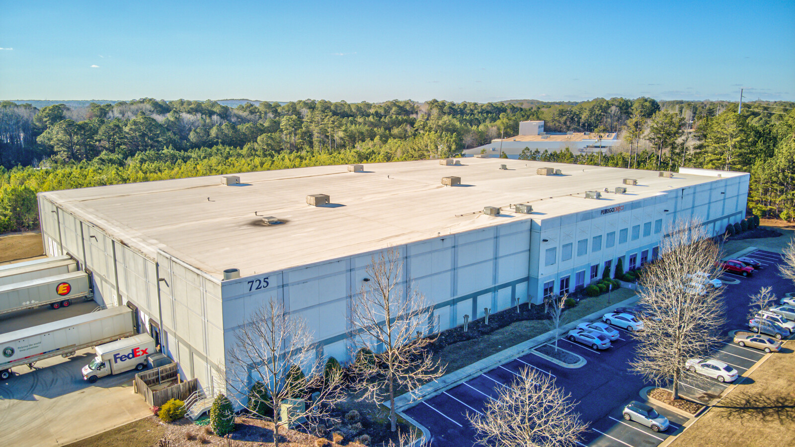
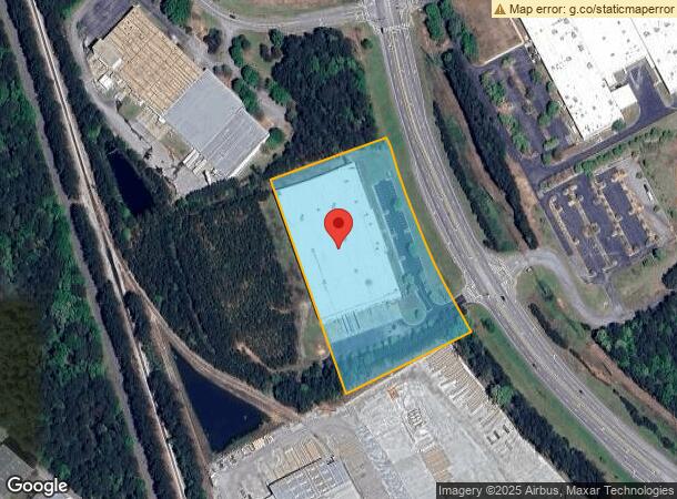
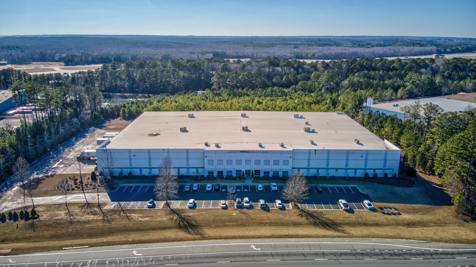
Property Record
725 Highway 74 S, Peachtree City, GA 30269
NEARBY LISTINGS FOR SALE OR LEASE
Property Detail
725 Highway 74 S
Atlanta-Sandy Springs-Roswell, GA
Pch Choate Llc Et Al
06-13-00-016
6.13 ACRES HWY 74
Warehouse
Fayette
X
Georgia
13077C0285D
46
2024
6.13 AC
2024
Fayette/Coweta County
140308
Atlanta
99,160 SF
DEMOGRAPHICS near 725 Highway 74 S
1 Mile
3 Mile
5 Mile
2024 Total Population
769
23,074
51,907
2029 Population
813
24,698
55,701
Pop Growth 2024-2029
+ 5.72%
+ 7.04%
+ 7.31%
Average Age
43
42
41
2024 Total Households
301
8,385
18,693
HH Growth 2024-2029
+ 5.65%
+ 7.07%
+ 7.34%
Median Household Inc
$65,833
$100,325
$101,763
Avg Household Size
2.60
2.70
2.70
2024 Avg HH Vehicles
2.00
2.00
2.00
Median Home Value
$334,821
$365,603
$379,515
Median Year Built
1989
1991
1993
Nearby Places
- Restaurants
- Banks
- Shops
- Fitness
- Groceries
PUBLIC TRANSPORTATION
AIRPORT
Hartsfield - Jackson Atlanta International
DRIVE
WALK
Distance
Hartsfield - Jackson Atlanta International
42 min
28.6 mi
Freight Ports
Georgia Ports - Savannah
DRIVE
WALK
Distance
Georgia Ports - Savannah
280 min
242.2 mi
Nearby Properties
Address
Land Use
TOTAL SIZE
Lot Size
Zoning
Address
Land Use
TOTAL SIZE
Lot Size
Zoning
384,330 SF
228 AC
I GI
Address
Land Use
TOTAL SIZE
Lot Size
Zoning
Address
Land Use
TOTAL SIZE
Lot Size
Zoning
74,557 SF
43.31 AC
I GI
Address
Land Use
TOTAL SIZE
Lot Size
Zoning
274,599 SF
28.10 AC
C GR12
Address
Land Use
TOTAL SIZE
Lot Size
Zoning
70,241 SF
11.09 AC
C GR14
Address
Land Use
TOTAL SIZE
Lot Size
Zoning
214,866 SF
10.96 AC
I GI
Address
Land Use
TOTAL SIZE
Lot Size
Zoning
115,988 SF
16.67 AC
C LUC
Address
Land Use
TOTAL SIZE
Lot Size
Zoning
87,848 SF
33.20 AC
C GI
Address
Land Use
TOTAL SIZE
Lot Size
Zoning
123,051 SF
20.80 AC
C GR12
Address
Land Use
TOTAL SIZE
Lot Size
Zoning
262,058 SF
44.79 AC
C GC
Address
Land Use
TOTAL SIZE
Lot Size
Zoning
309,402 SF
32.02 AC
I GI
Address
Land Use
TOTAL SIZE
Lot Size
Zoning
261,976 SF
43.41 AC
I GI
Address
Land Use
TOTAL SIZE
Lot Size
Zoning
82,744 SF
19.94 AC
Address
Land Use
TOTAL SIZE
Lot Size
Zoning
75,052 SF
18.90 AC
Address
Land Use
TOTAL SIZE
Lot Size
Zoning
377,939 SF
14.42 AC
I GI
Address
Land Use
TOTAL SIZE
Lot Size
Zoning
78,075 SF
11.38 AC
C GC
Address
Land Use
TOTAL SIZE
Lot Size
Zoning
46,582 SF
4.51 AC
C LUC
Address
Land Use
TOTAL SIZE
Lot Size
Zoning
47,505 SF
9.83 AC
I GI
Address
Land Use
TOTAL SIZE
Lot Size
Zoning
214.97 AC
Address
Land Use
TOTAL SIZE
Lot Size
Zoning
44,100 SF
4.69 AC
I GI
Address
Land Use
TOTAL SIZE
Lot Size
Zoning
160,007 SF
20.10 AC
I GI
Address
Land Use
TOTAL SIZE
Lot Size
Zoning
184,564 SF
19.13 AC
I GI
Address
Land Use
TOTAL SIZE
Lot Size
Zoning
14,964 SF
7.23 AC
I GI
Address
Land Use
TOTAL SIZE
Lot Size
Zoning
25,956 SF
35.23 AC
C GI
Address
Land Use
TOTAL SIZE
Lot Size
Zoning
51,916 SF
15.62 AC
I GI
Address
Land Use
TOTAL SIZE
Lot Size
Zoning
115,854 SF
14.40 AC
I LI
Address
Land Use
TOTAL SIZE
Lot Size
Zoning
115,980 SF
17.53 AC
I GI
Address
Land Use
TOTAL SIZE
Lot Size
Zoning
150,504 SF
15 AC
I GI
Address
Land Use
TOTAL SIZE
Lot Size
Zoning
1,084.68 AC
RFA
Address
Land Use
TOTAL SIZE
Lot Size
Zoning
48,541 SF
11.84 AC
I GI
The World's #1 Commercial Real Estate Marketplace
Connect with us
© 2025 CoStar Group
The information above has been obtained from sources believed reliable. While we do not doubt its accuracy we have not verified it and make no guarantee, warranty or representation about it. It is your responsibility to independently confirm its accuracy and completeness. Any projections, opinions, assumptions, or estimates used are for example only and do not represent the current or future performance of the property. The value of this transaction to you depends on tax and other factors which should be evaluated by your tax, financial, and legal advisors. You and your advisors should conduct a careful, independent investigation of the property to determine to your satisfaction the suitability of the property for your needs.