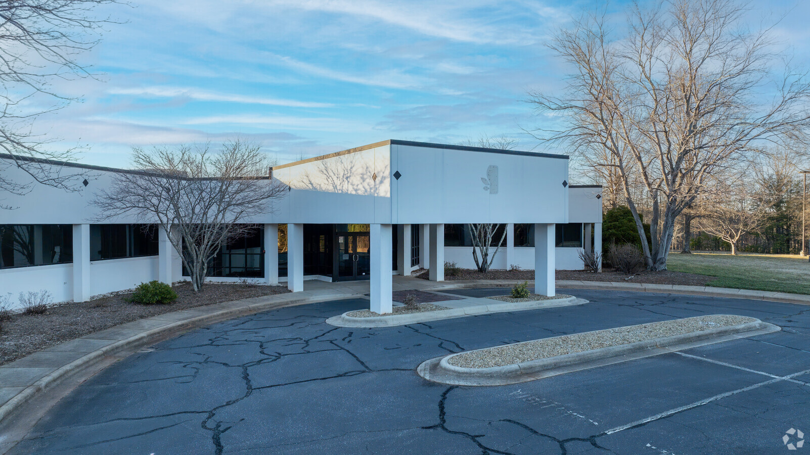
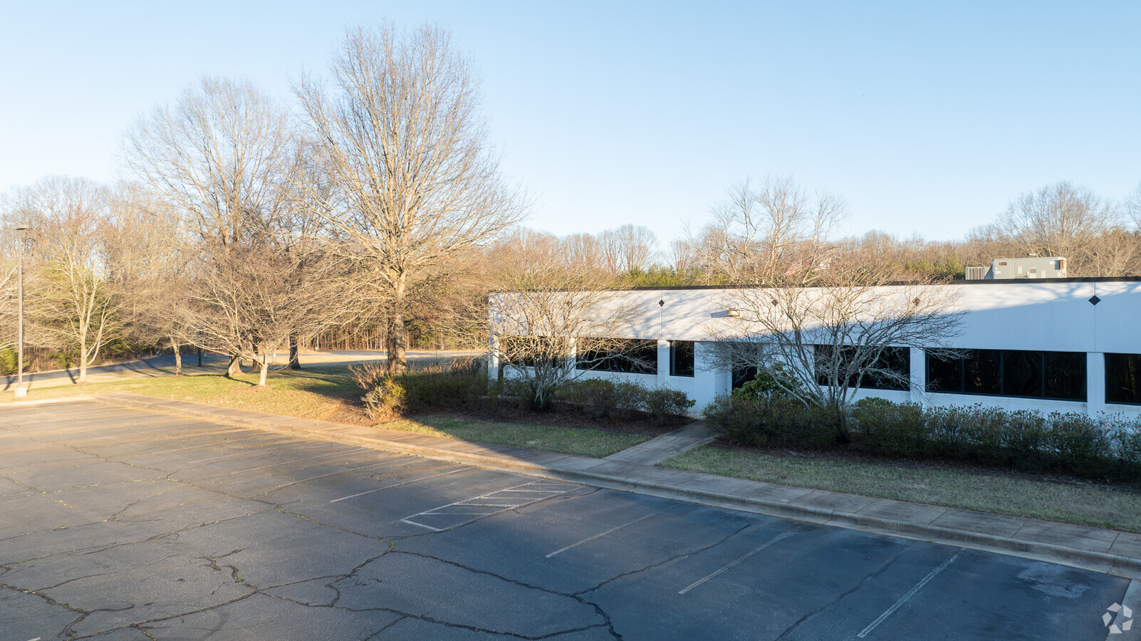
Property Record
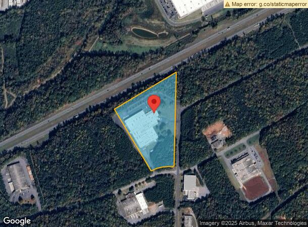
725 Reese Dr Sw, Conover, NC 28613
Current Lease Availabilities
NEARBY LISTINGS FOR SALE OR LEASE
Property Detail
725 Reese Dr Sw
3732195042210000
LOT 1 PLAT 79-140
Officebuilding
Catawba
X
North Carolina
3710373200J
1
2024
13.26 AC
2024
Catawba County
010204
Charlotte
137,438 SF
Hickory-Lenoir-Morganton, NC
DEMOGRAPHICS near 725 Reese Dr Sw
1 Mile
3 Mile
5 Mile
2024 Total Population
1,855
19,539
53,542
2029 Population
1,930
20,408
55,953
Pop Growth 2024-2029
+ 4.04%
+ 4.45%
+ 4.50%
Average Age
41
40
40
2024 Total Households
683
7,796
21,373
HH Growth 2024-2029
+ 3.95%
+ 4.34%
+ 4.44%
Median Household Inc
$52,273
$52,500
$54,702
Avg Household Size
2.30
2.40
2.40
2024 Avg HH Vehicles
2.00
2.00
2.00
Median Home Value
$190,822
$173,833
$168,990
Median Year Built
1992
1983
1983
Nearby Places
- Restaurants
- Banks
- Shops
- Fitness
- Groceries
Nearby Properties
Address
Land Use
TOTAL SIZE
Lot Size
Zoning
Address
Land Use
TOTAL SIZE
Lot Size
Zoning
83,982 SF
96.78 AC
OI
Address
Land Use
TOTAL SIZE
Lot Size
Zoning
57.59 AC
OI
Address
Land Use
TOTAL SIZE
Lot Size
Zoning
502,665 SF
36.97 AC
EM-1-CD
Address
Land Use
TOTAL SIZE
Lot Size
Zoning
219,033 SF
32.95 AC
IND-CZ
Address
Land Use
TOTAL SIZE
Lot Size
Zoning
7,684 SF
11.85 AC
R-20-CD
Address
Land Use
TOTAL SIZE
Lot Size
Zoning
217,586 SF
28.33 AC
CC-CD
Address
Land Use
TOTAL SIZE
Lot Size
Zoning
248,173 SF
53.73 AC
B-4
Address
Land Use
TOTAL SIZE
Lot Size
Zoning
201,590 SF
20.31 AC
C-3
Address
Land Use
TOTAL SIZE
Lot Size
Zoning
2.53 AC
OI
Address
Land Use
TOTAL SIZE
Lot Size
Zoning
30.60 AC
R-20
Address
Land Use
TOTAL SIZE
Lot Size
Zoning
4,700 SF
34.87 AC
COI
Address
Land Use
TOTAL SIZE
Lot Size
Zoning
36.13 AC
R-9
Address
Land Use
TOTAL SIZE
Lot Size
Zoning
23,646 SF
79.60 AC
M-1
Address
Land Use
TOTAL SIZE
Lot Size
Zoning
283,942 SF
26.59 AC
M-1
Address
Land Use
TOTAL SIZE
Lot Size
Zoning
226,704 SF
24.60 AC
EM-1
Address
Land Use
TOTAL SIZE
Lot Size
Zoning
270,125 SF
19.98 AC
EM-1
Address
Land Use
TOTAL SIZE
Lot Size
Zoning
136,204 SF
16.32 AC
C-3
Address
Land Use
TOTAL SIZE
Lot Size
Zoning
121,170 SF
22.34 AC
IND-CZ
Address
Land Use
TOTAL SIZE
Lot Size
Zoning
19.22 AC
OI
Address
Land Use
TOTAL SIZE
Lot Size
Zoning
146,574 SF
17.69 AC
C-3
Address
Land Use
TOTAL SIZE
Lot Size
Zoning
4,404 SF
12.31 AC
R-4
Address
Land Use
TOTAL SIZE
Lot Size
Zoning
81,212 SF
15.80 AC
PD-SC-M
Address
Land Use
TOTAL SIZE
Lot Size
Zoning
354,727 SF
28.03 AC
M-1
Address
Land Use
TOTAL SIZE
Lot Size
Zoning
31.22 AC
R-1
Address
Land Use
TOTAL SIZE
Lot Size
Zoning
132,633 SF
24.64 AC
IND
Address
Land Use
TOTAL SIZE
Lot Size
Zoning
213,422 SF
33.51 AC
M-1
Address
Land Use
TOTAL SIZE
Lot Size
Zoning
7,680 SF
9.22 AC
PD-H
Address
Land Use
TOTAL SIZE
Lot Size
Zoning
20.90 AC
M-1
Address
Land Use
TOTAL SIZE
Lot Size
Zoning
150,498 SF
11.27 AC
M-1
Address
Land Use
TOTAL SIZE
Lot Size
Zoning
318,757 SF
23.50 AC
M-1
The World's #1 Commercial Real Estate Marketplace
Connect with us
© 2025 CoStar Group
The information above has been obtained from sources believed reliable. While we do not doubt its accuracy we have not verified it and make no guarantee, warranty or representation about it. It is your responsibility to independently confirm its accuracy and completeness. Any projections, opinions, assumptions, or estimates used are for example only and do not represent the current or future performance of the property. The value of this transaction to you depends on tax and other factors which should be evaluated by your tax, financial, and legal advisors. You and your advisors should conduct a careful, independent investigation of the property to determine to your satisfaction the suitability of the property for your needs.