Property Record
725 W 32Nd St, Yuma, AZ 85364


NEARBY LISTINGS FOR SALE OR LEASE
Property Detail
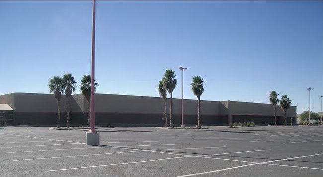
725 W 32Nd St
Medicalbuilding
SECTION: 09 TOWNSHIP: 09S RANGE: 23W NW4 NE4 NW4 EXC CITY R/W PER 1961/423, 1988/308 AKA ROADWAY EXPRESS-MEINHARDT TRUST LOT TIE PLAT 13/98 8-19-94
X
Yuma
04027C1520F
Arizona
2024
8.81 AC
2025
Other Market Areas
011107
Yuma, AZ
99,137 SF
695-34-001
DEMOGRAPHICS near 725 W 32Nd St
1 Mile
3 Mile
5 Mile
2024 Total Population
11,801
60,102
95,421
2029 Population
13,260
65,433
103,281
Pop Growth 2024-2029
+ 12.36%
+ 8.87%
+ 8.24%
Average Age
42
37
37
2024 Total Households
5,401
22,081
33,685
HH Growth 2024-2029
+ 13.55%
+ 9.48%
+ 8.64%
Median Household Inc
$44,232
$56,132
$55,752
Avg Household Size
2.10
2.60
2.70
2024 Avg HH Vehicles
1.00
2.00
2.00
Median Home Value
$120,128
$172,231
$171,951
Median Year Built
1987
1984
1985
Nearby Places
Map Layers
Map Styles
 Street
 Aerial
- Restaurants
- Banks
- Shops
- Fitness
- Groceries
PUBLIC TRANSPORTATION
COMMUTER RAIL
Yuma Amtrak (Sunset Limited - Amtrak, Texas Eagle - Amtrak)
DRIVE
WALK
Distance
Yuma Amtrak (Sunset Limited - Amtrak, Texas Eagle - Amtrak)
10 min
4.7 mi
AIRPORT
Yuma International
DRIVE
WALK
Distance
Yuma International
5 min
2.0 mi
Freight Ports
Port of San Diego
DRIVE
WALK
Distance
Port of San Diego
198 min
174.6 mi
Nearby Properties
Address
Land Use
TOTAL SIZE
Lot Size
Zoning
Address
Land Use
TOTAL SIZE
Lot Size
Zoning
383,999 SF
87.91 AC
R-1-6
Address
Land Use
TOTAL SIZE
Lot Size
Zoning
163,094 SF
27 AC
AG
Address
Land Use
TOTAL SIZE
Lot Size
Zoning
197,031 SF
28.76 AC
B-2
Address
Land Use
TOTAL SIZE
Lot Size
Zoning
406,808 SF
28.05 AC
R-3
Address
Land Use
TOTAL SIZE
Lot Size
Zoning
206,107 SF
21.96 AC
B-2
Address
Land Use
TOTAL SIZE
Lot Size
Zoning
61,000 SF
36.50 AC
B-2
Address
Land Use
TOTAL SIZE
Lot Size
Zoning
79,891 SF
8.97 AC
R-1-6
Address
Land Use
TOTAL SIZE
Lot Size
Zoning
155,526 SF
52.75 AC
R-1-6
Address
Land Use
TOTAL SIZE
Lot Size
Zoning
212,439 SF
20.28 AC
B-1
Address
Land Use
TOTAL SIZE
Lot Size
Zoning
407,940 SF
24.04 AC
HI
Address
Land Use
TOTAL SIZE
Lot Size
Zoning
51,586 SF
6.71 AC
B-2
Address
Land Use
TOTAL SIZE
Lot Size
Zoning
119,714 SF
6.75 AC
C-2
Address
Land Use
TOTAL SIZE
Lot Size
Zoning
264,412 SF
28.05 AC
LI
Address
Land Use
TOTAL SIZE
Lot Size
Zoning
95,263 SF
5.46 AC
B-2
Address
Land Use
TOTAL SIZE
Lot Size
Zoning
114,420 SF
6.13 AC
B-2
Address
Land Use
TOTAL SIZE
Lot Size
Zoning
57,308 SF
12.32 AC
R-1-6
Address
Land Use
TOTAL SIZE
Lot Size
Zoning
50,918 SF
3.85 AC
TR
Address
Land Use
TOTAL SIZE
Lot Size
Zoning
141,161 SF
11.18 AC
B-2
Address
Land Use
TOTAL SIZE
Lot Size
Zoning
77,301 SF
2.25 AC
B-2
Address
Land Use
TOTAL SIZE
Lot Size
Zoning
68,961 SF
3.23 AC
B-2
Address
Land Use
TOTAL SIZE
Lot Size
Zoning
168,098 SF
8.77 AC
R-3
Address
Land Use
TOTAL SIZE
Lot Size
Zoning
48,251 SF
4.75 AC
B-2
Address
Land Use
TOTAL SIZE
Lot Size
Zoning
33,765 SF
2.81 AC
B-2
Address
Land Use
TOTAL SIZE
Lot Size
Zoning
302,392 SF
16.80 AC
R-3
Address
Land Use
TOTAL SIZE
Lot Size
Zoning
133,196 SF
14.75 AC
B-2
Address
Land Use
TOTAL SIZE
Lot Size
Zoning
165,296 SF
12.44 AC
R-3
Address
Land Use
TOTAL SIZE
Lot Size
Zoning
90,280 SF
2.98 AC
B-2
Address
Land Use
TOTAL SIZE
Lot Size
Zoning
91,382 SF
52.31 AC
HI
The World's #1 Commercial Real Estate Marketplace
Connect with us
© 2025 CoStar Group
The information above has been obtained from sources believed reliable. While we do not doubt its accuracy we have not verified it and make no guarantee, warranty or representation about it. It is your responsibility to independently confirm its accuracy and completeness. Any projections, opinions, assumptions, or estimates used are for example only and do not represent the current or future performance of the property. The value of this transaction to you depends on tax and other factors which should be evaluated by your tax, financial, and legal advisors. You and your advisors should conduct a careful, independent investigation of the property to determine to your satisfaction the suitability of the property for your needs.