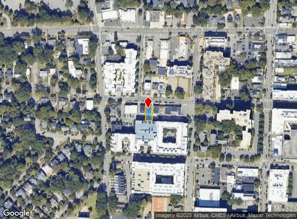
Property Record
727 W Johnson St, Raleigh, NC 27603


Current Lease Availabilities
NEARBY LISTINGS FOR SALE OR LEASE
Property Detail
727 W Johnson St
1704.18-31-8641-000
Glenlane Assoc Prop
Commercialnec
PROP OF DOROTHY M STREB
X
Wake
3720170400K
North Carolina
2024
0.11 AC
2024
West Raleigh
050300
Raleigh/Durham
2,936 SF
Raleigh, NC
DEMOGRAPHICS near 727 W Johnson St
1 Mile
3 Mile
5 Mile
2024 Total Population
20,262
105,490
237,687
2029 Population
22,198
114,875
258,741
Pop Growth 2024-2029
+ 9.55%
+ 8.90%
+ 8.86%
Average Age
36
36
37
2024 Total Households
10,900
43,675
101,144
HH Growth 2024-2029
+ 10.34%
+ 9.64%
+ 9.27%
Median Household Inc
$84,106
$69,894
$67,681
Avg Household Size
1.60
2.10
2.10
2024 Avg HH Vehicles
1.00
2.00
2.00
Median Home Value
$516,169
$507,380
$400,179
Median Year Built
2003
1983
1987
Nearby Places
- Restaurants
- Banks
- Shops
- Fitness
- Groceries
PUBLIC TRANSPORTATION
COMMUTER RAIL
Raleigh Union Station (Piedmont - North Carolina by Train (NC Train))
DRIVE
WALK
Distance
Raleigh Union Station (Piedmont - North Carolina by Train (NC Train))
2 min
14 min
0.8 mi
Cary Station (Piedmont - North Carolina by Train (NC Train))
DRIVE
WALK
Distance
Cary Station (Piedmont - North Carolina by Train (NC Train))
16 min
8.4 mi
AIRPORT
Raleigh-Durham International
DRIVE
WALK
Distance
Raleigh-Durham International
21 min
12.4 mi
Freight Ports
Port of Wilmington
DRIVE
WALK
Distance
Port of Wilmington
156 min
134.5 mi
Nearby Properties
Address
Land Use
TOTAL SIZE
Lot Size
Zoning
Address
Land Use
TOTAL SIZE
Lot Size
Zoning
5,616,802 SF
507.97 AC
OX-12
Address
Land Use
TOTAL SIZE
Lot Size
Zoning
972,279 SF
4.05 AC
DX-20
Address
Land Use
TOTAL SIZE
Lot Size
Zoning
1,109,877 SF
746.53 AC
CMP
Address
Land Use
TOTAL SIZE
Lot Size
Zoning
1,597,789 SF
13.35 AC
DX-20
Address
Land Use
TOTAL SIZE
Lot Size
Zoning
854,180 SF
210.81 AC
OX-4
Address
Land Use
TOTAL SIZE
Lot Size
Zoning
458,830 SF
3.98 AC
DX-20
Address
Land Use
TOTAL SIZE
Lot Size
Zoning
1,810,132 SF
OX-12
Address
Land Use
TOTAL SIZE
Lot Size
Zoning
706,810 SF
40.78 AC
IH
Address
Land Use
TOTAL SIZE
Lot Size
Zoning
675,817 SF
3.56 AC
DX-12
Address
Land Use
TOTAL SIZE
Lot Size
Zoning
372,222 SF
9.64 AC
DX-12
Address
Land Use
TOTAL SIZE
Lot Size
Zoning
250,448 SF
25.28 AC
OX-3
Address
Land Use
TOTAL SIZE
Lot Size
Zoning
982,323 SF
154.02 AC
OX-7
Address
Land Use
TOTAL SIZE
Lot Size
Zoning
642,124 SF
3.26 AC
DX-12
Address
Land Use
TOTAL SIZE
Lot Size
Zoning
561,966 SF
3.81 AC
IX-7
Address
Land Use
TOTAL SIZE
Lot Size
Zoning
654,148 SF
1.21 AC
DX-40
Address
Land Use
TOTAL SIZE
Lot Size
Zoning
517,826 SF
2.52 AC
DX-7
Address
Land Use
TOTAL SIZE
Lot Size
Zoning
179,565 SF
1.10 AC
DX-7
Address
Land Use
TOTAL SIZE
Lot Size
Zoning
524,391 SF
4.13 AC
NX-5
Address
Land Use
TOTAL SIZE
Lot Size
Zoning
344,814 SF
1.95 AC
DX-40
Address
Land Use
TOTAL SIZE
Lot Size
Zoning
560,300 SF
1.06 AC
DX-20
Address
Land Use
TOTAL SIZE
Lot Size
Zoning
580,268 SF
9.02 AC
PD
Address
Land Use
TOTAL SIZE
Lot Size
Zoning
462,217 SF
1.01 AC
DX-20
Address
Land Use
TOTAL SIZE
Lot Size
Zoning
420,188 SF
2.14 AC
DX-7
Address
Land Use
TOTAL SIZE
Lot Size
Zoning
426,539 SF
2.90 AC
NX-5
Address
Land Use
TOTAL SIZE
Lot Size
Zoning
613,248 SF
2.20 AC
IND-2
Address
Land Use
TOTAL SIZE
Lot Size
Zoning
765,252 SF
1.72 AC
DX-20
Address
Land Use
TOTAL SIZE
Lot Size
Zoning
159,921 SF
4.99 AC
DX-5
Address
Land Use
TOTAL SIZE
Lot Size
Zoning
376,902 SF
189.85 AC
OX-3
Address
Land Use
TOTAL SIZE
Lot Size
Zoning
506,411 SF
2.52 AC
DX-12
Address
Land Use
TOTAL SIZE
Lot Size
Zoning
40,024 SF
6.19 AC
DX-3
The World's #1 Commercial Real Estate Marketplace
Connect with us
© 2025 CoStar Group
The information above has been obtained from sources believed reliable. While we do not doubt its accuracy we have not verified it and make no guarantee, warranty or representation about it. It is your responsibility to independently confirm its accuracy and completeness. Any projections, opinions, assumptions, or estimates used are for example only and do not represent the current or future performance of the property. The value of this transaction to you depends on tax and other factors which should be evaluated by your tax, financial, and legal advisors. You and your advisors should conduct a careful, independent investigation of the property to determine to your satisfaction the suitability of the property for your needs.