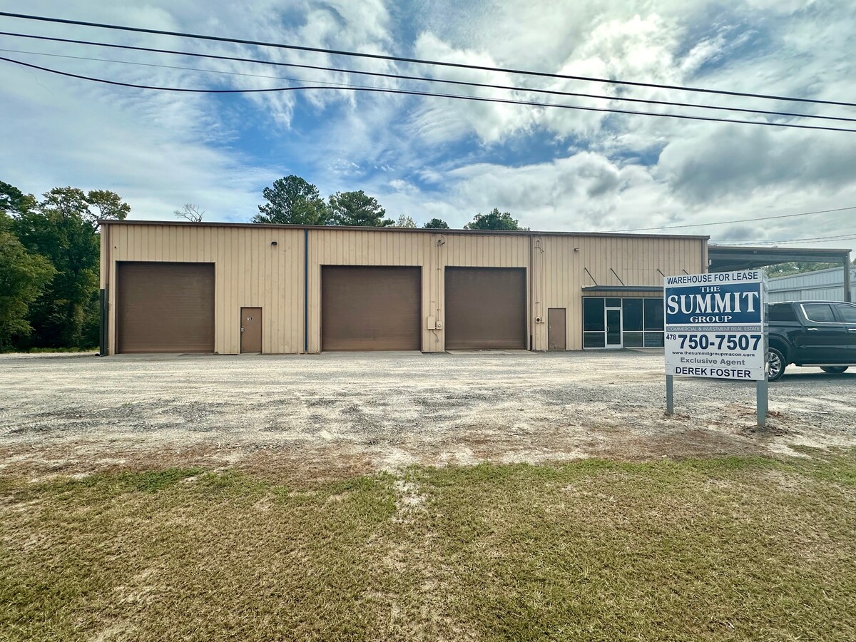
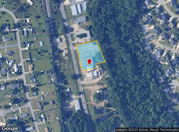
Property Record
728 Ga Highway 247 S, Bonaire, GA 31005
Current Lease Availabilities
NEARBY LISTINGS FOR SALE OR LEASE
Property Detail
728 Ga Highway 247 S
Warner Robins, GA
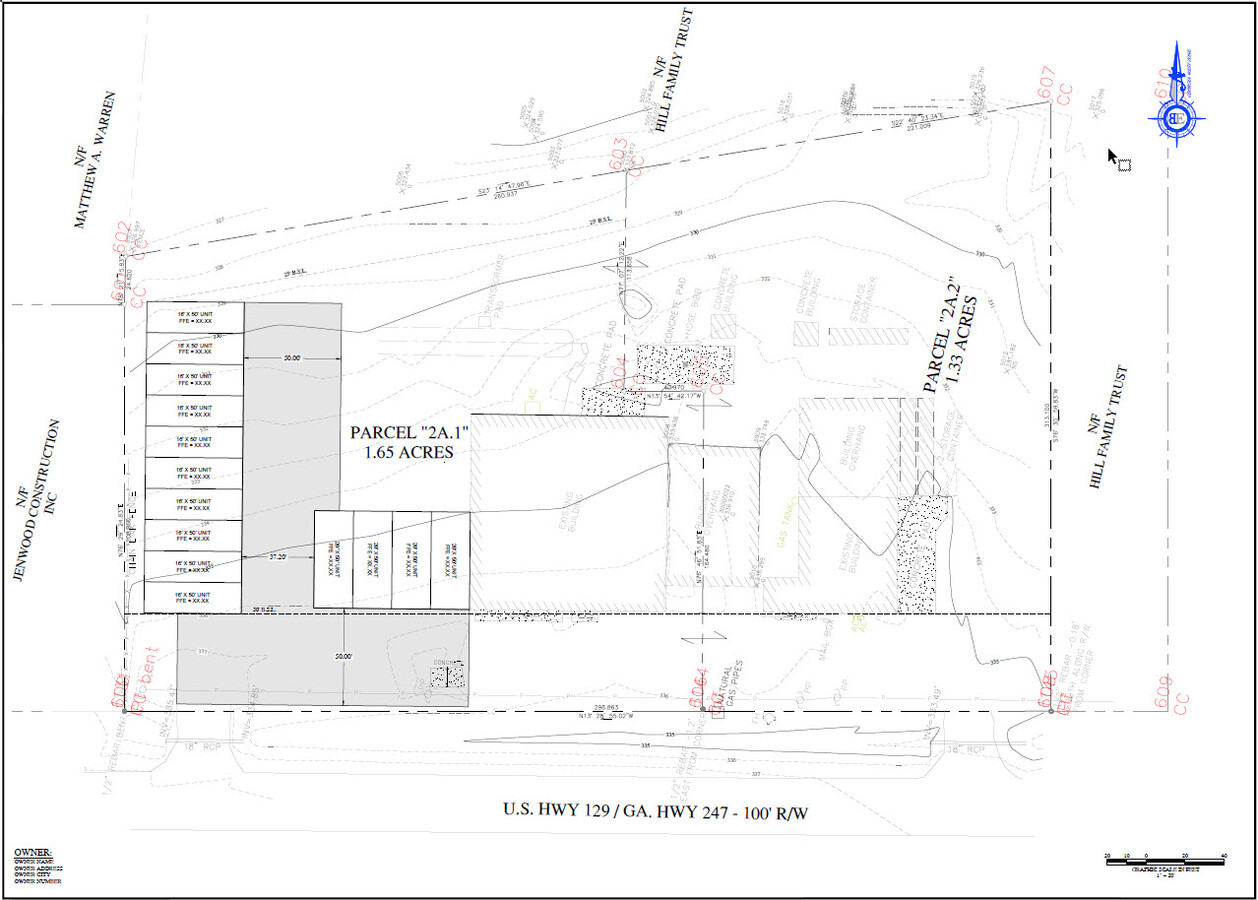
Hwy 247 500 Ff
001250043000
PARCEL 2A.1 1.65 ACRES
Publicstorage
Houston
X
Georgia
13289C0200B
22&43
2024
1.65 AC
2024
Perry/Warner Robins
021115
Other Market Areas
10,000 SF
DEMOGRAPHICS near 728 Ga Highway 247 S
1 Mile
3 Mile
5 Mile
2024 Total Population
4,167
19,100
61,256
2029 Population
4,691
21,240
67,366
Pop Growth 2024-2029
+ 12.57%
+ 11.20%
+ 9.97%
Average Age
34
38
37
2024 Total Households
1,294
6,589
22,470
HH Growth 2024-2029
+ 12.36%
+ 10.84%
+ 9.77%
Median Household Inc
$116,266
$110,365
$87,632
Avg Household Size
3.20
2.90
2.70
2024 Avg HH Vehicles
3.00
3.00
2.00
Median Home Value
$252,063
$245,222
$192,036
Median Year Built
2009
2003
1998
Nearby Places
- Restaurants
- Banks
- Shops
- Fitness
- Groceries
Nearby Properties
Address
Land Use
TOTAL SIZE
Lot Size
Zoning
Address
Land Use
TOTAL SIZE
Lot Size
Zoning
180,000 SF
146.60 AC
RAG
Address
Land Use
TOTAL SIZE
Lot Size
Zoning
67,732 SF
25 AC
R4
Address
Land Use
TOTAL SIZE
Lot Size
Zoning
139,756 SF
34.14 AC
R1
Address
Land Use
TOTAL SIZE
Lot Size
Zoning
134,400 SF
22.43 AC
R1
Address
Land Use
TOTAL SIZE
Lot Size
Zoning
106,055 SF
35.17 AC
R1
Address
Land Use
TOTAL SIZE
Lot Size
Zoning
100,000 SF
12.12 AC
RAG
Address
Land Use
TOTAL SIZE
Lot Size
Zoning
48,462 SF
5.54 AC
C2
Address
Land Use
TOTAL SIZE
Lot Size
Zoning
29,950 SF
4.97 AC
R1
Address
Land Use
TOTAL SIZE
Lot Size
Zoning
4,830 SF
3.83 AC
M1
Address
Land Use
TOTAL SIZE
Lot Size
Zoning
14,400 SF
81.92 AC
M2
Address
Land Use
TOTAL SIZE
Lot Size
Zoning
4,469 SF
159.20 AC
M2
Address
Land Use
TOTAL SIZE
Lot Size
Zoning
45,749 SF
4.95 AC
C2
Address
Land Use
TOTAL SIZE
Lot Size
Zoning
54,142 SF
19.17 AC
M2
Address
Land Use
TOTAL SIZE
Lot Size
Zoning
18,633 SF
6.54 AC
PUD
Address
Land Use
TOTAL SIZE
Lot Size
Zoning
309.40 AC
R1
Address
Land Use
TOTAL SIZE
Lot Size
Zoning
2,400 SF
4.15 AC
PUD
Address
Land Use
TOTAL SIZE
Lot Size
Zoning
107.14 AC
R1 C2
Address
Land Use
TOTAL SIZE
Lot Size
Zoning
13,278 SF
1.81 AC
C1
Address
Land Use
TOTAL SIZE
Lot Size
Zoning
45,208 SF
6 AC
M2
Address
Land Use
TOTAL SIZE
Lot Size
Zoning
64.64 AC
R3
Address
Land Use
TOTAL SIZE
Lot Size
Zoning
1,036 SF
324.10 AC
RAG
Address
Land Use
TOTAL SIZE
Lot Size
Zoning
7,320 SF
144.55 AC
R1
Address
Land Use
TOTAL SIZE
Lot Size
Zoning
362.42 AC
RAG
Address
Land Use
TOTAL SIZE
Lot Size
Zoning
108,217 SF
5 AC
M2
Address
Land Use
TOTAL SIZE
Lot Size
Zoning
3,307 SF
6.40 AC
R1
Address
Land Use
TOTAL SIZE
Lot Size
Zoning
28,907 SF
3.66 AC
C2
Address
Land Use
TOTAL SIZE
Lot Size
Zoning
5,400 SF
1.88 AC
M1
Address
Land Use
TOTAL SIZE
Lot Size
Zoning
115.78 AC
RAG
Address
Land Use
TOTAL SIZE
Lot Size
Zoning
13,450 SF
0.69 AC
RAG
Address
Land Use
TOTAL SIZE
Lot Size
Zoning
27,639 SF
2.18 AC
C2
The World's #1 Commercial Real Estate Marketplace
Connect with us
© 2025 CoStar Group
The information above has been obtained from sources believed reliable. While we do not doubt its accuracy we have not verified it and make no guarantee, warranty or representation about it. It is your responsibility to independently confirm its accuracy and completeness. Any projections, opinions, assumptions, or estimates used are for example only and do not represent the current or future performance of the property. The value of this transaction to you depends on tax and other factors which should be evaluated by your tax, financial, and legal advisors. You and your advisors should conduct a careful, independent investigation of the property to determine to your satisfaction the suitability of the property for your needs.