Property Record
730 Horsepond Rd, Dover, DE 19901
NEARBY LISTINGS FOR SALE OR LEASE
-
-
View all Dover listings for sale on LoopNet.com
Property Detail
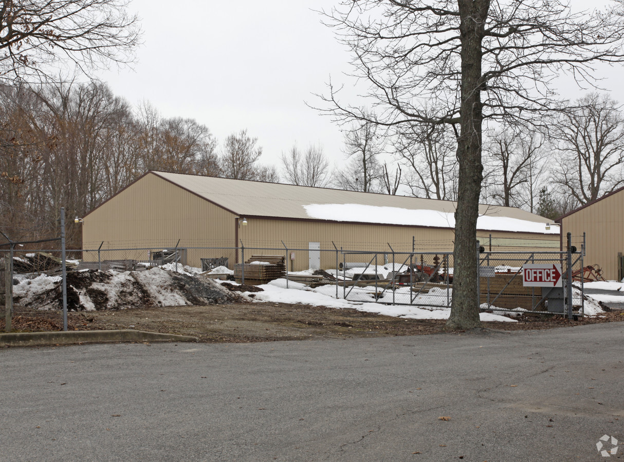
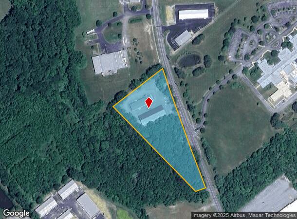
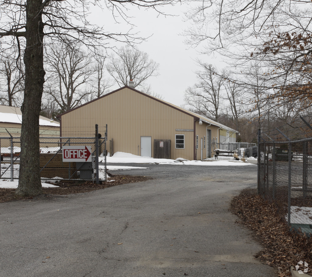
730 Horsepond Rd
2-05-07716-02-1100-000
Elliott
Commercialnec
W SD CO RD 348 4.2284 A 730 HORSEPOND ROAD
AE
Kent
10001C0188J
Delaware
2023
4.10 AC
2024
Kent County
041000
Philadelphia
9,600 SF
Dover, DE
DEMOGRAPHICS near 730 Horsepond Rd
1 Mile
3 Mile
5 Mile
2024 Total Population
2,567
32,844
69,255
2029 Population
2,729
35,200
74,273
Pop Growth 2024-2029
+ 6.31%
+ 7.17%
+ 7.25%
Average Age
37
37
38
2024 Total Households
1,087
12,936
26,422
HH Growth 2024-2029
+ 6.53%
+ 7.41%
+ 7.52%
Median Household Inc
$52,645
$51,442
$59,869
Avg Household Size
2.30
2.40
2.50
2024 Avg HH Vehicles
1.00
2.00
2.00
Median Home Value
$95,955
$217,315
$259,744
Median Year Built
1982
1979
1986
Nearby Places
- Restaurants
- Banks
- Shops
- Fitness
- Groceries
SALE & LEASE HISTORY
LISTING DATE
SALE/LEASE

Sep 23, 2016
For Sale
Feb 01, 2018
For Sale
Nearby Properties
Address
Land Use
TOTAL SIZE
Lot Size
Zoning
Address
Land Use
TOTAL SIZE
Lot Size
Zoning
2,301.50 AC
R20
Address
Land Use
TOTAL SIZE
Lot Size
Zoning
12.10 AC
IO
Address
Land Use
TOTAL SIZE
Lot Size
Zoning
Address
Land Use
TOTAL SIZE
Lot Size
Zoning
189,363 SF
123.90 AC
IO
Address
Land Use
TOTAL SIZE
Lot Size
Zoning
172,440 SF
28.86 AC
RM2
Address
Land Use
TOTAL SIZE
Lot Size
Zoning
5,151.20 AC
AC
Address
Land Use
TOTAL SIZE
Lot Size
Zoning
322,096 SF
18.20 AC
SC2
Address
Land Use
TOTAL SIZE
Lot Size
Zoning
179,601 SF
42.90 AC
IO
Address
Land Use
TOTAL SIZE
Lot Size
Zoning
129,471 SF
TND
Address
Land Use
TOTAL SIZE
Lot Size
Zoning
379,358 SF
67.30 AC
SC3
Address
Land Use
TOTAL SIZE
Lot Size
Zoning
108,450 SF
11 AC
RM
Address
Land Use
TOTAL SIZE
Lot Size
Zoning
116,604 SF
3.20 AC
IO
Address
Land Use
TOTAL SIZE
Lot Size
Zoning
187,104 SF
7.80 AC
RM1
Address
Land Use
TOTAL SIZE
Lot Size
Zoning
Address
Land Use
TOTAL SIZE
Lot Size
Zoning
78 AC
CPO
Address
Land Use
TOTAL SIZE
Lot Size
Zoning
72,794 SF
11.57 AC
IO
Address
Land Use
TOTAL SIZE
Lot Size
Zoning
Address
Land Use
TOTAL SIZE
Lot Size
Zoning
434.50 AC
DAFB
Address
Land Use
TOTAL SIZE
Lot Size
Zoning
421,941 SF
23.70 AC
IPM
Address
Land Use
TOTAL SIZE
Lot Size
Zoning
111,744 SF
11.47 AC
RG2
Address
Land Use
TOTAL SIZE
Lot Size
Zoning
113,226 SF
2.50 AC
IO
Address
Land Use
TOTAL SIZE
Lot Size
Zoning
105,470 SF
6.90 AC
IO
Address
Land Use
TOTAL SIZE
Lot Size
Zoning
168,550 SF
22.40 AC
IO
Address
Land Use
TOTAL SIZE
Lot Size
Zoning
Address
Land Use
TOTAL SIZE
Lot Size
Zoning
55,272 SF
11.30 AC
IO
Address
Land Use
TOTAL SIZE
Lot Size
Zoning
79,447 SF
3.18 AC
C4
Address
Land Use
TOTAL SIZE
Lot Size
Zoning
6,336 SF
52.20 AC
MHP
Address
Land Use
TOTAL SIZE
Lot Size
Zoning
199,272 SF
8.50 AC
RG1
Address
Land Use
TOTAL SIZE
Lot Size
Zoning
74,521 SF
15.90 AC
IO
Address
Land Use
TOTAL SIZE
Lot Size
Zoning
463.40 AC
AC
The World's #1 Commercial Real Estate Marketplace
Connect with us
© 2025 CoStar Group
The information above has been obtained from sources believed reliable. While we do not doubt its accuracy we have not verified it and make no guarantee, warranty or representation about it. It is your responsibility to independently confirm its accuracy and completeness. Any projections, opinions, assumptions, or estimates used are for example only and do not represent the current or future performance of the property. The value of this transaction to you depends on tax and other factors which should be evaluated by your tax, financial, and legal advisors. You and your advisors should conduct a careful, independent investigation of the property to determine to your satisfaction the suitability of the property for your needs.