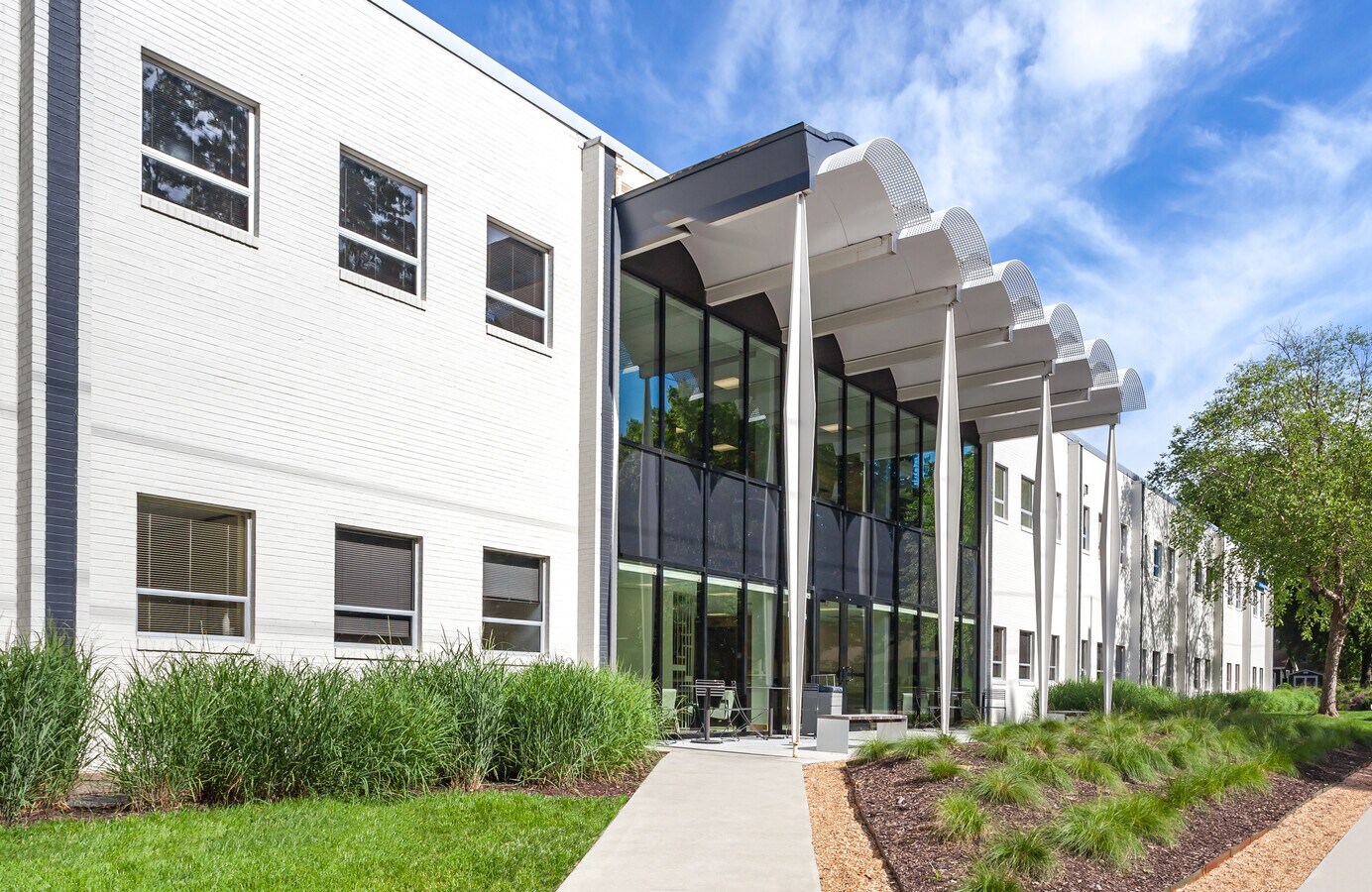
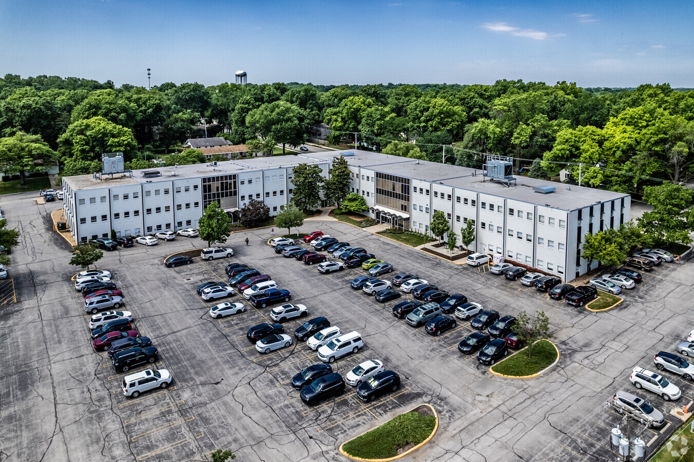
Property Record
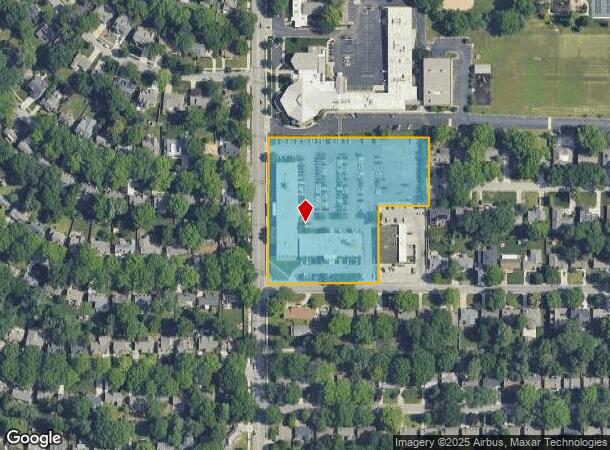
7301 Mission Rd, Prairie Village, KS 66208
NEARBY LISTINGS FOR SALE OR LEASE
Property Detail
7301 Mission Rd
OF251222-1006
22-12-25 N2/3 N1/2 SW1/4 NW1/4EX E 795 EX S 235 N 442 W 153 E 948 OF 1/4 1/4 4.443 ACS M/L PVC 583
Officebuilding
Johnson
X
Kansas
20091C0039G
4.16 AC
2023
Northeast Johnson County
2023
Kansas City
050900
Kansas City, MO-KS
29,948 SF
DEMOGRAPHICS near 7301 Mission Rd
1 Mile
3 Mile
5 Mile
2024 Total Population
12,224
100,896
278,110
2029 Population
12,717
103,559
284,646
Pop Growth 2024-2029
+ 4.03%
+ 2.64%
+ 2.35%
Average Age
40
41
40
2024 Total Households
5,146
45,085
127,643
HH Growth 2024-2029
+ 4.24%
+ 2.71%
+ 2.39%
Median Household Inc
$103,311
$92,399
$72,242
Avg Household Size
2.30
2.20
2.10
2024 Avg HH Vehicles
2.00
2.00
2.00
Median Home Value
$366,523
$334,504
$273,405
Median Year Built
1955
1955
1960
Nearby Places
- Restaurants
- Banks
- Shops
- Fitness
- Groceries
PUBLIC TRANSPORTATION
COMMUTER RAIL
Kansas City (Lincoln Service Missouri River Runner - Amtrak, Missouri River Runner - Amtrak, Southwest Chief - Amtrak)
DRIVE
WALK
Distance
Kansas City (Lincoln Service Missouri River Runner - Amtrak, Missouri River Runner - Amtrak, Southwest Chief - Amtrak)
19 min
8.9 mi
AIRPORT
Kansas City International
DRIVE
WALK
Distance
Kansas City International
40 min
29.5 mi
Freight Ports
Tulsa Port Of Catoosa
DRIVE
WALK
Distance
Tulsa Port Of Catoosa
262 min
228.4 mi
SALE & LEASE HISTORY
LISTING DATE
SALE/LEASE

Sep 24, 2016
For Lease
Nearby Properties
Address
Land Use
TOTAL SIZE
Lot Size
Zoning
Address
Land Use
TOTAL SIZE
Lot Size
Zoning
183,684 SF
36.94 AC
R-1A
Address
Land Use
TOTAL SIZE
Lot Size
Zoning
188,248 SF
4.78 AC
C-2
Address
Land Use
TOTAL SIZE
Lot Size
Zoning
312,446 SF
39.34 AC
R-1
Address
Land Use
TOTAL SIZE
Lot Size
Zoning
133,505 SF
16.41 AC
R-1
Address
Land Use
TOTAL SIZE
Lot Size
Zoning
212,475 SF
30.20 AC
PUB
Address
Land Use
TOTAL SIZE
Lot Size
Zoning
79,437 SF
4.12 AC
DFD
Address
Land Use
TOTAL SIZE
Lot Size
Zoning
42,597 SF
4.39 AC
MS2
Address
Land Use
TOTAL SIZE
Lot Size
Zoning
90,774 SF
1.72 AC
MS2
Address
Land Use
TOTAL SIZE
Lot Size
Zoning
83,966 SF
10.92 AC
R-1
Address
Land Use
TOTAL SIZE
Lot Size
Zoning
168,438 SF
3.13 AC
C-O
Address
Land Use
TOTAL SIZE
Lot Size
Zoning
99,812 SF
3.85 AC
R-1A
Address
Land Use
TOTAL SIZE
Lot Size
Zoning
63,471 SF
7.36 AC
PARK
Address
Land Use
TOTAL SIZE
Lot Size
Zoning
120,225 SF
9.13 AC
R-1
Address
Land Use
TOTAL SIZE
Lot Size
Zoning
73,793 SF
9.21 AC
R-1A
Address
Land Use
TOTAL SIZE
Lot Size
Zoning
124,249 SF
6.13 AC
R-1B
Address
Land Use
TOTAL SIZE
Lot Size
Zoning
68,134 SF
5.24 AC
C-O
Address
Land Use
TOTAL SIZE
Lot Size
Zoning
100,784 SF
4.68 AC
C-2B
Address
Land Use
TOTAL SIZE
Lot Size
Zoning
67,981 SF
7.12 AC
R-1A
Address
Land Use
TOTAL SIZE
Lot Size
Zoning
106,648 SF
16.93 AC
R-1A
Address
Land Use
TOTAL SIZE
Lot Size
Zoning
82,035 SF
8.49 AC
R-1
Address
Land Use
TOTAL SIZE
Lot Size
Zoning
74,802 SF
10.55 AC
CP-O
Address
Land Use
TOTAL SIZE
Lot Size
Zoning
36,769 SF
17.41 AC
R-1
Address
Land Use
TOTAL SIZE
Lot Size
Zoning
310,300 SF
7.88 AC
CP-2
Address
Land Use
TOTAL SIZE
Lot Size
Zoning
77,648 SF
6.90 AC
R-1
Address
Land Use
TOTAL SIZE
Lot Size
Zoning
405,226 SF
6.87 AC
MXD
Address
Land Use
TOTAL SIZE
Lot Size
Zoning
90,912 SF
1.22 AC
C-3
Address
Land Use
TOTAL SIZE
Lot Size
Zoning
36,324 SF
16.55 AC
R-1A
Address
Land Use
TOTAL SIZE
Lot Size
Zoning
213,409 SF
5.20 AC
R-1A
Address
Land Use
TOTAL SIZE
Lot Size
Zoning
85,753 SF
2.04 AC
DFD
Address
Land Use
TOTAL SIZE
Lot Size
Zoning
257,979 SF
14.35 AC
C-2
The World's #1 Commercial Real Estate Marketplace
Connect with us
© 2025 CoStar Group
The information above has been obtained from sources believed reliable. While we do not doubt its accuracy we have not verified it and make no guarantee, warranty or representation about it. It is your responsibility to independently confirm its accuracy and completeness. Any projections, opinions, assumptions, or estimates used are for example only and do not represent the current or future performance of the property. The value of this transaction to you depends on tax and other factors which should be evaluated by your tax, financial, and legal advisors. You and your advisors should conduct a careful, independent investigation of the property to determine to your satisfaction the suitability of the property for your needs.