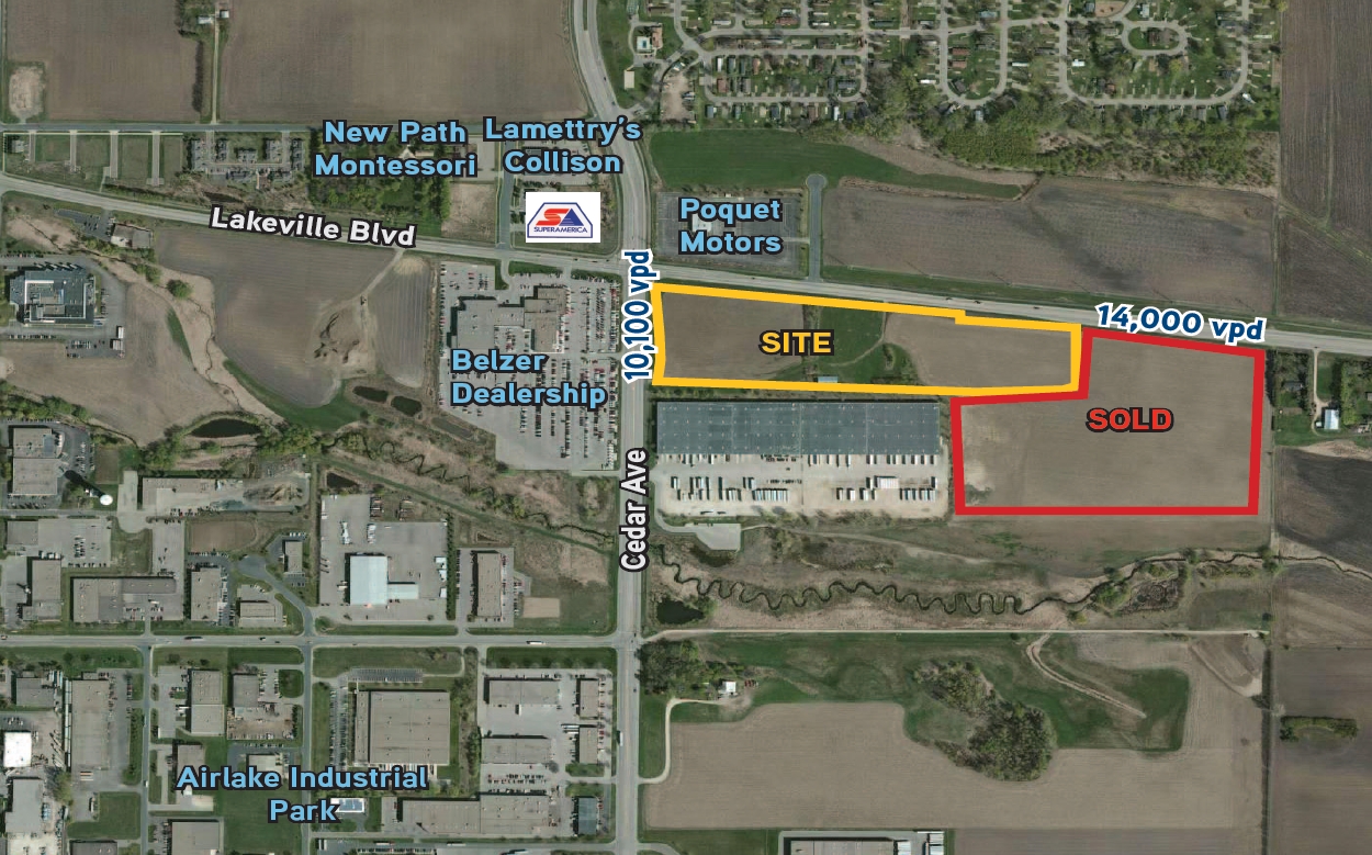
Property Record
7310 Lakeville Blvd W, Lakeville, MN 55044


NEARBY LISTINGS FOR SALE OR LEASE
Property Detail
7310 Lakeville Blvd W
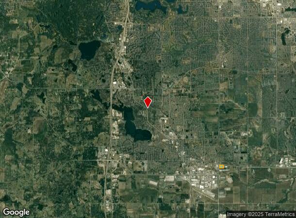
Minneapolis-St. Paul-Bloomington, MN-WI
Airlake Station First Addition
22-11180-01-010
AIRLAKE STATION FIRST ADDITION 1 1
Industrialgeneral
Dakota
X
Minnesota
27037C0214E
10
2023
7.63 AC
2023
Dakota County Outlying
060815
Minneapolis/St Paul
118,065 SF
DEMOGRAPHICS near 7310 Lakeville Blvd W
1 Mile
3 Mile
5 Mile
2024 Total Population
3,538
26,670
86,415
2029 Population
3,785
27,585
88,910
Pop Growth 2024-2029
+ 6.98%
+ 3.43%
+ 2.89%
Average Age
33
36
36
2024 Total Households
1,158
8,929
28,735
HH Growth 2024-2029
+ 6.99%
+ 3.40%
+ 2.98%
Median Household Inc
$86,802
$119,418
$117,727
Avg Household Size
3.00
3.00
2.90
2024 Avg HH Vehicles
2.00
2.00
2.00
Median Home Value
$388,071
$384,503
$367,978
Median Year Built
2010
2002
1998
Nearby Places
- Restaurants
- Banks
- Shops
- Fitness
- Groceries
PUBLIC TRANSPORTATION
AIRPORT
Minneapolis-St Paul International/Wold-Chamberlain
DRIVE
WALK
Distance
Minneapolis-St Paul International/Wold-Chamberlain
27 min
19.2 mi
Freight Ports
Port Milwaukee
DRIVE
WALK
Distance
Port Milwaukee
387 min
345.7 mi
SALE & LEASE HISTORY
LISTING DATE
SALE/LEASE

Sep 24, 2016
For Sale
Sep 24, 2016
For Sale
Nearby Properties
Address
Land Use
TOTAL SIZE
Lot Size
Zoning
Address
Land Use
TOTAL SIZE
Lot Size
Zoning
749,550 SF
71.74 AC
Address
Land Use
TOTAL SIZE
Lot Size
Zoning
268,116 SF
7.80 AC
Address
Land Use
TOTAL SIZE
Lot Size
Zoning
219,110 SF
4.45 AC
Address
Land Use
TOTAL SIZE
Lot Size
Zoning
179,859 SF
43.48 AC
Address
Land Use
TOTAL SIZE
Lot Size
Zoning
282,100 SF
18.86 AC
Address
Land Use
TOTAL SIZE
Lot Size
Zoning
132,937 SF
3.55 AC
Address
Land Use
TOTAL SIZE
Lot Size
Zoning
103,070 SF
10.76 AC
Address
Land Use
TOTAL SIZE
Lot Size
Zoning
126,400 SF
27.99 AC
Address
Land Use
TOTAL SIZE
Lot Size
Zoning
183,049 SF
15.23 AC
Address
Land Use
TOTAL SIZE
Lot Size
Zoning
187,993 SF
21.88 AC
Address
Land Use
TOTAL SIZE
Lot Size
Zoning
121,600 SF
27.55 AC
Address
Land Use
TOTAL SIZE
Lot Size
Zoning
275,666 SF
23.58 AC
Address
Land Use
TOTAL SIZE
Lot Size
Zoning
96,005 SF
3.22 AC
Address
Land Use
TOTAL SIZE
Lot Size
Zoning
94,592 SF
14.30 AC
Address
Land Use
TOTAL SIZE
Lot Size
Zoning
276,560 SF
20.11 AC
Address
Land Use
TOTAL SIZE
Lot Size
Zoning
93,883 SF
4.17 AC
Address
Land Use
TOTAL SIZE
Lot Size
Zoning
70,749 SF
16.04 AC
Address
Land Use
TOTAL SIZE
Lot Size
Zoning
53,022 SF
11.89 AC
Address
Land Use
TOTAL SIZE
Lot Size
Zoning
151,109 SF
14.54 AC
Address
Land Use
TOTAL SIZE
Lot Size
Zoning
56,950 SF
27.71 AC
Address
Land Use
TOTAL SIZE
Lot Size
Zoning
130,180 SF
9.01 AC
Address
Land Use
TOTAL SIZE
Lot Size
Zoning
78,220 SF
5.96 AC
Address
Land Use
TOTAL SIZE
Lot Size
Zoning
158,698 SF
8.59 AC
Address
Land Use
TOTAL SIZE
Lot Size
Zoning
109,440 SF
8.92 AC
Address
Land Use
TOTAL SIZE
Lot Size
Zoning
87,832 SF
3.02 AC
Address
Land Use
TOTAL SIZE
Lot Size
Zoning
202,341 SF
16.13 AC
Address
Land Use
TOTAL SIZE
Lot Size
Zoning
150,332 SF
6.12 AC
The World's #1 Commercial Real Estate Marketplace
Connect with us
© 2025 CoStar Group
The information above has been obtained from sources believed reliable. While we do not doubt its accuracy we have not verified it and make no guarantee, warranty or representation about it. It is your responsibility to independently confirm its accuracy and completeness. Any projections, opinions, assumptions, or estimates used are for example only and do not represent the current or future performance of the property. The value of this transaction to you depends on tax and other factors which should be evaluated by your tax, financial, and legal advisors. You and your advisors should conduct a careful, independent investigation of the property to determine to your satisfaction the suitability of the property for your needs.