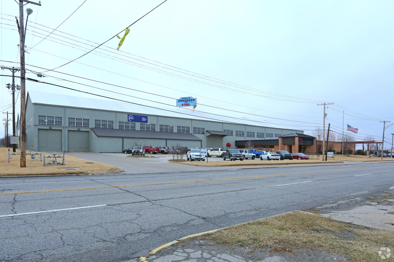
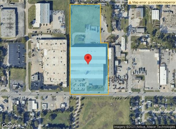
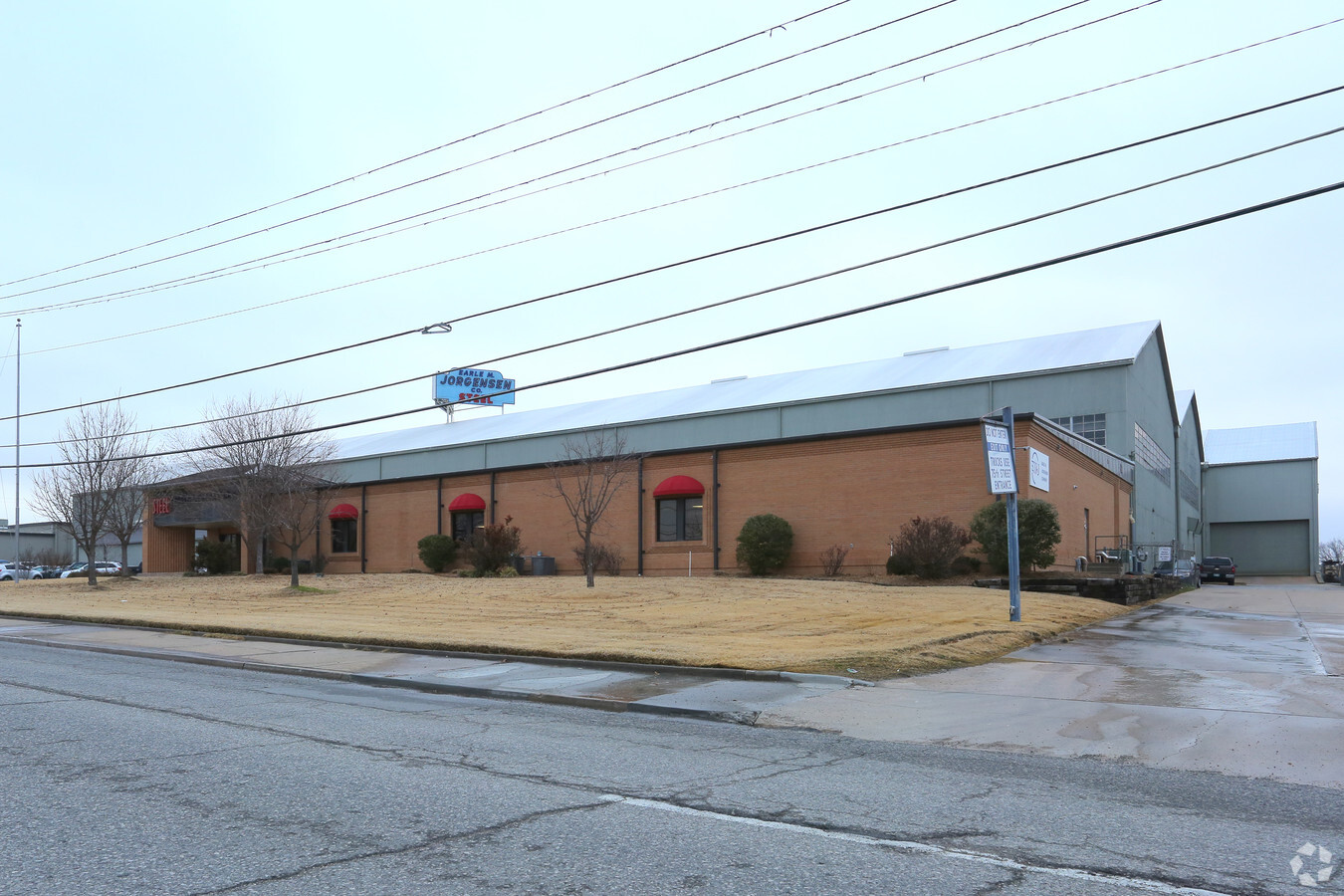
Property Record
7311 E Pine St, Tulsa, OK 74115
NEARBY LISTINGS FOR SALE OR LEASE
Property Detail
7311 E Pine St
90326-03-26-35530
Unplatted
Heavyindustrial
BEG SWC SW SE TH N990 E339 S419 E78 S571 W417 POB SEC 26 20 13
X
Tulsa
40143C0242L
Oklahoma
2023
8.73 AC
2024
Northeast Tulsa
011300
Tulsa
142,155 SF
Tulsa, OK
DEMOGRAPHICS near 7311 E Pine St
1 Mile
3 Mile
5 Mile
2024 Total Population
8,508
53,150
148,391
2029 Population
8,836
55,233
154,280
Pop Growth 2024-2029
+ 3.86%
+ 3.92%
+ 3.97%
Average Age
33
36
36
2024 Total Households
2,797
20,237
58,184
HH Growth 2024-2029
+ 3.93%
+ 3.95%
+ 4.09%
Median Household Inc
$40,015
$41,753
$44,678
Avg Household Size
2.90
2.50
2.40
2024 Avg HH Vehicles
2.00
2.00
2.00
Median Home Value
$62,800
$82,500
$121,877
Median Year Built
1955
1956
1959
Nearby Places
- Restaurants
- Banks
- Shops
- Fitness
- Groceries
PUBLIC TRANSPORTATION
AIRPORT
Tulsa International
DRIVE
WALK
Distance
Tulsa International
8 min
4.1 mi
Freight Ports
Tulsa Port Of Catoosa
DRIVE
WALK
Distance
Tulsa Port Of Catoosa
17 min
11.6 mi
Nearby Properties
Address
Land Use
TOTAL SIZE
Lot Size
Zoning
Address
Land Use
TOTAL SIZE
Lot Size
Zoning
353.75 AC
IL
Address
Land Use
TOTAL SIZE
Lot Size
Zoning
94,115 SF
15.18 AC
IM
Address
Land Use
TOTAL SIZE
Lot Size
Zoning
118,824 SF
38.79 AC
IM
Address
Land Use
TOTAL SIZE
Lot Size
Zoning
1 SF
207.77 AC
IM
Address
Land Use
TOTAL SIZE
Lot Size
Zoning
195,492 SF
17.11 AC
RM1
Address
Land Use
TOTAL SIZE
Lot Size
Zoning
228.59 AC
IL
Address
Land Use
TOTAL SIZE
Lot Size
Zoning
90,638 SF
8.59 AC
RS3
Address
Land Use
TOTAL SIZE
Lot Size
Zoning
42,665 SF
493.63 AC
RS3
Address
Land Use
TOTAL SIZE
Lot Size
Zoning
110.77 AC
IL
Address
Land Use
TOTAL SIZE
Lot Size
Zoning
36,962 SF
1.23 AC
CH
Address
Land Use
TOTAL SIZE
Lot Size
Zoning
103,248 SF
8.87 AC
IL
Address
Land Use
TOTAL SIZE
Lot Size
Zoning
29,584 SF
2.99 AC
IM
Address
Land Use
TOTAL SIZE
Lot Size
Zoning
97.68 AC
CH
Address
Land Use
TOTAL SIZE
Lot Size
Zoning
41,874 SF
35.70 AC
RS3
Address
Land Use
TOTAL SIZE
Lot Size
Zoning
124,648 SF
21.23 AC
IL
Address
Land Use
TOTAL SIZE
Lot Size
Zoning
78,096 SF
3.20 AC
RM2
Address
Land Use
TOTAL SIZE
Lot Size
Zoning
117,204 SF
9.79 AC
IM
Address
Land Use
TOTAL SIZE
Lot Size
Zoning
34,356 SF
35.67 AC
RS3
Address
Land Use
TOTAL SIZE
Lot Size
Zoning
60,690 SF
3.69 AC
RS3
Address
Land Use
TOTAL SIZE
Lot Size
Zoning
101,090 SF
1.70 AC
RS2
Address
Land Use
TOTAL SIZE
Lot Size
Zoning
80,020 SF
2.96 AC
RM2
Address
Land Use
TOTAL SIZE
Lot Size
Zoning
185,649 SF
56.23 AC
IL
Address
Land Use
TOTAL SIZE
Lot Size
Zoning
55,425 SF
2.96 AC
IL
Address
Land Use
TOTAL SIZE
Lot Size
Zoning
35,474 SF
6.11 AC
CM
Address
Land Use
TOTAL SIZE
Lot Size
Zoning
513.99 AC
RS3
Address
Land Use
TOTAL SIZE
Lot Size
Zoning
56,531 SF
7.79 AC
RS3
Address
Land Use
TOTAL SIZE
Lot Size
Zoning
44,195 SF
5.07 AC
RS3
Address
Land Use
TOTAL SIZE
Lot Size
Zoning
50,018 SF
3.91 AC
RS3
The World's #1 Commercial Real Estate Marketplace
Connect with us
© 2025 CoStar Group
The information above has been obtained from sources believed reliable. While we do not doubt its accuracy we have not verified it and make no guarantee, warranty or representation about it. It is your responsibility to independently confirm its accuracy and completeness. Any projections, opinions, assumptions, or estimates used are for example only and do not represent the current or future performance of the property. The value of this transaction to you depends on tax and other factors which should be evaluated by your tax, financial, and legal advisors. You and your advisors should conduct a careful, independent investigation of the property to determine to your satisfaction the suitability of the property for your needs.