Property Record
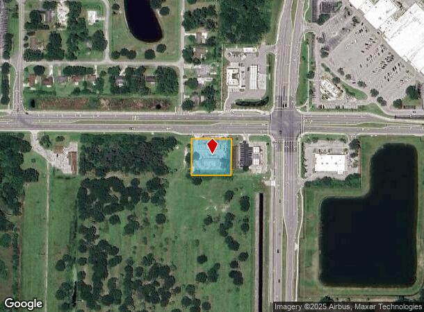
7323 Indrio Rd, Fort Pierce, FL 34951

NEARBY LISTINGS FOR SALE OR LEASE
Property Detail
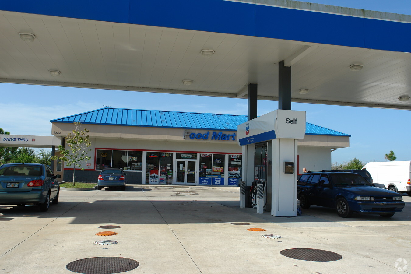
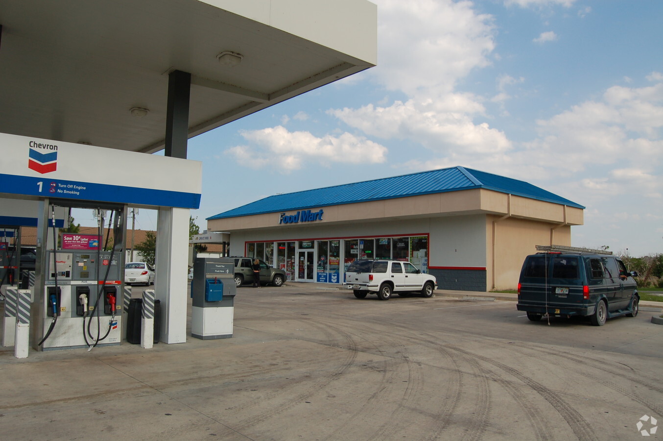
7323 Indrio Rd
13-14-411-0002-0003
Metes And Bounds
Servicestation
14 34 39 S 200 FT OF N 220 FT OF E 480 FT OF NE 1/4 OF SE 1/4-LESS E 280 FT AND LESS THAT PART FOR RD R/W MPDAF: FROM E 1/4 COR OF SEC, TH N 89 52 34 W 280.04 FT, TH S 00 07 26 W 20 FT TO POB; TH S 00 14 52 W 4 FT, TH N 89 52 34 W 200 FT, TH N 00 14
X
St Lucie
12061C0370H
Florida
2023
0.90 AC
2023
Fort Pierce
382200
Port St Lucie/Fort Pierce
5,860 SF
Port St Lucie, FL
DEMOGRAPHICS near 7323 Indrio Rd
1 Mile
3 Mile
5 Mile
2024 Total Population
3,472
17,225
49,243
2029 Population
4,216
20,552
57,579
Pop Growth 2024-2029
+ 21.43%
+ 19.31%
+ 16.93%
Average Age
40
45
44
2024 Total Households
1,373
7,060
19,317
HH Growth 2024-2029
+ 20.90%
+ 18.99%
+ 16.62%
Median Household Inc
$53,940
$53,935
$51,146
Avg Household Size
2.50
2.40
2.40
2024 Avg HH Vehicles
2.00
2.00
2.00
Median Home Value
$188,996
$182,662
$187,028
Median Year Built
1984
1986
1988
Nearby Places
- Restaurants
- Banks
- Shops
- Fitness
- Groceries
Nearby Properties
Address
Land Use
TOTAL SIZE
Lot Size
Zoning
Address
Land Use
TOTAL SIZE
Lot Size
Zoning
147,175 SF
56.96 AC
RS-2 - COU
Address
Land Use
TOTAL SIZE
Lot Size
Zoning
132,572 SF
17.39 AC
COMM GENRA
Address
Land Use
TOTAL SIZE
Lot Size
Zoning
57,024 SF
10.45 AC
RM-9 COUNT
Address
Land Use
TOTAL SIZE
Lot Size
Zoning
76,130 SF
13.71 AC
INDUSTRIAL
Address
Land Use
TOTAL SIZE
Lot Size
Zoning
82,558 SF
219.88 AC
UTILITIES
Address
Land Use
TOTAL SIZE
Lot Size
Zoning
37,090 SF
35.84 AC
PLANNED MX
Address
Land Use
TOTAL SIZE
Lot Size
Zoning
87,207 SF
17.16 AC
INSTITUTIO
Address
Land Use
TOTAL SIZE
Lot Size
Zoning
924 SF
30.87 AC
RS-6
Address
Land Use
TOTAL SIZE
Lot Size
Zoning
5,151 SF
36.87 AC
INSTITUTIO
Address
Land Use
TOTAL SIZE
Lot Size
Zoning
50,635 SF
3.48 AC
COMM GENRA
Address
Land Use
TOTAL SIZE
Lot Size
Zoning
48,010 SF
11.02 AC
UTILITIES
Address
Land Use
TOTAL SIZE
Lot Size
Zoning
10,313 SF
325.01 AC
CONSERVATI
Address
Land Use
TOTAL SIZE
Lot Size
Zoning
62,327 SF
11.61 AC
INDUSTRIAL
Address
Land Use
TOTAL SIZE
Lot Size
Zoning
105.13 AC
CONSERVATI
Address
Land Use
TOTAL SIZE
Lot Size
Zoning
1,436 SF
157.05 AC
UTILITIES
Address
Land Use
TOTAL SIZE
Lot Size
Zoning
7.01 AC
ROW
Address
Land Use
TOTAL SIZE
Lot Size
Zoning
45,876 SF
19.50 AC
PLANNED MX
Address
Land Use
TOTAL SIZE
Lot Size
Zoning
11,200 SF
1.72 AC
COMM GENRA
Address
Land Use
TOTAL SIZE
Lot Size
Zoning
25,920 SF
3.21 AC
INDUSTRIAL
Address
Land Use
TOTAL SIZE
Lot Size
Zoning
760 SF
79.55 AC
RS-6
Address
Land Use
TOTAL SIZE
Lot Size
Zoning
11,835 SF
5.20 AC
RECREATION
Address
Land Use
TOTAL SIZE
Lot Size
Zoning
14,557 SF
197.94 AC
INSTITUTIO
Address
Land Use
TOTAL SIZE
Lot Size
Zoning
3,311 SF
0.72 AC
COMM NEIGH
Address
Land Use
TOTAL SIZE
Lot Size
Zoning
8,718 SF
2.54 AC
COMM GENRA
Address
Land Use
TOTAL SIZE
Lot Size
Zoning
16,500 SF
1.40 AC
AR-1 COUNT
Address
Land Use
TOTAL SIZE
Lot Size
Zoning
30.05 AC
RM-5 - COU
Address
Land Use
TOTAL SIZE
Lot Size
Zoning
11,873 SF
11.83 AC
COMM NEIGH
Address
Land Use
TOTAL SIZE
Lot Size
Zoning
8,596 SF
4.09 AC
COMM GENRA
Address
Land Use
TOTAL SIZE
Lot Size
Zoning
15,548 SF
1.65 AC
COMM NEIGH
Address
Land Use
TOTAL SIZE
Lot Size
Zoning
3,400 SF
1.32 AC
COMM GENRA
The World's #1 Commercial Real Estate Marketplace
Connect with us
© 2025 CoStar Group
The information above has been obtained from sources believed reliable. While we do not doubt its accuracy we have not verified it and make no guarantee, warranty or representation about it. It is your responsibility to independently confirm its accuracy and completeness. Any projections, opinions, assumptions, or estimates used are for example only and do not represent the current or future performance of the property. The value of this transaction to you depends on tax and other factors which should be evaluated by your tax, financial, and legal advisors. You and your advisors should conduct a careful, independent investigation of the property to determine to your satisfaction the suitability of the property for your needs.