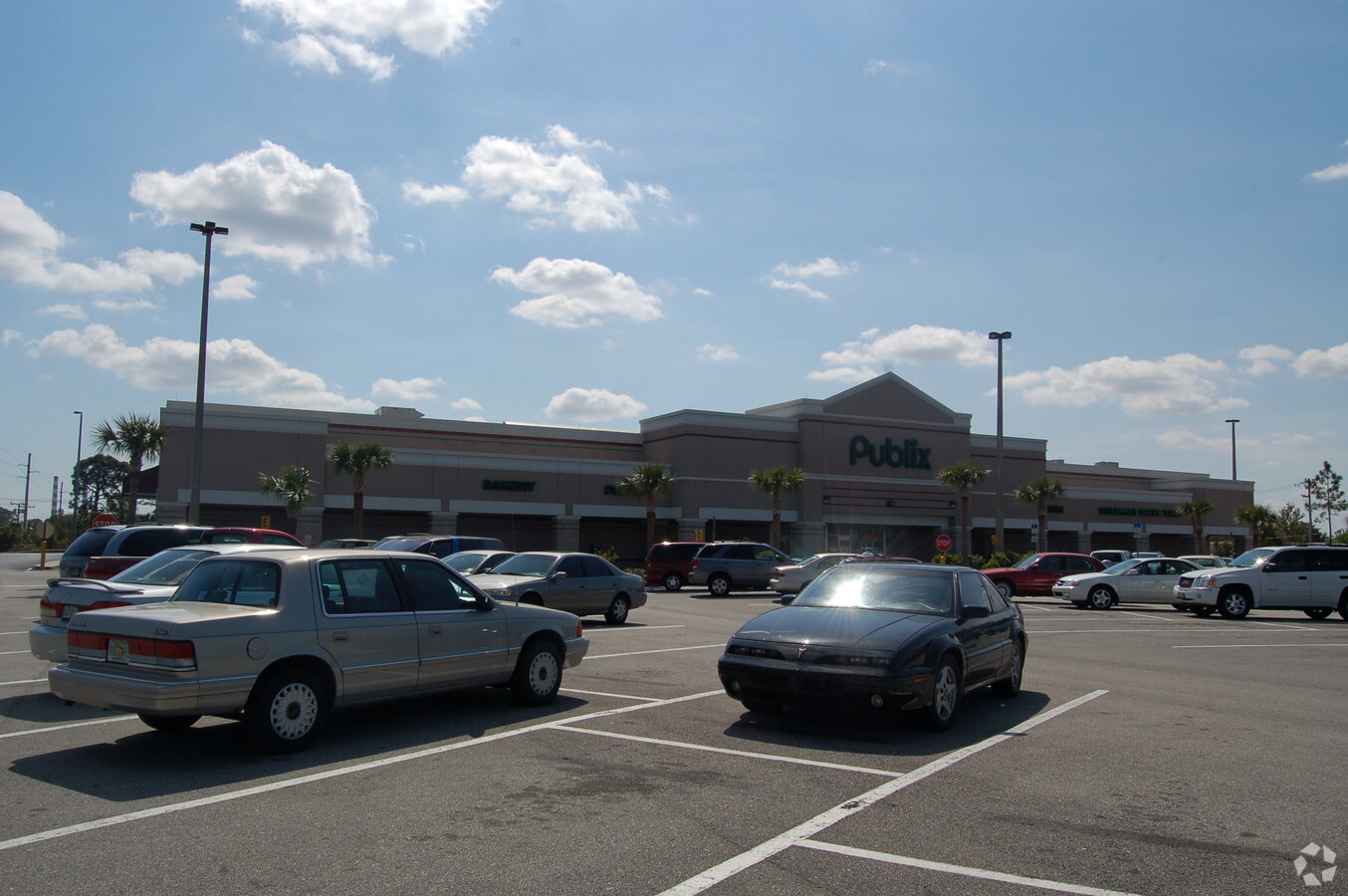
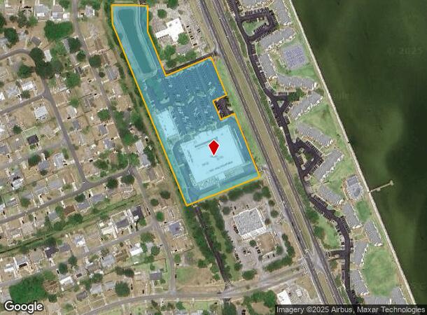
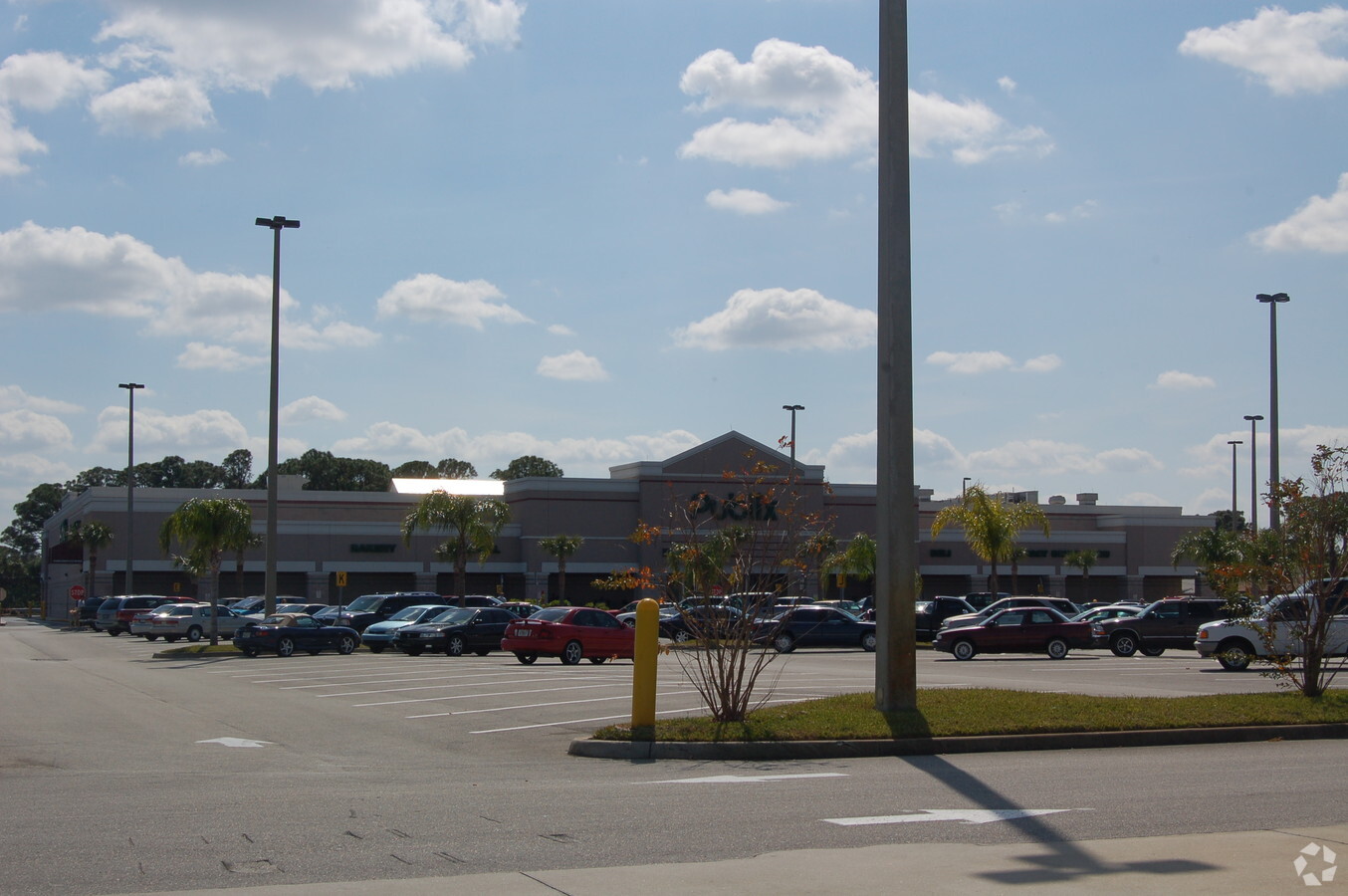
Property Record
7325 N Highway 1, Cocoa, FL 32927
NEARBY LISTINGS FOR SALE OR LEASE
Property Detail
7325 N Highway 1
Palm Bay-Melbourne-Titusville, FL
Opus South Said Plat Being
23-35-13-04-00000.0-0004.00
OPUS SOUTH LOT 4, LOT 1 BLK 4 OF PB 2 PG 2 & N 1/2 OF VAC CEDAR ST EXC HWY R/W
Regionalshoppingcenterormallwithanchorstore
Brevard
X
Florida
12009C0310H
4
2023
7.28 AC
2023
Brevard County
062106
Orlando
59,557 SF
DEMOGRAPHICS near 7325 N Highway 1
1 Mile
3 Mile
5 Mile
2024 Total Population
4,324
21,429
40,430
2029 Population
4,695
23,193
43,888
Pop Growth 2024-2029
+ 8.58%
+ 8.23%
+ 8.55%
Average Age
43
42
43
2024 Total Households
1,854
8,506
16,005
HH Growth 2024-2029
+ 8.58%
+ 8.11%
+ 8.39%
Median Household Inc
$58,432
$69,232
$75,288
Avg Household Size
2.20
2.40
2.40
2024 Avg HH Vehicles
2.00
2.00
2.00
Median Home Value
$188,194
$216,847
$239,989
Median Year Built
1982
1986
1987
Nearby Places
- Restaurants
- Banks
- Shops
- Fitness
- Groceries
PUBLIC TRANSPORTATION
AIRPORT
Melbourne Orlando International
DRIVE
WALK
Distance
Melbourne Orlando International
50 min
35.6 mi
Freight Ports
Port Canaveral
DRIVE
WALK
Distance
Port Canaveral
22 min
15.0 mi
SALE & LEASE HISTORY
LISTING DATE
SALE/LEASE

Sep 25, 2016
For Lease
Nearby Properties
Address
Land Use
TOTAL SIZE
Lot Size
Zoning
Address
Land Use
TOTAL SIZE
Lot Size
Zoning
414,240 SF
127.62 AC
GMLH
Address
Land Use
TOTAL SIZE
Lot Size
Zoning
179,039 SF
515.29 AC
P
Address
Land Use
TOTAL SIZE
Lot Size
Zoning
248,110 SF
12.77 AC
Address
Land Use
TOTAL SIZE
Lot Size
Zoning
141,221 SF
85 AC
IU
Address
Land Use
TOTAL SIZE
Lot Size
Zoning
33,719 SF
42.28 AC
IU
Address
Land Use
TOTAL SIZE
Lot Size
Zoning
105,543 SF
16.08 AC
RU19
Address
Land Use
TOTAL SIZE
Lot Size
Zoning
96,436 SF
19.10 AC
RU19
Address
Land Use
TOTAL SIZE
Lot Size
Zoning
63,083 SF
18.93 AC
GU
Address
Land Use
TOTAL SIZE
Lot Size
Zoning
89,772 SF
10.12 AC
BU1
Address
Land Use
TOTAL SIZE
Lot Size
Zoning
83,661 SF
15.08 AC
PID
Address
Land Use
TOTAL SIZE
Lot Size
Zoning
42,936 SF
27.69 AC
GU
Address
Land Use
TOTAL SIZE
Lot Size
Zoning
92,847 SF
7.02 AC
BU-2
Address
Land Use
TOTAL SIZE
Lot Size
Zoning
52,526 SF
5.15 AC
PID
Address
Land Use
TOTAL SIZE
Lot Size
Zoning
24,151 SF
4.62 AC
GML-H
Address
Land Use
TOTAL SIZE
Lot Size
Zoning
21,820 SF
4.32 AC
BU1
Address
Land Use
TOTAL SIZE
Lot Size
Zoning
19,042 SF
17.98 AC
AU
Address
Land Use
TOTAL SIZE
Lot Size
Zoning
60,075 SF
3.55 AC
P
Address
Land Use
TOTAL SIZE
Lot Size
Zoning
33,019 SF
107.50 AC
GML
Address
Land Use
TOTAL SIZE
Lot Size
Zoning
36,712 SF
1.80 AC
BU1
Address
Land Use
TOTAL SIZE
Lot Size
Zoning
52,734 SF
9 AC
PIP
Address
Land Use
TOTAL SIZE
Lot Size
Zoning
1,150 SF
80.93 AC
IU
Address
Land Use
TOTAL SIZE
Lot Size
Zoning
2,536 SF
73.93 AC
M3
Address
Land Use
TOTAL SIZE
Lot Size
Zoning
60,319 SF
9.37 AC
IU
Address
Land Use
TOTAL SIZE
Lot Size
Zoning
20,615 SF
6 AC
INL
Address
Land Use
TOTAL SIZE
Lot Size
Zoning
7,454 SF
24.95 AC
GML
Address
Land Use
TOTAL SIZE
Lot Size
Zoning
15,873 SF
2.02 AC
BU-1
Address
Land Use
TOTAL SIZE
Lot Size
Zoning
1,730 SF
4.10 AC
GML
Address
Land Use
TOTAL SIZE
Lot Size
Zoning
20,091 SF
6.54 AC
INL
Address
Land Use
TOTAL SIZE
Lot Size
Zoning
16,785 SF
3.11 AC
GML
The World's #1 Commercial Real Estate Marketplace
Connect with us
© 2025 CoStar Group
The information above has been obtained from sources believed reliable. While we do not doubt its accuracy we have not verified it and make no guarantee, warranty or representation about it. It is your responsibility to independently confirm its accuracy and completeness. Any projections, opinions, assumptions, or estimates used are for example only and do not represent the current or future performance of the property. The value of this transaction to you depends on tax and other factors which should be evaluated by your tax, financial, and legal advisors. You and your advisors should conduct a careful, independent investigation of the property to determine to your satisfaction the suitability of the property for your needs.