Property Record
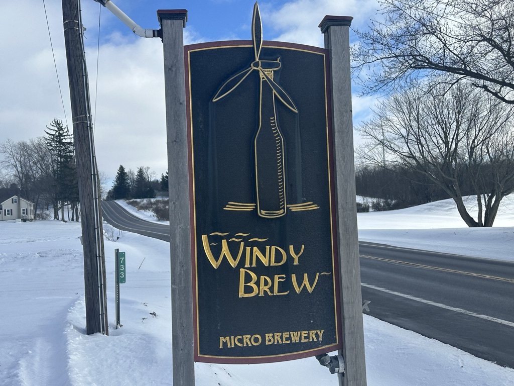
733 Route 20A, Strykersville, NY 14145
This Property Is For Sale
NEARBY LISTINGS FOR SALE OR LEASE
-
-
View all Strykersville listings for sale on LoopNet.com
Property Detail
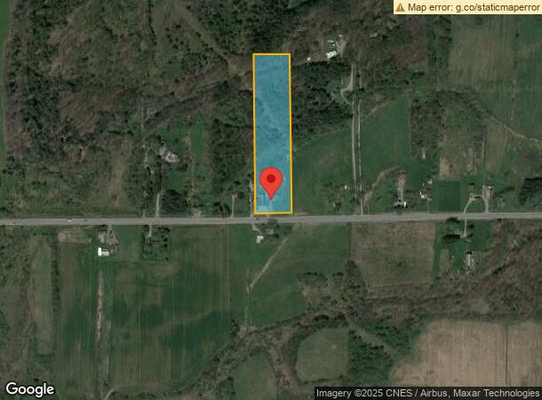
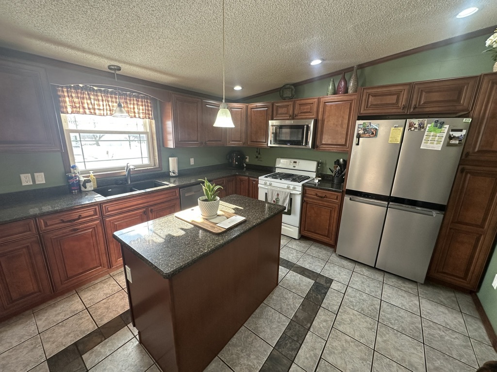
733 Route 20A
Other Market Areas
LOT 32 TOWN 9 RANGE 4
564600-054-000-0002-010-002-0000
Wyoming
Commercialofficeresidentialmixeduse
New York
2023
10.002
2023
5.50 AC
970400
New York West Area
1,560 SF
DEMOGRAPHICS near 733 Route 20A
1 Mile
3 Mile
5 Mile
2024 Total Population
75
1,030
3,676
2029 Population
71
984
3,550
Pop Growth 2024-2029
(5.33%)
(4.47%)
(3.43%)
Average Age
43
44
45
2024 Total Households
31
423
1,519
HH Growth 2024-2029
(6.45%)
(4.49%)
(3.55%)
Median Household Inc
$85,000
$81,338
$80,907
Avg Household Size
2.30
2.40
2.40
2024 Avg HH Vehicles
2.00
2.00
2.00
Median Home Value
$173,076
$195,547
$211,079
Median Year Built
1963
1965
1966
Nearby Places
- Restaurants
- Banks
- Shops
- Fitness
- Groceries
PUBLIC TRANSPORTATION
AIRPORT
Buffalo Niagara International
DRIVE
WALK
Distance
Buffalo Niagara International
41 min
25.5 mi
Freight Ports
Albany, NY Port
DRIVE
WALK
Distance
Albany, NY Port
332 min
276.8 mi
Nearby Properties
Address
Land Use
TOTAL SIZE
Lot Size
Zoning
Address
Land Use
TOTAL SIZE
Lot Size
Zoning
4,920 SF
556.97 AC
Address
Land Use
TOTAL SIZE
Lot Size
Zoning
151.91 AC
07 - MIXED
Address
Land Use
TOTAL SIZE
Lot Size
Zoning
8,304 SF
4 AC
9
Address
Land Use
TOTAL SIZE
Lot Size
Zoning
2,189 SF
128.22 AC
Address
Land Use
TOTAL SIZE
Lot Size
Zoning
7,631 SF
6.72 AC
07 - MIXED
Address
Land Use
TOTAL SIZE
Lot Size
Zoning
4,492 SF
5.10 AC
07
Address
Land Use
TOTAL SIZE
Lot Size
Zoning
197.87 AC
07 - MIXED
Address
Land Use
TOTAL SIZE
Lot Size
Zoning
Address
Land Use
TOTAL SIZE
Lot Size
Zoning
138.37 AC
Address
Land Use
TOTAL SIZE
Lot Size
Zoning
1,600 SF
134.58 AC
B00
Address
Land Use
TOTAL SIZE
Lot Size
Zoning
126.27 AC
07 - MIXED
Address
Land Use
TOTAL SIZE
Lot Size
Zoning
27.82 AC
Address
Land Use
TOTAL SIZE
Lot Size
Zoning
2,520 SF
84.78 AC
Address
Land Use
TOTAL SIZE
Lot Size
Zoning
92.51 AC
Address
Land Use
TOTAL SIZE
Lot Size
Zoning
880 SF
5.27 AC
Address
Land Use
TOTAL SIZE
Lot Size
Zoning
65.61 AC
07 - MIXED
Address
Land Use
TOTAL SIZE
Lot Size
Zoning
89 AC
04 - FARM
Address
Land Use
TOTAL SIZE
Lot Size
Zoning
92.86 AC
04 - FARM
Address
Land Use
TOTAL SIZE
Lot Size
Zoning
80.87 AC
07 - MIXED
Address
Land Use
TOTAL SIZE
Lot Size
Zoning
84.02 AC
07 - MIXED
Address
Land Use
TOTAL SIZE
Lot Size
Zoning
5,224 SF
3.87 AC
07 - MIXED
Address
Land Use
TOTAL SIZE
Lot Size
Zoning
3,052 SF
0.78 AC
07 - MIXED
Address
Land Use
TOTAL SIZE
Lot Size
Zoning
1,618 SF
8.10 AC
07 - MIXED
Address
Land Use
TOTAL SIZE
Lot Size
Zoning
400 SF
146.40 AC
Address
Land Use
TOTAL SIZE
Lot Size
Zoning
1,958 SF
1.02 AC
04 - FARM
Address
Land Use
TOTAL SIZE
Lot Size
Zoning
54.62 AC
07 - MIXED
Address
Land Use
TOTAL SIZE
Lot Size
Zoning
2,560 SF
1.62 AC
07 - MIXED
Address
Land Use
TOTAL SIZE
Lot Size
Zoning
70.47 AC
07 - MIXED
Address
Land Use
TOTAL SIZE
Lot Size
Zoning
97.55 AC
07 - MIXED
The World's #1 Commercial Real Estate Marketplace
Connect with us
© 2025 CoStar Group
The information above has been obtained from sources believed reliable. While we do not doubt its accuracy we have not verified it and make no guarantee, warranty or representation about it. It is your responsibility to independently confirm its accuracy and completeness. Any projections, opinions, assumptions, or estimates used are for example only and do not represent the current or future performance of the property. The value of this transaction to you depends on tax and other factors which should be evaluated by your tax, financial, and legal advisors. You and your advisors should conduct a careful, independent investigation of the property to determine to your satisfaction the suitability of the property for your needs.