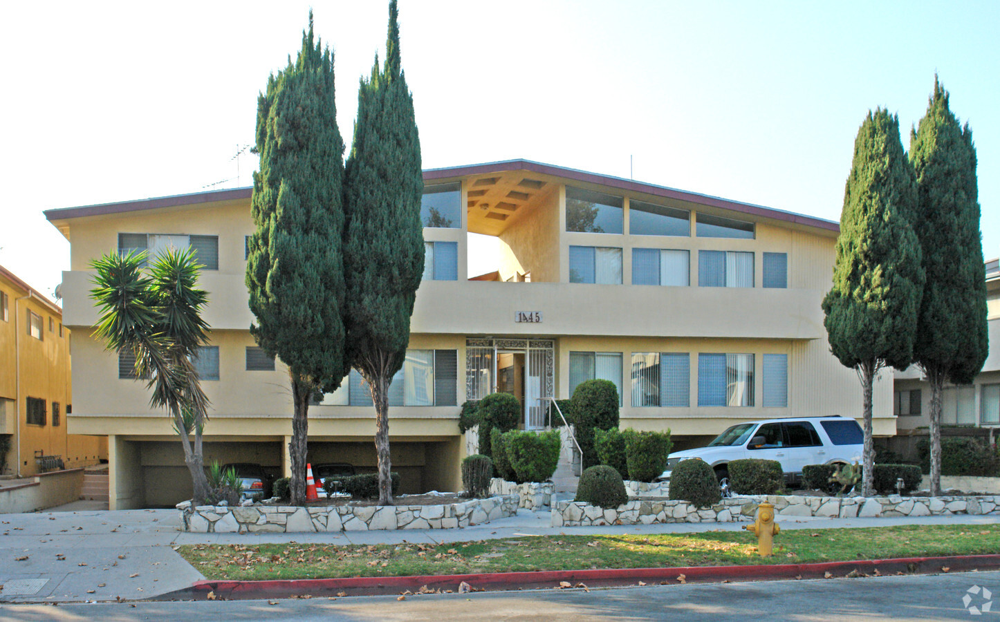
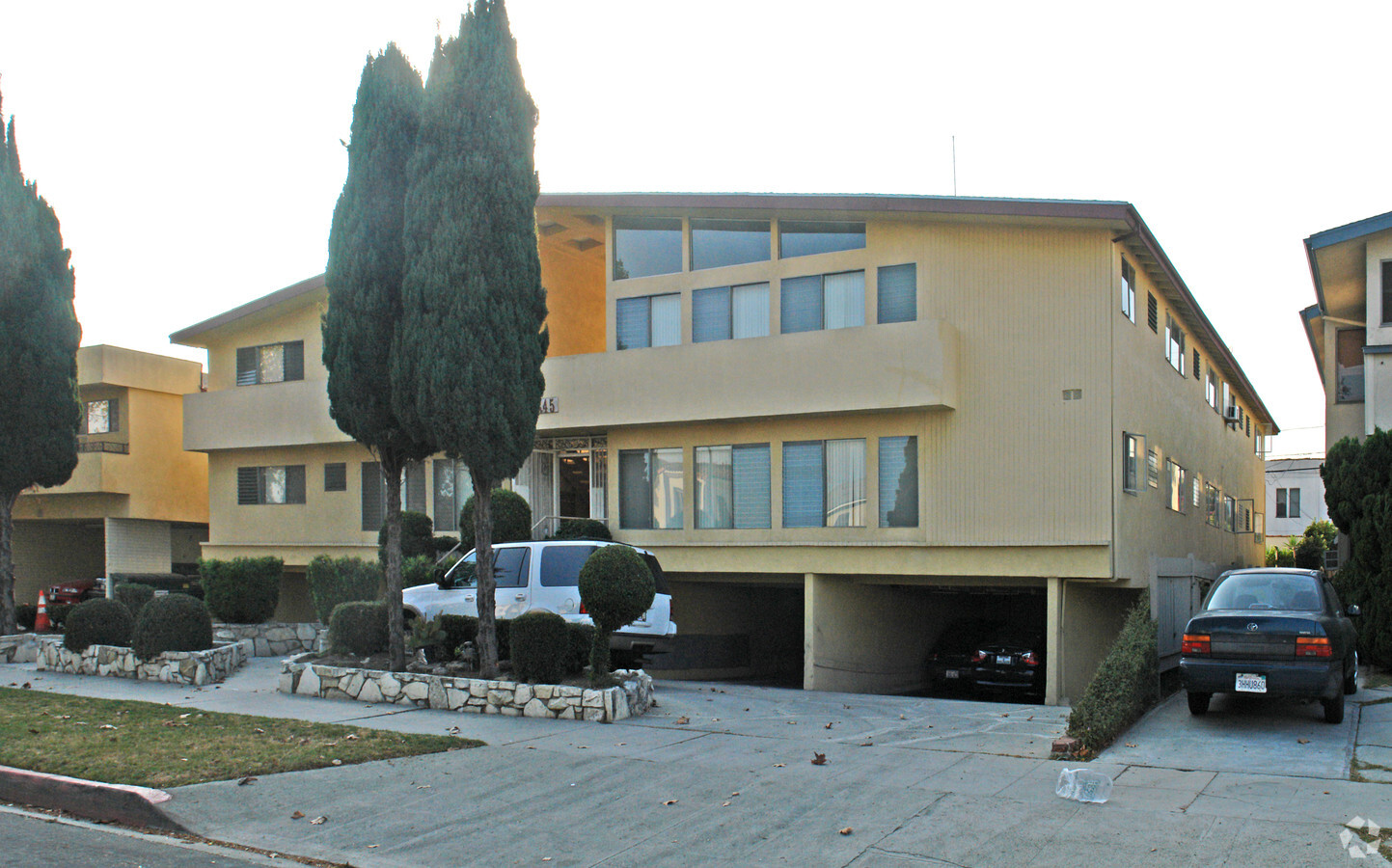
Property Record
735 S State Highway Pp Dr, Sparta, MO 65753
NEARBY LISTINGS FOR SALE OR LEASE
Property Detail
735 S State Highway Pp Dr
Los Angeles-Long Beach-Glendale, CA
7385
4303-018-008
TRACT # 7385 LOTS 79 AND LOT/SEC 80
Multifamilydwelling
Los Angeles
X
California
06037C1595G
79
2024
0.30 AC
2024
Pico-Robertson
217002
Los Angeles
12,900 SF
DEMOGRAPHICS near 735 S State Highway Pp Dr
1 Mile
3 Mile
5 Mile
2024 Total Population
46,445
335,898
926,600
2029 Population
45,332
328,753
908,430
Pop Growth 2024-2029
(2.40%)
(2.13%)
(1.96%)
Average Age
39
41
40
2024 Total Households
19,113
154,253
404,812
HH Growth 2024-2029
(2.60%)
(2.30%)
(2.09%)
Median Household Inc
$94,036
$91,466
$76,609
Avg Household Size
2.30
2.10
2.20
2024 Avg HH Vehicles
2.00
1.00
1.00
Median Home Value
$1,107,617
$1,082,577
$1,060,812
Median Year Built
1956
1960
1963
Nearby Places
- Restaurants
- Banks
- Shops
- Fitness
- Groceries
PUBLIC TRANSPORTATION
AIRPORT
Los Angeles International
Drive
Walk
Distance
Los Angeles International
19 min
9.4 mi
Bob Hope
Drive
Walk
Distance
Bob Hope
27 min
14.2 mi
Long Beach (Daugherty Field)
Drive
Walk
Distance
Long Beach (Daugherty Field)
37 min
25.9 mi
Freight Ports
Port of Long Beach
Drive
Walk
Distance
Port of Long Beach
40 min
27.7 mi
Nearby Properties
Address
Land Use
TOTAL SIZE
Lot Size
Zoning
Address
Land Use
TOTAL SIZE
Lot Size
Zoning
1436724
21.11 AC
LAC2
Address
Land Use
TOTAL SIZE
Lot Size
Zoning
2529036
8.48 AC
LAC2
Address
Land Use
TOTAL SIZE
Lot Size
Zoning
1002990
8.42 AC
LAC4
Address
Land Use
TOTAL SIZE
Lot Size
Zoning
1447077
10.63 AC
LAC2
Address
Land Use
TOTAL SIZE
Lot Size
Zoning
157691
45.86 AC
CCS1*
Address
Land Use
TOTAL SIZE
Lot Size
Zoning
436774
1.49 AC
LAC2
Address
Land Use
TOTAL SIZE
Lot Size
Zoning
1353044
6.18 AC
LAC2
Address
Land Use
TOTAL SIZE
Lot Size
Zoning
227227
7.62 AC
BHC3*
Address
Land Use
TOTAL SIZE
Lot Size
Zoning
33373
52.98 AC
LACCS
Address
Land Use
TOTAL SIZE
Lot Size
Zoning
346856
3.67 AC
CCC3*
Address
Land Use
TOTAL SIZE
Lot Size
Zoning
840124
2.77 AC
LAC2
Address
Land Use
TOTAL SIZE
Lot Size
Zoning
636436
6.62 AC
LAC2
Address
Land Use
TOTAL SIZE
Lot Size
Zoning
493248
11.18 AC
CCS1YY
Address
Land Use
TOTAL SIZE
Lot Size
Zoning
252523
2.26 AC
LAC2
Address
Land Use
TOTAL SIZE
Lot Size
Zoning
1232625
2.40 AC
LAC2
Address
Land Use
TOTAL SIZE
Lot Size
Zoning
1226598
2.30 AC
LAC2
Address
Land Use
TOTAL SIZE
Lot Size
Zoning
32180
BHC3*
Address
Land Use
TOTAL SIZE
Lot Size
Zoning
824156
2.15 AC
LAC2
Address
Land Use
TOTAL SIZE
Lot Size
Zoning
767078
9.30 AC
LAC2
Address
Land Use
TOTAL SIZE
Lot Size
Zoning
871235
14.56 AC
LAC2
Address
Land Use
TOTAL SIZE
Lot Size
Zoning
476779
1.57 AC
LAC4
Address
Land Use
TOTAL SIZE
Lot Size
Zoning
133959
1.23 AC
BHC3*
Address
Land Use
TOTAL SIZE
Lot Size
Zoning
728063
2.08 AC
LAC4
Address
Land Use
TOTAL SIZE
Lot Size
Zoning
472363
3.24 AC
LAC4
Address
Land Use
TOTAL SIZE
Lot Size
Zoning
515531
14.65 AC
LAC2
Address
Land Use
TOTAL SIZE
Lot Size
Zoning
808626
1.88 AC
LAC2
Address
Land Use
TOTAL SIZE
Lot Size
Zoning
754581
3.75 AC
LAC1
Address
Land Use
TOTAL SIZE
Lot Size
Zoning
793274
7.80 AC
LAR4
Address
Land Use
TOTAL SIZE
Lot Size
Zoning
110580
6.88 AC
LAC2
Address
Land Use
TOTAL SIZE
Lot Size
Zoning
Start a new search to find other properties for sale or lease
Connect with us
© 2024 CoStar Group
The information above has been obtained from sources believed reliable. While we do not doubt its accuracy we have not verified it and make no guarantee, warranty or representation about it. It is your responsibility to independently confirm its accuracy and completeness. Any projections, opinions, assumptions, or estimates used are for example only and do not represent the current or future performance of the property. The value of this transaction to you depends on tax and other factors which should be evaluated by your tax, financial, and legal advisors. You and your advisors should conduct a careful, independent investigation of the property to determine to your satisfaction the suitability of the property for your needs.