Property Record
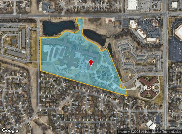
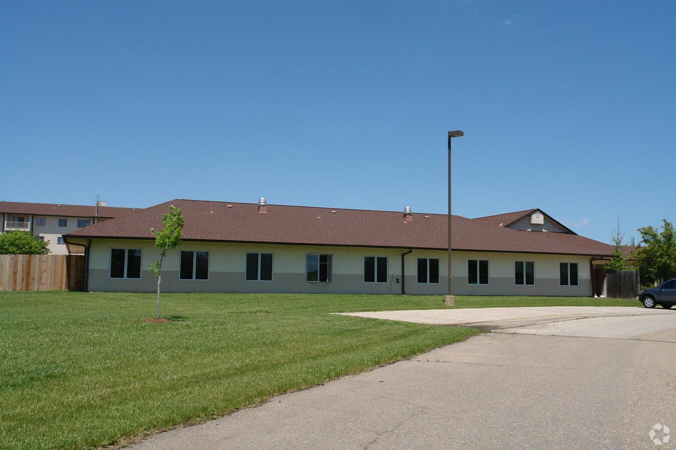
7373 E 29Th St N, Wichita, KS 67226

NEARBY LISTINGS FOR SALE OR LEASE
-
-
View all Wichita listings for sale on LoopNet.com
Property Detail
7373 E 29Th St N
Wichita, KS
Larksfield Place Add
113-06-0-11-01-007.00C
LOT 1 BLOCK 1 LARKSFIELD PLACE ADD.
Hospitalprivate
Sedgwick
X
Kansas
20173C0376G
1
2023
32.82 AC
2023
Northeast
010107
Wichita
343,926 SF
DEMOGRAPHICS near 7373 E 29Th St N
1 Mile
3 Mile
5 Mile
2024 Total Population
10,426
56,135
135,325
2029 Population
10,576
56,977
138,255
Pop Growth 2024-2029
+ 1.44%
+ 1.50%
+ 2.17%
Average Age
40
39
38
2024 Total Households
4,836
22,744
54,858
HH Growth 2024-2029
+ 1.43%
+ 1.40%
+ 2.08%
Median Household Inc
$57,323
$66,690
$60,068
Avg Household Size
2.10
2.30
2.30
2024 Avg HH Vehicles
2.00
2.00
2.00
Median Home Value
$184,222
$209,707
$185,285
Median Year Built
1986
1984
1974
Nearby Places
- Restaurants
- Banks
- Shops
- Fitness
- Groceries
PUBLIC TRANSPORTATION
AIRPORT
Wichita Dwight D Eisenhower Ntl
DRIVE
WALK
Distance
Wichita Dwight D Eisenhower Ntl
26 min
15.4 mi
Freight Ports
Tulsa Port Of Catoosa
DRIVE
WALK
Distance
Tulsa Port Of Catoosa
215 min
199.0 mi
Nearby Properties
Address
Land Use
TOTAL SIZE
Lot Size
Zoning
Address
Land Use
TOTAL SIZE
Lot Size
Zoning
481,160 SF
63.37 AC
SF-5
Address
Land Use
TOTAL SIZE
Lot Size
Zoning
346,728 SF
15.91 AC
SF-5
Address
Land Use
TOTAL SIZE
Lot Size
Zoning
243,108 SF
5.42 AC
LI
Address
Land Use
TOTAL SIZE
Lot Size
Zoning
338,272 SF
332.54 AC
LI
Address
Land Use
TOTAL SIZE
Lot Size
Zoning
148,617 SF
17.27 AC
SF-5
Address
Land Use
TOTAL SIZE
Lot Size
Zoning
104,331 SF
SF-5
Address
Land Use
TOTAL SIZE
Lot Size
Zoning
103,261 SF
5.49 AC
B
Address
Land Use
TOTAL SIZE
Lot Size
Zoning
195,293 SF
24.53 AC
SF-5
Address
Land Use
TOTAL SIZE
Lot Size
Zoning
186,902 SF
5.24 AC
SF-5
Address
Land Use
TOTAL SIZE
Lot Size
Zoning
169,134 SF
18.97 AC
SF-5
Address
Land Use
TOTAL SIZE
Lot Size
Zoning
199,468 SF
24.45 AC
SF-5
Address
Land Use
TOTAL SIZE
Lot Size
Zoning
147,784 SF
39.28 AC
SF-5
Address
Land Use
TOTAL SIZE
Lot Size
Zoning
79,739 SF
10.11 AC
R6
Address
Land Use
TOTAL SIZE
Lot Size
Zoning
73,314 SF
3.18 AC
SF-5
Address
Land Use
TOTAL SIZE
Lot Size
Zoning
102,200 SF
8.77 AC
R6
Address
Land Use
TOTAL SIZE
Lot Size
Zoning
146,863 SF
14.24 AC
SF-5
Address
Land Use
TOTAL SIZE
Lot Size
Zoning
74,242 SF
23.99 AC
GC
Address
Land Use
TOTAL SIZE
Lot Size
Zoning
113,980 SF
20.09 AC
SF-5
Address
Land Use
TOTAL SIZE
Lot Size
Zoning
84,452 SF
0.46 AC
B
Address
Land Use
TOTAL SIZE
Lot Size
Zoning
67,067 SF
8.36 AC
SF-5
Address
Land Use
TOTAL SIZE
Lot Size
Zoning
99,325 SF
17.82 AC
SF-5
Address
Land Use
TOTAL SIZE
Lot Size
Zoning
41,526 SF
17.52 AC
LC
Address
Land Use
TOTAL SIZE
Lot Size
Zoning
121,469 SF
47.62 AC
LI
Address
Land Use
TOTAL SIZE
Lot Size
Zoning
40,267 SF
10.54 AC
R6
Address
Land Use
TOTAL SIZE
Lot Size
Zoning
116,114 SF
53.39 AC
SF-5
Address
Land Use
TOTAL SIZE
Lot Size
Zoning
60,232 SF
0.72 AC
SF-5
Address
Land Use
TOTAL SIZE
Lot Size
Zoning
72,001 SF
21.99 AC
LI
Address
Land Use
TOTAL SIZE
Lot Size
Zoning
154,691 SF
8.40 AC
SF-5
Address
Land Use
TOTAL SIZE
Lot Size
Zoning
81,955 SF
7.28 AC
R4
The World's #1 Commercial Real Estate Marketplace
Connect with us
© 2025 CoStar Group
The information above has been obtained from sources believed reliable. While we do not doubt its accuracy we have not verified it and make no guarantee, warranty or representation about it. It is your responsibility to independently confirm its accuracy and completeness. Any projections, opinions, assumptions, or estimates used are for example only and do not represent the current or future performance of the property. The value of this transaction to you depends on tax and other factors which should be evaluated by your tax, financial, and legal advisors. You and your advisors should conduct a careful, independent investigation of the property to determine to your satisfaction the suitability of the property for your needs.