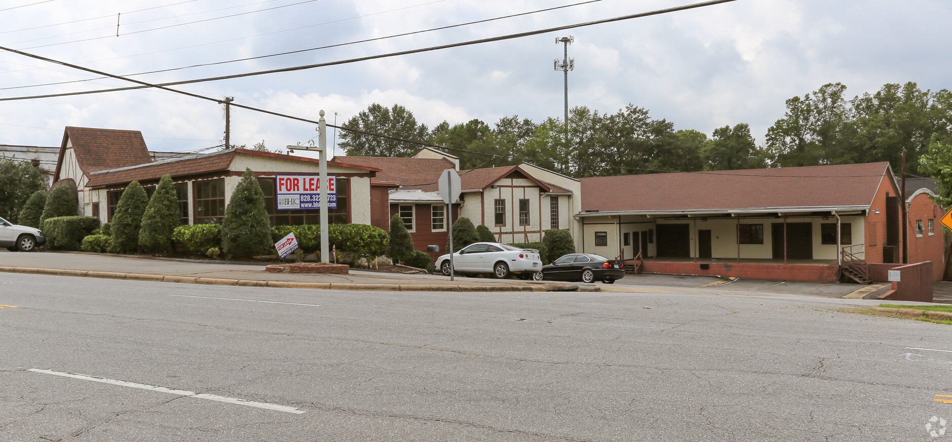
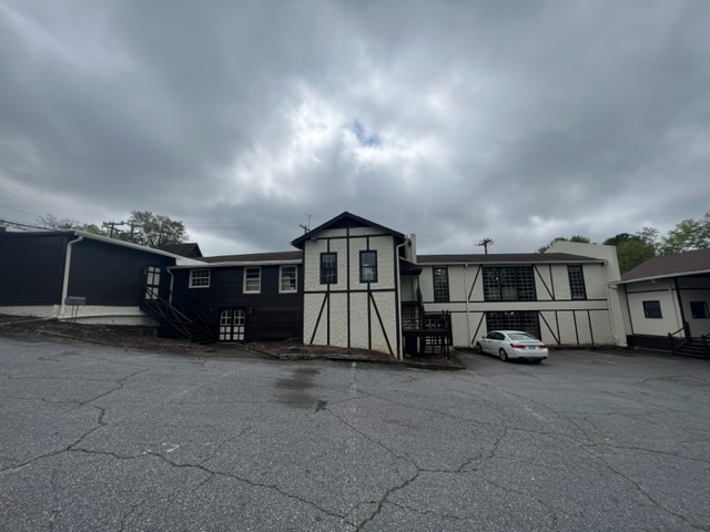
Property Record
739 Old Lenoir Rd, Hickory, NC 28601


NEARBY LISTINGS FOR SALE OR LEASE
Property Detail
739 Old Lenoir Rd
Hickory-Lenoir-Morganton, NC
Oakland Heights
2793169336390000
LOT 1-2 & PT3-6 & 16-21 PL 1-7
Warehouse
Catawba
AE
North Carolina
3710279300K
1-2
2024
2.66 AC
2024
Catawba County
010600
Charlotte
18,080 SF
DEMOGRAPHICS near 739 Old Lenoir Rd
1 Mile
3 Mile
5 Mile
2024 Total Population
5,244
34,876
69,428
2029 Population
5,451
36,327
71,993
Pop Growth 2024-2029
+ 3.95%
+ 4.16%
+ 3.69%
Average Age
41
41
41
2024 Total Households
2,225
14,667
28,742
HH Growth 2024-2029
+ 3.87%
+ 4.21%
+ 3.73%
Median Household Inc
$56,688
$53,153
$57,043
Avg Household Size
2.30
2.20
2.30
2024 Avg HH Vehicles
2.00
2.00
2.00
Median Home Value
$234,810
$183,247
$189,486
Median Year Built
1972
1973
1979
Nearby Places
- Restaurants
- Banks
- Shops
- Fitness
- Groceries
SALE & LEASE HISTORY
LISTING DATE
SALE/LEASE

Feb 27, 2018
For Lease
Nearby Properties
Address
Land Use
TOTAL SIZE
Lot Size
Zoning
Address
Land Use
TOTAL SIZE
Lot Size
Zoning
534,243 SF
285.78 AC
Address
Land Use
TOTAL SIZE
Lot Size
Zoning
10,422 SF
4.23 AC
OI
Address
Land Use
TOTAL SIZE
Lot Size
Zoning
8,492 SF
15.83 AC
R-4
Address
Land Use
TOTAL SIZE
Lot Size
Zoning
16,594 SF
7.22 AC
PD
Address
Land Use
TOTAL SIZE
Lot Size
Zoning
19.87 AC
OI
Address
Land Use
TOTAL SIZE
Lot Size
Zoning
7,722 SF
10.01 AC
R-4
Address
Land Use
TOTAL SIZE
Lot Size
Zoning
27.56 AC
OI
Address
Land Use
TOTAL SIZE
Lot Size
Zoning
8,436 SF
13.28 AC
R-4
Address
Land Use
TOTAL SIZE
Lot Size
Zoning
104,270 SF
0.75 AC
C-1
Address
Land Use
TOTAL SIZE
Lot Size
Zoning
311,263 SF
37.60 AC
IND
Address
Land Use
TOTAL SIZE
Lot Size
Zoning
7,240 SF
INDUSTRIAL
Address
Land Use
TOTAL SIZE
Lot Size
Zoning
146,932 SF
27.08 AC
C-3
Address
Land Use
TOTAL SIZE
Lot Size
Zoning
90,440 SF
5.17 AC
OI
Address
Land Use
TOTAL SIZE
Lot Size
Zoning
9,950 SF
9.42 AC
R-3
Address
Land Use
TOTAL SIZE
Lot Size
Zoning
8,960 SF
14.07 AC
R-4
Address
Land Use
TOTAL SIZE
Lot Size
Zoning
8,637 SF
5 AC
CC-1
Address
Land Use
TOTAL SIZE
Lot Size
Zoning
14.15 AC
OI
Address
Land Use
TOTAL SIZE
Lot Size
Zoning
22,343 SF
15.54 AC
CC-1
Address
Land Use
TOTAL SIZE
Lot Size
Zoning
60,130 SF
4.02 AC
IND
Address
Land Use
TOTAL SIZE
Lot Size
Zoning
8.36 AC
OI
Address
Land Use
TOTAL SIZE
Lot Size
Zoning
7,742 SF
10.93 AC
PD
Address
Land Use
TOTAL SIZE
Lot Size
Zoning
137,515 SF
12.03 AC
NC
Address
Land Use
TOTAL SIZE
Lot Size
Zoning
22.99 AC
PD
Address
Land Use
TOTAL SIZE
Lot Size
Zoning
301,264 SF
19.88 AC
I
Address
Land Use
TOTAL SIZE
Lot Size
Zoning
2.38 AC
C-1
Address
Land Use
TOTAL SIZE
Lot Size
Zoning
13.37 AC
C-2
Address
Land Use
TOTAL SIZE
Lot Size
Zoning
8,246 SF
37.33 AC
OI
Address
Land Use
TOTAL SIZE
Lot Size
Zoning
51,052 SF
6.80 AC
CC-1
Address
Land Use
TOTAL SIZE
Lot Size
Zoning
9.07 AC
NC
Address
Land Use
TOTAL SIZE
Lot Size
Zoning
13.07 AC
OI
The World's #1 Commercial Real Estate Marketplace
Connect with us
© 2025 CoStar Group
The information above has been obtained from sources believed reliable. While we do not doubt its accuracy we have not verified it and make no guarantee, warranty or representation about it. It is your responsibility to independently confirm its accuracy and completeness. Any projections, opinions, assumptions, or estimates used are for example only and do not represent the current or future performance of the property. The value of this transaction to you depends on tax and other factors which should be evaluated by your tax, financial, and legal advisors. You and your advisors should conduct a careful, independent investigation of the property to determine to your satisfaction the suitability of the property for your needs.