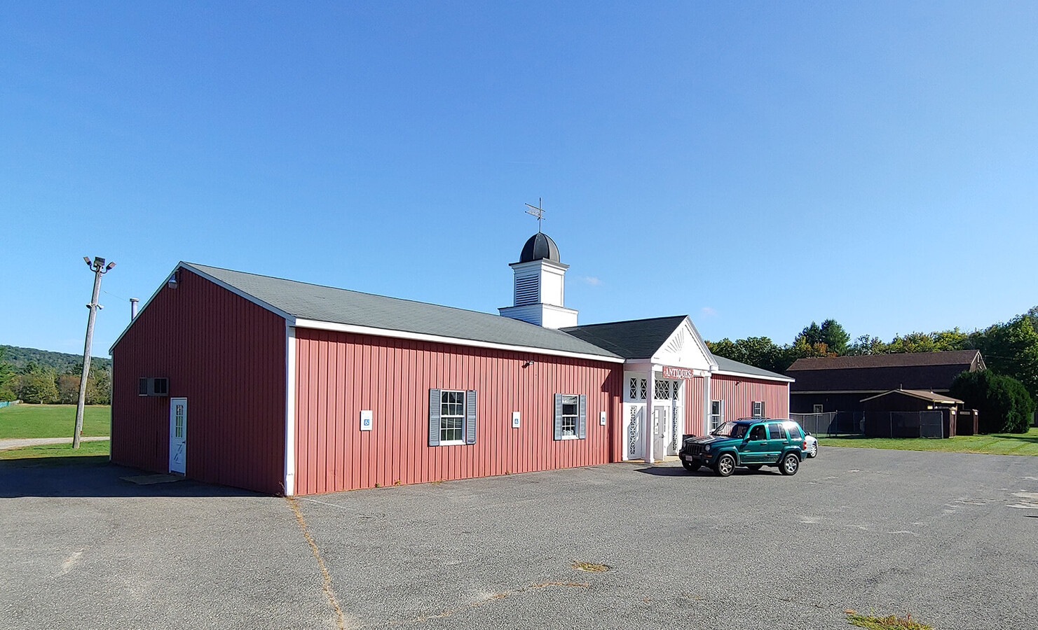
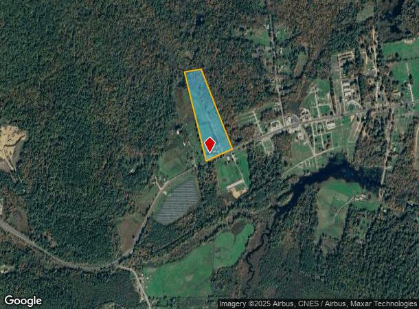
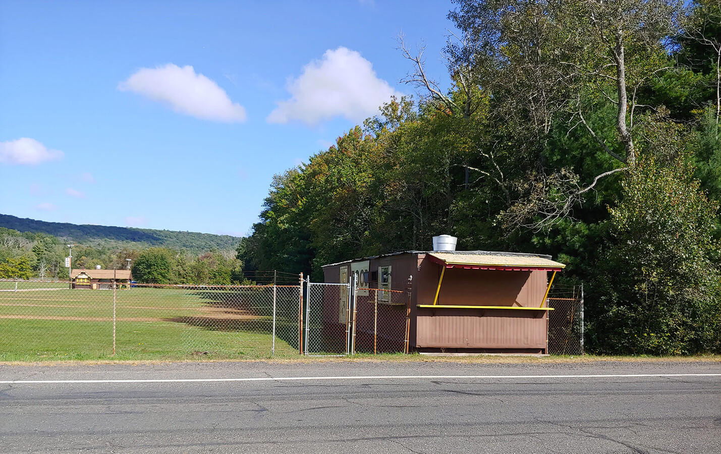
Property Record
74 Palmer Rd, Brimfield, MA 01010
NEARBY LISTINGS FOR SALE OR LEASE
-
-
View all Brimfield listings for sale on LoopNet.com
Property Detail
74 Palmer Rd
BRIM-000011-A000000-000014
Hampden
Amusementpark
Massachusetts
A
14
25013C0476F
12 AC
2024
Hampden County
2024
Hartford
813802
Springfield, MA
4,000 SF
DEMOGRAPHICS near 74 Palmer Rd
1 Mile
3 Mile
5 Mile
2024 Total Population
265
2,790
10,931
2029 Population
258
2,736
10,814
Pop Growth 2024-2029
(2.64%)
(1.94%)
(1.07%)
Average Age
46
45
44
2024 Total Households
109
1,134
4,482
HH Growth 2024-2029
(3.67%)
(2.03%)
(1.12%)
Median Household Inc
$78,125
$90,509
$82,273
Avg Household Size
2.40
2.40
2.40
2024 Avg HH Vehicles
2.00
2.00
2.00
Median Home Value
$340,740
$336,472
$299,464
Median Year Built
1988
1986
1982
Nearby Places
- Restaurants
- Banks
- Shops
- Fitness
- Groceries
PUBLIC TRANSPORTATION
AIRPORT
Worcester Regional
DRIVE
WALK
Distance
Worcester Regional
46 min
29.5 mi
Bradley International
DRIVE
WALK
Distance
Bradley International
67 min
39.2 mi
Freight Ports
Port of Davisville, RI
DRIVE
WALK
Distance
Port of Davisville, RI
104 min
80.8 mi
SALE & LEASE HISTORY
LISTING DATE
SALE/LEASE

Aug 03, 2020
For Sale
Nearby Properties
Address
Land Use
TOTAL SIZE
Lot Size
Zoning
Address
Land Use
TOTAL SIZE
Lot Size
Zoning
1,846.93 AC
AR
Address
Land Use
TOTAL SIZE
Lot Size
Zoning
189.22 AC
B
Address
Land Use
TOTAL SIZE
Lot Size
Zoning
10.65 AC
B
Address
Land Use
TOTAL SIZE
Lot Size
Zoning
5.60 AC
AR
Address
Land Use
TOTAL SIZE
Lot Size
Zoning
714 AC
AR
Address
Land Use
TOTAL SIZE
Lot Size
Zoning
65.96 AC
AR
Address
Land Use
TOTAL SIZE
Lot Size
Zoning
5.90 AC
1B
Address
Land Use
TOTAL SIZE
Lot Size
Zoning
9,812 SF
2 AC
B
Address
Land Use
TOTAL SIZE
Lot Size
Zoning
29,400 SF
4.63 AC
AR
Address
Land Use
TOTAL SIZE
Lot Size
Zoning
67.50 AC
AR
Address
Land Use
TOTAL SIZE
Lot Size
Zoning
4,732 SF
15 AC
B
Address
Land Use
TOTAL SIZE
Lot Size
Zoning
2,944 SF
15 AC
AR
Address
Land Use
TOTAL SIZE
Lot Size
Zoning
465.80 AC
AR
Address
Land Use
TOTAL SIZE
Lot Size
Zoning
4,920 SF
0.46 AC
B
Address
Land Use
TOTAL SIZE
Lot Size
Zoning
53.47 AC
AR
Address
Land Use
TOTAL SIZE
Lot Size
Zoning
5,856 SF
0.90 AC
B
Address
Land Use
TOTAL SIZE
Lot Size
Zoning
150 AC
AR
Address
Land Use
TOTAL SIZE
Lot Size
Zoning
10.16 AC
AR
Address
Land Use
TOTAL SIZE
Lot Size
Zoning
8,114 SF
2.04 AC
B
Address
Land Use
TOTAL SIZE
Lot Size
Zoning
Address
Land Use
TOTAL SIZE
Lot Size
Zoning
1,392 SF
13.48 AC
B
Address
Land Use
TOTAL SIZE
Lot Size
Zoning
360 AC
Address
Land Use
TOTAL SIZE
Lot Size
Zoning
2,040 SF
7.20 AC
Address
Land Use
TOTAL SIZE
Lot Size
Zoning
20,218 SF
82 AC
B
Address
Land Use
TOTAL SIZE
Lot Size
Zoning
3,300 SF
0.90 AC
AR
Address
Land Use
TOTAL SIZE
Lot Size
Zoning
4.29 AC
AR
Address
Land Use
TOTAL SIZE
Lot Size
Zoning
3,273 SF
0.19 AC
B
Address
Land Use
TOTAL SIZE
Lot Size
Zoning
9.27 AC
B
Address
Land Use
TOTAL SIZE
Lot Size
Zoning
1.96 AC
AR
The World's #1 Commercial Real Estate Marketplace
Connect with us
© 2025 CoStar Group
The information above has been obtained from sources believed reliable. While we do not doubt its accuracy we have not verified it and make no guarantee, warranty or representation about it. It is your responsibility to independently confirm its accuracy and completeness. Any projections, opinions, assumptions, or estimates used are for example only and do not represent the current or future performance of the property. The value of this transaction to you depends on tax and other factors which should be evaluated by your tax, financial, and legal advisors. You and your advisors should conduct a careful, independent investigation of the property to determine to your satisfaction the suitability of the property for your needs.