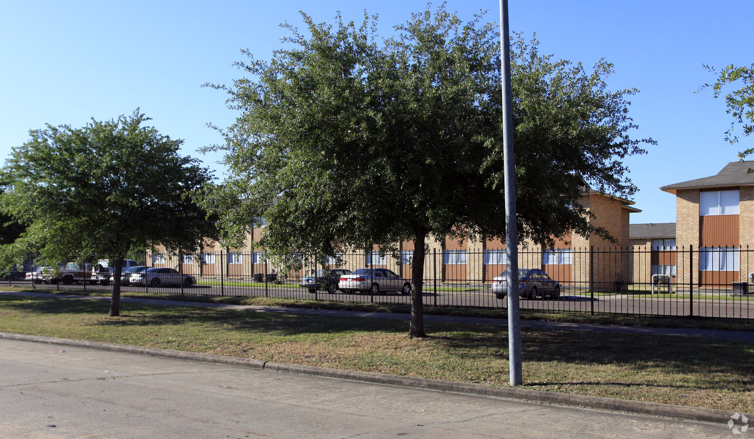
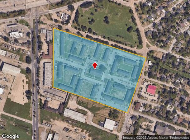
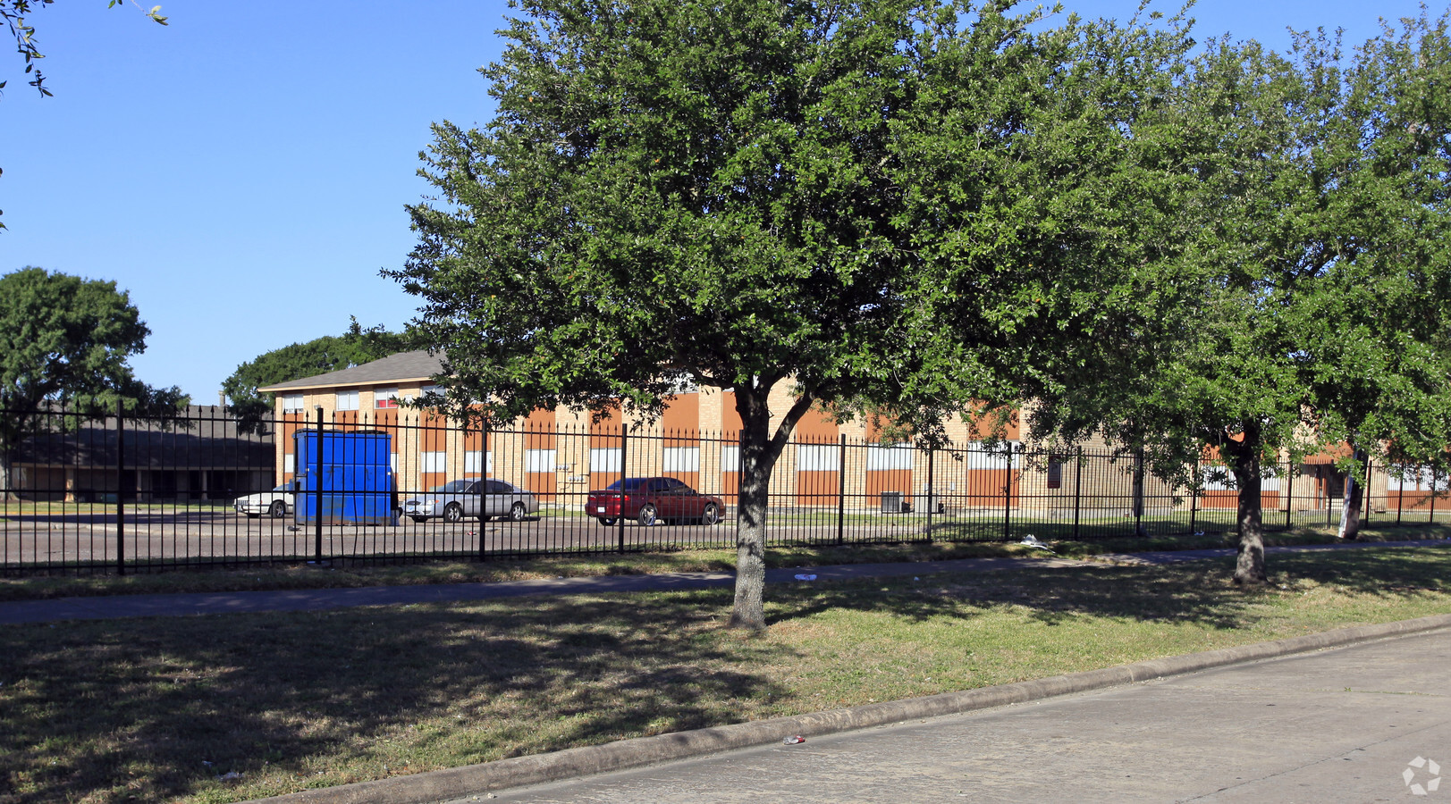
Property Record
7400 Calhoun Rd, Houston, TX 77033

NEARBY LISTINGS FOR SALE OR LEASE
Property Detail
7400 Calhoun Rd
0451470000022
Abst 373 E Harris Wesley Square Apts Par
Governmentalpublicusegeneral
TR 5C & TRS 6E & 6E-1 ABST 373 E HARRIS WESLEY SQUARE APTS PAR R/P ABST 843 S D WALTMAN
X
Harris
48201C0890M
Texas
2023
13.44 AC
2023
Sunnyside
3320002001
Houston
213,344 SF
Houston-The Woodlands-Sugar Land, TX
DEMOGRAPHICS near 7400 Calhoun Rd
1 Mile
3 Mile
5 Mile
2024 Total Population
18,780
135,991
367,665
2029 Population
19,426
140,270
380,516
Pop Growth 2024-2029
+ 3.44%
+ 3.15%
+ 3.50%
Average Age
37
36
37
2024 Total Households
6,379
51,086
147,618
HH Growth 2024-2029
+ 3.42%
+ 3.36%
+ 3.70%
Median Household Inc
$28,616
$42,879
$52,060
Avg Household Size
2.80
2.40
2.30
2024 Avg HH Vehicles
1.00
1.00
1.00
Median Home Value
$108,762
$139,869
$217,555
Median Year Built
1960
1972
1978
Nearby Places
- Restaurants
- Banks
- Shops
- Fitness
- Groceries
PUBLIC TRANSPORTATION
COMMUTER RAIL
Houston (Sunset Limited - Amtrak)
DRIVE
WALK
Distance
Houston (Sunset Limited - Amtrak)
14 min
8.5 mi
AIRPORT
William P Hobby
DRIVE
WALK
Distance
William P Hobby
19 min
8.8 mi
George Bush Intcntl/Houston
DRIVE
WALK
Distance
George Bush Intcntl/Houston
35 min
25.8 mi
Freight Ports
Port of Houston
DRIVE
WALK
Distance
Port of Houston
16 min
9.0 mi
Nearby Properties
Address
Land Use
TOTAL SIZE
Lot Size
Zoning
Address
Land Use
TOTAL SIZE
Lot Size
Zoning
1,360,194 SF
Address
Land Use
TOTAL SIZE
Lot Size
Zoning
396,888 SF
2.02 AC
Address
Land Use
TOTAL SIZE
Lot Size
Zoning
486,076 SF
3.79 AC
Address
Land Use
TOTAL SIZE
Lot Size
Zoning
453,987 SF
4.32 AC
Address
Land Use
TOTAL SIZE
Lot Size
Zoning
486,076 SF
3.79 AC
Address
Land Use
TOTAL SIZE
Lot Size
Zoning
557,397 SF
5.58 AC
Address
Land Use
TOTAL SIZE
Lot Size
Zoning
518,025 SF
18.09 AC
Address
Land Use
TOTAL SIZE
Lot Size
Zoning
643,698 SF
6.57 AC
Address
Land Use
TOTAL SIZE
Lot Size
Zoning
542,367 SF
18.58 AC
Address
Land Use
TOTAL SIZE
Lot Size
Zoning
372,028 SF
26.56 AC
Address
Land Use
TOTAL SIZE
Lot Size
Zoning
397,924 SF
3.64 AC
Address
Land Use
TOTAL SIZE
Lot Size
Zoning
460,438 SF
3.37 AC
Address
Land Use
TOTAL SIZE
Lot Size
Zoning
365,485 SF
13.94 AC
Address
Land Use
TOTAL SIZE
Lot Size
Zoning
378,704 SF
4.24 AC
Address
Land Use
TOTAL SIZE
Lot Size
Zoning
476,754 SF
4.14 AC
Address
Land Use
TOTAL SIZE
Lot Size
Zoning
257,963 SF
6.39 AC
Address
Land Use
TOTAL SIZE
Lot Size
Zoning
370,098 SF
4.22 AC
Address
Land Use
TOTAL SIZE
Lot Size
Zoning
159,235 SF
1.49 AC
Address
Land Use
TOTAL SIZE
Lot Size
Zoning
310,171 SF
2.35 AC
Address
Land Use
TOTAL SIZE
Lot Size
Zoning
295,210 SF
13.68 AC
Address
Land Use
TOTAL SIZE
Lot Size
Zoning
358,709 SF
2.66 AC
Address
Land Use
TOTAL SIZE
Lot Size
Zoning
204,180 SF
1.02 AC
Address
Land Use
TOTAL SIZE
Lot Size
Zoning
757,830 SF
31.03 AC
Address
Land Use
TOTAL SIZE
Lot Size
Zoning
261,482 SF
11.62 AC
Address
Land Use
TOTAL SIZE
Lot Size
Zoning
128,700 SF
Address
Land Use
TOTAL SIZE
Lot Size
Zoning
265,145 SF
10.07 AC
Address
Land Use
TOTAL SIZE
Lot Size
Zoning
419,760 SF
15.27 AC
Address
Land Use
TOTAL SIZE
Lot Size
Zoning
239,330 SF
9.47 AC
Address
Land Use
TOTAL SIZE
Lot Size
Zoning
319,680 SF
24.57 AC
Address
Land Use
TOTAL SIZE
Lot Size
Zoning
228,886 SF
1.85 AC
The World's #1 Commercial Real Estate Marketplace
Connect with us
© 2025 CoStar Group
The information above has been obtained from sources believed reliable. While we do not doubt its accuracy we have not verified it and make no guarantee, warranty or representation about it. It is your responsibility to independently confirm its accuracy and completeness. Any projections, opinions, assumptions, or estimates used are for example only and do not represent the current or future performance of the property. The value of this transaction to you depends on tax and other factors which should be evaluated by your tax, financial, and legal advisors. You and your advisors should conduct a careful, independent investigation of the property to determine to your satisfaction the suitability of the property for your needs.