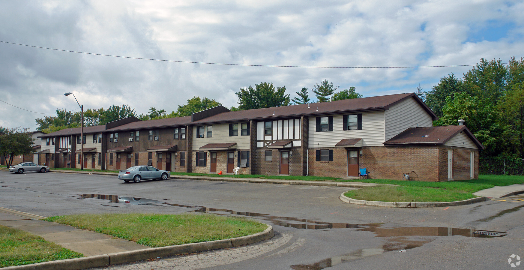
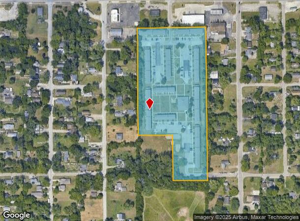
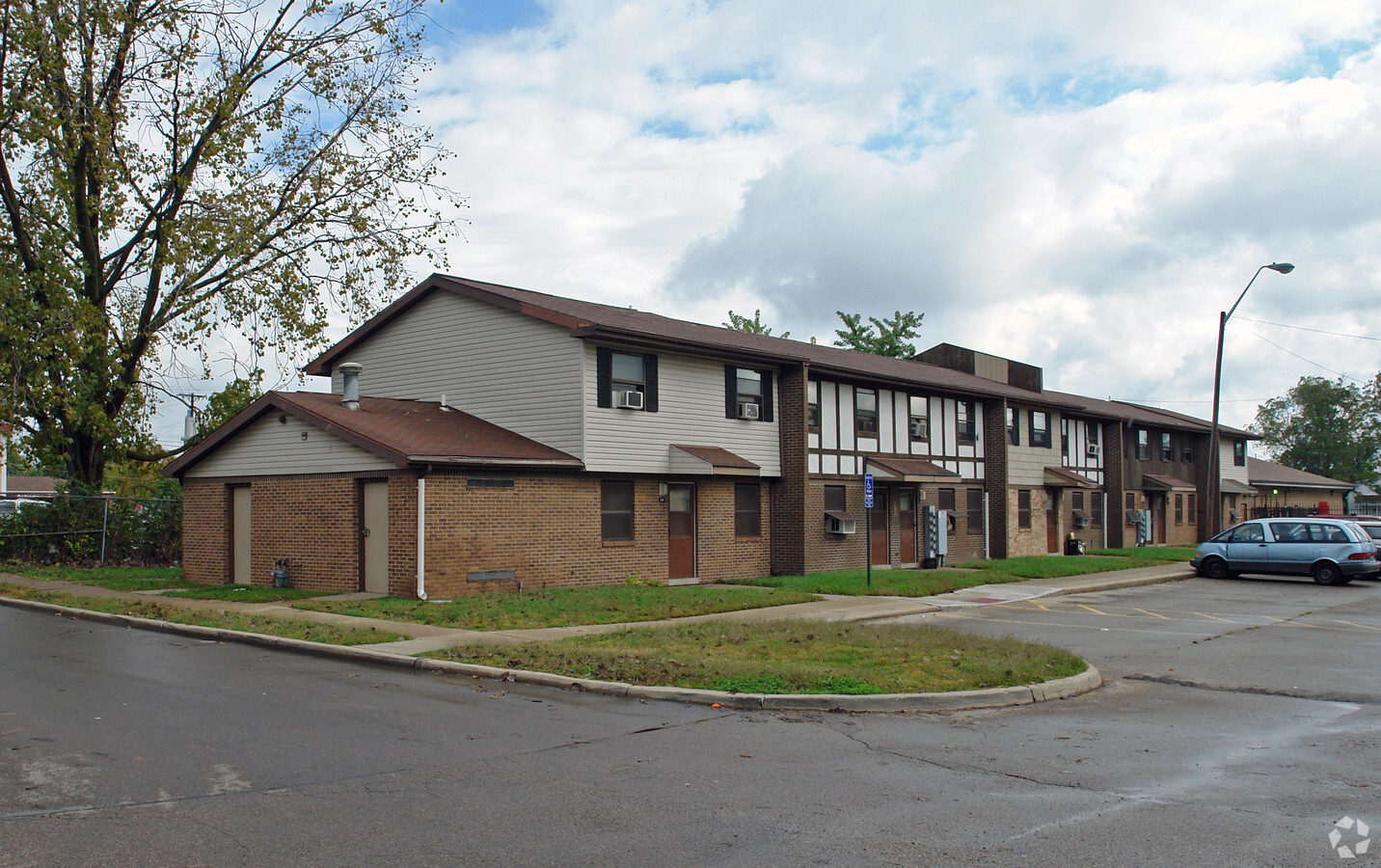
Property Record
7401 Bronson St, Dayton, OH 45417
NEARBY LISTINGS FOR SALE OR LEASE
-
-
View all Dayton listings for sale on LoopNet.com
Property Detail
7401 Bronson St
Dayton, OH
Olive Hill
G28-24518-0001
5-3-3 LOT 1 OLIVE HILL DO NOT TRANSFER PLATTED 2025
Hospitalprivate
Montgomery
X
Ohio
39113C0235E
1
2023
7.73 AC
2024
Outer Central/West
060200
Cincinnati/Dayton
63,490 SF
DEMOGRAPHICS near 7401 Bronson St
1 Mile
3 Mile
5 Mile
2024 Total Population
2,657
23,270
84,310
2029 Population
2,677
23,604
86,022
Pop Growth 2024-2029
+ 0.75%
+ 1.44%
+ 2.03%
Average Age
36
40
40
2024 Total Households
1,050
9,419
35,514
HH Growth 2024-2029
+ 0.67%
+ 1.56%
+ 2.02%
Median Household Inc
$31,407
$33,401
$37,406
Avg Household Size
2.50
2.20
2.20
2024 Avg HH Vehicles
2.00
1.00
1.00
Median Home Value
$86,332
$76,937
$79,916
Median Year Built
1961
1959
1957
Nearby Places
- Restaurants
- Banks
- Shops
- Fitness
- Groceries
PUBLIC TRANSPORTATION
AIRPORT
James M Cox Dayton International
DRIVE
WALK
Distance
James M Cox Dayton International
25 min
14.6 mi
Freight Ports
Port of Toledo
DRIVE
WALK
Distance
Port of Toledo
186 min
159.7 mi
Nearby Properties
Address
Land Use
TOTAL SIZE
Lot Size
Zoning
Address
Land Use
TOTAL SIZE
Lot Size
Zoning
134,515 SF
370.05 AC
Address
Land Use
TOTAL SIZE
Lot Size
Zoning
125,433 SF
92.08 AC
Address
Land Use
TOTAL SIZE
Lot Size
Zoning
79,822 SF
4.42 AC
Address
Land Use
TOTAL SIZE
Lot Size
Zoning
31.16 AC
Address
Land Use
TOTAL SIZE
Lot Size
Zoning
390,656 SF
47.47 AC
Address
Land Use
TOTAL SIZE
Lot Size
Zoning
24,530 SF
11.89 AC
Address
Land Use
TOTAL SIZE
Lot Size
Zoning
25.32 AC
Address
Land Use
TOTAL SIZE
Lot Size
Zoning
9.97 AC
Address
Land Use
TOTAL SIZE
Lot Size
Zoning
138,450 SF
26.57 AC
Address
Land Use
TOTAL SIZE
Lot Size
Zoning
8.41 AC
Address
Land Use
TOTAL SIZE
Lot Size
Zoning
29.73 AC
Address
Land Use
TOTAL SIZE
Lot Size
Zoning
140,368 SF
42.01 AC
Address
Land Use
TOTAL SIZE
Lot Size
Zoning
10.34 AC
Address
Land Use
TOTAL SIZE
Lot Size
Zoning
49,167 SF
75.18 AC
Address
Land Use
TOTAL SIZE
Lot Size
Zoning
208,216 SF
10.23 AC
Address
Land Use
TOTAL SIZE
Lot Size
Zoning
8,514 SF
6.14 AC
Address
Land Use
TOTAL SIZE
Lot Size
Zoning
15.78 AC
Address
Land Use
TOTAL SIZE
Lot Size
Zoning
69,277 SF
23.58 AC
Address
Land Use
TOTAL SIZE
Lot Size
Zoning
44,352 SF
84.79 AC
Address
Land Use
TOTAL SIZE
Lot Size
Zoning
8.72 AC
Address
Land Use
TOTAL SIZE
Lot Size
Zoning
103,419 SF
29.01 AC
Address
Land Use
TOTAL SIZE
Lot Size
Zoning
75,742 SF
21.49 AC
Address
Land Use
TOTAL SIZE
Lot Size
Zoning
0.57 AC
Address
Land Use
TOTAL SIZE
Lot Size
Zoning
49,911 SF
4.94 AC
Address
Land Use
TOTAL SIZE
Lot Size
Zoning
0.78 AC
Address
Land Use
TOTAL SIZE
Lot Size
Zoning
89,740 SF
19.97 AC
Address
Land Use
TOTAL SIZE
Lot Size
Zoning
15,654 SF
4.50 AC
Address
Land Use
TOTAL SIZE
Lot Size
Zoning
1,428 SF
4.66 AC
Address
Land Use
TOTAL SIZE
Lot Size
Zoning
154,260 SF
5.62 AC
The World's #1 Commercial Real Estate Marketplace
Connect with us
© 2025 CoStar Group
The information above has been obtained from sources believed reliable. While we do not doubt its accuracy we have not verified it and make no guarantee, warranty or representation about it. It is your responsibility to independently confirm its accuracy and completeness. Any projections, opinions, assumptions, or estimates used are for example only and do not represent the current or future performance of the property. The value of this transaction to you depends on tax and other factors which should be evaluated by your tax, financial, and legal advisors. You and your advisors should conduct a careful, independent investigation of the property to determine to your satisfaction the suitability of the property for your needs.