Property Record
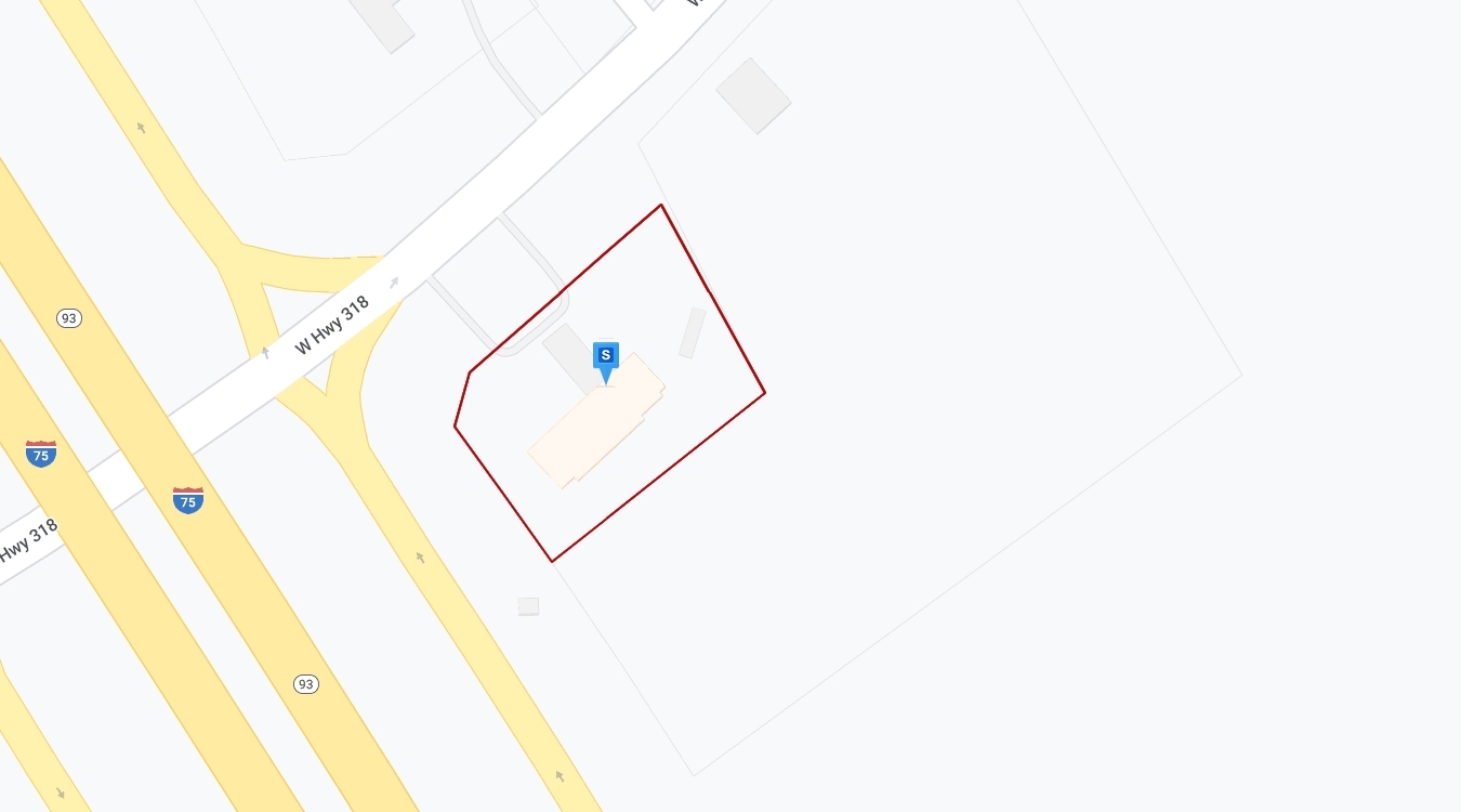
7412 W Highway 318, Reddick, FL 32686
NEARBY LISTINGS FOR SALE OR LEASE
-
-
View all Reddick listings for sale on LoopNet.com
Property Detail
7412 W Highway 318
03161-001-00
SEC 31 TWP 12 RGE 21 COM NW COR OF NE 1/4 TH N 89-53-36 W 10.25 FT TH S 02-56-00 E 873.57 FT TO NELY ROW OF I-75 TH S 32-37-20 E 593.63 FT ON ROW TO POB TH N 48-41-56 E 216.25 FT TH N 32-37-20 W TO SELY ROW OF SR 318 TH N 48-41-56 E 30.84 FT ON ROW T
Supermarket
Marion
A
Florida
12083C0140D
5 AC
2023
Outlying Marion County
2023
Ocala
000202
Ocala, FL
DEMOGRAPHICS near 7412 W Highway 318
1 Mile
3 Mile
5 Mile
2024 Total Population
168
2,165
5,657
2029 Population
193
2,404
6,322
Pop Growth 2024-2029
+ 14.88%
+ 11.04%
+ 11.76%
Average Age
46
47
46
2024 Total Households
69
928
2,329
HH Growth 2024-2029
+ 14.49%
+ 10.78%
+ 11.72%
Median Household Inc
$62,500
$51,742
$55,672
Avg Household Size
2.40
2.30
2.30
2024 Avg HH Vehicles
2.00
2.00
2.00
Median Home Value
$341,666
$282,662
$274,425
Median Year Built
1990
1984
1985
Nearby Places
- Restaurants
- Banks
- Shops
- Fitness
- Groceries
PUBLIC TRANSPORTATION
AIRPORT
Gainesville Regional
DRIVE
WALK
Distance
Gainesville Regional
37 min
24.0 mi
Freight Ports
Jacksonville Port
DRIVE
WALK
Distance
Jacksonville Port
122 min
93.8 mi
Nearby Properties
Address
Land Use
TOTAL SIZE
Lot Size
Zoning
Address
Land Use
TOTAL SIZE
Lot Size
Zoning
32,919 SF
115.49 AC
PRV
Address
Land Use
TOTAL SIZE
Lot Size
Zoning
11,331 SF
74.32 AC
PRV
Address
Land Use
TOTAL SIZE
Lot Size
Zoning
37,615 SF
39.61 AC
A1
Address
Land Use
TOTAL SIZE
Lot Size
Zoning
2,616 SF
41.47 AC
PUD
Address
Land Use
TOTAL SIZE
Lot Size
Zoning
38,715 SF
50 AC
B3
Address
Land Use
TOTAL SIZE
Lot Size
Zoning
140.91 AC
PUD
Address
Land Use
TOTAL SIZE
Lot Size
Zoning
1,839 SF
719.20 AC
A1
Address
Land Use
TOTAL SIZE
Lot Size
Zoning
11,063 SF
417.23 AC
A1
Address
Land Use
TOTAL SIZE
Lot Size
Zoning
62,288 SF
49.98 AC
B4
Address
Land Use
TOTAL SIZE
Lot Size
Zoning
15,397 SF
7.24 AC
B2
Address
Land Use
TOTAL SIZE
Lot Size
Zoning
7,192 SF
115.44 AC
A1
Address
Land Use
TOTAL SIZE
Lot Size
Zoning
11,333 SF
243.73 AC
A1
Address
Land Use
TOTAL SIZE
Lot Size
Zoning
9,603 SF
6.30 AC
GU
Address
Land Use
TOTAL SIZE
Lot Size
Zoning
10,640 SF
2.08 AC
RAC
Address
Land Use
TOTAL SIZE
Lot Size
Zoning
5,828 SF
148.39 AC
A1
Address
Land Use
TOTAL SIZE
Lot Size
Zoning
5,625 SF
5.84 AC
A1
Address
Land Use
TOTAL SIZE
Lot Size
Zoning
11,280 SF
9.01 AC
B2
Address
Land Use
TOTAL SIZE
Lot Size
Zoning
21,766 SF
10.01 AC
B2
Address
Land Use
TOTAL SIZE
Lot Size
Zoning
4,674 SF
15.27 AC
A1
Address
Land Use
TOTAL SIZE
Lot Size
Zoning
5,449 SF
33.83 AC
A1
Address
Land Use
TOTAL SIZE
Lot Size
Zoning
9,301 SF
1.32 AC
B
Address
Land Use
TOTAL SIZE
Lot Size
Zoning
9,230 SF
1.24 AC
B4
Address
Land Use
TOTAL SIZE
Lot Size
Zoning
6,468 SF
159.54 AC
A1
Address
Land Use
TOTAL SIZE
Lot Size
Zoning
83.57 AC
A1
Address
Land Use
TOTAL SIZE
Lot Size
Zoning
4,825 SF
61.38 AC
A1
Address
Land Use
TOTAL SIZE
Lot Size
Zoning
5 AC
B2
Address
Land Use
TOTAL SIZE
Lot Size
Zoning
1,991 SF
15.42 AC
A1
Address
Land Use
TOTAL SIZE
Lot Size
Zoning
4,525 SF
46.16 AC
A1
Address
Land Use
TOTAL SIZE
Lot Size
Zoning
5,378 SF
23.95 AC
A1
Address
Land Use
TOTAL SIZE
Lot Size
Zoning
21,655 SF
33.01 AC
A1
The World's #1 Commercial Real Estate Marketplace
Connect with us
© 2025 CoStar Group
The information above has been obtained from sources believed reliable. While we do not doubt its accuracy we have not verified it and make no guarantee, warranty or representation about it. It is your responsibility to independently confirm its accuracy and completeness. Any projections, opinions, assumptions, or estimates used are for example only and do not represent the current or future performance of the property. The value of this transaction to you depends on tax and other factors which should be evaluated by your tax, financial, and legal advisors. You and your advisors should conduct a careful, independent investigation of the property to determine to your satisfaction the suitability of the property for your needs.