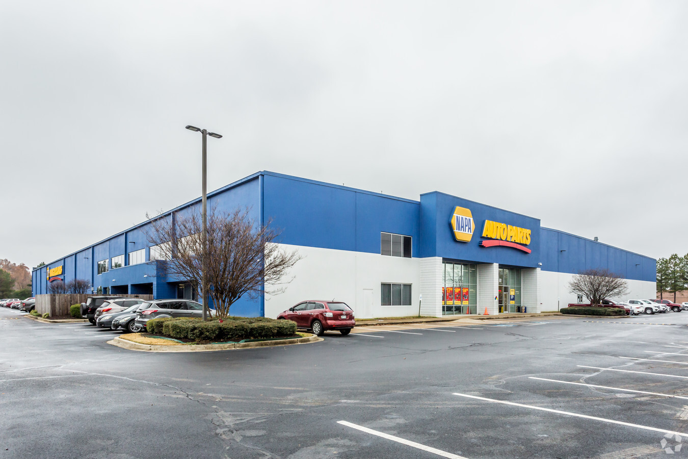
Property Record
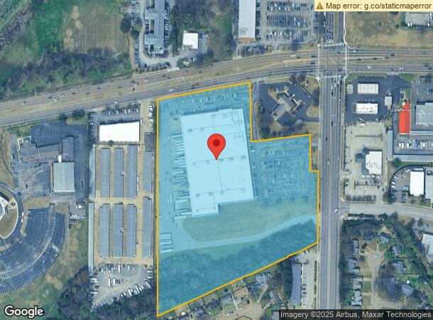
7415 Us Highway 64, Bartlett, TN 38133


NEARBY LISTINGS FOR SALE OR LEASE
Property Detail
7415 Us Highway 64
09-2004-0-0009
WS APPLING RD TO SS HWY 64 SEE MAP D-21 & 22
Warehouse
Shelby
AE
Tennessee
47157C0304G
15.06 AC
2023
Northeast
2024
Memphis
021112
Memphis, TN-MS-AR
136,551 SF
DEMOGRAPHICS near 7415 Us Highway 64
1 Mile
3 Mile
5 Mile
2024 Total Population
7,679
61,166
154,834
2029 Population
7,446
59,409
150,280
Pop Growth 2024-2029
(3.03%)
(2.87%)
(2.94%)
Average Age
36
39
38
2024 Total Households
2,739
23,803
59,932
HH Growth 2024-2029
(3.25%)
(2.96%)
(3.00%)
Median Household Inc
$62,677
$66,991
$69,486
Avg Household Size
2.80
2.50
2.50
2024 Avg HH Vehicles
2.00
2.00
2.00
Median Home Value
$163,464
$205,511
$217,166
Median Year Built
1989
1988
1990
Nearby Places
- Restaurants
- Banks
- Shops
- Fitness
- Groceries
PUBLIC TRANSPORTATION
AIRPORT
Memphis International
DRIVE
WALK
Distance
Memphis International
29 min
19.7 mi
Freight Ports
Port of Shreveport
DRIVE
WALK
Distance
Port of Shreveport
420 min
387.0 mi
Nearby Properties
Address
Land Use
TOTAL SIZE
Lot Size
Zoning
Address
Land Use
TOTAL SIZE
Lot Size
Zoning
270,045 SF
28.34 AC
CA
Address
Land Use
TOTAL SIZE
Lot Size
Zoning
231,038 SF
24.97 AC
RU-2
Address
Land Use
TOTAL SIZE
Lot Size
Zoning
591,149 SF
45.48 AC
CMU-3
Address
Land Use
TOTAL SIZE
Lot Size
Zoning
1,153,892 SF
50.47 AC
I-P
Address
Land Use
TOTAL SIZE
Lot Size
Zoning
325,370 SF
64.04 AC
CA
Address
Land Use
TOTAL SIZE
Lot Size
Zoning
207,537 SF
21.73 AC
C-G
Address
Land Use
TOTAL SIZE
Lot Size
Zoning
134,272 SF
28.85 AC
CMP-1
Address
Land Use
TOTAL SIZE
Lot Size
Zoning
75,099 SF
12.22 AC
EMP
Address
Land Use
TOTAL SIZE
Lot Size
Zoning
338,215 SF
33.08 AC
CA
Address
Land Use
TOTAL SIZE
Lot Size
Zoning
94,003 SF
7.20 AC
CMU-2
Address
Land Use
TOTAL SIZE
Lot Size
Zoning
19,050 SF
24.99 AC
R-M
Address
Land Use
TOTAL SIZE
Lot Size
Zoning
260,599 SF
28.13 AC
CA
Address
Land Use
TOTAL SIZE
Lot Size
Zoning
64,002 SF
67.10 AC
RU-2
Address
Land Use
TOTAL SIZE
Lot Size
Zoning
79,341 SF
31.15 AC
RU-3
Address
Land Use
TOTAL SIZE
Lot Size
Zoning
86,056 SF
24.14 AC
CA
Address
Land Use
TOTAL SIZE
Lot Size
Zoning
498,680 SF
46.61 AC
I-P
Address
Land Use
TOTAL SIZE
Lot Size
Zoning
253,831 SF
16.74 AC
EMP
Address
Land Use
TOTAL SIZE
Lot Size
Zoning
198,103 SF
17.75 AC
CG-MS
Address
Land Use
TOTAL SIZE
Lot Size
Zoning
62,852 SF
10.15 AC
RS-12
Address
Land Use
TOTAL SIZE
Lot Size
Zoning
108,678 SF
8.99 AC
R-E
Address
Land Use
TOTAL SIZE
Lot Size
Zoning
39,581 SF
7.69 AC
R-6
Address
Land Use
TOTAL SIZE
Lot Size
Zoning
133,020 SF
11.73 AC
SC-1
Address
Land Use
TOTAL SIZE
Lot Size
Zoning
105,950 SF
21.19 AC
RU-3
Address
Land Use
TOTAL SIZE
Lot Size
Zoning
222,468 SF
37.55 AC
C-H
Address
Land Use
TOTAL SIZE
Lot Size
Zoning
142,703 SF
18.62 AC
CMU-3
Address
Land Use
TOTAL SIZE
Lot Size
Zoning
449,267 SF
20.03 AC
RU-3
Address
Land Use
TOTAL SIZE
Lot Size
Zoning
56,431 SF
1.24 AC
C-G
Address
Land Use
TOTAL SIZE
Lot Size
Zoning
199,320 SF
9.05 AC
CA
Address
Land Use
TOTAL SIZE
Lot Size
Zoning
191,316 SF
21.71 AC
CMU-3
Address
Land Use
TOTAL SIZE
Lot Size
Zoning
86,875 SF
7.09 AC
I-P
The World's #1 Commercial Real Estate Marketplace
Connect with us
© 2025 CoStar Group
The information above has been obtained from sources believed reliable. While we do not doubt its accuracy we have not verified it and make no guarantee, warranty or representation about it. It is your responsibility to independently confirm its accuracy and completeness. Any projections, opinions, assumptions, or estimates used are for example only and do not represent the current or future performance of the property. The value of this transaction to you depends on tax and other factors which should be evaluated by your tax, financial, and legal advisors. You and your advisors should conduct a careful, independent investigation of the property to determine to your satisfaction the suitability of the property for your needs.